
The National Weather Service in Peachtree City has issued a Wind Chill Warning for the North Georgia mountains, and Metro Atlanta has been “upgraded” to a Wind Chill Advisory beginning late Thursday night through Saturday morning.
Dangerously cold wind chills -- as low as 10 degrees below zero -- are possible all across north Georgia, including Metro Atlanta through Saturday afternoon.
Bitter cold air coupled with strong winds will produce frigid conditions that can cause hypothermia for anyone caught outside and unprepared.
The animation below shows the Futurecast wind chill values from Friday morning through Saturday afternoon.

Science Behind the Wind Chill
The National Weather Service says the “wind chill is a term used to describe what the air temperature ‘feels like’ to the human skin due to the combination of cold temperatures and winds blowing on exposed skin.”
In fact, research conducted by the NWS as recently as Summer 2001 involved placing human volunteers on treadmills in a chilled wind tunnel and measuring the volunteers’ skin while the individuals walked on the treadmill. Each volunteer was subjected to various temperatures and wind speeds, with the results used to compile the Wind Chill Index that we use today.
The Wind Chill is expressed as a function that is dependent on the air temperature as well as the wind speed, as illustrated in the chart below.
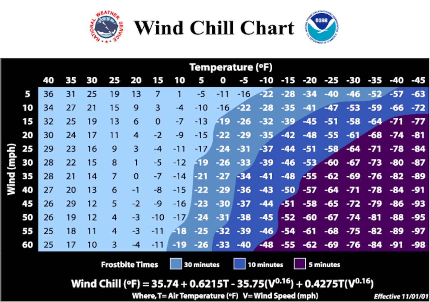
Naturally, we understand that the lower the temperature, the colder it ‘feels like’ outside.
However, 32 degrees with no wind feels substantially “warmer” compared to 32 degrees with a 10 mph wind (the Wind Chill at that point would be in the 20s).
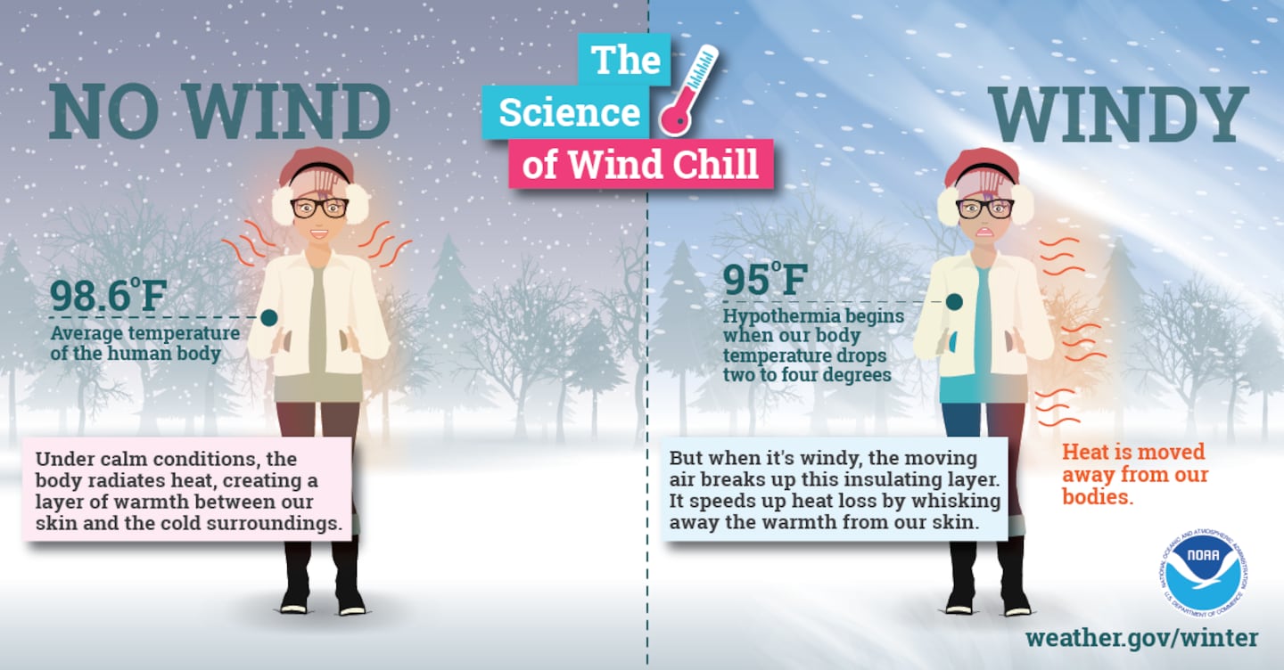
This ‘feels like’ situation is due to the wind blowing body heat away from us, causing our bodies to continuously cool to the point of potential hypothermia.
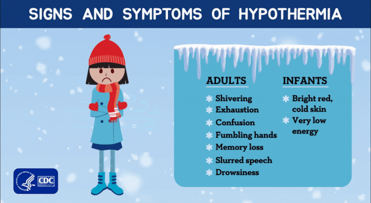
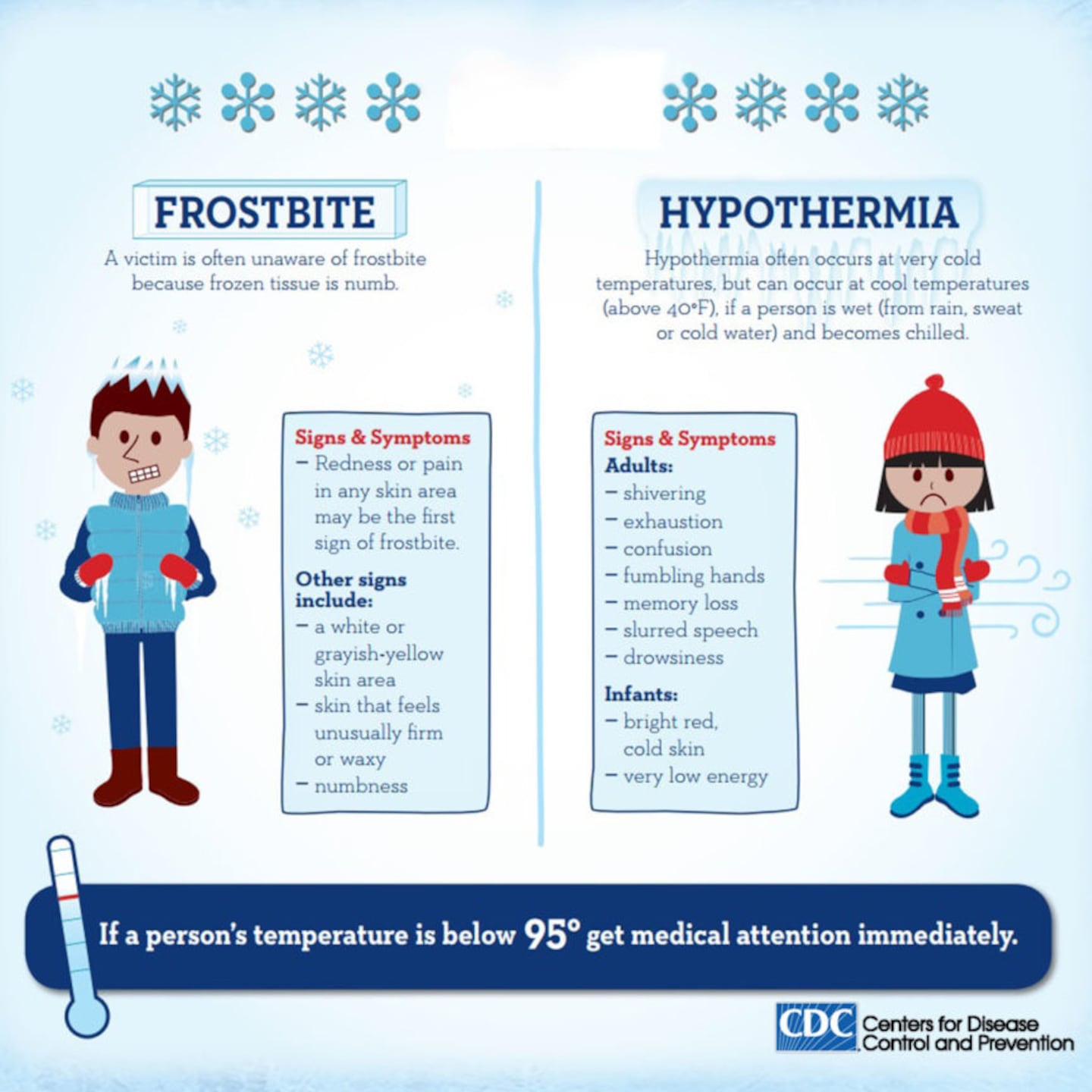
According to the CDC, hypothermia is defined as abnormally low body temperature caused by prolonged exposure to very cold temperatures. As a result, the body loses heat faster than it is able to produce, which can lead to a potentially dangerous situation as the body shuts down.
When the wind chill values are low, avoid going outside for long periods of time. If you must go outside, dress in many warm layers of clothing -- this will trap the body heat and is more effective than one bulky layer.
Keep an Eye on Frostbite
In addition to hypothermia, frostbite is a concern this weekend for anyone spending over an hour outside in the freezing cold temperatures. Remember, air temperatures are expected to drop to the low 20s by Friday morning, and they will stay well below freezing through Monday morning.
According to the CDC, “frostbite is a type of injury caused by freezing. It leads to a loss of feeling and color in the areas it affects, usually extremities such as the nose, ears, cheeks, chin, fingers, and toes. Frostbite can permanently damage the body, and severe cases can lead to amputation (removing the affected body part).”
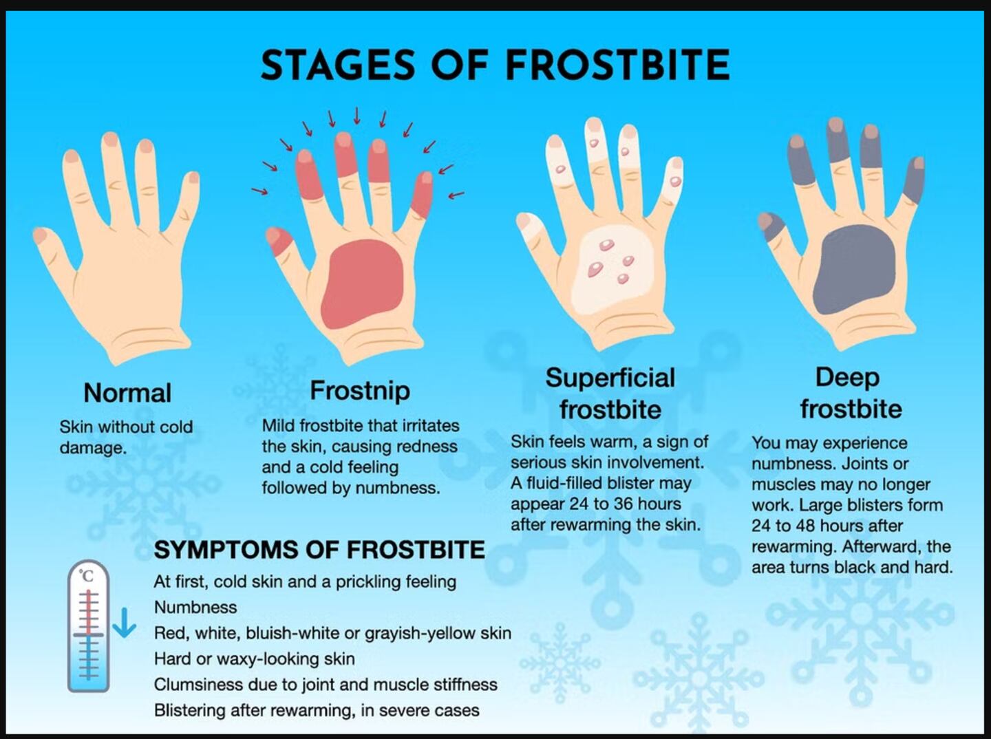
Protect your fingers, ears and nose against frostbite by wearing warm layers that insulate these extremities. Be aware that toes are also at risk of frostbite when wearing socks and shoes that provide insufficient insulation.
If you are traveling this weekend, keep an extra blanket, jacket, and pair of gloves in the car in case you have car issues that leave you stranded on the side of the road. You will want to bundle up while you are waiting for a tow!
Please stay warm, and have a happy and merry holiday weekend!
Share Your Christmas Temperature Reports with Me!
Facebook: Christina Edwards WSB
Twitter: @ChristinaWSBwx
©2022 Cox Media Group


