
We see it happen almost every year, news worthy tornado destruction for days to our West, right up to our Alabama doorstep, then not much here, followed by another outbreak over the Carolina’s or points North or South of here from the same system.
Don’t get me wrong, I am not sorry about this nor sad. Despite my love of nature and big storms, I never wish destructive storms on life or property on anyone anywhere.
This blog post is NOT a forecast for this week. This is merely instructional in a generic sense. Check the WSB forecasters for the latest on what to expect this Wednesday night into Thursday.
For Metro Atlanta and much of Georgia sometimes it’s sorta just luck, sometimes it’s the presence of the cool stable air of “the wedge” aka CAD (cold air damming). The wedge can be a real friend by “killing off” storms as they move our way from the West. Nature’s own protective force field.
Or good timing plays a role, the heating of the day from the sun means most of the time maximum thermal instability is reached in the afternoon and early evening, so if a weather system does not reach you until the morning the air mass will be less unstable when that system arrives.
Also, many times the main discrete severe thunderstorms (supercells) and/or a squall line (QLCS) races far out ahead of the main forcing mechanism(s) that created it, so it “runs out of steam” or “runs low on fuel” if you will by the time they get to us. The thunderstorms getting here are often like a marathon runner at the finish line instead of the starting line or the hitting stride mid-point of the race. They are exhausted and on a downward cycle and will need to be rejuvenated.
Often the entire weather system simply is much weaker in our area than to the West, the atmosphere simply is much less supportive of severe weather in our area with a given system here but it WAS supportive of it to our West, just that straightforward! The weather changes as it moves. Cities along I-20 don’t just get the same weather at a later time.
Yes, I am really over-simplifying or dumbing down things here. But I am trying not to write a meteorology textbook.
If checking with Birmingham actually worked we’d never be wrong lol. If checking with Dallas worked then Birmingham AL forecasters would never be wrong.
EXAMPLES:
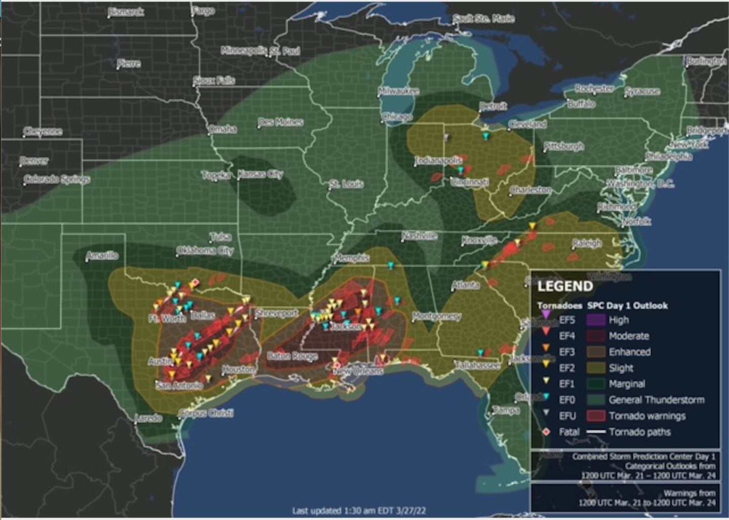
It happened just last week. Big outbreak to our West, fizzled to heavy but non-severe rain and thunderstorms here, then rejuvenated (regenerated) later in the day Northeast and Southeast of here.
It MIGHT happen again this week.
Here is the Monday SPC severe weather outlook for the days ahead. Notice a similar forecast expectation as of 3/28:
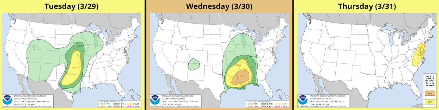
You can see (above) that as of Monday afternoon (3/28) the expectation is that the parameters for severe weather (thermodynamics, instability, kinematics etc.) will be maximized to our West for the worst of it, weaken here, then try to regenerate Thursday afternoon in the Mid-Atlantic states to NC, and maybe SC and Eastern GA as well depending on timing of the front. But do notice there is a level 1/5 severe risk shown for West/NW GA Wednesday overnight.
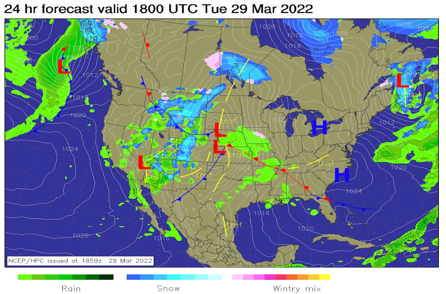
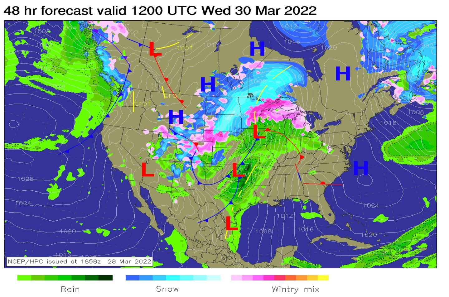
In the maps (below) notice how the storms are often worse when they form closer to fronts and low pressure systems but lessen farther away from fronts and low pressure systems:
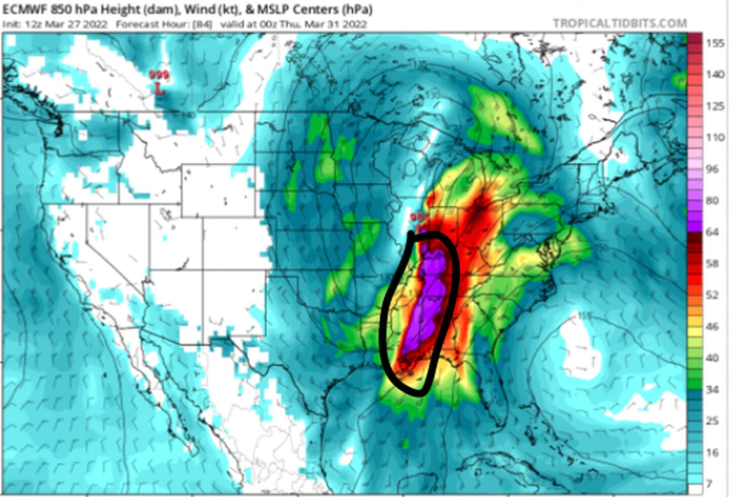
Notice in the series of forecast charts below how the low-level jet winds (favoring severe wind storms) about 1 mile high are at first much stronger to the West of Georgia, and then later strongest to the North and East of Metro Atlanta (circled in black). The system is forecast to weaken over us.
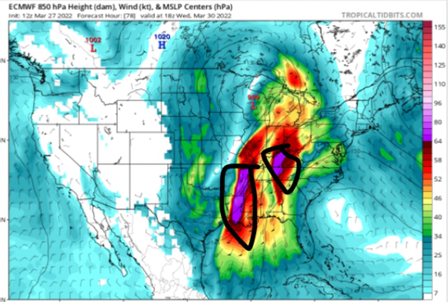
The “marathon” (below) is just getting started near the front (bold black line) so the storms are fresh and strong being fairly close to the front and maximum severe weather parameters:

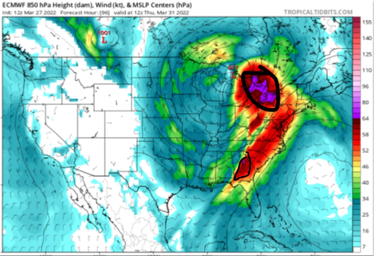
But they begin to weaken as the squall line gets further away from the front (starting line of the marathon):
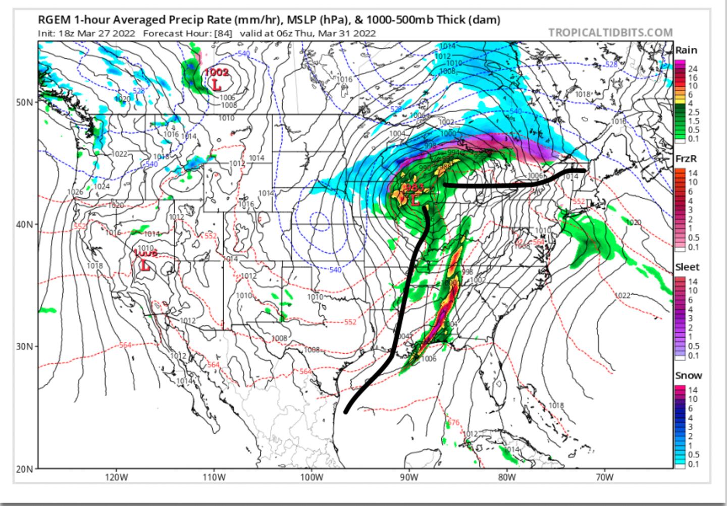
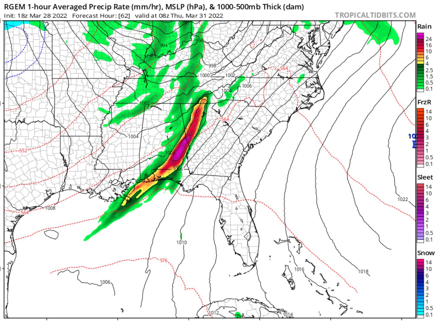
CANADIAN MODEL FORECAST MAP SIMULATED RADAR 4AM THURSDAY:
So the tornado ingredients all come together to our West, but then the ingredients start to become scattered across the table by the time the recipe reaches our area and some are even missing.
Again, I have purposely over-simplified this explanation. There are thousands of data points examined and hundreds of parameters analyzed to make a severe weather forecast so I “dumbed it down” simply to illustrate some of the basics as to why so often THE WORST of the severe weather occurs elsewhere. We all know we can, do and have been hit hard here, too. I am happy it doesn’t happen with the frequency or intensity of our neighbors in Alabama or in the area from Texas/OK/Arkansas Eastward to TN/AL.
Please take note. THIS IS NOT A FORECAST FOR OUR WEATHER WEDNESDAY-THURSDAY. I leave that to the forecasters at WSB who have not retired. This as I said is merely an illustration for those wondering why tornado outbreaks are oftentimes much worse to our West.
For more frequent updates follow me on Twitter @MellishMeterWSB.
©2022 Cox Media Group


