This time of year, the time and temperature report often comes with a Wind Chill report as well.
I know the phrase “Wind Chill” sounds made up -- as hilariously described by Bill Engvall on his album Dorkfish -- but I promise there is solid science behind the it!
The National Weather Service says the “Wind Chill is a term used to describe what the air temperature ‘feels like’ to the human skin due to the combination of cold temperatures and winds blowing on exposed skin.”
In fact, research conducted by the NWS as recently as Summer 2001 involved placing human volunteers on treadmills in a chilled wind tunnel and measuring the volunteers’ skin while the individuals walked on the treadmill. Each volunteer was subjected to various temperatures and wind speeds, with the results used to compile the Wind Chill Index that we use today.
The Wind Chill is expressed as a function that is dependent on the air temperature as well as the wind speed, as illustrated in the chart below.
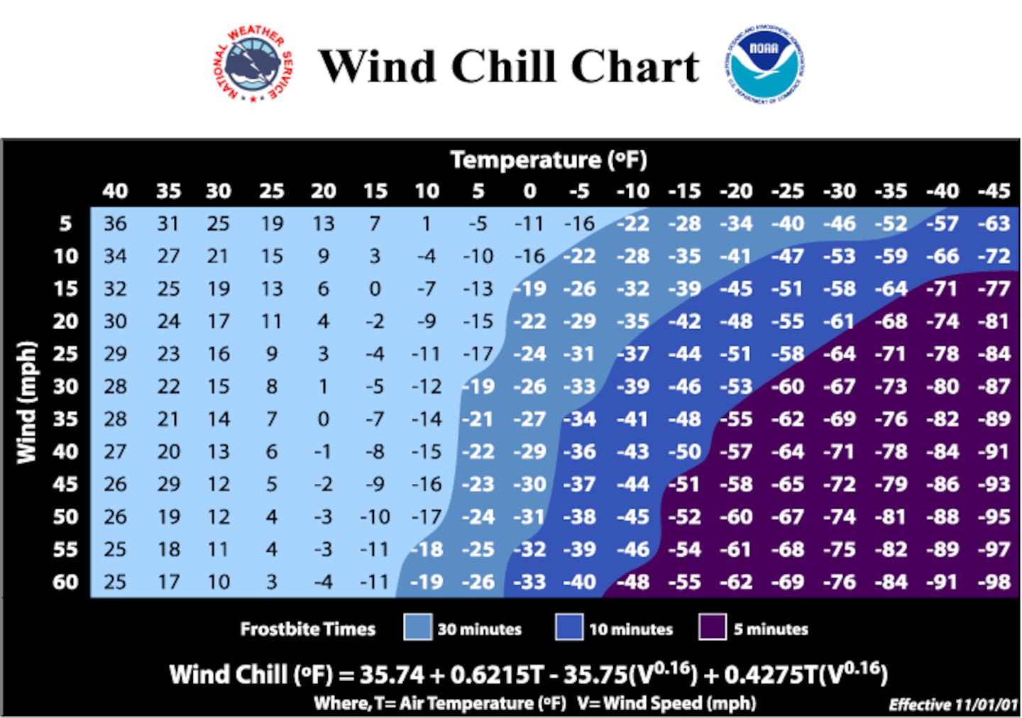
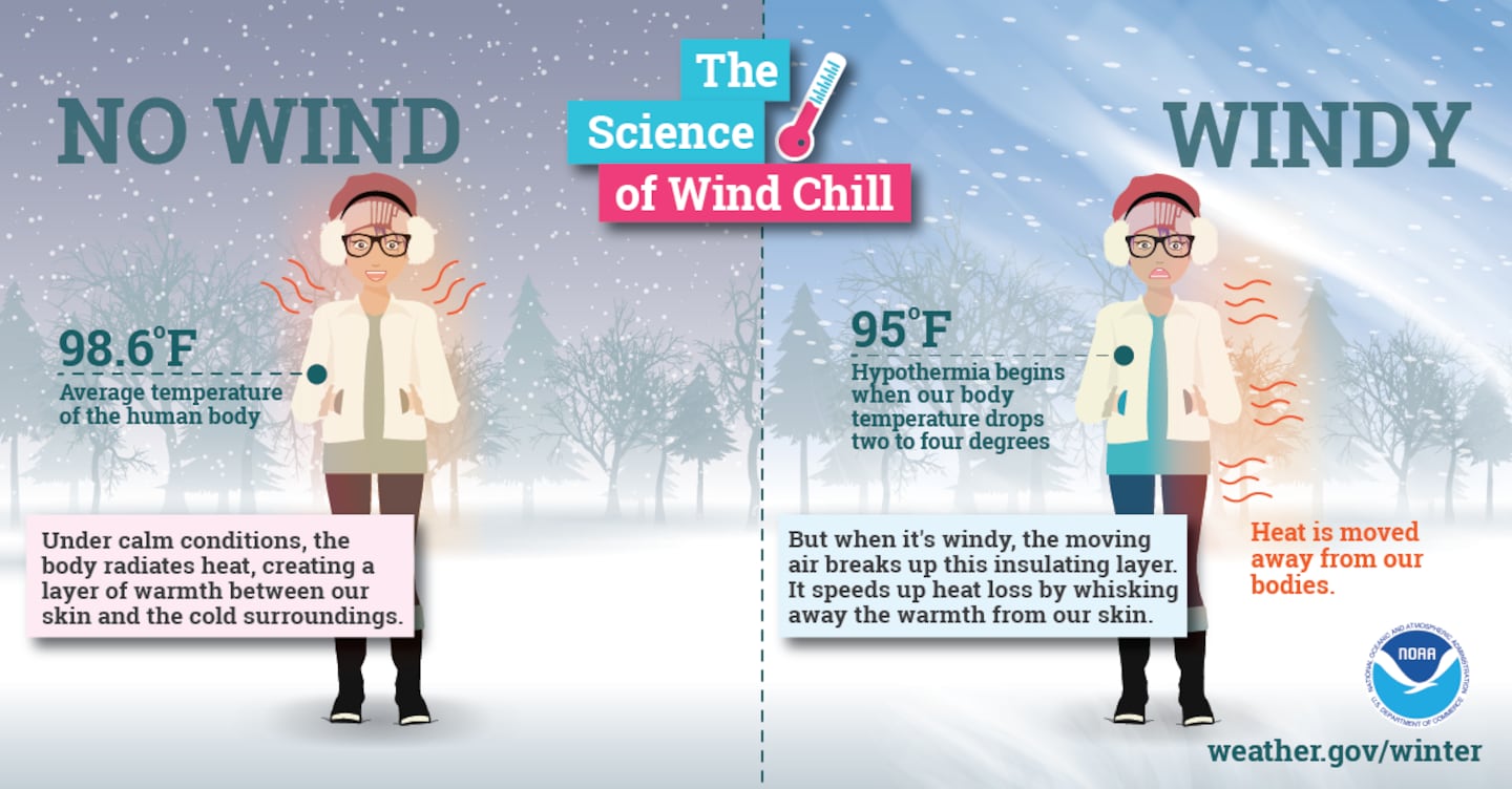
Naturally, we understand that the lower the temperature, the colder it ‘feels like’ outside. However, 32 degrees with no wind feels substantially “warmer” compared to 32 degrees with a 10 mph wind (the Wind Chill at that point would be in the 20s).
This ‘feels like’ situation is due to the wind blowing body heat away from us, causing our bodies to continuously cool to the point of potential hypothermia.
Arctic Blast Surging as Far South as Miami
The Big Chill will arrive Saturday morning, sending temperatures into to the 30s as far south as Orlando and Miami!
🥶No-joke wind chills! Covering this on 9 now! pic.twitter.com/xhR4zIB1wE
— Brian Shields, WFTV (@BrianWFTV) January 27, 2022
🥶🚨 Looking ahead to this weekend - A stretch of cold weather is expected, with freezing temperatures*, wind chills in the 20s*, and chilly afternoon highs! 🚨🥶
— NWS Miami (@NWSMiami) January 27, 2022
*Coldest weather across the interior of south Florida pic.twitter.com/4wO50dpv00
1/26: Here's the forecast backward trajectory of the Arctic airmass heading into South Florida this upcoming weekend. That's right! The air currently over extreme northeastern Canada will travel all the way down (with some minor stops along the way 😉) to South Florida. #flwx https://t.co/Ef5jWHZb2T pic.twitter.com/rl0SueOG6K
— NWS Miami (@NWSMiami) January 26, 2022
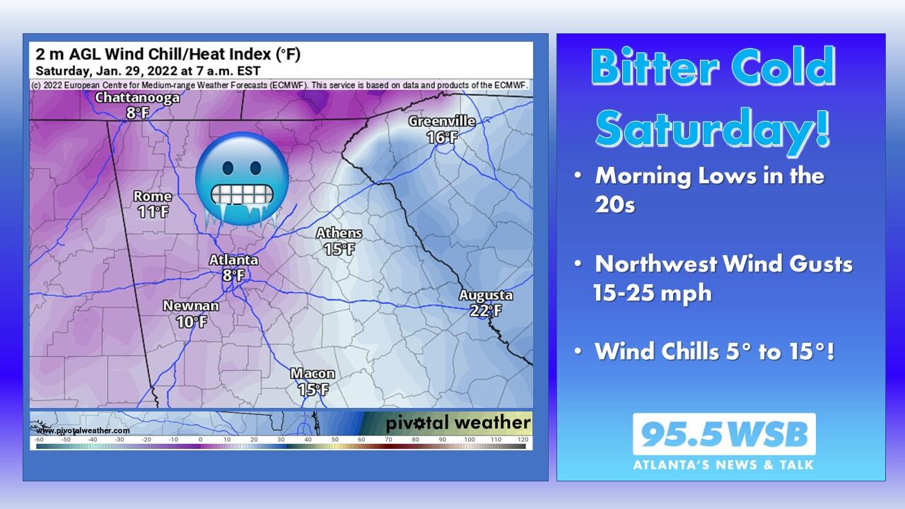
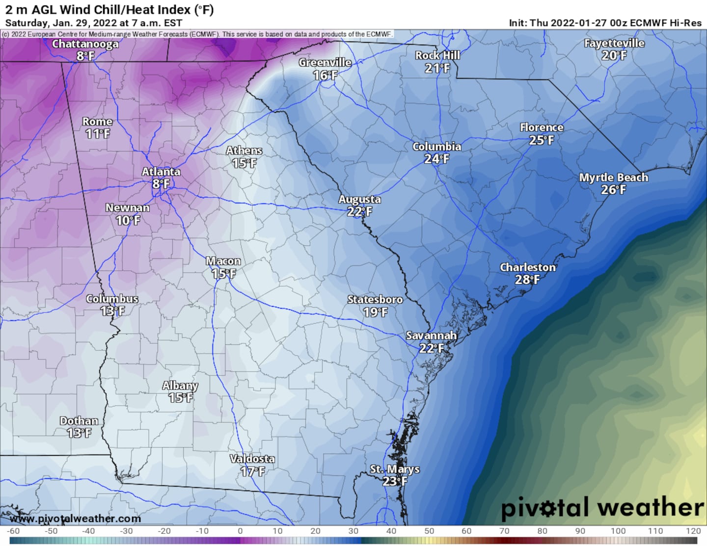
Bitterly Cold for Metro Atlanta on Saturday Morning
Actual Forecast Lows for this weekend will dip as low as 22-25 degrees throughout Metro Atlanta.
However, the winds will be gusty! The Arctic Blast will involve a north-northwest wind blowing as high as 20 to 25 mph on Saturday morning.
As a result, wind chills will dip as low as the single digits to low teens -- yes, including “Inside the Perimeter”, where the concrete jungle usually provides an “urban heat island” buffer compared to the usual cool spots in the Metro.
A Wind Chill Advisory may be issued by the National Weather Service in Peachtree City for Saturday Morning. According to the Peachtree City Weather Forecast Office, Wind Chill Advisories are issued within their county warning area when Wind Chills are expected to range between -9° and 5°F. A Wind Chill Warning is issued when the expected Wind Chill meets or exceeds -10°F.
If work or recreation bring you outside on Saturday, be sure to layer up! Limit your exposure to the cold wind by taking frequent breaks indoors.
Thankfully, the wind will die down on Sunday morning, and by Sunday afternoon, temperatures will thaw into the low 50s.
Share Your Temperature Reports with Me!
Facebook: Christina Edwards WSB
Twitter: @ChristinaWSBwx
©2022 Cox Media Group


