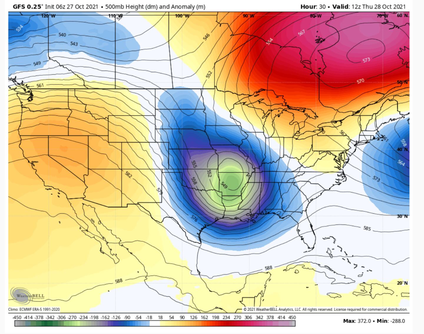
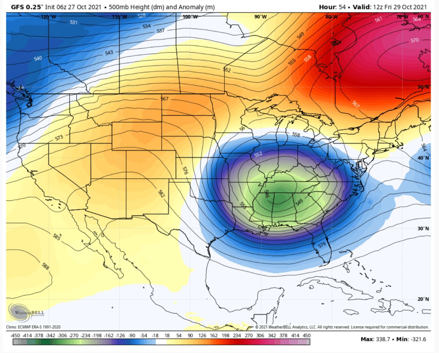
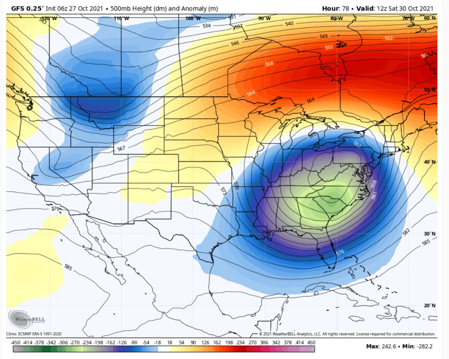
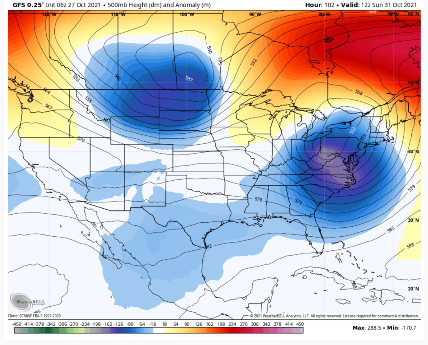
A big change is coming as we go from a high pressure ridge Wednesday to the formation of a deep closed upper-level cut-off low aloft into the weekend.
I’ve shown and explained the relationship between the jet stream pattern flow and what the weather does here at the surface thanks to things going on 10,000-60,000 feet up dozens of times over the years.
In Synoptic Meteorology we often use the 500mb (mid-level jet stream level) as a proxy for higher and lower wind flow and pressure patterns.
Look and SEE the relationship between 500mb low pressure troffs (troughs) and high pressure ridges and the weather that occurs upstream, downstream and under each:
It’s not 1:1 but as a ridge develops aloft you usually turn warmer and drier, and as an upper level troff moves in you turn cooler and wetter. It’s much more complicated than that but this is not a textbook lesson so it will suffice as a ruff rule of thumb for now.
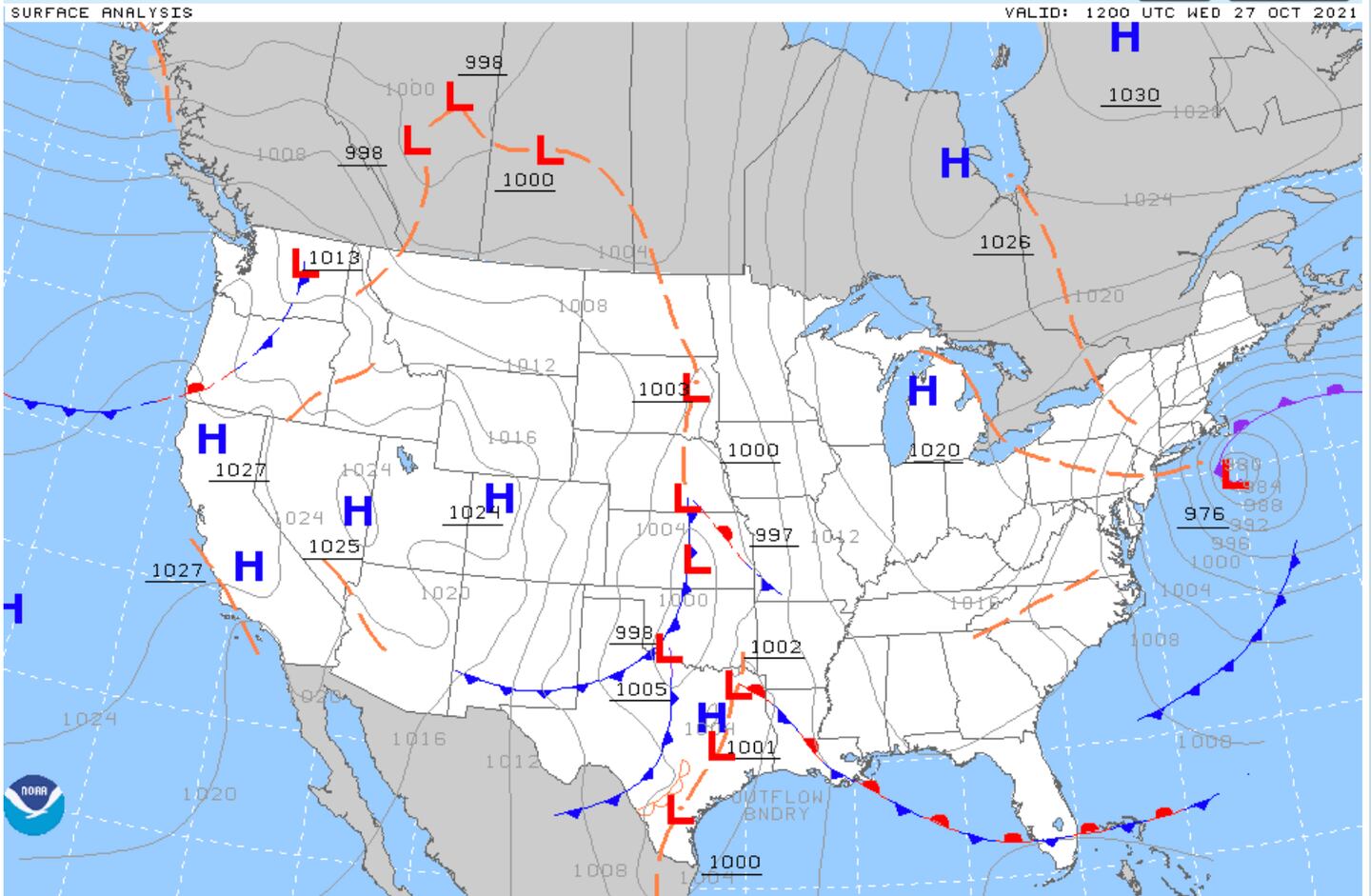
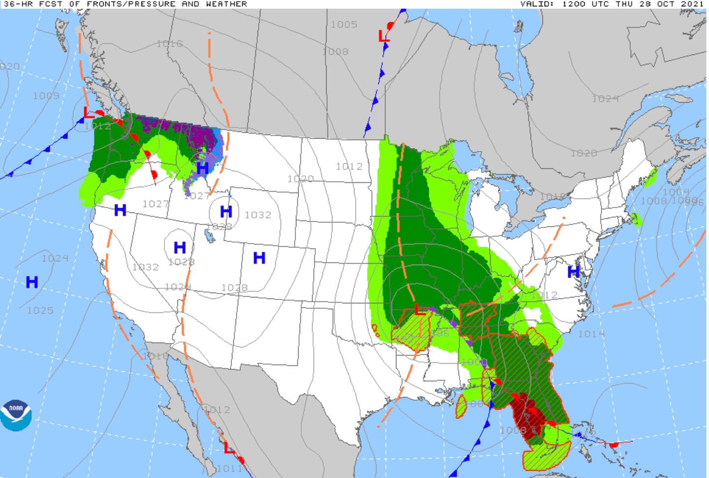
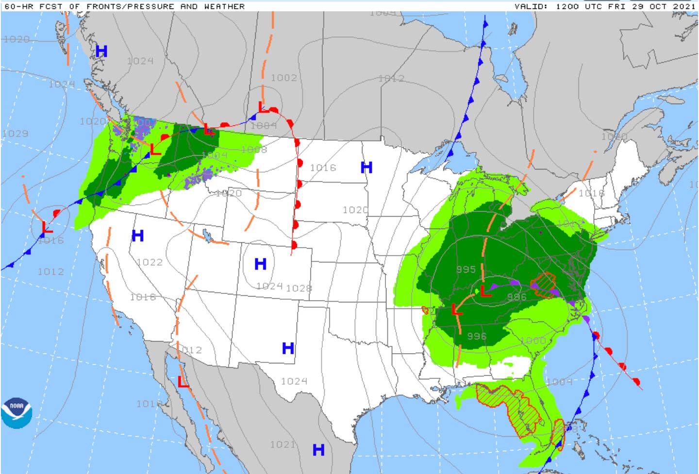
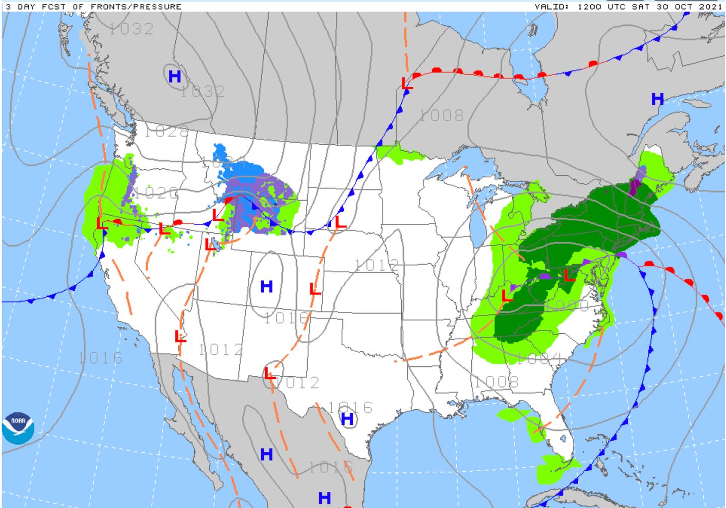
In the series of model forecast charts below, NOTICE the relationship between the 500mb jet pattern features and the surface weather features. It is “Weather 101″...
SO LOOK AND SEE THE PATTERN CHANGE FROM TODAY WEDNESDAY TO SUNDAY MORNING:
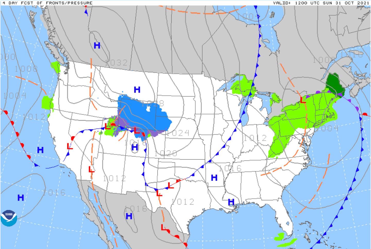
SURFACE WEATHER CHARTS WEDNESDAY-SUNDAY:
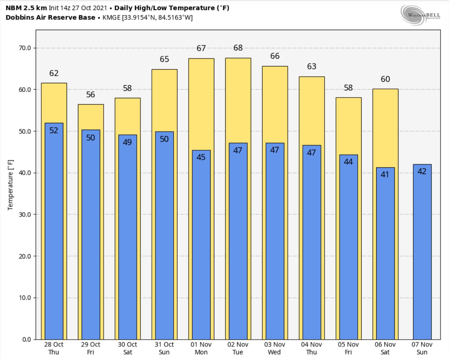
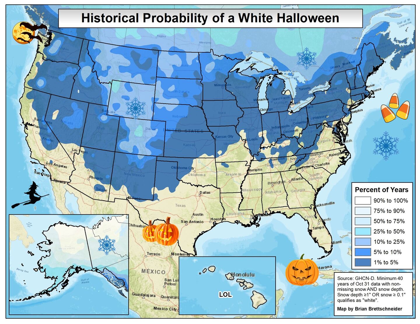
Although rain and another chill is coming NO frost on the pumpkin is expected and no halloween snow. TRICK OR TREAT looks dry and chilly.
Connect with me on Twitter @MellishMeterWSB.
©2021 Cox Media Group


