Summertime forecasting is easy on one hand but tough as nails on the other hand.
Many people move to our wonderful state every year, and others have never heard or thought about how weather forecasting differs by season around here. So let me explain how summer weather works around here so you will know more than your friends.
NOT ALL THUNDERSTORMS ARE THE SAME… if they are caused by a front or low-pressure system or upper-air disturbance they will be more widespread and more accurately forecast as a rule. HOWEVER, if there is no front or low-pressure system just a potentially unstable air mass then the if, when and where they pop-up is random and chaotic and therefore naturally has less predictability.
Fronts and low-pressure surface and aloft are much more common in Spring, Fall and Winter. Therefore, it’s easier to forecast more accurately precipitation during those seasons, not so in summer.
THE WEATHER RARELY CHANGES DURING JUNE, JULY, AND AUGUST: If you say “hot and humid with widely scattered afternoon storms”, then you will be correct 95 percent of the time. There will always of course be summers that are an exception, or periods of any summer that might be different. But how scattered will the storms be? It changes every day and that is the extremely hard part! Just saying there’s a chance doesn’t cut it. That’s not a forecast... it’s merely a description of summer.
IT RAINS JUST ABOUT EVERY DAY IN SUMMER (somewhere): The combination of a moist air mass and the intense daytime heating process usually leads to “scattered, afternoon and evening showers and thunderstorms”. They are known as air mass thundershowers and are not affiliated with any low-pressure system or fronts.
These are rather random in nature, don’t move very quickly, and are very much “hit and miss”. Mostly miss. They are diurnal solar heating driven pop-up “pop corn” variety with coverage ranging from rogue to isolated or widely spaced. “Scattered” to one extent or another most every day. Only occasionally are they numerous or widespread in the summer.
In forecasting I do not bother to put in the everyday run of the mill chance of a stray thundershower in my forecast, that is when the “POP” or probability of precipitation of 10-20%. You can figure that much out on your own. I DO try to discern the 30%-90% probability days. (High-end days are rare). Personally, I rarely cancel summer outdoor plans for a chance less than 70%.
About the only way we get a really widespread rain event around here in the summer is the result of a tropical system, or an occasional “mesoscale convective complex/mesoscale convective system” (MCC/MCS) Otherwise, a pretty typical forecast for this time of year: Heat + humidity = Hit or miss showers and storms. They die off after dark, rarely lasting past midnight.
Nobody, and I mean nobody, knows where the storms will fire until we actually see them on radar by early afternoon. We might have a general idea where the best chance of thunderstorm initiation will be, but it is one of the great challenges of summer weather forecasting in Georgia. Most of these storms form between 2:00 and 10:00 p.m.
TYPICAL NATIONAL THUNDERSTORM OUTLOOK ISSUED IN THE MORNING (10/40/70%):

So many times people on summer mornings will ask if it will rain in their county or subdivision, and the correct answer is that WE DON’T KNOW. Even when you see the storms forming on radar in the afternoon, they are usually widely spaced, and move erratically. One part of your town might see one inch of rain, but the other side of town is bone dry. Such is life with “scattered afternoon thunderstorms”.
Some spots get a few drops, others get enough for flooding, while most get zero. In summer with scattered or isolated storms you can take a bike ride or a short drive and experience 3 different types of weather in a short time and short distance. No one can have a great forecast in advance of how that will play out on any give day. No one. This is why forecasting in the summer is so hard. Getting the probability and area coverage forecast right every day is very hard, near impossible. We do the best the science and data allows.
The best we can do is indicate what the data shows as the best time for a storm to possibly form, which areas of the state have a better chance than other parts, and when they should stop developing and go away if they do form at all.
The: “Probability of precipitation” or POP is the way we try to quantify that uncertainty. It is the “chance of rain or chance of a thunderstorm”. Most days in summer the chance of any given spot getting a storm is 2 or 3 out of 10.
There are times when we think a day will be fairly “active” with thunderstorm formation but something changes and it ends up being dry. Other days the data points to a quiet day and it ends up being stormier than expected as something we couldn’t see in the morning data shows up, other times the atmosphere turns more stable than expected and the chance of rain turns out much lower than expected.
THUNDERSTORM FORECASTS OFTEN HAVE A SHELF LIFE OF ONLY 2-4 HOURS before needing an update. Those phone apps and web sites can’t handle that. Because they’re typically automated and fed by one computer that updates only once in the AM and one in the PM.
Of course, if you happen to be underneath one of the storms that form, you immediately think anyone that says the chance of rain is 20-30 percent is an idiot since you have no way of knowing the rain is only over you unless you check radar. Just to blow your mind, the chance of a storm forming on any summer afternoon in GEORGIA is actually around 80 percent, but due to the very scattered nature of the storms, the chance of your neighborhood getting one is usually only 10-20 percent or so. Remember, if you are getting pounded that is an observation of weather not a forecast of 100% rain likely, because all around you can be bone dry and even have sun, so at the same time someone is getting a gully washer and someone else is dry in the same area covered by the forecast, but you can’t say the chance of rain is 100% AND 0%. Again, observed weather is not a forecast.
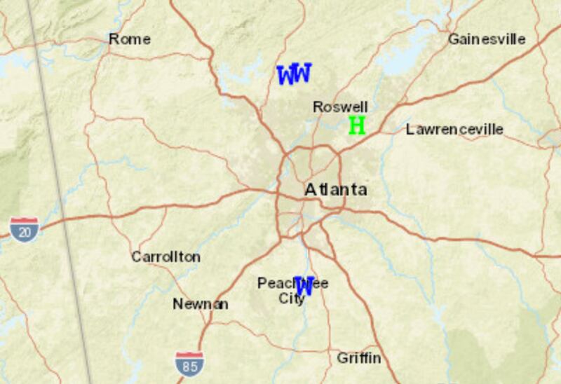
SUN AND A DELUGE NEXT TO EACH OTHER (June 15 2020):

*AFTERNOON STORMS CAN PRODUCE PROBLEMS: The greatest threat from a summer afternoon thunderstorm is lightning; one storm can produce hundreds of very dangerous ground strikes. And, they can produce localized areas of damaging winds called “wet microbursts”. These often last for only a few minutes, and sometimes happen toward the end of a storm’s life cycle as the cell begins to collapse. Severe thunderstorm warnings are issued when this is a high probability. These winds can topple trees and cause spot power outages.
ALL thunderstorms have some heavy rain, some strong gusty winds, some small hail and dangerous destructive deadly lightning. This does not make them severe! House fires can be started by lightning from even the weakest thunderstorm, and a tree or branch can fall and cause a power outage. This does not mean the storm was severe. A true severe storm has winds of about 60 MPH or higher and/or hail the size of golf balls or larger.
The National Weather Service in summer issues way too many severe thunderstorm warnings that turn out to be false alarms; at least for most of the area of the warnings, this is not my fault. I don’t run the NWS.
Often in summer the “severe” or damaging part of a storm will only last 5 minutes or so and may impact as little as one or two subdivisions yet the official warning covers all or much of a whole county or counties. Thus an OVER-warn.
All grown-up adults know that all thunderstorms are dangerous and you should take-cover without needing an official warning. If you can hear thunder you are in danger of being struck, when thunder roars go indoors.
A recent example on Wednesday July 15th 2020 many severe thunderstorm warnings were issued. But look at the verification below, just one large hail report and two reports of trees down, that was it!
The National Weather service does NOT over-warn for the more widespread thunderstorms the rest of the year when a severe storm often impacts large parts of a county or counties.
TORNADOES ARE VERY RARE IN SUMMER: Wind fields are light and variable from the surface to the tropopause on most summer days, limiting the wind shear and rotation of air, so it is almost impossible for a tornado to form. About the only time we see them in the summer is in spiral bands associated with landfalling tropical storms or hurricanes. And, when that happens, the tornadoes are usually very small and short lived.
SPASH AND DASH TYPE:

The storms Wednesday July 15th 2020 were both pulse air-mass storms and frontal storms, there was a decaying front in the area which aided in the storm development and gave the coverage and intensity a boost. The coverage was greater than I had forecast early that morning.
HEAVY HERE AND THERE AND DRY IN BETWEEN (rain reports from July 15 2020):


AFTERNOONS ARE HOT: This isn’t breaking news or anything unusual. Hot weather is the norm here from June through August, and often through much of September. Highs usually are in the 90s, but when an intense upper high forms over the state, we can hit triple digits. It has been as hot as 112 degrees in the state… recorded on September 25, 1925 in Bibb County.
SOIL MOISTURE IS IMPORTANT: This is one factor many people don’t consider, but it is very important when it comes to the amount of heat we experience. When soil moisture is high, some of the sun’s energy is used to evaporate that moisture, which takes away from the amount of solar energy used to heat the ground, which in turn heats the air. You rarely ever see 100-degree days when the soil is moist. On the other hand, with dry soil and brown grass, temperatures can easily reach the triple digits.
MOST BACKYARD THERMOMETERS DO NOT WORK WELL HERE ON HOT SUMMER AFTERNOONS: Almost every hot day, we hear from someone reporting a high of anywhere from 105 to 115 degrees. To properly measure air temperature, you need a thermometer in an instrument shelter, about six feet off the ground over grass. The shelter should have easy and free air movement, and it needs to be painted white. Needless to say, most backyard thermometers are not set up this way, and they wind up measuring the temperature of the instrument casing instead of the air. You really need an aspirating fan if you don’t have a shelter. Few “backyard” reports are accurate this time of the year.
THE SAME GOES FOR YOUR CAR: The auto car thermometers out in traffic, the sun, a parking lot will give readings way too high that reflect the temp of the car and the surroundings NOT the air. They work better in the winter spring and late fall when solar influence is less. Also true of those “bank sign” thermometers or those out front of churches and other businesses.
Hot weather in Georgia during the summer isn’t some kind of emergency, or breaking news. It is just a way of life. Use you common sense and stay cool as best you can. On the blog here I won’t insult your intelligence with “hot weather rules”… I am well aware you know or should know what to do if you begin to overheat and how to avoid doing so in the first place.
But we must acknowledge that sometimes the LEVEL of heat is ABOVE normal, and heat and humidity with over exertion or lack of hydration can lead to health problems.
HURRICANES BREAK THE ROUTINE: The core of the hurricane season comes in August, September, and early October, but the season itself runs from June through November.
When it comes to “air mass pulse-type thunderstorms” the science cannot tell you well in advance when or where storms will form, we CAN do that much better with the “synoptic-type” thunderstorms and sometimes “mesoscale-type” storms.
The typical MID-summer chance of a thunderstorm on any given day is 30-40% in Metro Atlanta, lower in early and late summer. Rain or storms everywhere or all-day are very rare in the summer here. It is also VERY RARE to have ZERO chance of a shower or thunderstorm on any day in summer.
Last weekend I was in Woodstock in the early evening and the sun was shinning, thunder was heard, and it was pouring on one side of main street and dry on the other side!
That just does not happen the rest of the year, so now you know... even if your neighbors don’t, that not all rain and thunderstorm forecasts are the same.
WHAT THE DIFFERENT TYPE SYSTEMS LOOK LIKE ON SATELLITE AND RADAR:


Side Note: the squiggly light blue line forming a circle is a thunderstorm “out-flow boundary” or mini-cold front formed by rain-cooled air, aka a gust front. This is the gust of cool air you often get before it starts to rain. They sometimes spark new storms.
For more Follow me on TWITTER @MellishMeterWSB.
Cox Media Group


