
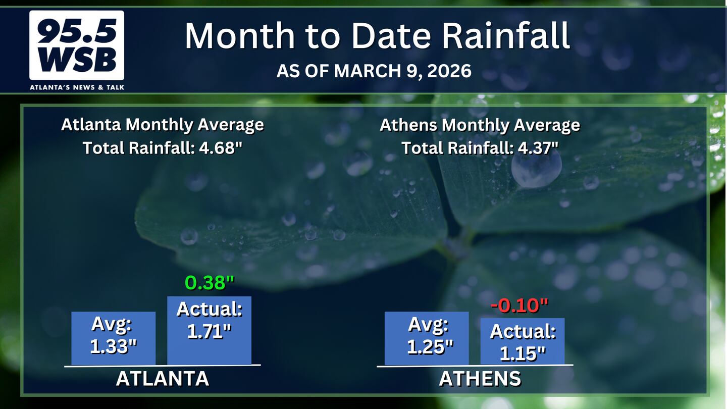
A respectable amount of rain fell over North Georgia and Metro Atlanta over the weekend, boosting the Month-to-Date rainfall so far this March and helping to ease the developing drought in the state.
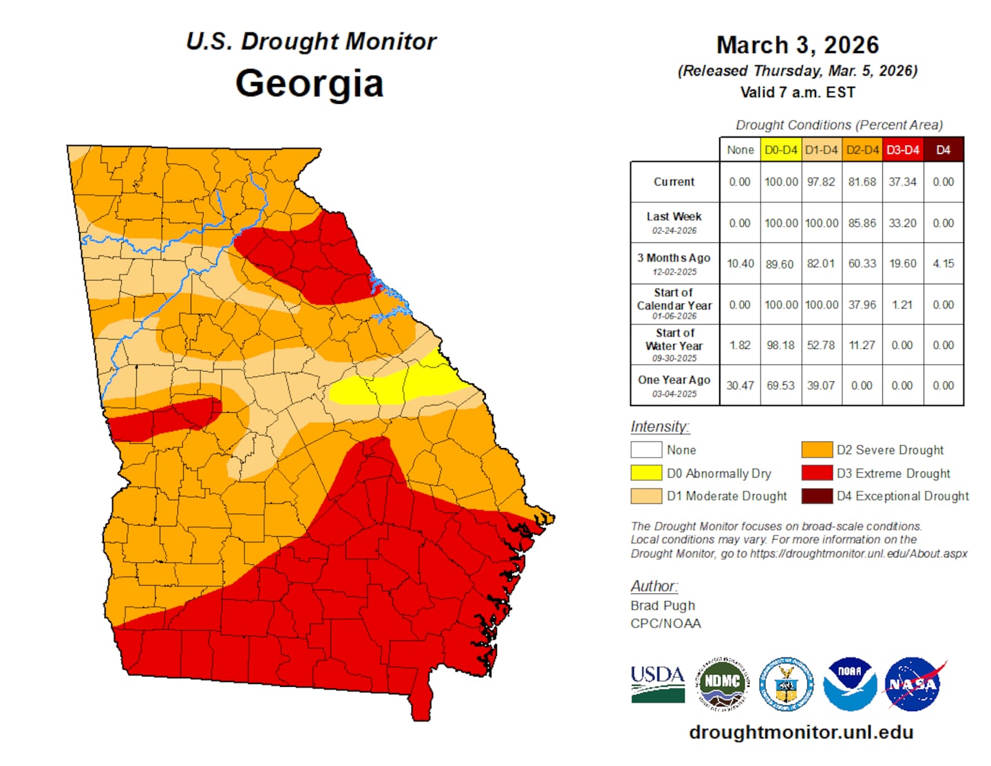
Before the rain arrived, Extreme Drought (D3) conditions developed in Athens and spread west towards Barrow County.
Elsewhere, Moderate (D1) to Severe Drought (D2) conditions developed throughout Metro Atlanta and North Georgia.

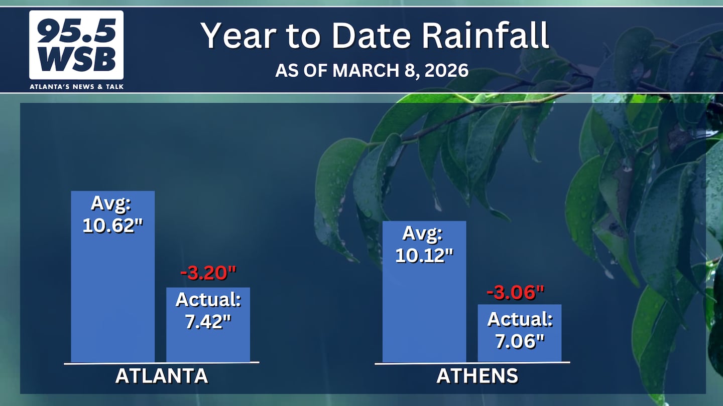
Year-To-Date, rainfall is still trending about 3 to 4 inches below average, but another round of heavy rain and thunderstorms this evening will help to mitigate this deficit.
Tracking Tonight’s Rain and Thunderstorms
A thunderstorm cluster will roll through the Southeast later today, arriving in western Georgia late tonight.
The animation below illustrates the Futurecast Radar for tonight into early tomorrow morning. The earliest storms well arrive in western Metro Atlanta after 8pm, continuing to push into the downtown Atlanta area through Midnight.
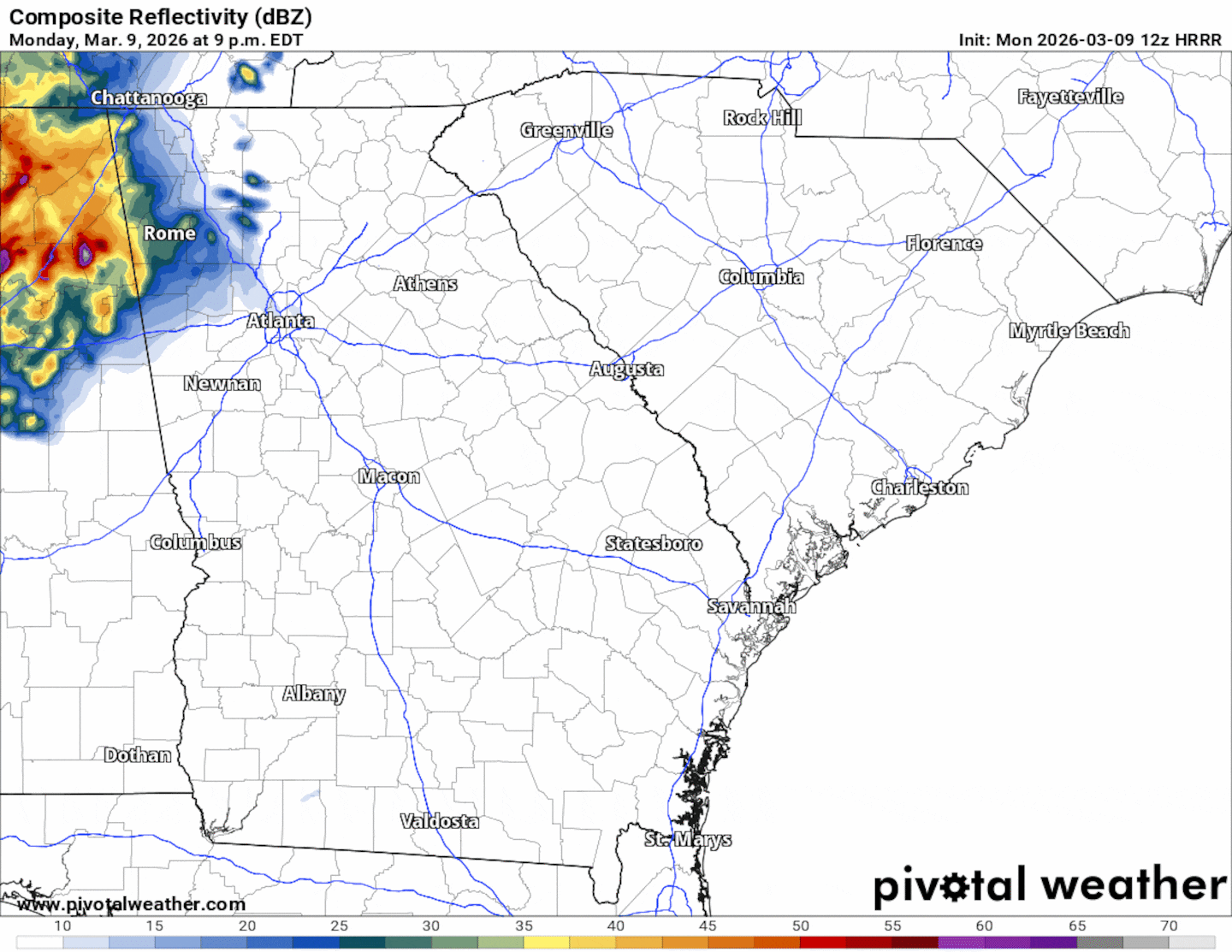
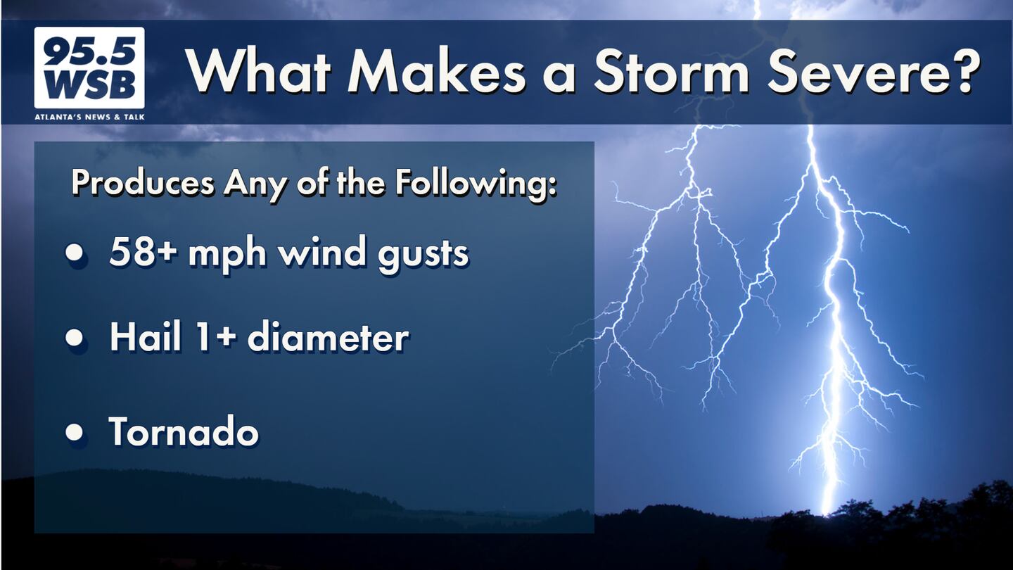
Some storms may be strong to severe, with damaging winds and large hail the main impacts before midnight. Tornadoes are not expected with this system.
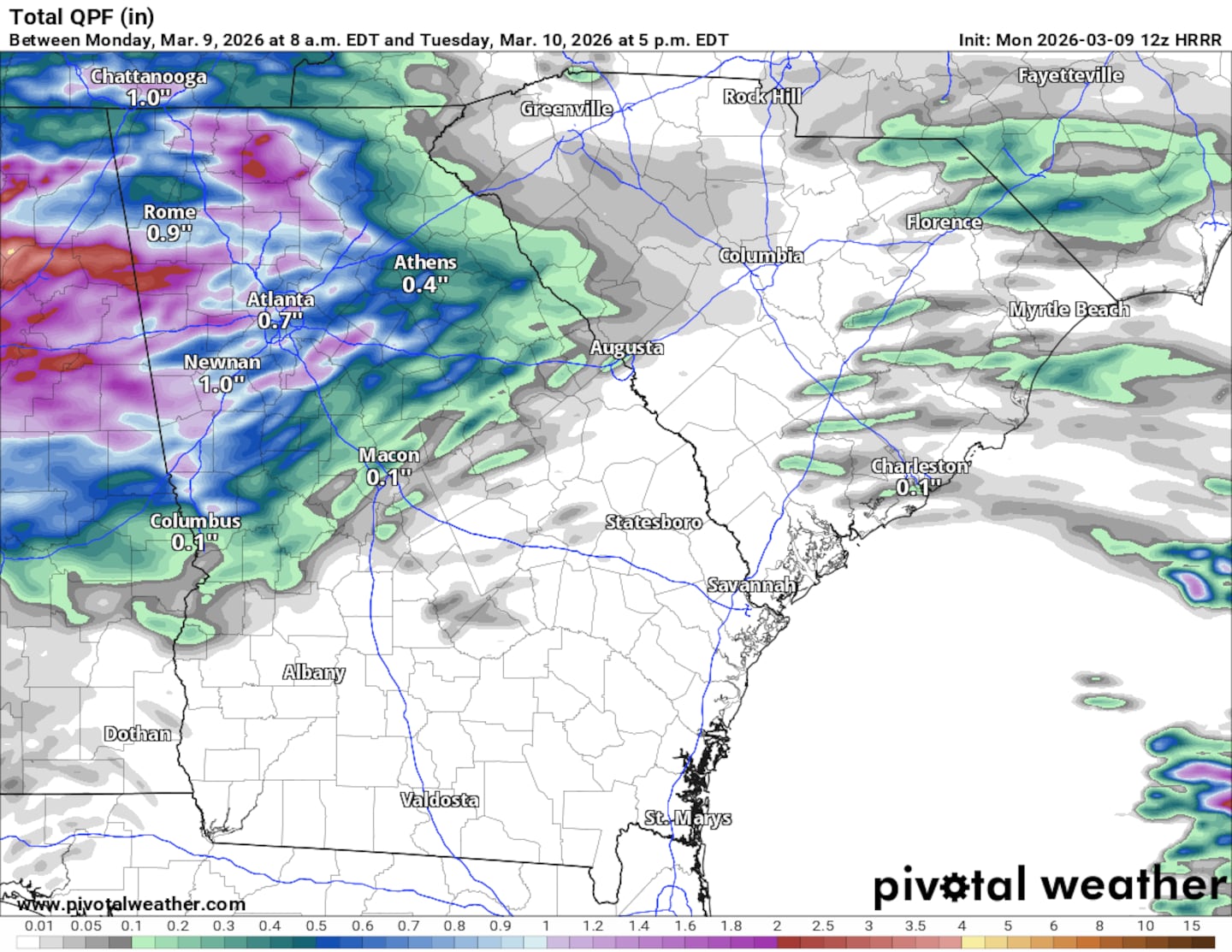
This round of storms will bring an additional 1 to 1 inches of rainfall through Tuesday morning.
Share Your Rainfall Reports With Me!
Facebook: Christina Edwards WSB
Instagram: ChristinaWSBwx
Twitter: @ChristinaWSBwx
©2026 Cox Media Group


