
Chilly temperatures along with the umbrella grab a jacket or sweatshirt. In fact, there will not be much change in temperature all day long on Monday with fog and rain likely.
No widespread flooding is expected, but creeks and streams will be on the rise over the course of the week. A “relative” pause in the rain is possible Tuesday night into first thing Wednesday but the weather looks unsettled until Friday. At least the reward appears to be that a dry weekend will follow. 3-day rainfall amounts expected to average 3-4 inches with isolated higher totals possible.
High temperatures in the 40s and 50s through the week with lows in the 30s and 40s. Highs on the weekend in the 50s with lows in the 30s.


THURSDAY SURFACE WEATHER CHART MORE SHOWERS:

FRIDAY SURFACE WEATHER CHART DRYING OUT:

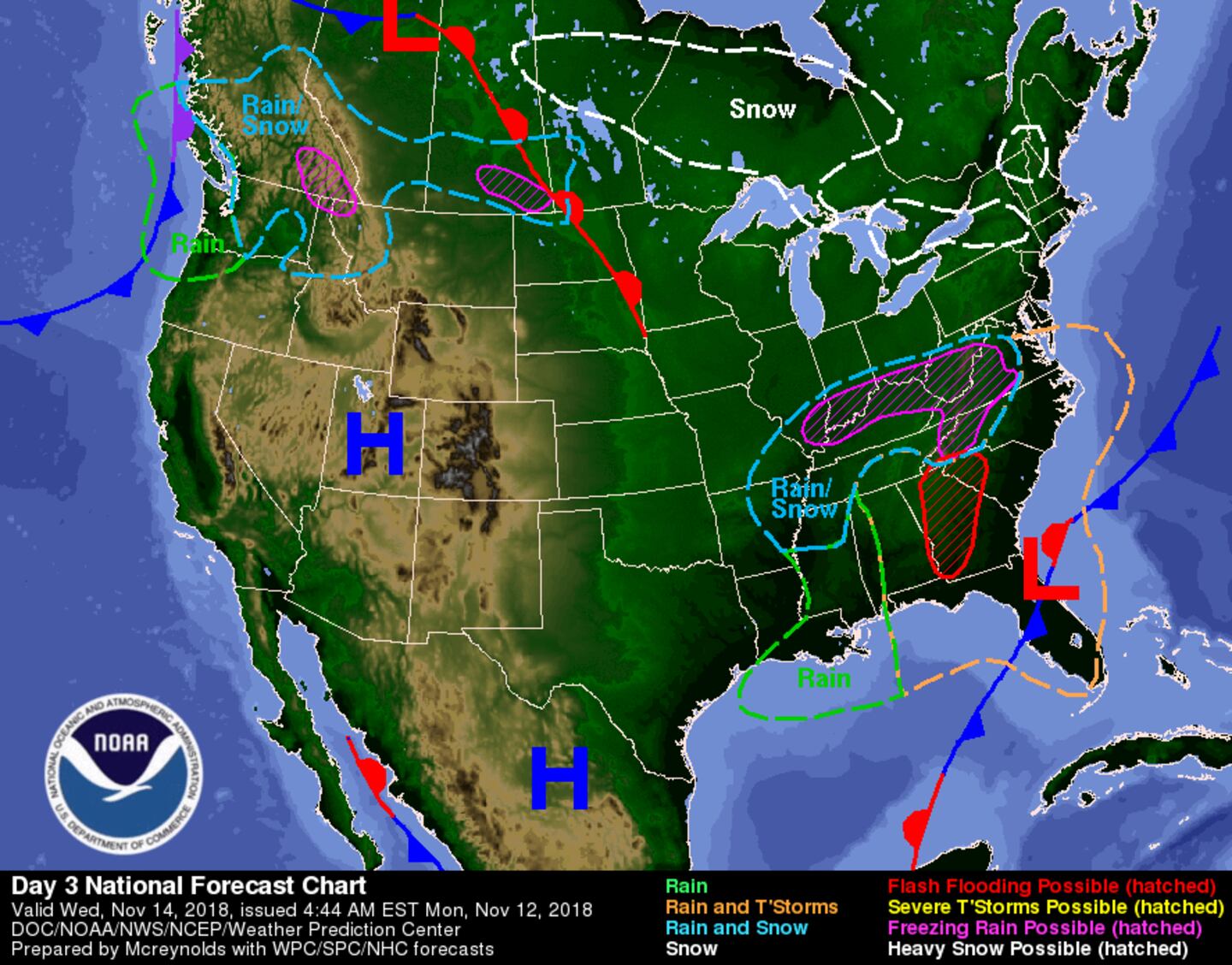
FLOOD RISK ZONES MONDAY/MONDAY NIGHT:
FLOOD RISK ZONES WEDNESDAY/WEDNESDAY NIGHT:
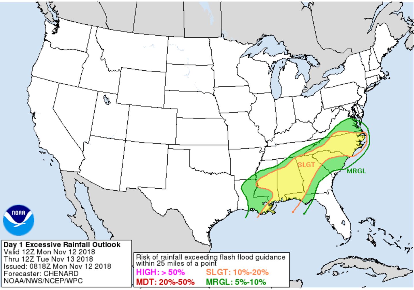
24-HOUR RAINFALL ESTIMATE MONDAY:

24-HOUR RAINFALL AVERAGE ESTIMATE TUESDAY:

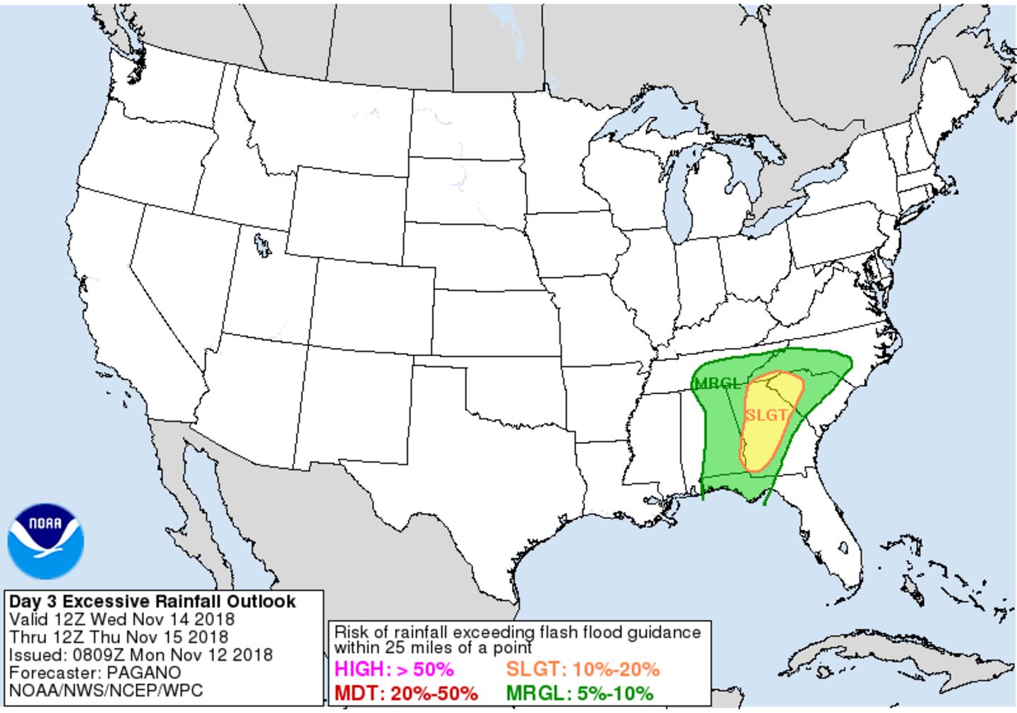
WEDNESDAY RAINFALL ESTIMATE AVERAGE:

For more follow me on Twitter @MellishMeterWSB.


