
The above map shows the current Winter Weather Bulletins in effect for Georgia. As I’ve been warning in my blog here all week the rain/snow line is likely to shift even up to the last minute. As I pointed out the models often do not handle the strength of “the wedge” (CAD) well usually being too warm. They have also “tweaked” the models so we don’t know if they will perform better or worse than they used to so that makes it more difficult to make confident human adjustments to their output.
As is typically the case, some models show a lot of snow and ice and others show little or none, and they show different locations as well.
We can not rule out that the wintry mix will end up further West and South over most of the Metro area than what is currently being shown so be prepared just in case and stay tuned for updates.
Flood Watch and Wind Advisory for all of Metro Atlanta. Isolated power outages possible tonight and Sunday. Flooding possible for the usual creeks and streams.
It is likely the lines depicted will have to be adjusted in future updates and they could be move South or North.
I’ll have more updates later.


Follow me on Twitter @MellishMeterWSB.
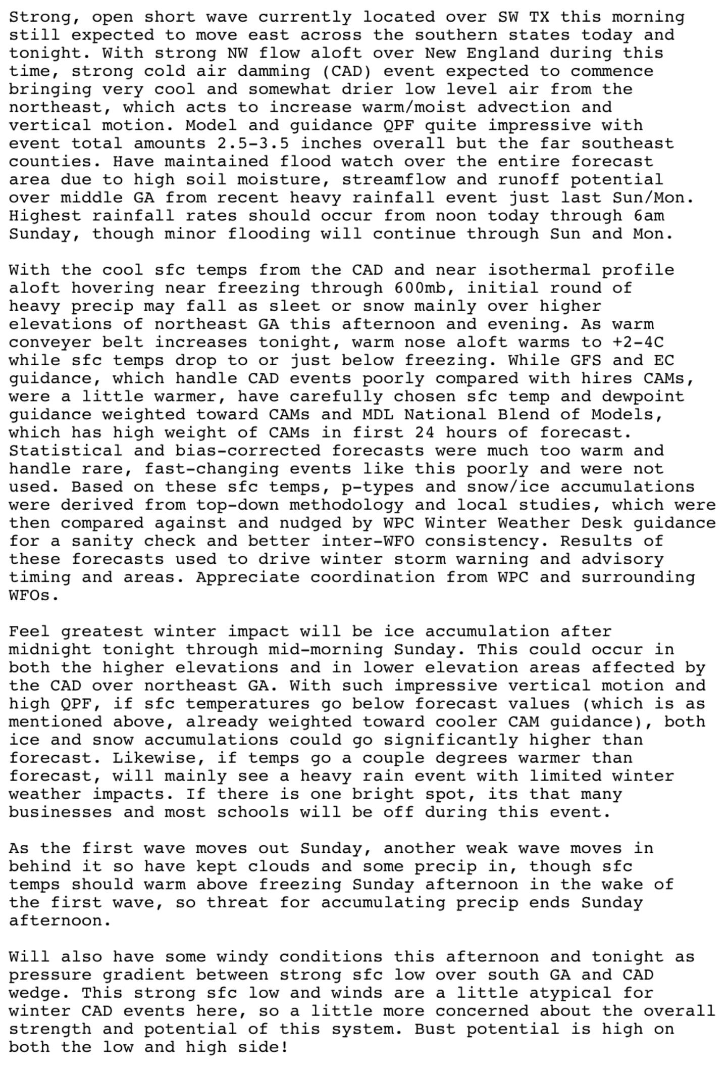
Atlanta National Weather Service technical discussion:
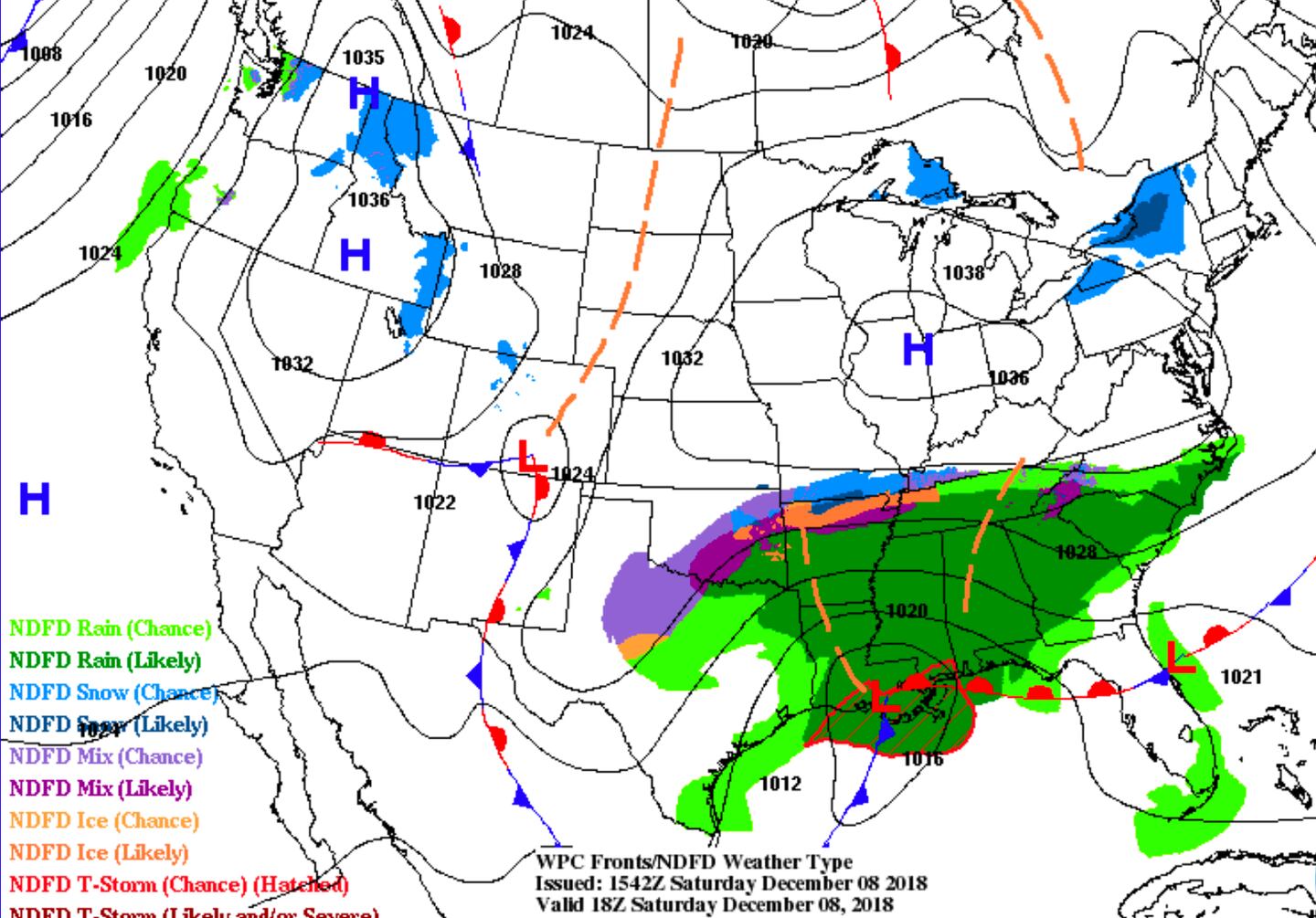
SURFACE WEATHER CHART SATURDAY AFTERNOON/EARLY EVENING:
FORECAST SURFACE CYCLONE TRACK (dots indicate model spread of low center):


