
Climatology or climate history tells us to expect it, some years you don’t get it. But most of the global models are indicating it will happen this year, and it fits what I showed in previous blogs and Tweets on the subject back on July 22nd regarding the MJO phase forecast. In that post I indicated the quiet period post early July Elsa would not last through August, that still looks to be the case.
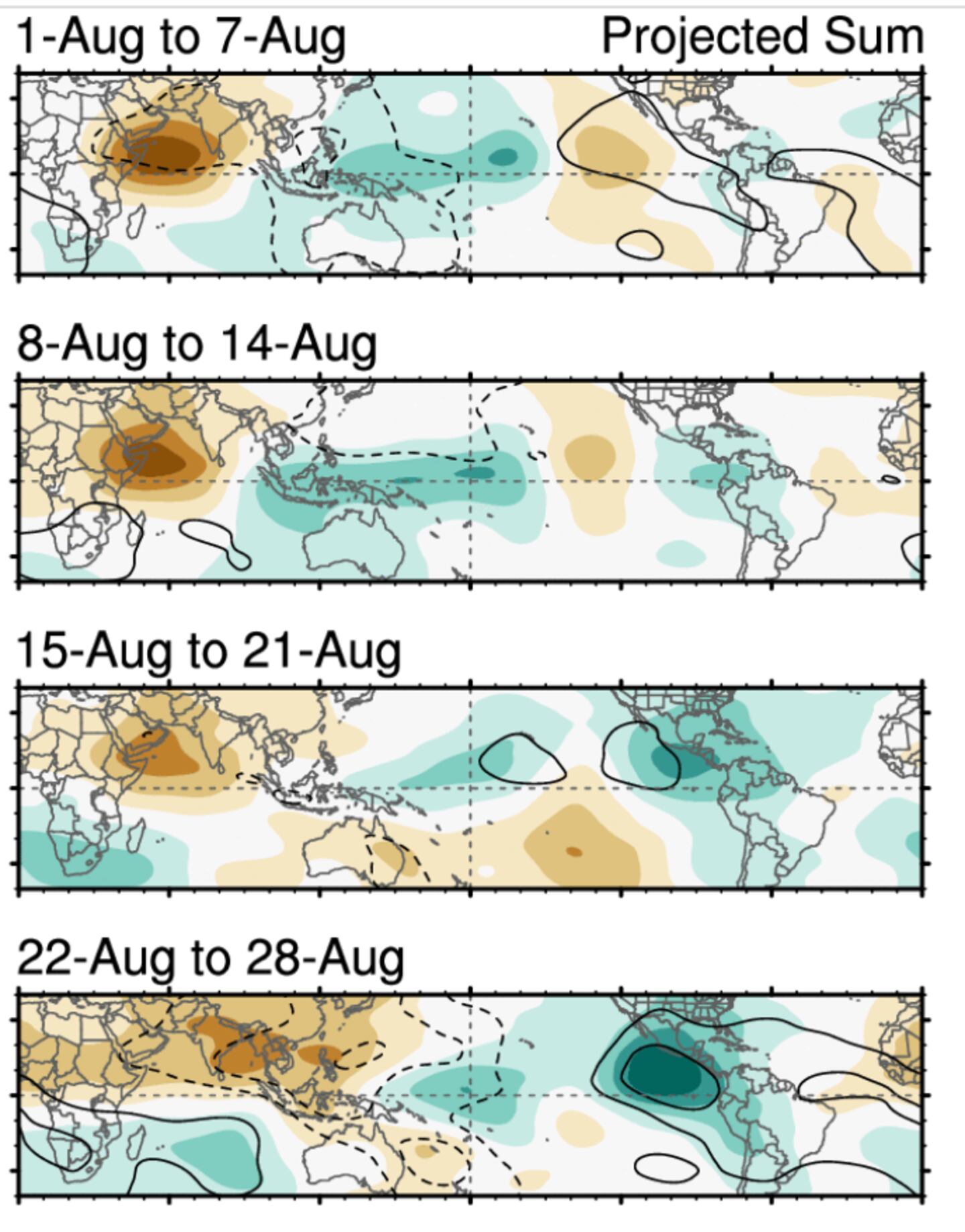
During the course of the next 15 days the MJO is forecast to move into and through phases 8, 1, 2 and maybe 3/4 by September as seen below (lines in color):

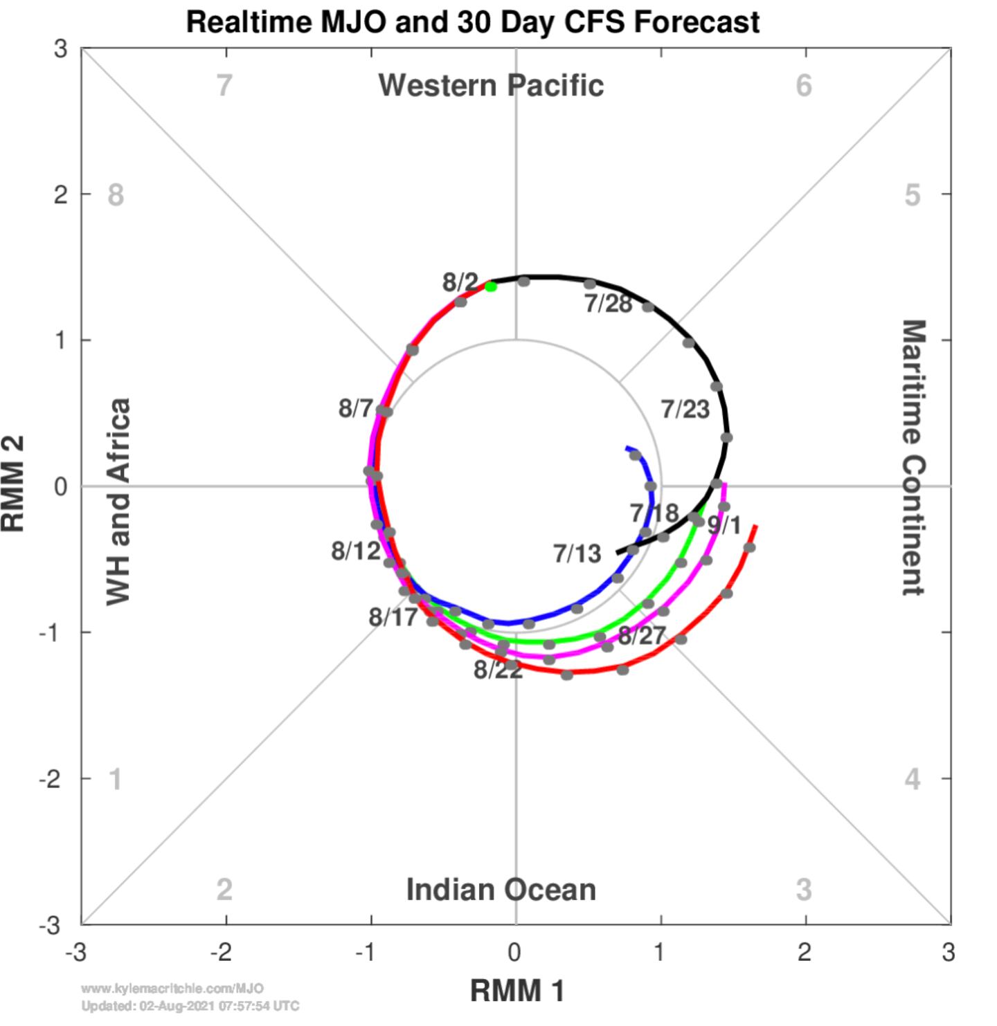
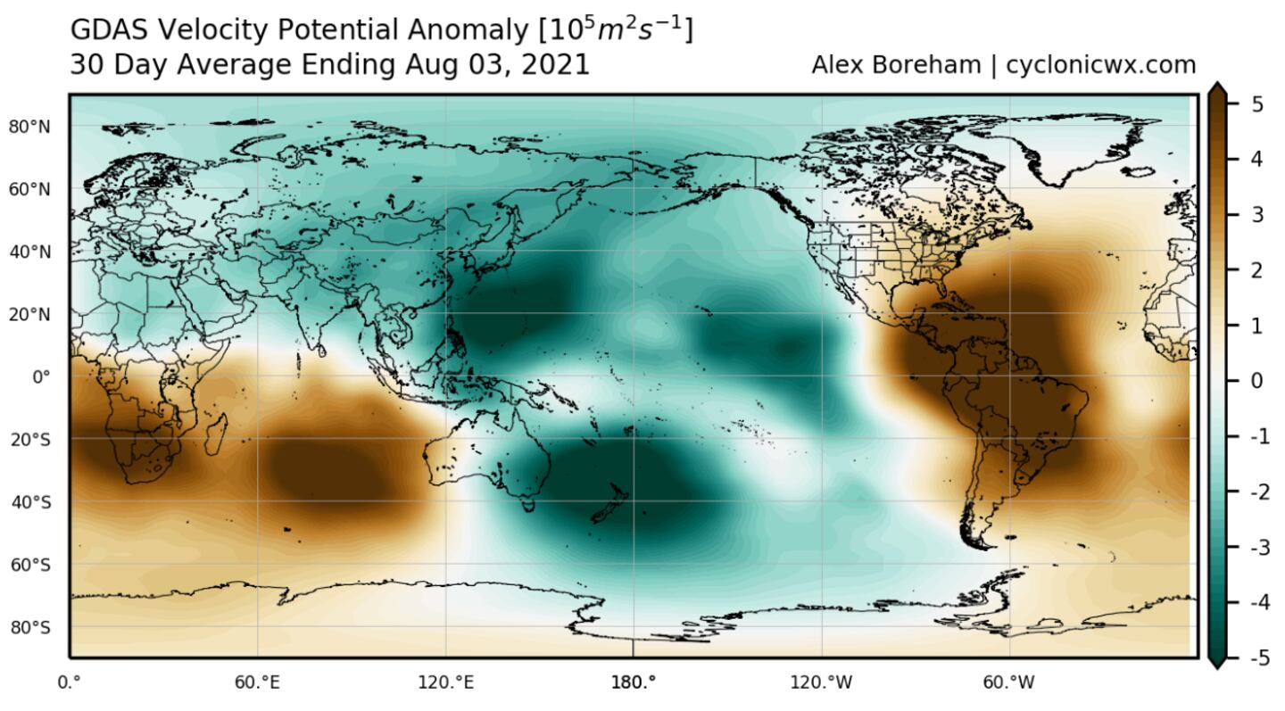
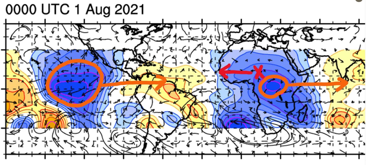
CURRENT MJO STATUS (- cool blue shades represent upper level divergence while the + warm red shades represent upper level convergence). Diverging air aloft is off-set by rising air beneath it and as such areas move East over the Atlantic it provides a boost to tropical system potential.
Hence the MJO map shows areas of large scale rising (+) air conducive to storms and large areas of sinking air (-) inhibiting storms:

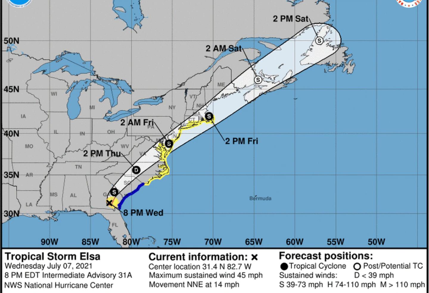
You can see why the tropics turned quiet in July in the Gulf/Caribbean/Atlantic given the unfavorable MJO conditions last Month:
I’ve explained in prior Tweets and blogs which phases of the MJO are favorable for the formation of tropical depressions storms and hurricanes and the favored tracks (8,2,4,5). Convection over Indonesia including South of India is consistent with the model forecast positive phases as we move through August.
There is often a cycle to the movement on the order of 40-60 days as it moves from West to East across the hemisphere and back again. There is often some lag to the impacts so development of any tropical system can come after the max upward motion passes beyond the Caribbean or Atlantic. There are of course other non-MJO factors that contribute to TC formation or inhibition such as wind shear, Sea-surface temperatures, dry air (SAL), and CCKWs (convectively coupled Kelvin waves).
MJO FORECAST:
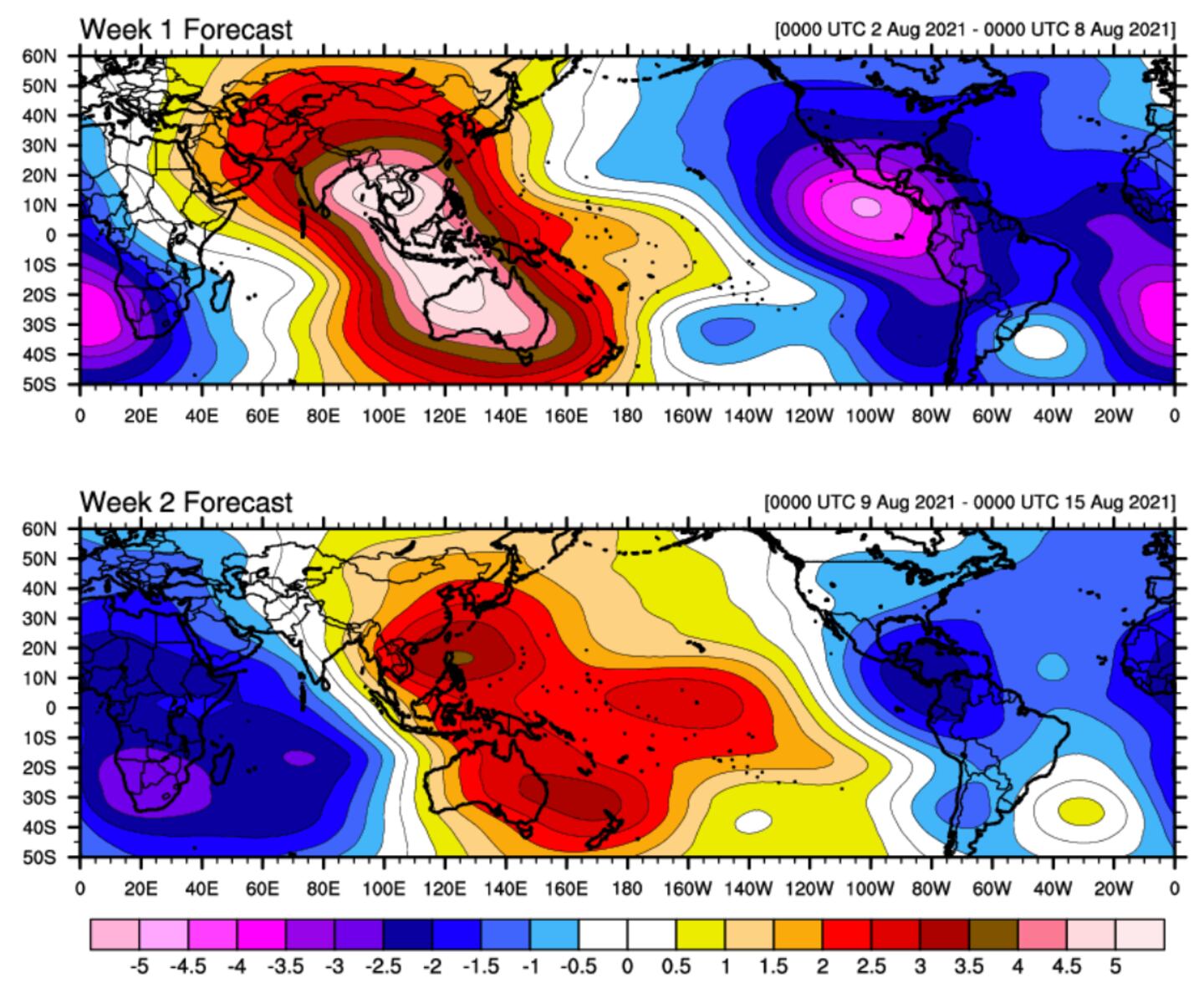
More favorable rising air as we go through August moves over Caribbean, Atlantic, and Africa. Most models agree, but differ on how much more favorable conditions become, often using Velocity Potential anomaly (VP) calculated at 200mb as above.
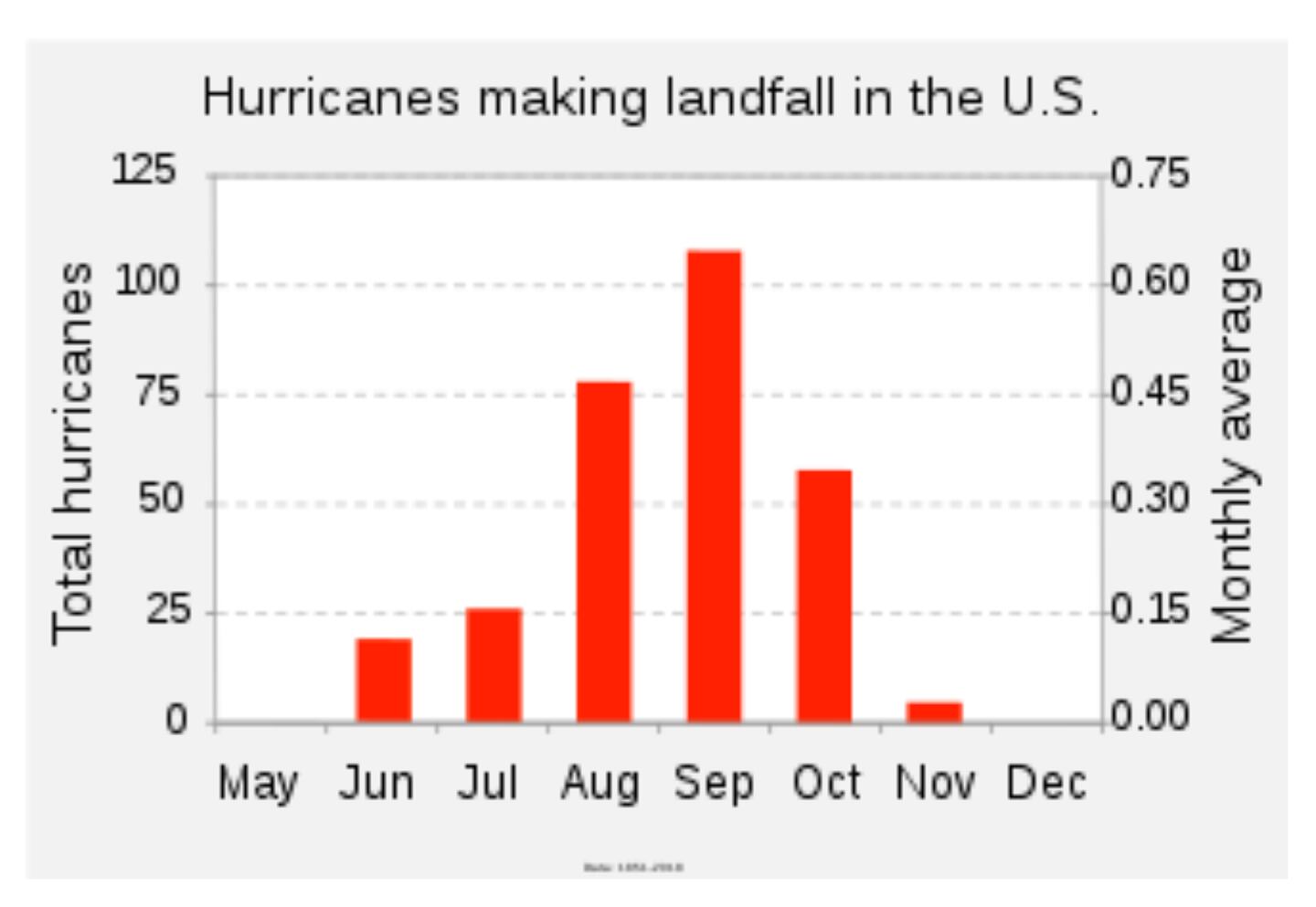
75% of tropical cyclone activity comes in the period from August 15th to September 15th.

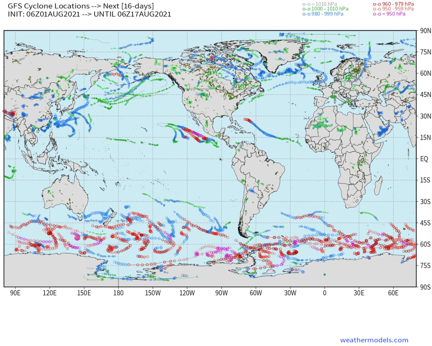
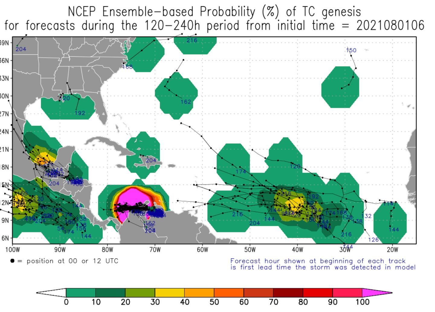
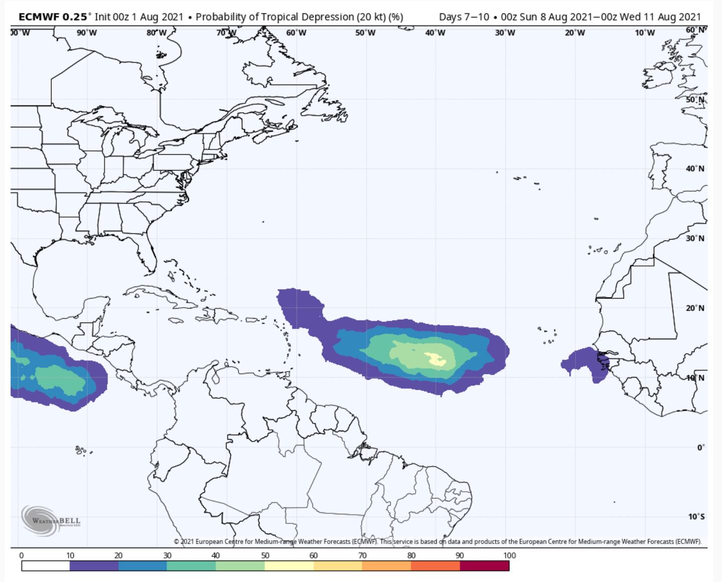
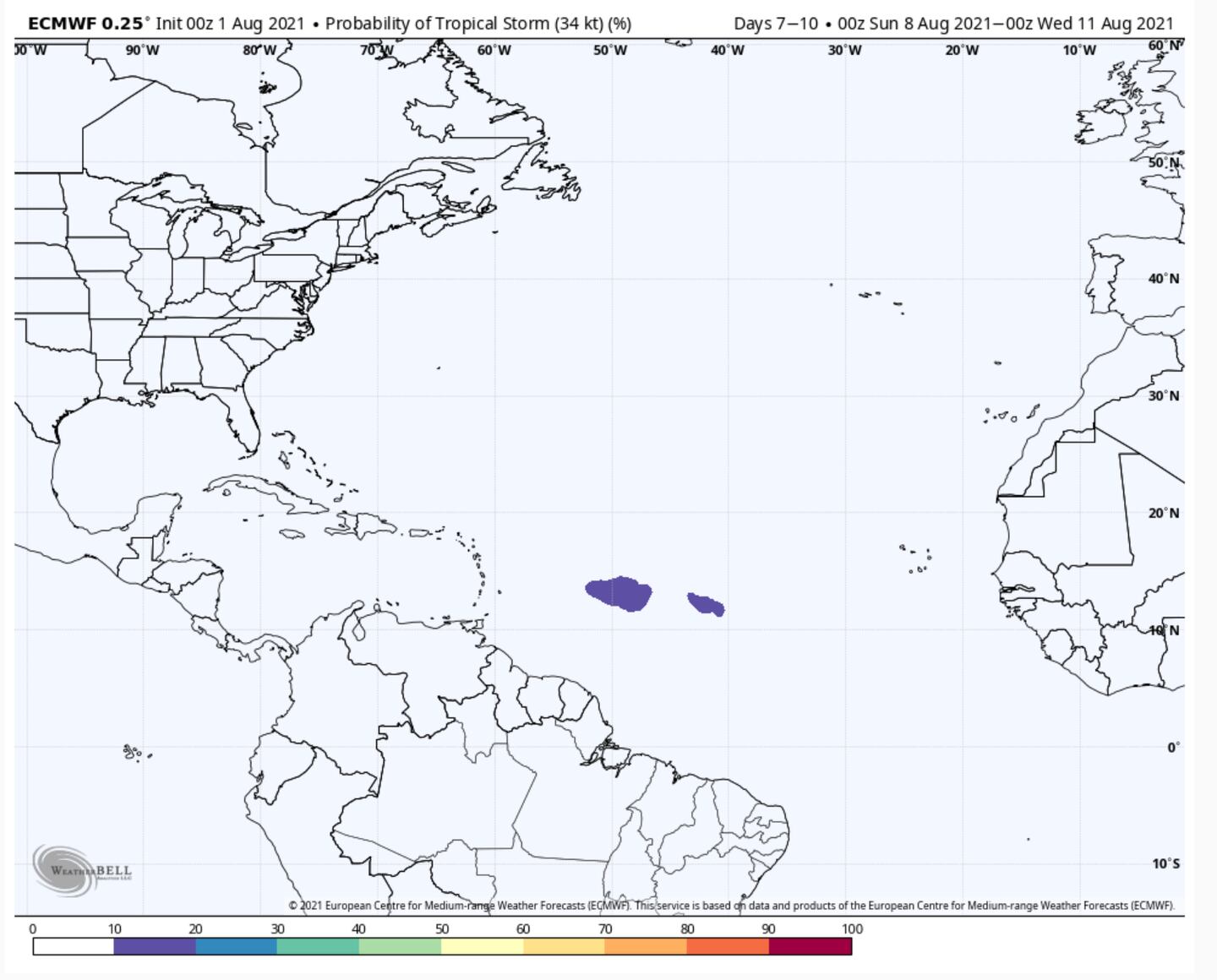
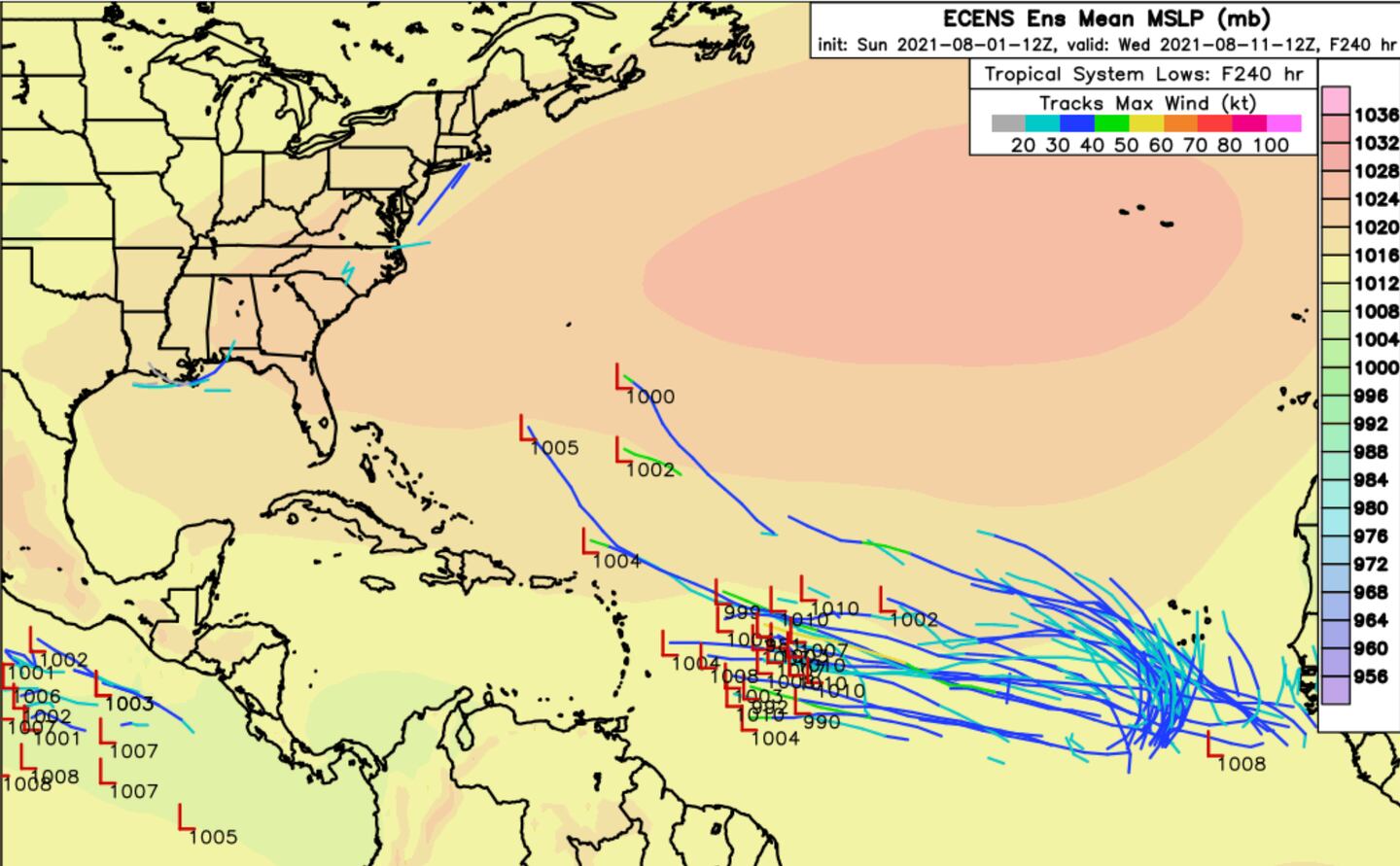
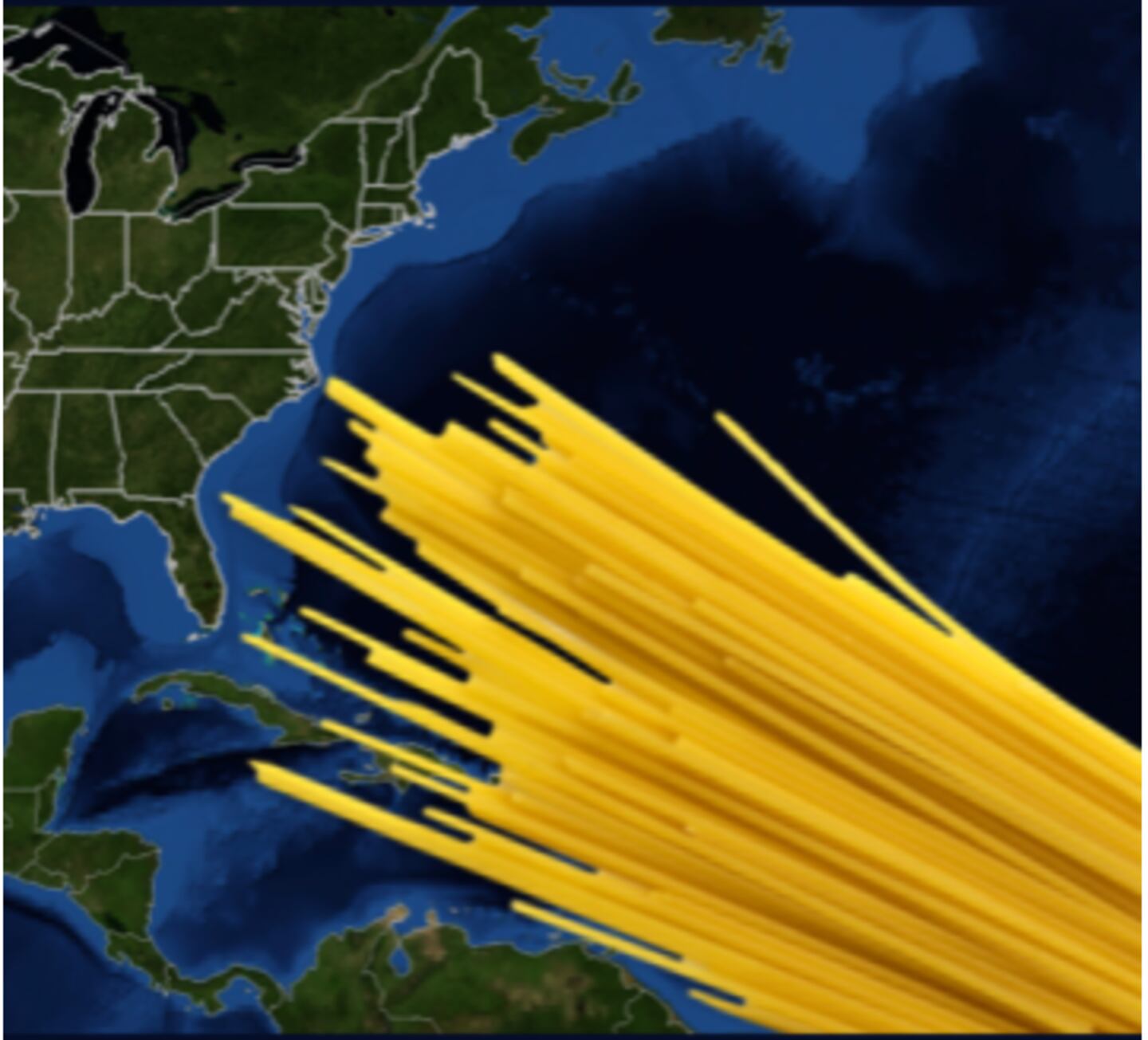
We will as always show model forecast charts when storms form, including “spaghetti” charts. Good time to look up what they are and mean if you’re not familiar.
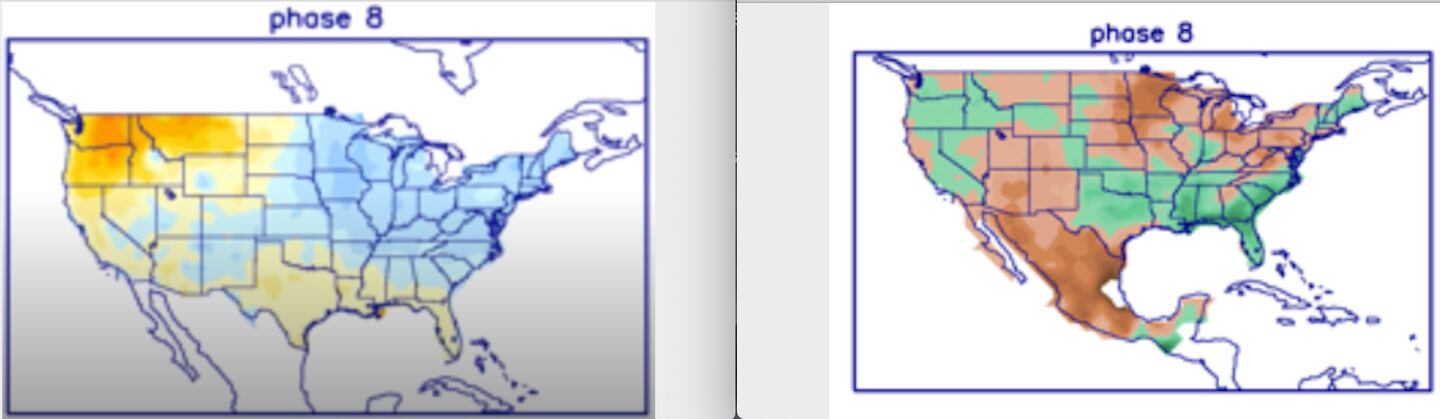
Meteorologists also use the MJO phase signal to look for periods of above/below temperatures and rainfall 10-90 days in advance. It often shows up here before it shows up on daily model maps.
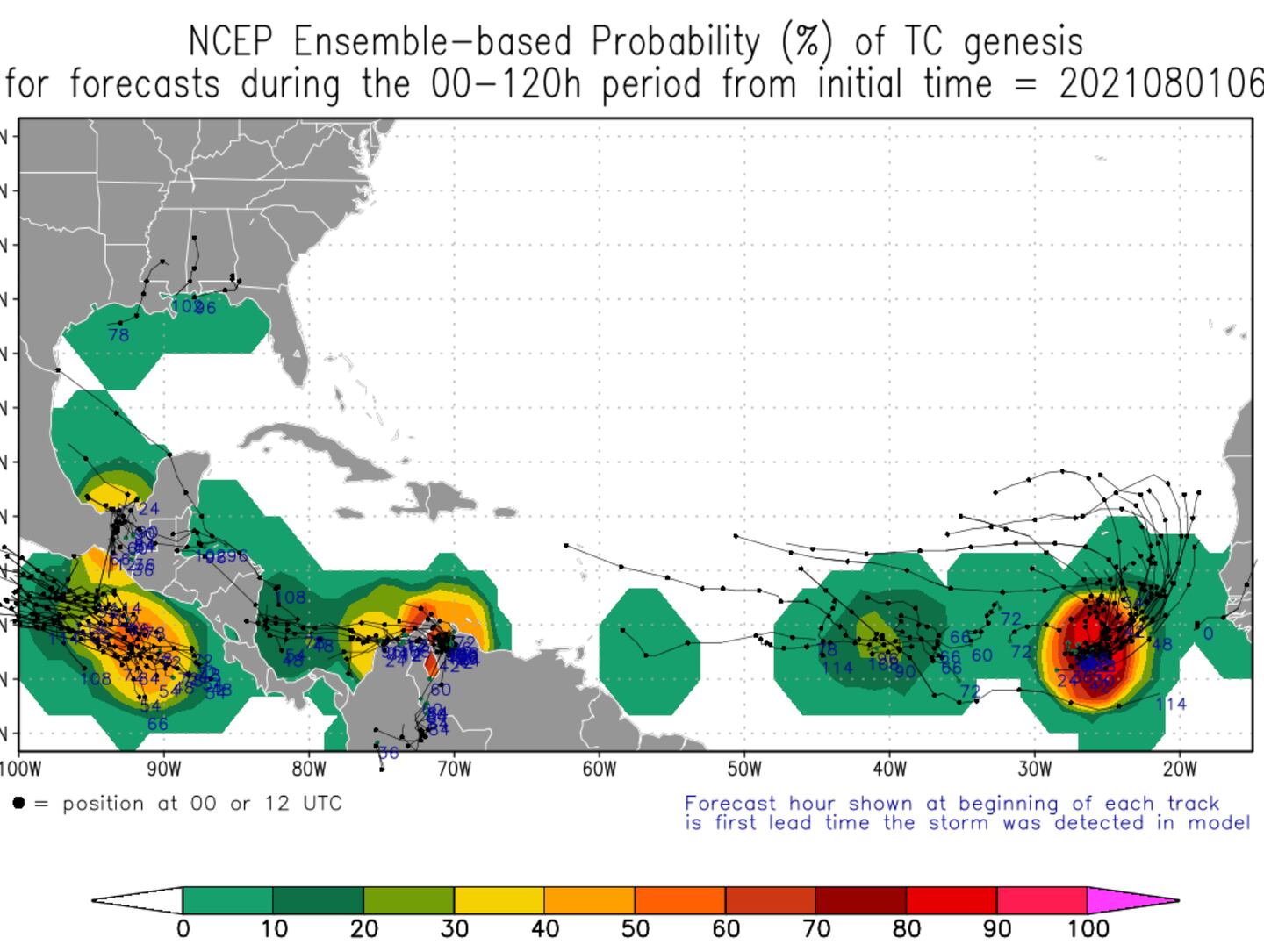
An example below:
For updates and more follow me on Twitter @MellishMeterWSB.
©2021 Cox Media Group


