You can follow me on Twitter as always for short-term forecast updates about tropical systems and our local weather.
Since I’ve already posted many blogs and many tweets over the past couple weeks I’ll just do some bullet points for this one to cut through the noise of the moment on important ideas that are old to meteorologists but often get missed or lost by the laymen or even by news people in the media.
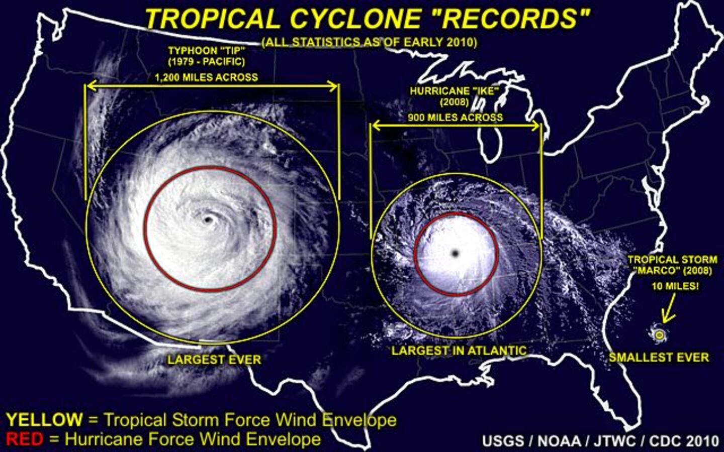
1) Too much emphasis is put on the spot where the eye or center of low pressure will strike land. That’s just 5-10% of the area of a storm system that is hundreds of miles in diameter across!
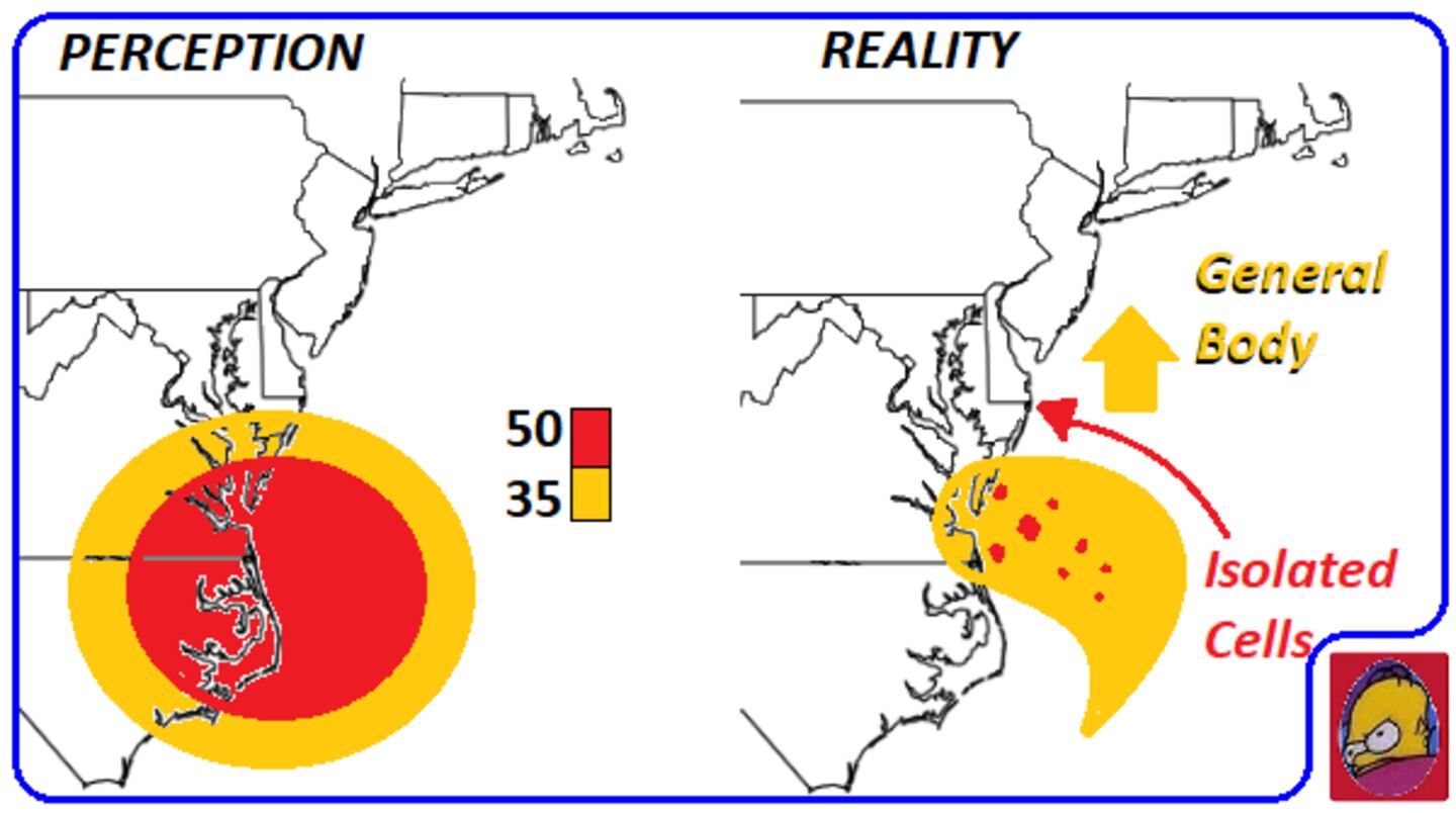
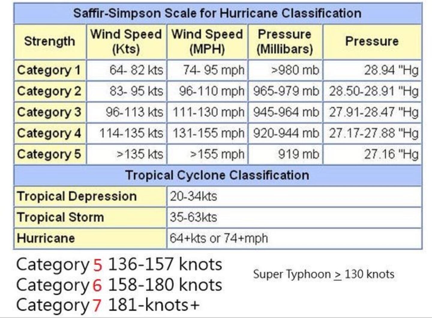
2) We classify these systems based on the maximum sustained wind speed near the center or eye which is merely one point, meteorologists know that we fully expect 95% of people impacted by the storm NOT to have those top winds! Category 1-5 is a classification NOT a forecast.
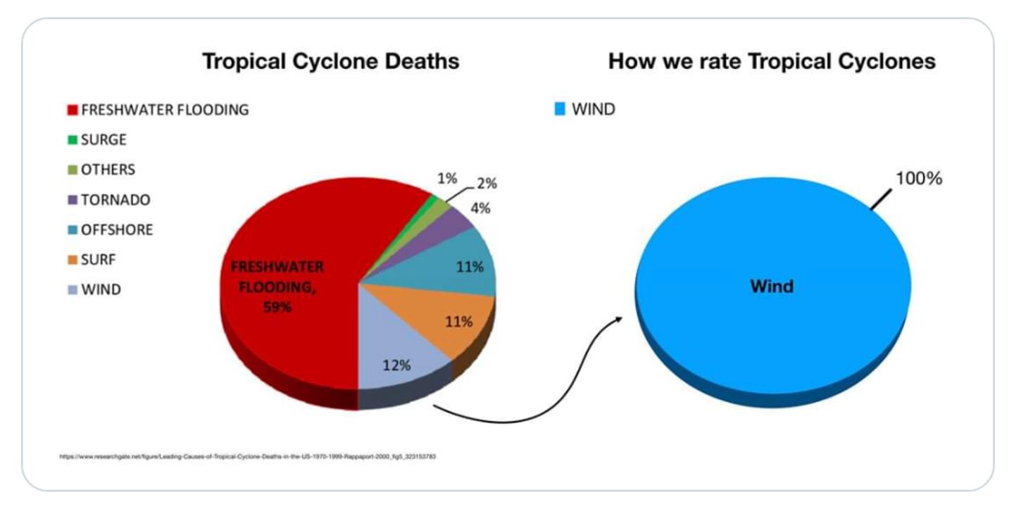
3) Water not wind is the number one killer in tropical storms and hurricanes on average, and it’s not even close, wind: 12% water: 82%.
4) The science is not very reliable on forecasting intensity of tropical cyclones one way or another. They often strengthen and weaken more than we expect and at different times than expected. Intensity changes can and do occur quickly and unexpectedly.
5) Not only do destructive and deadly impacts occur far from the eye or center of a storm but they also can and do occur well outside of and away from “the cone of uncertainty” shown on forecast charts both on coasts and in-land. Storm surge can sometimes penetrate 30-40 miles in-land, and flooding hundreds of miles inland.
6) It is typical for initial early reports after a storm for reports to say it missed or was nowhere near as bad as expected. Then, days later as more people get back to evacuated areas and more assessment is done it turns out it was quite bad or the worst was just someplace else, but by then the general public and the medias attention has moved on to other things.
7) Related to 6 too much hype by non-meteorologists (and a few meteorology sources not being named here) especially on social media like facebook and Twitter lead to expectations of Armageddon so anything short seems like “a bust”, everyone with a computer becomes a sudden expert lol smh. This can drown out (no pun intended) calm rational straight-forward forecasting which is available if you want it. But some prefer the hype for fun or so they can say bust on forecasts that were not made by pros or based on scary headlines written by news people not meteorologists.
8) Despite struggling with forecasting how strong or weak a tropical cyclone will be, almost all the time, the path of the eye will fall within the NHC “CONE” of uncertainty or variability even weeks in advance. Any individual model on the other hand can be off by 300 or more miles a week or two out which is why professional interpretation is required. The eye of a storm can range 10-60 miles in diameter.
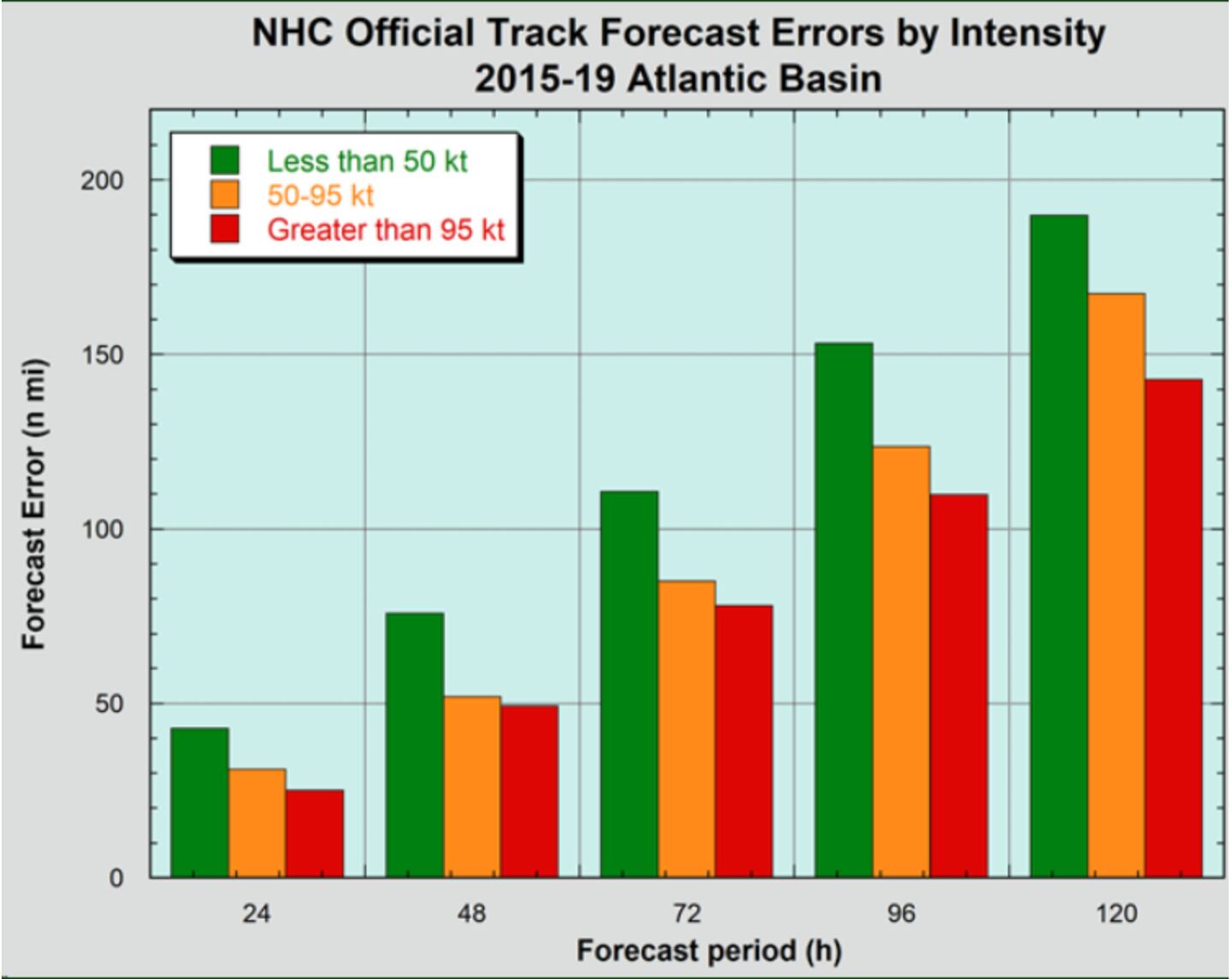
9) An error of say 50 miles is common normal and to be expected on exact position of the center or eye and is considered an accurate forecast, but if an area is hit or missed by that being off by 50 miles it can make all the difference in the world. The forecast is still excellent for what is realistic by the science, miracles are not what meteorologists do. A built-in margin of error is understood by adults.
10) Hurricane Force winds are sustained at 74 MPH. That is the level at which most people with “hurricane shutters” put them in place. The “Cone of Uncertainty” you see on forecast track maps shows the average error over the past 5 years. It is NOY specific to the storm being tracked! It’s the 5-year average track forecast error for past storms.
It is POSSIBLE that Laura could pose the most widespread storm surge threat to the U.S. coastline since Sandy in 2012.
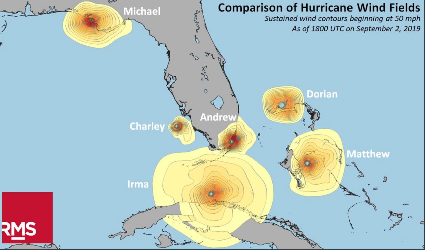
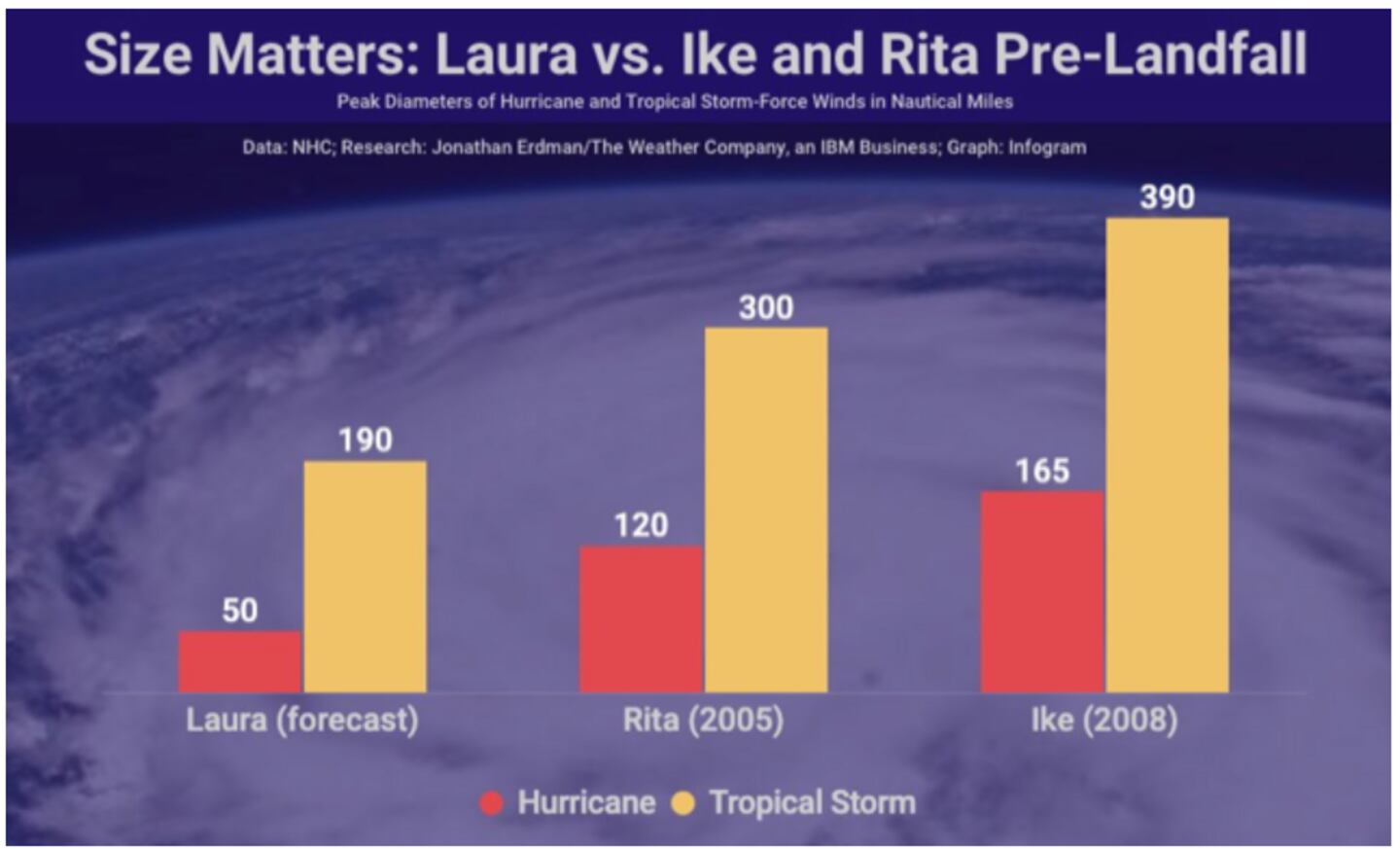
For storm surge size matters as much as intensity or more. Broader wind field storms produce more surge as chart above shows.
A 2010 research paper by Rappaport et al. found that on average Category 1-2 hurricanes intensify heading for the Gulf Coast while category 3-5 hurricanes on average weaken by landfall along the Northern Gulf Coast.
The NHC reminds us that the average track error is about 90 miles at 60 hours, 50 miles at 36 hours, under 50 miles at 24 hours.
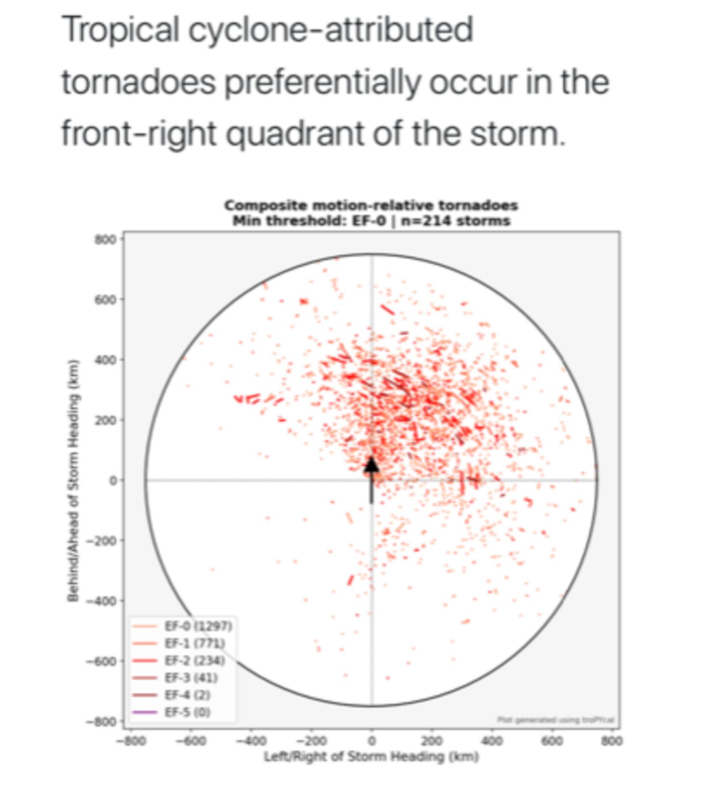
Do not focus on that track line or center point path, wind flooding storm surge inundation and tornadoes extend far far away from the center point.
For more Follow me on Twitter @MellishMeterWSB and my 5-day forecast on WSB RADIO 955 on all streaming platforms, smart speakers, mobile or tablets. My written forecast on wsbradio.com
Cox Media Group


