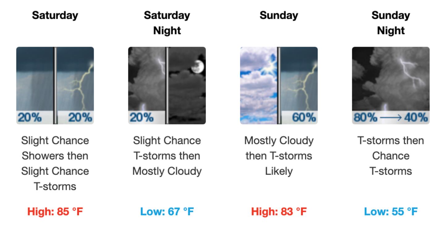
Severe weather is by no means a slam dunk in Atlanta on Sunday, and whether there is or not it still does not look like an all day rain.
That is not to say that I am giving any kind of “all clear” that is not the case so far.
Some of our best HIGH RESOLUTION models do not go that far out in time, so the forecast will have to be fine-tuned during the day Saturday as we get new data.
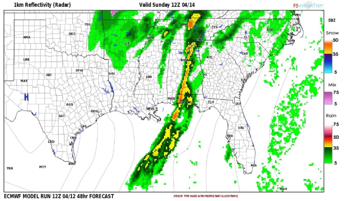
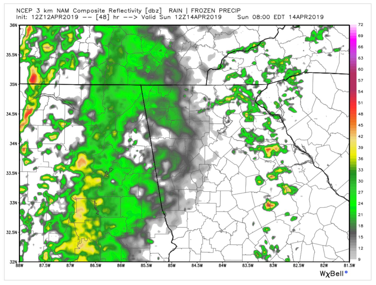
At this point two of my favorite models, one global-scale (ECMWF) and one meso-scale ((NAM) give at least hints, that there may be some weakening of the system as it arrives in Georgia as often happens... like a marathon runner running out of gas at the end of a long race.
There are indications that there may be two rounds of scattered showers and thunderstorms one in the morning, take a break for multiple hours, followed by a second by the end of the day.
Again none of this is certain as this is based only on those two models out of dozens.
I should be able to refine the forecast with greater details and better confidence when we get more data Saturday and the timeframe enters the realm of the higher resolution models and CAM models (Convection allowing models) convection refers to thunderstorms.
For now, the SPC (Storm Prediction Center) specialists at National NOAA\NWS maintain the severe weather risk here as shown in the previous blog post.
SIMULATED RADAR ECMWF MODEL 8AM SUNDAY:
SIMULATED RADAR NAM MODEL 8AM SUNDAY:
Stay tuned for updates and Follow me on Twitter @MellishMeterWSB.
Download the WSB RADIO APP and turn on severe weather alerts.
THE MASTERS IN AUGUSTA: