
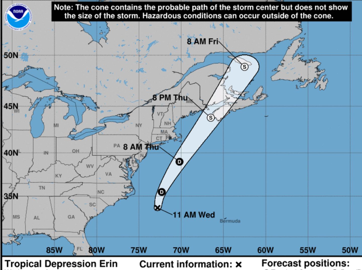
Tropical Storm Erin could impact the Northeast U.S. and Southeast Canada with some wind and rain as a Tropical Storm before heading out to sea.
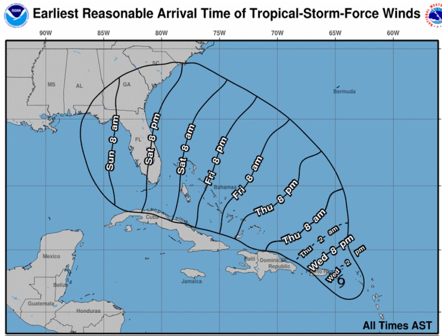
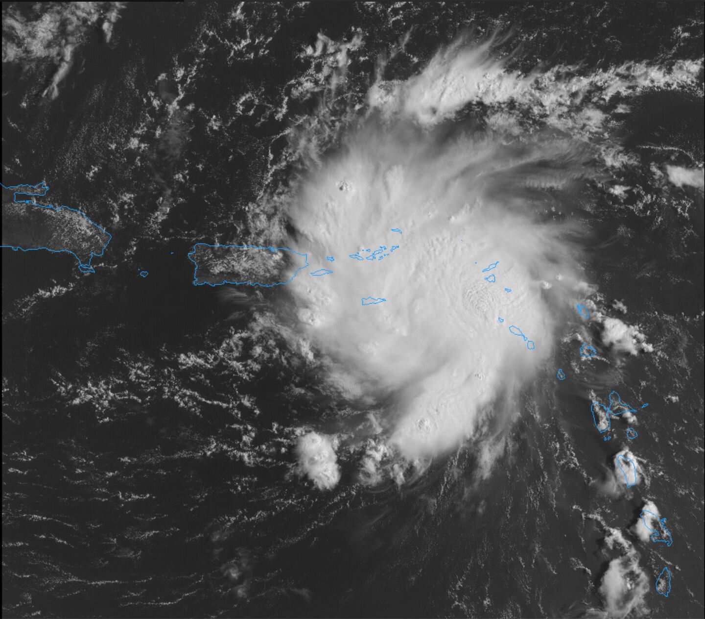
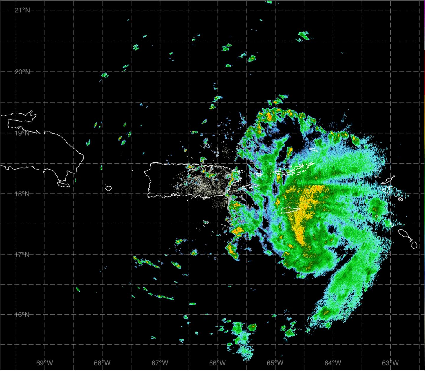
As for Dorian it will bring tropical storm conditions to the Virgin Islands and Puerto Rico today, with hurricane conditions possible with flash flooding possible as well including the Dominican Republic.
Then later this week and on the weekend the Bahamas and the East Coast of Florida have an increasing threat of storm surge and heavy rain flooding with tropical storm or hurricane conditions. Current forecast is for a low-end CATEGORY 3 Hurricane as it reaches Florida with max winds near the eye of 115 MPH or more.
Conditions are projected to favor potential “rapid intensification”:
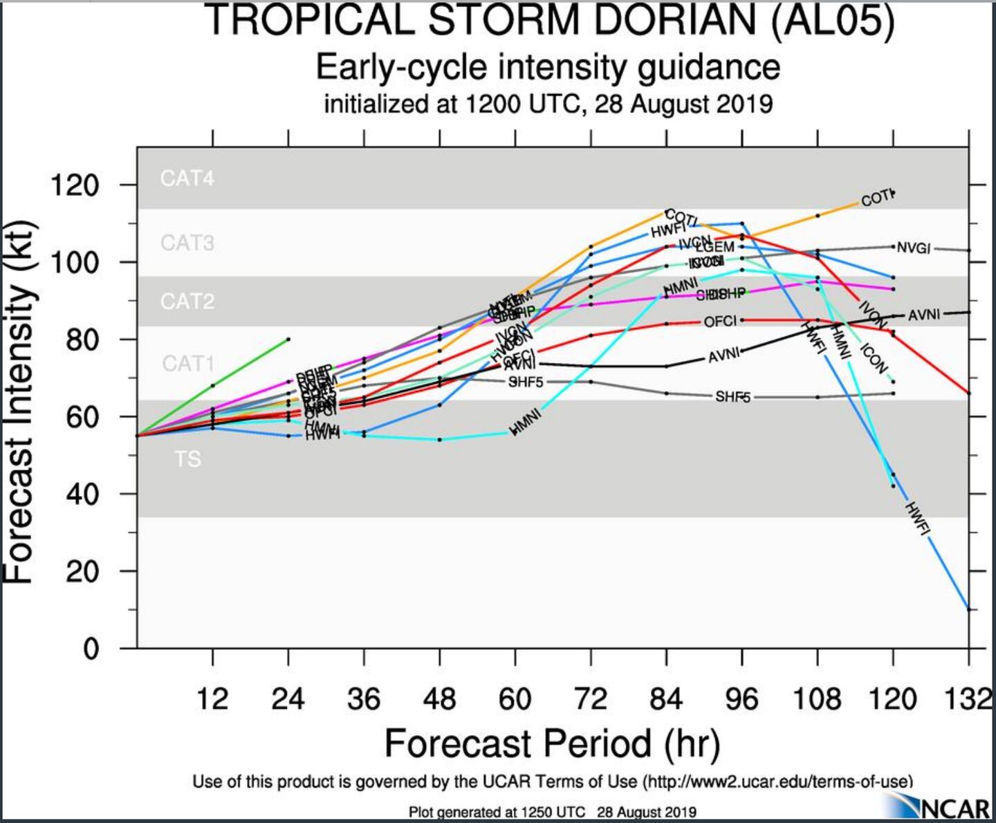
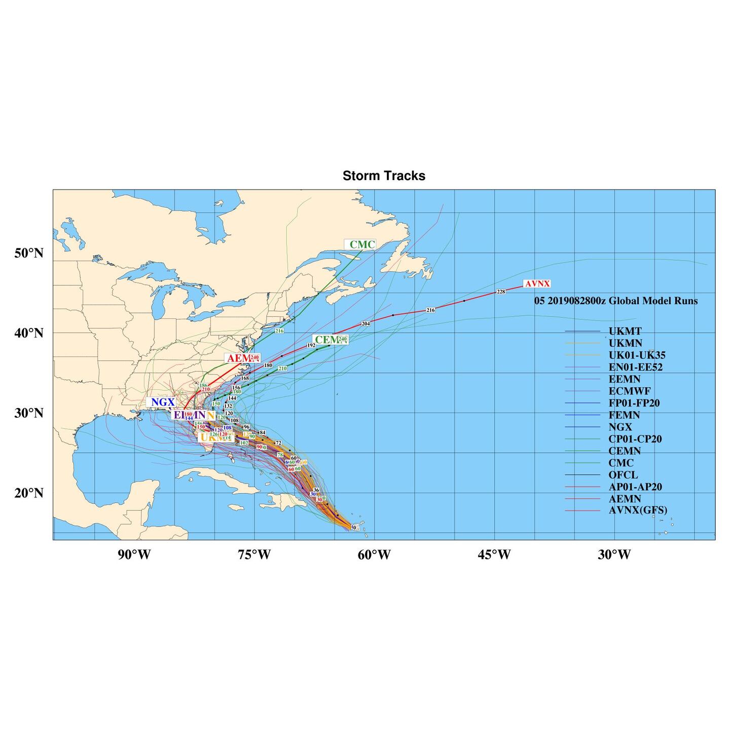
Uncertainty in the forecast path and strength of Dorian is unusually high due to a greater than normal wide spread in guidance from the numerical equations.
I think the models should “settle down” Thursday afternoon after the system has cleared most of the bigger islands and better data can be ingested into the computer models.
ERIN:
NATIONAL HURRICANE CENTER (NHC) OFFICIAL FORECAST FOR DORIAN:
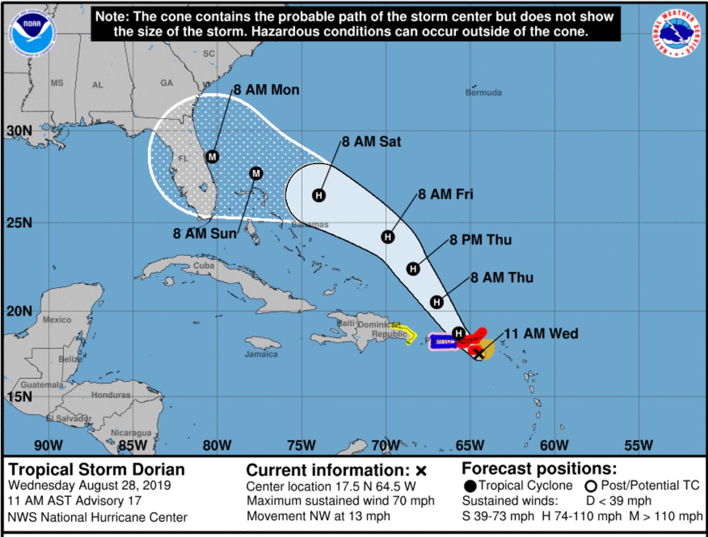
Remember the “Cone of Uncertainty” in NHC forecasts is the average error for any tropical cyclone, it is NOT specific to Dorian. Significant impacts are often felt OUTSIDE of the cone. The track and cone apply ONLY to the eye of the storm regardless of size.
As I've been advising for days now Weekend and Labor Day plans are risky for Florida and even the Georgia and Alabama coasts, but with the AVERAGE historical track ERROR of 200 miles at 5 days ALL INTERESTS from North Carolina to Mississippi should monitor future forecast updates on Dorian!
The forecast for these areas can change for the worse or better in the days ahead.
Dorian or its remnants could end up stalling or slowing to a crawl somewhere in the Southeastern states next week resulting in an extended period of cloudy and showery weather with flooding SOMEWHERE and maybe isolated tornadoes, but location can not be determined yet. As of now odds favor South or East of Metro Atlanta but no safe bet.
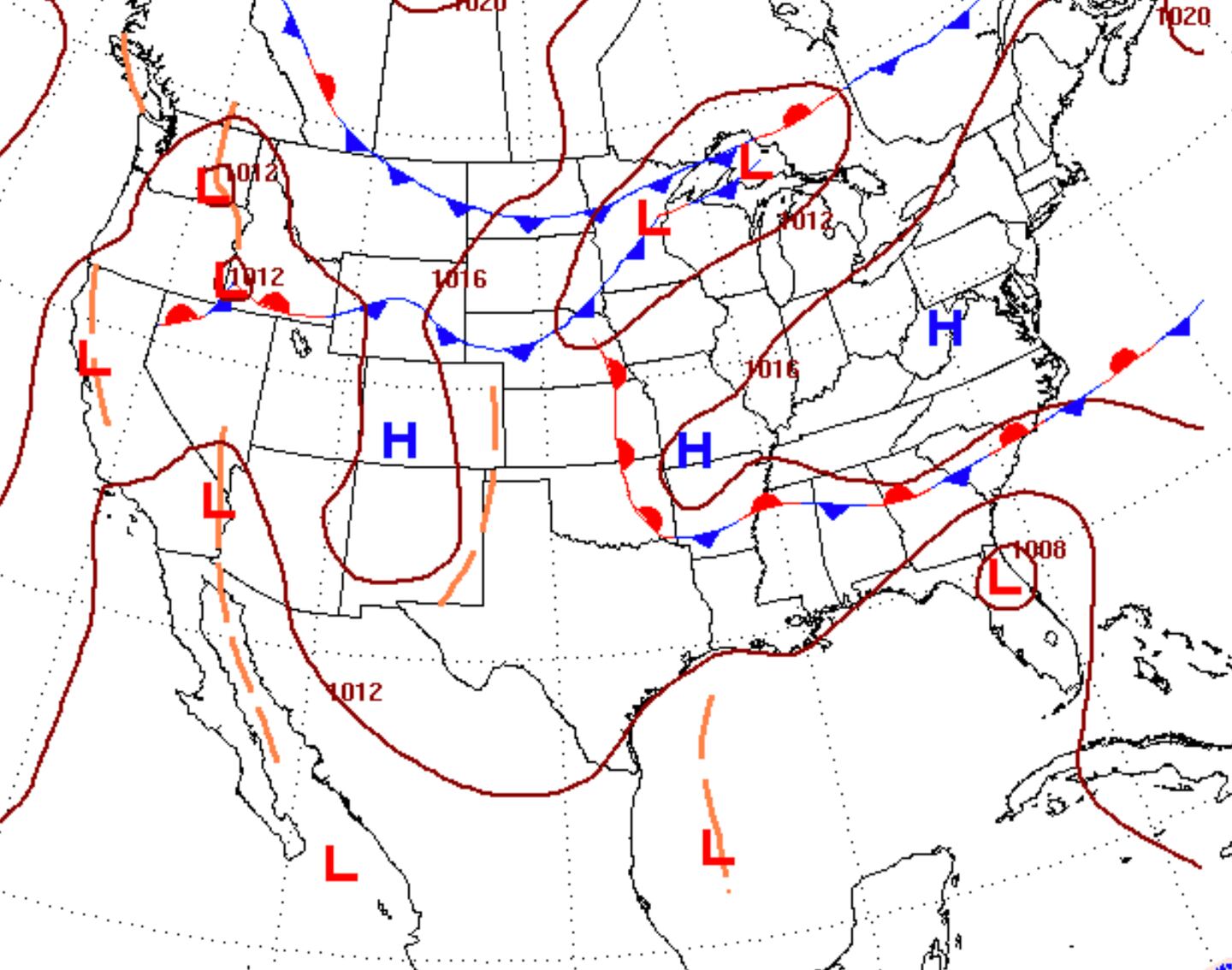
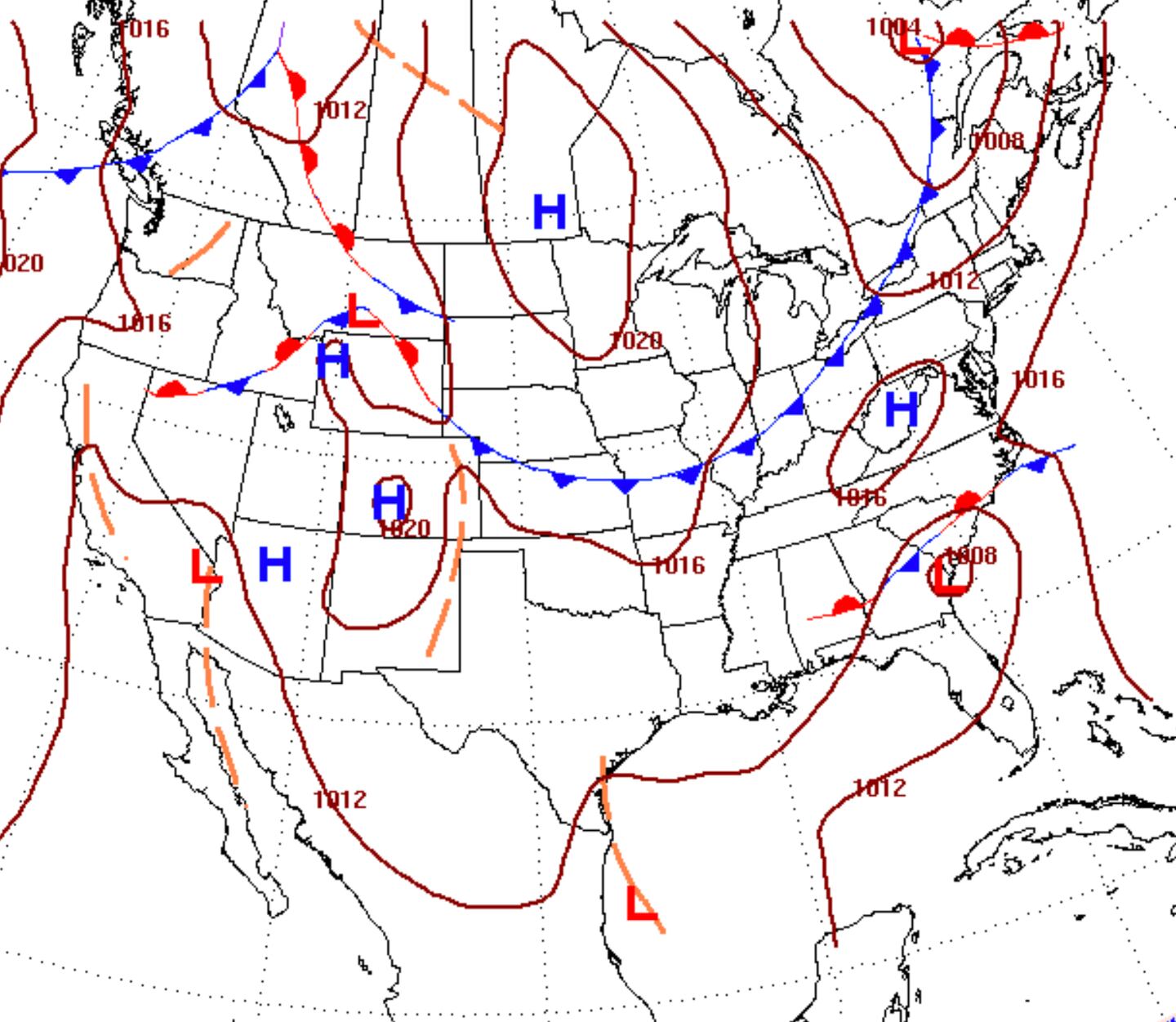
NHC DORIAN LOW PRESSURE CENTER LOCATIONS 8AM TUESDAY/WEDNESDAY:
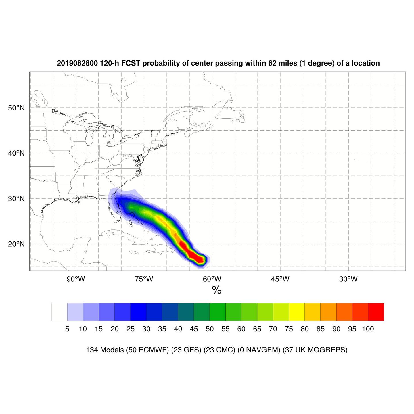
MODEL TRACK SPREAD ON DORIAN AND MULTI-MODEL ENSEMBLE PROBABILITIES NEXT 5-DAYS:
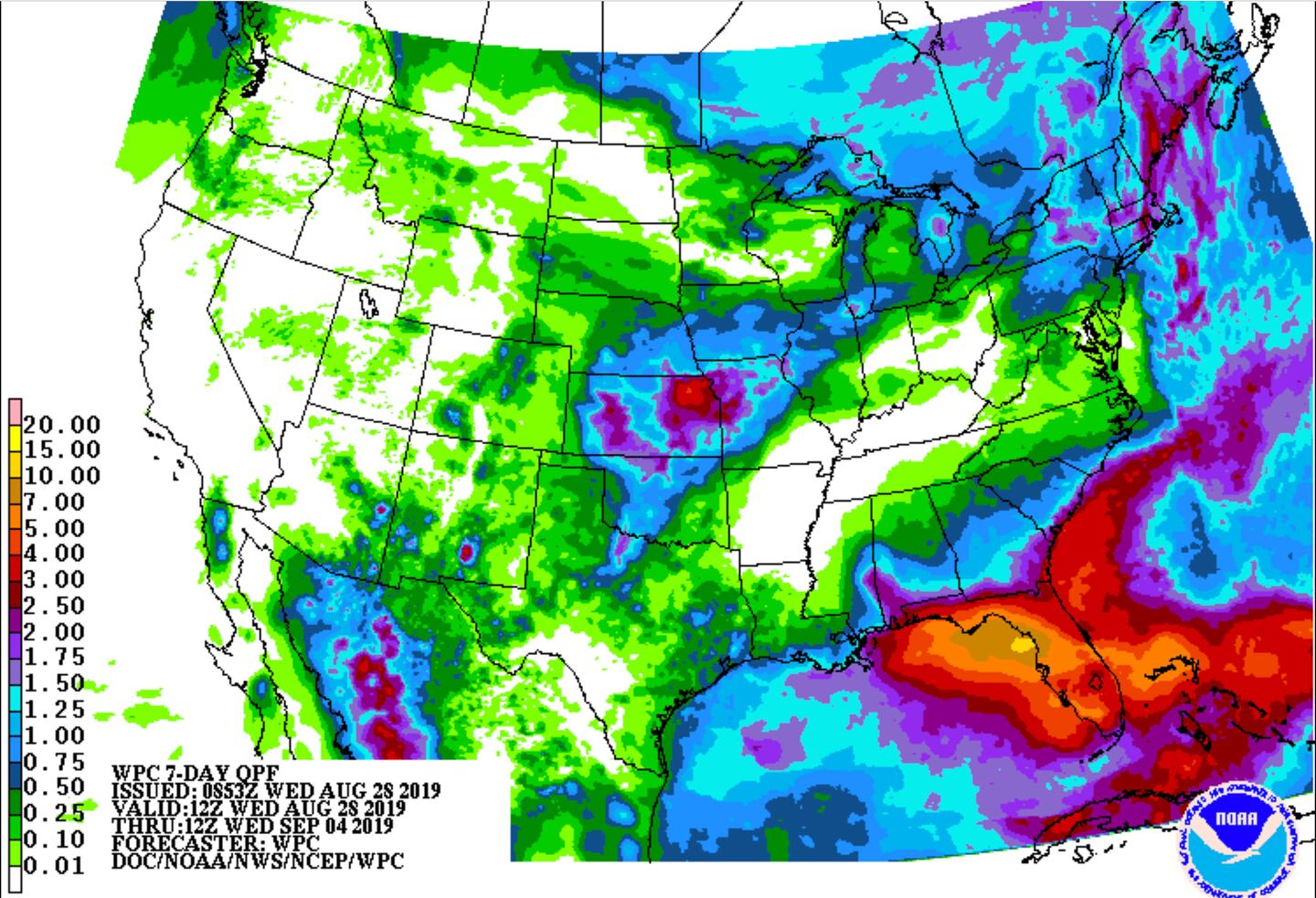
7-DAY RAINFALL ESTIMATE:
Remember, as a rule track forecasts are very good BUT intensity (strength of storm) forecasts are poor.
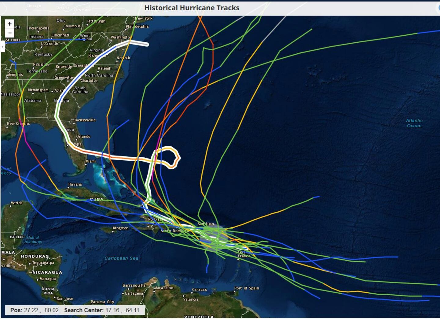
17 storms since 1950 within 100 miles of where Darian is now, of those one hit Florida-- hurricane Jeanne as a CAT 3 in 2004.
For updates follow me on Twitter @MellishMeterWSB.


 Sign Up

