
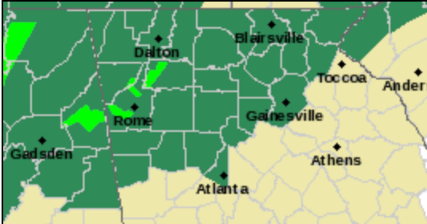
Much of Georgia is under a Level 1 minimal risk of severe weather on Wednesday with part of the area under the “standard” Level 2 SEVERE WEATHER RISK:
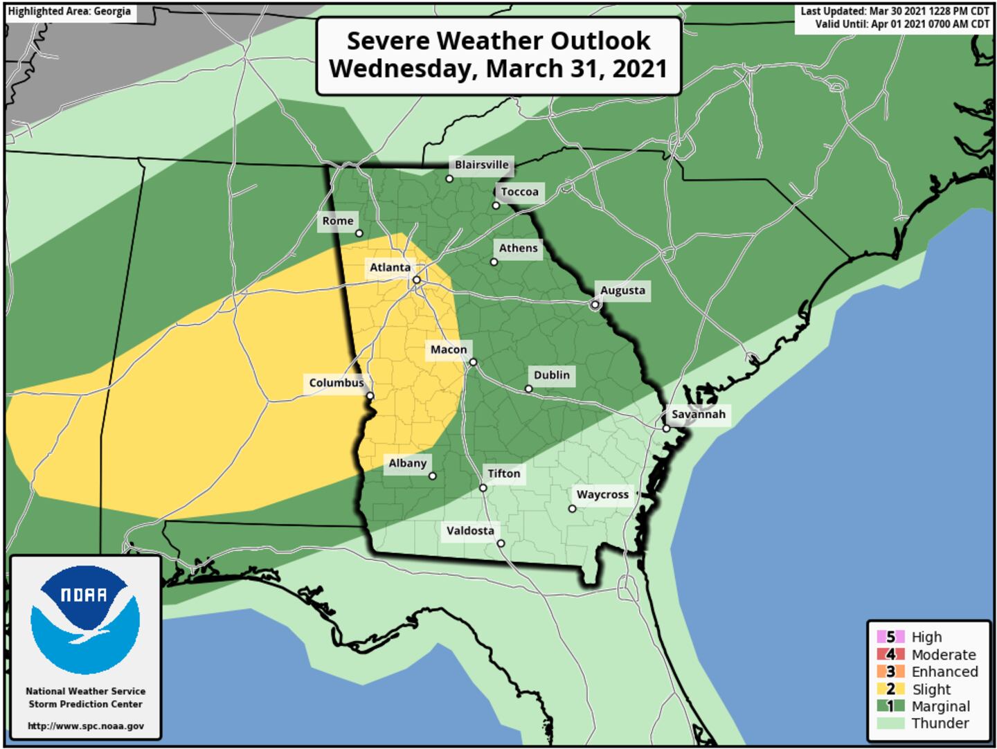
This is a much lower risk than the last two weather events in our region, isolated not widespread severe storms are possible. The risk OF A TORNADO is particularly lower than last weeks system but not quite zero.
Of course weather changes and forecasts are updated continuously so stay tuned for updates.
The current window for the most vigorous thunderstorms is 2pm-8pm.
Due to soggy soils it will NOT REQUIRE a severe storm to topple a tree or fall a big branch somewhere.
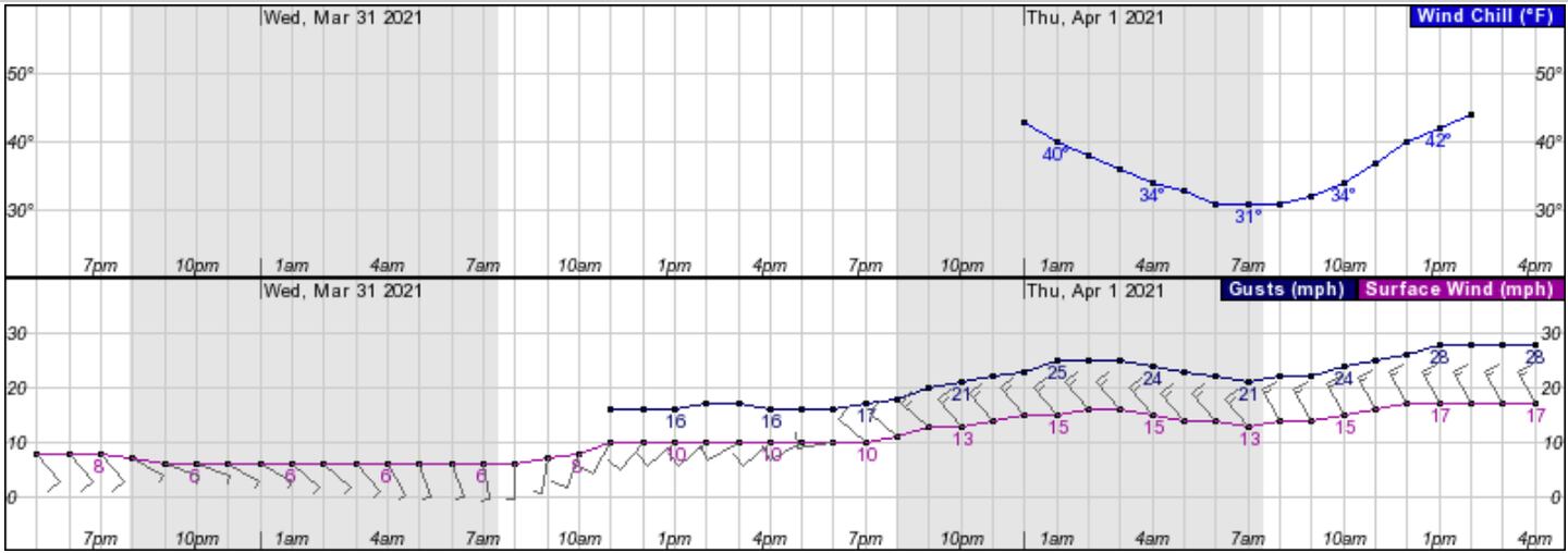
Also, behind the storm front and even WITHOUT a thunderstorm the winds will be strong and gusty with “pressure gradient winds” Wednesday night and Thursday that could also drop a branch or tree somewhere even when it’s not raining.
The wind and temperature plunge also means a WIND CHILL FACTOR:
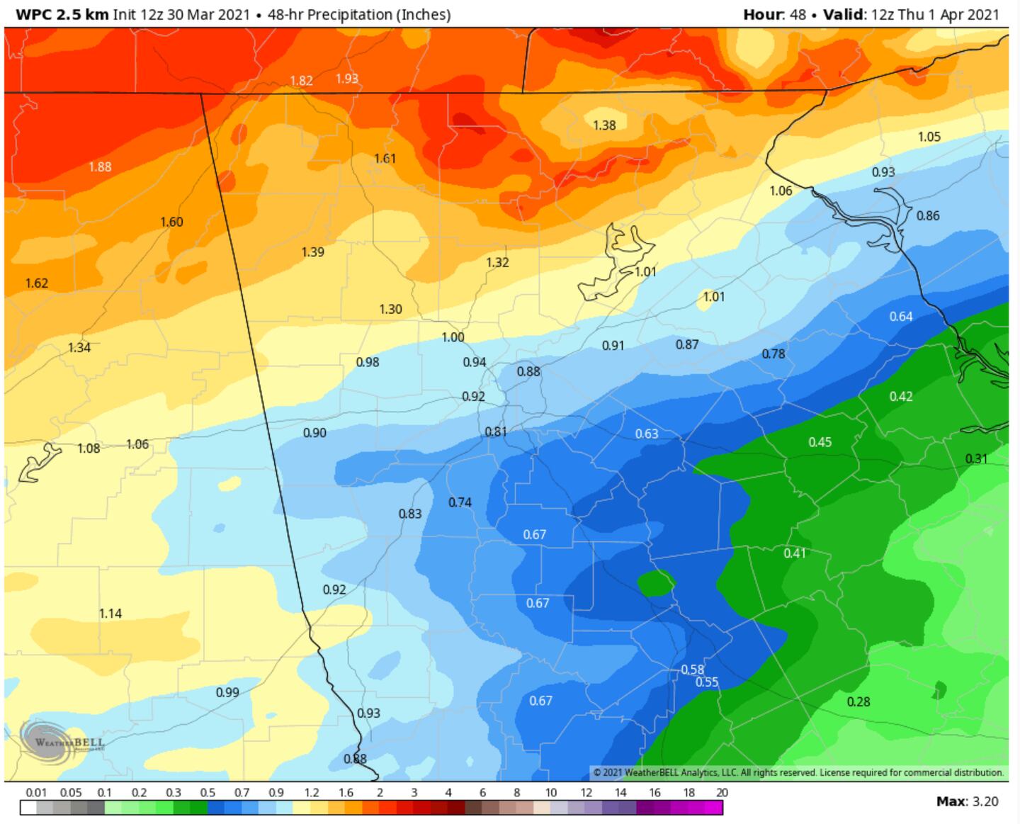
WEDNESDAY-WEDNESDAY NIGHT RAINFALL ESTIMATE:

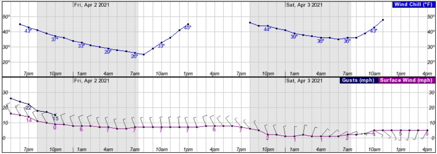
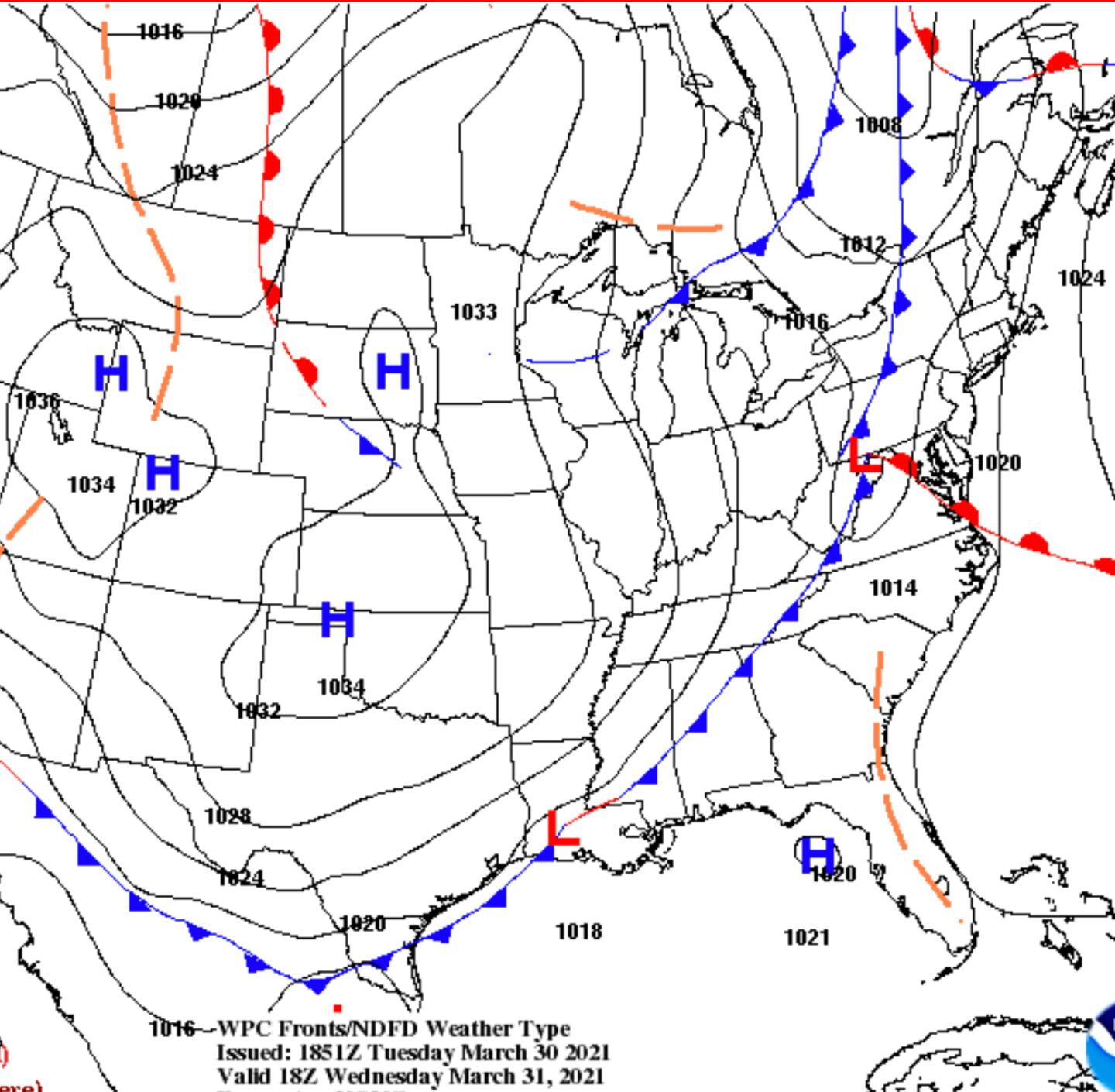
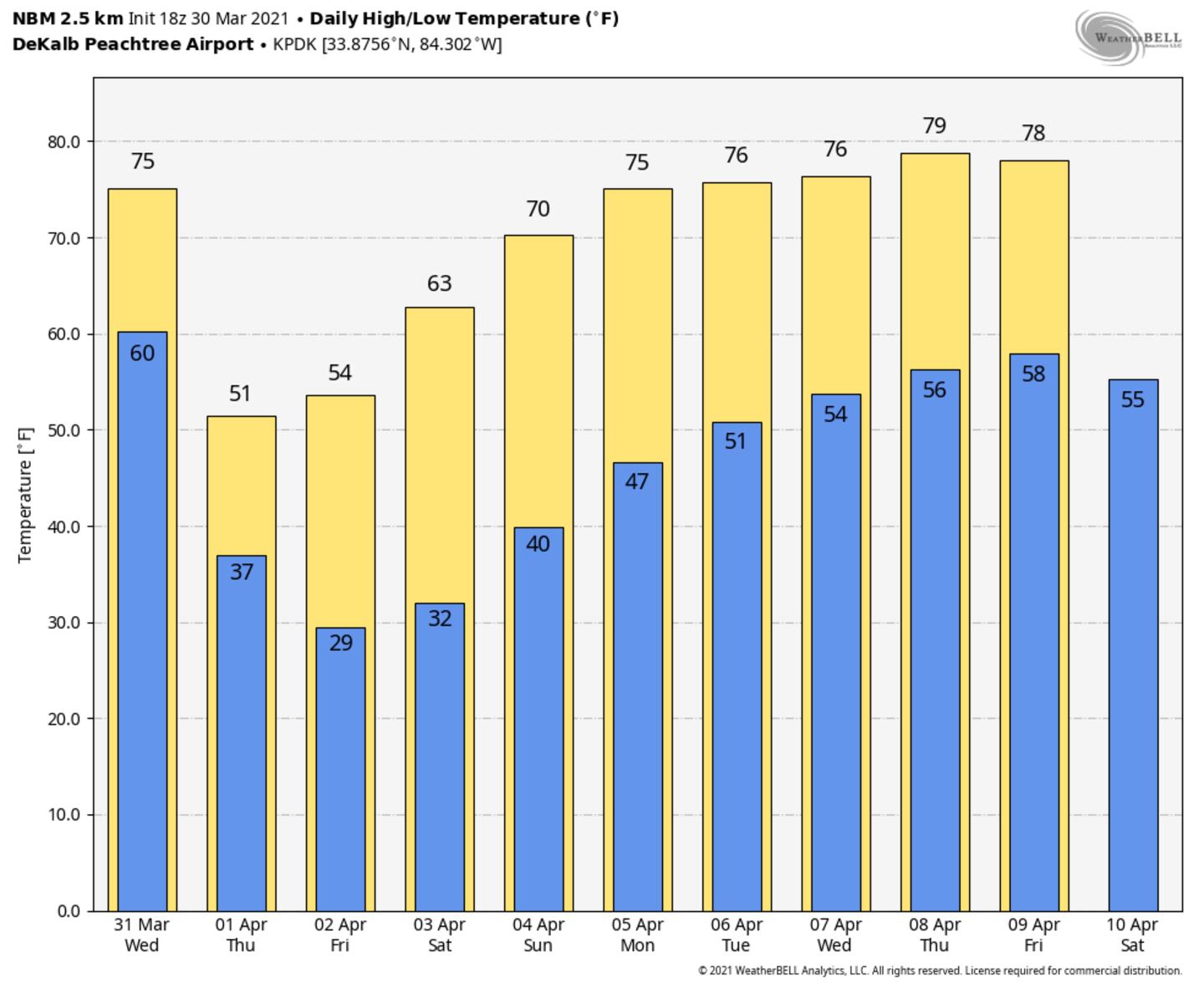
STRONG COLD FRONT PASSAGE WEDNESDAY FOLLOWED BY FROST OR FREEZE BY FRIDAY:
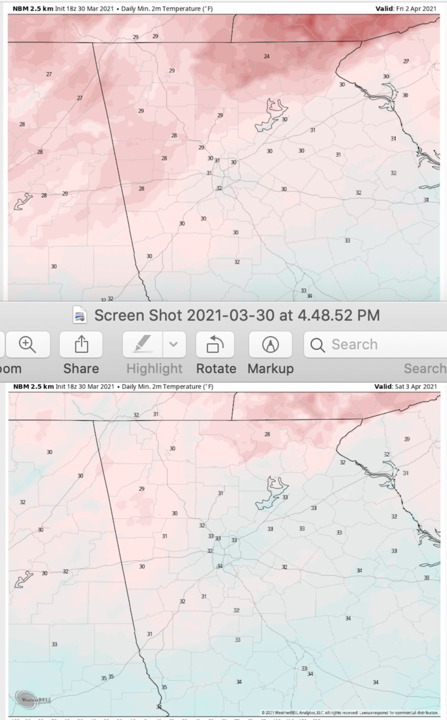
MULTI-BLEND MODEL LOW TEMPERATURE PROJECTION FRIDAY/SATURDAY MORNINGS:
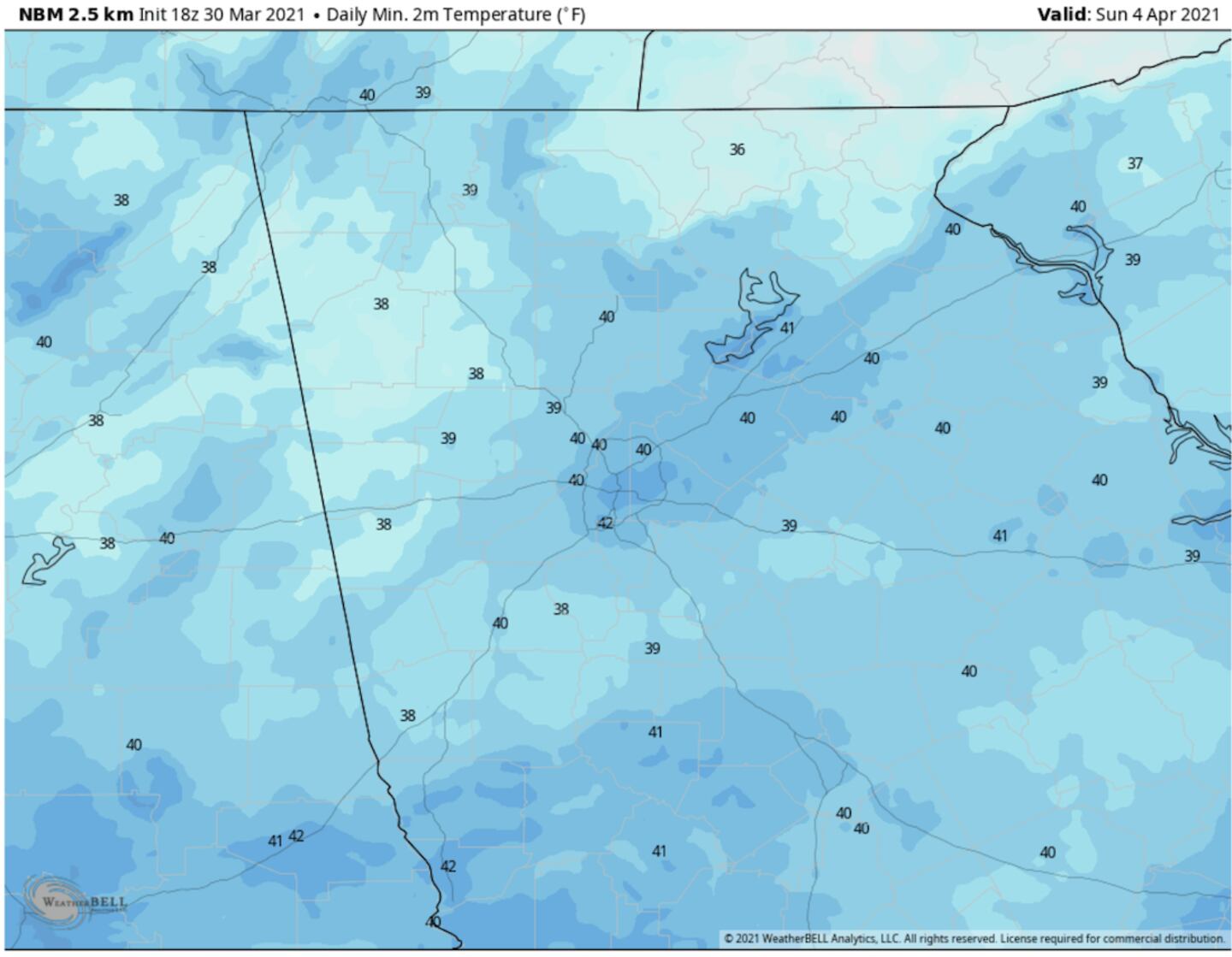
EASTER SUNDAY SUNRISE SERVICE TEMPERATURES FORECAST MODEL BLEND:
A BIG WARM-UP FOLLOWS THE COLD SNAP:
For more follow me on Twitter @MellishMeterWSB.
Cox Media Group


