
As of the 11am ET Friday National Hurricane Center Advisory, Ian is a Category 1 Hurricane with maximum sustained winds of 85 mph with wind gusts as high as 105 mph.
Hurricane Ian is forecast to move north through the Atlantic Ocean through midday Friday. Ian will then make landfall Friday afternoon as a Category 1 Hurricane along the South Carolina coast line near Charleston.
According to the National Hurricane Center, the damage associated with a Category 1 Hurricane include:
Very dangerous winds will produce some damage: Well-constructed frame homes could have damage to roof, shingles, vinyl siding and gutters. Large branches of trees will snap and shallowly rooted trees may be toppled. Extensive damage to power lines and poles likely will result in power outages that could last a few to several days.
— https://www.nhc.noaa.gov/aboutsshws.php
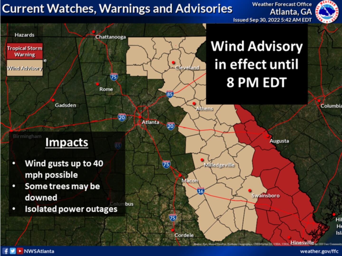
Metro Atlanta remains far west of the precipitation shield and damaging wind field. As a result, rain chances have trended downward, and only spotty showers are expected late Friday afternoon through Saturday morning.

Winds will still be breezy for Metro Atlanta, with wind gusts as high as 25-35 mph possible in the heart of the Metro Friday and Saturday.
Higher elevations of the North Georgia mountains may experience wind gusts of 35-40 mph. Eastern cities including Athens and Augusta may experience wind gusts as high as 35-40 mph.

Morning lows will remain in the mid 50s, and afternoon highs will linger in the low 70s.
©2022 Cox Media Group


