
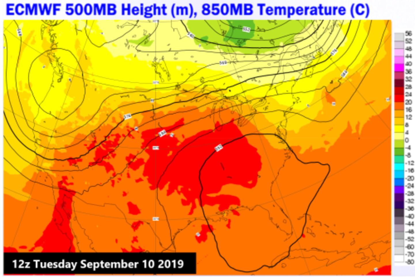
An upper level jet stream high pressure heat wave ridge worthy of mid-summer is providing our heat wave giving us abnormally hot weather for this time of year with record or near record levels before it backs down some.
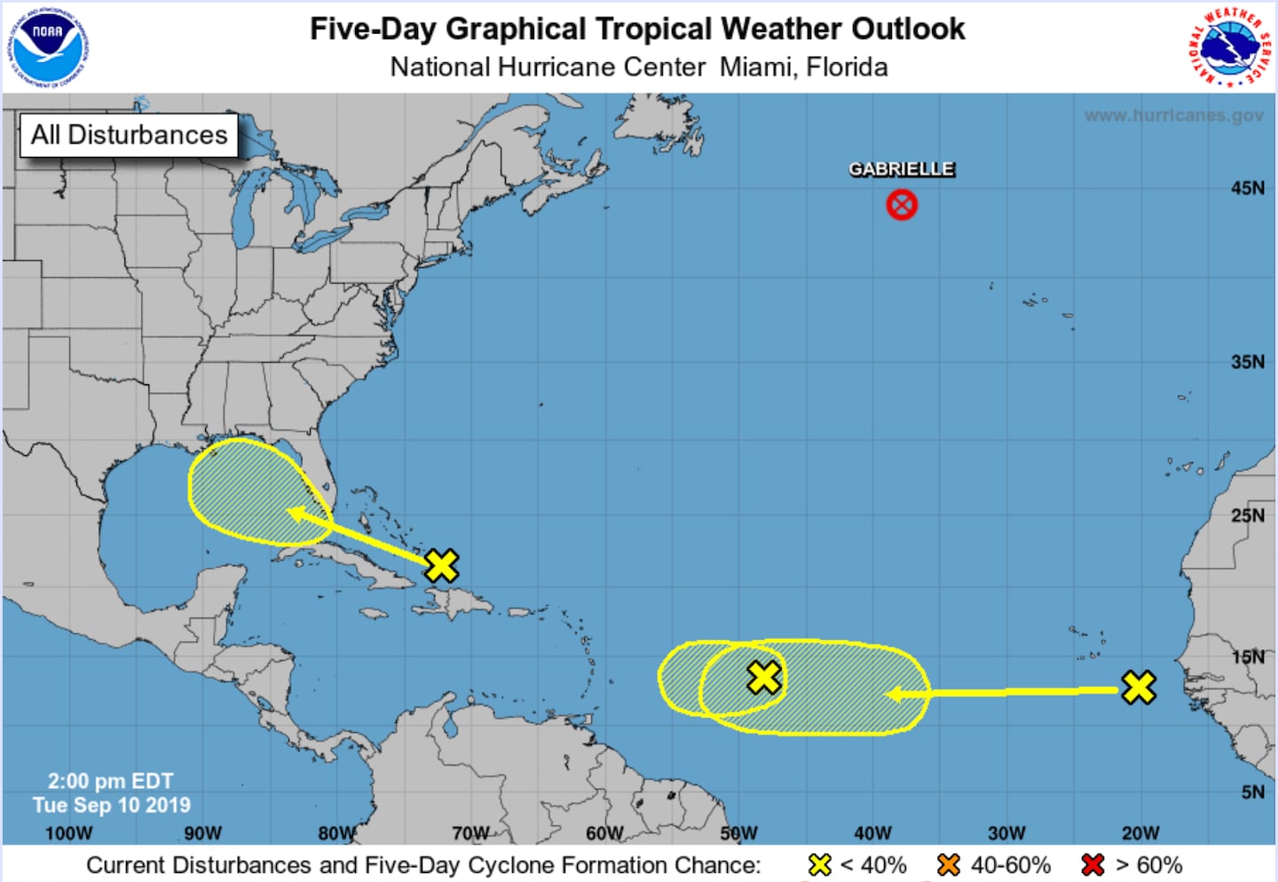
Meanwhile it’s peak tropical cyclone season (tropical storms and hurricanes) in the Atlantic and Caribbean so we need to watch as there are plenty of “seeds” out there from North Africa to the ocean waters the rest of this month not just the ones shown below.
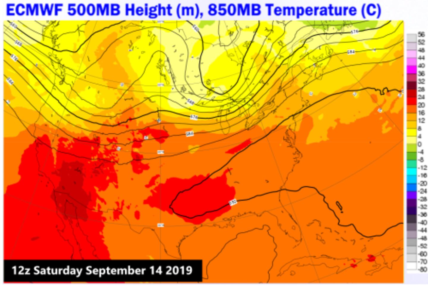
The gulf will have to be monitored given some weakness in the underbelly of the high pressure ridge and then a reforming of the ridge over the Great Smokies and then Bermuda positions. So one area to watch will be from the Bahamas West through Florida to Texas.
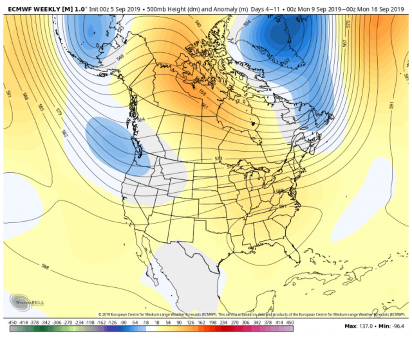
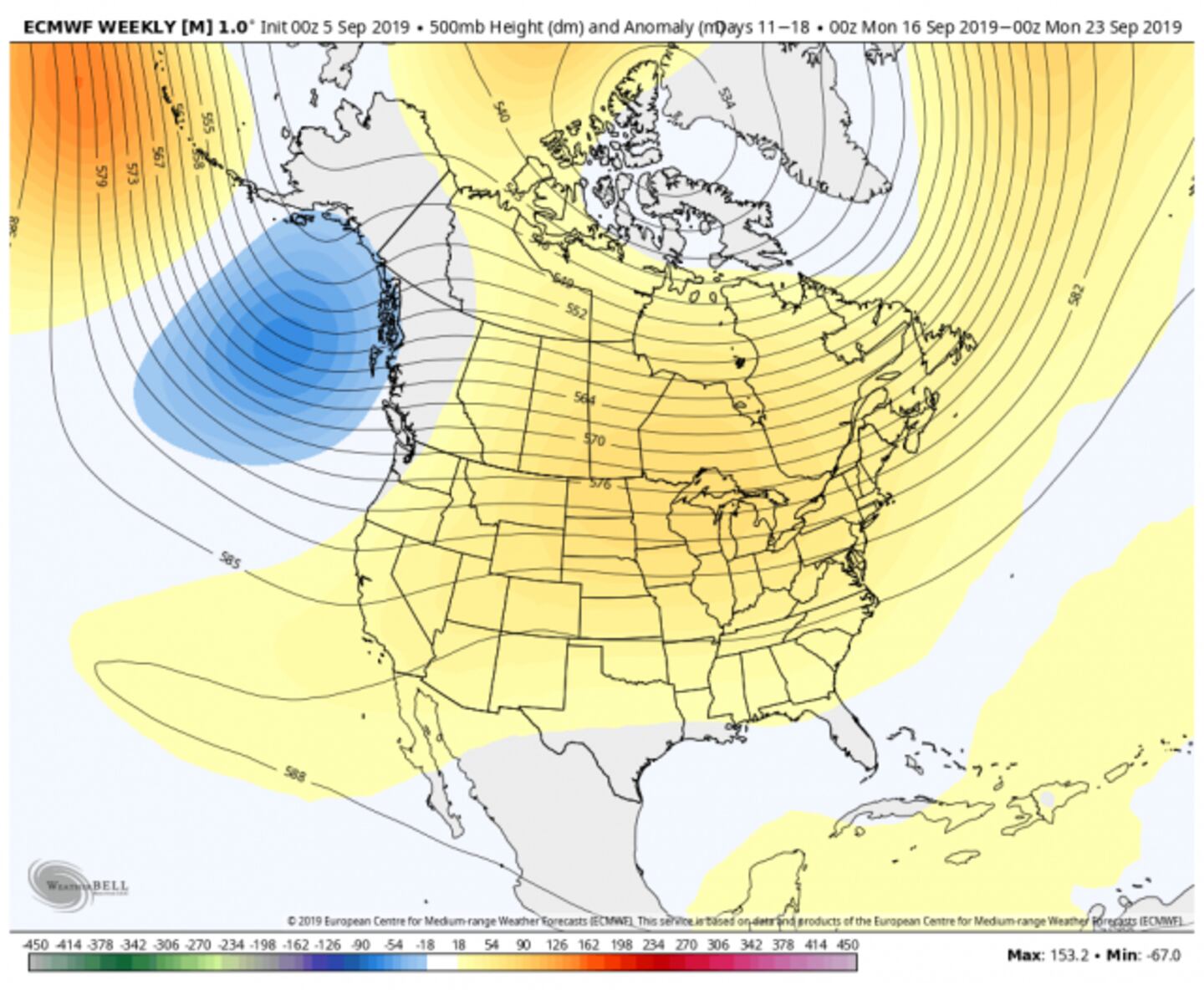
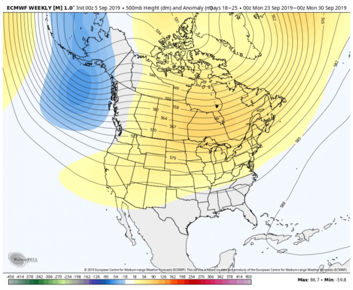
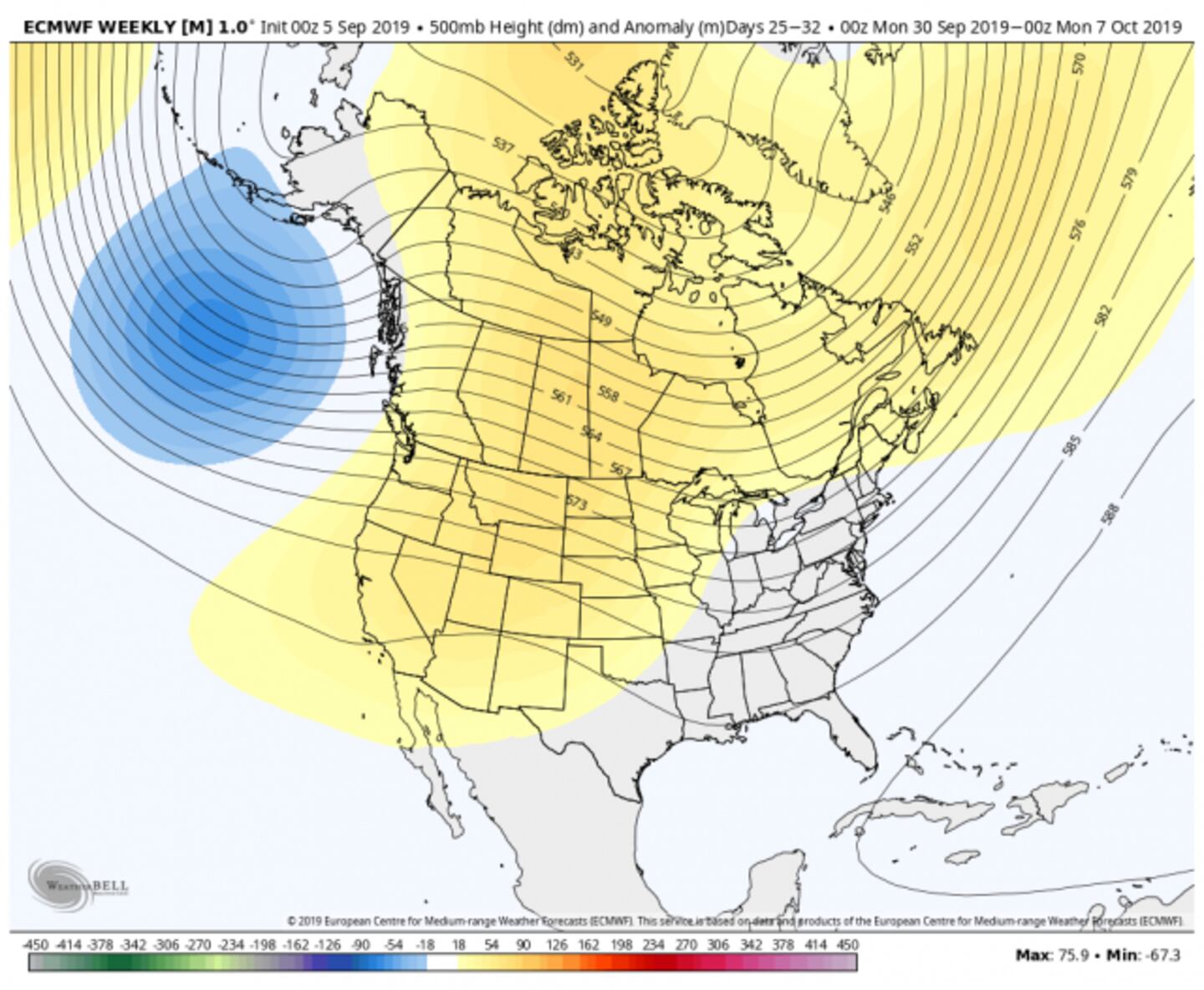
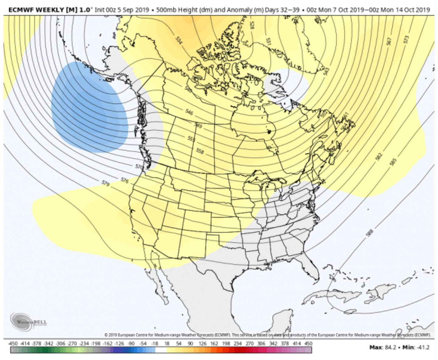
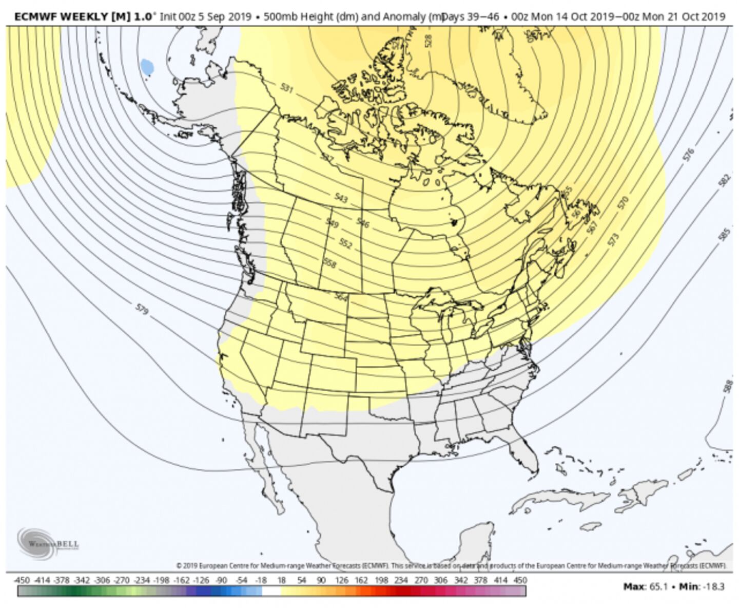

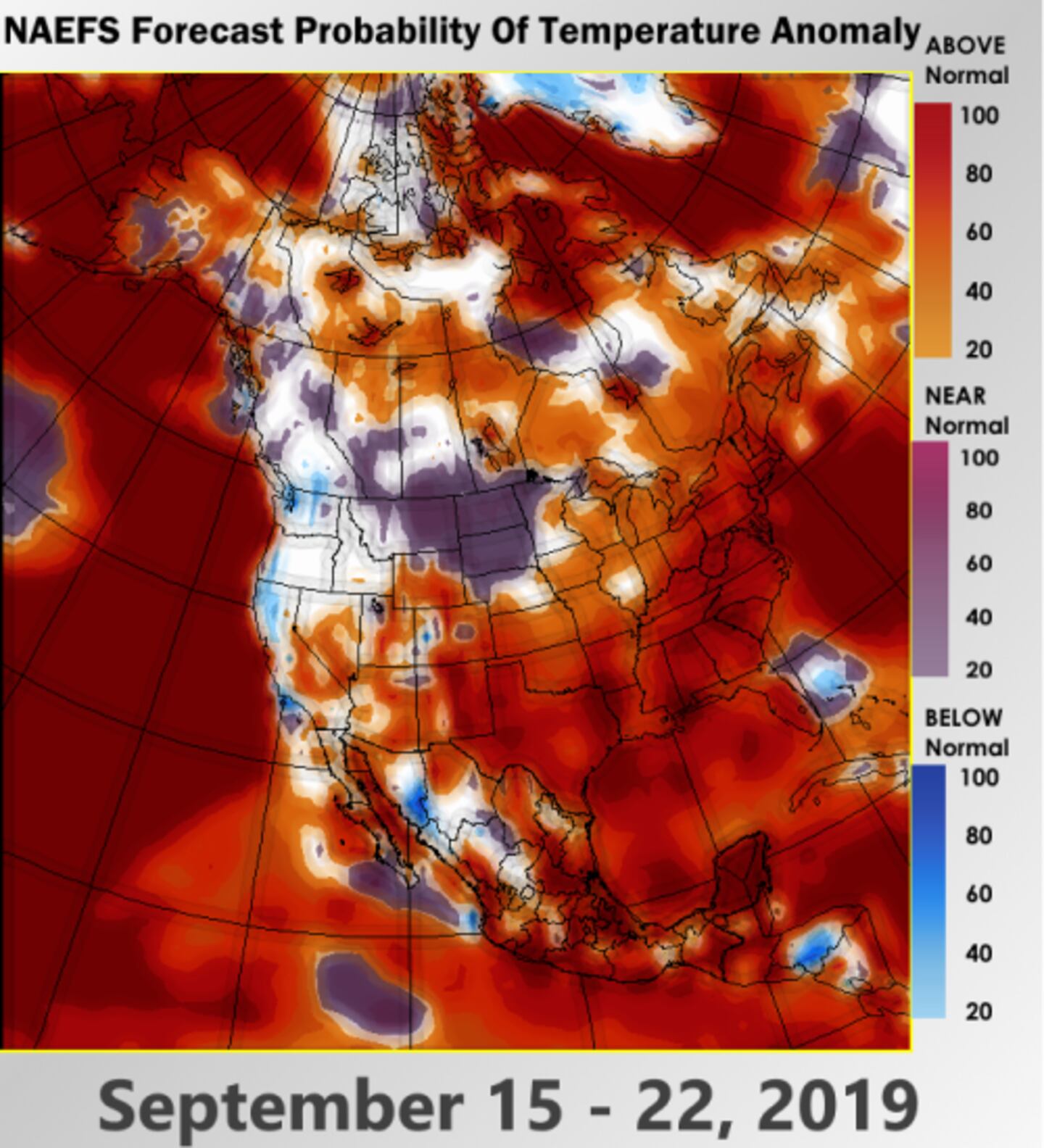
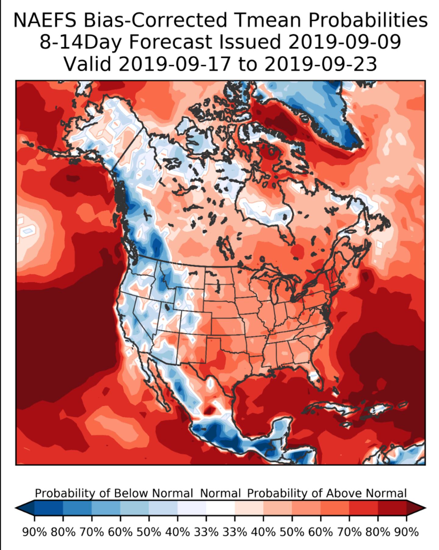
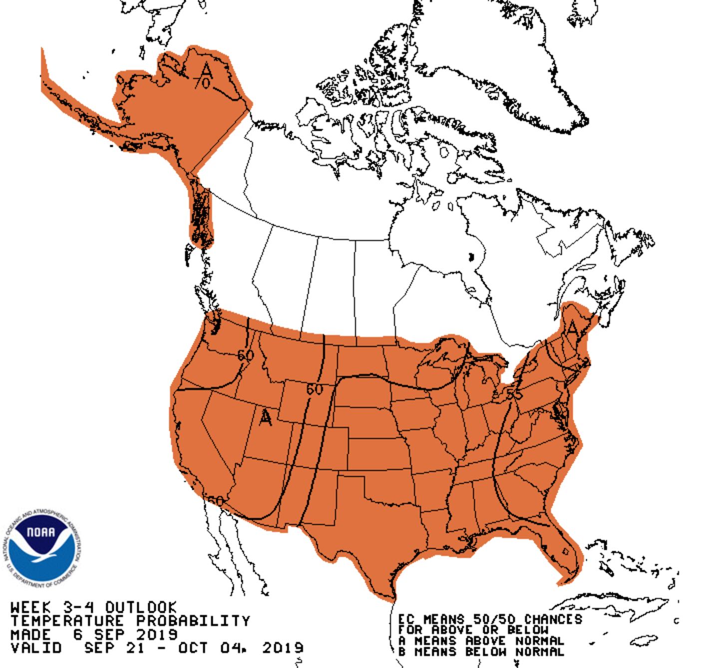
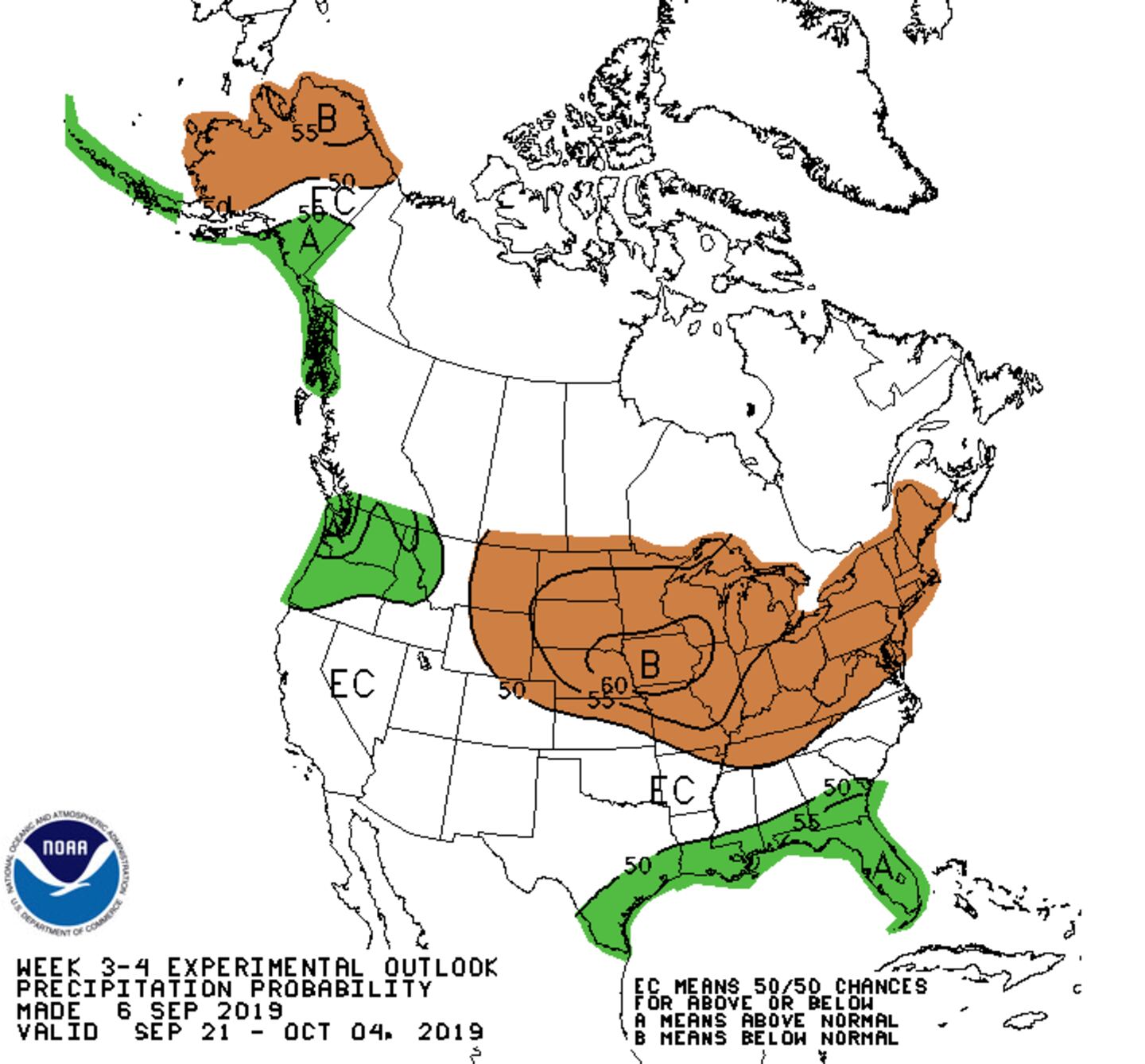
Indicators for October are for temperatures to average near-normal to a little above-normal. Rainfall is expected to average below-normal the next 6 weeks absent any tropical systems that can’t be foreseen at this time. There continues to be some support for November to change to below-normal temperatures.
ENSEMBLES:

The air conditioning bill and watering bill remain higher than normal longer than normal with the heat coinciding with a long dry spell for growing drought.
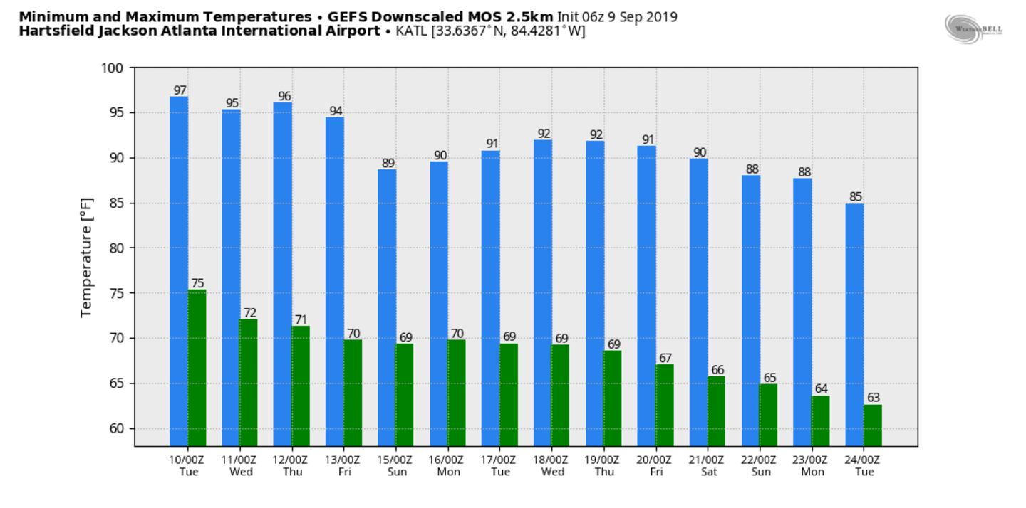
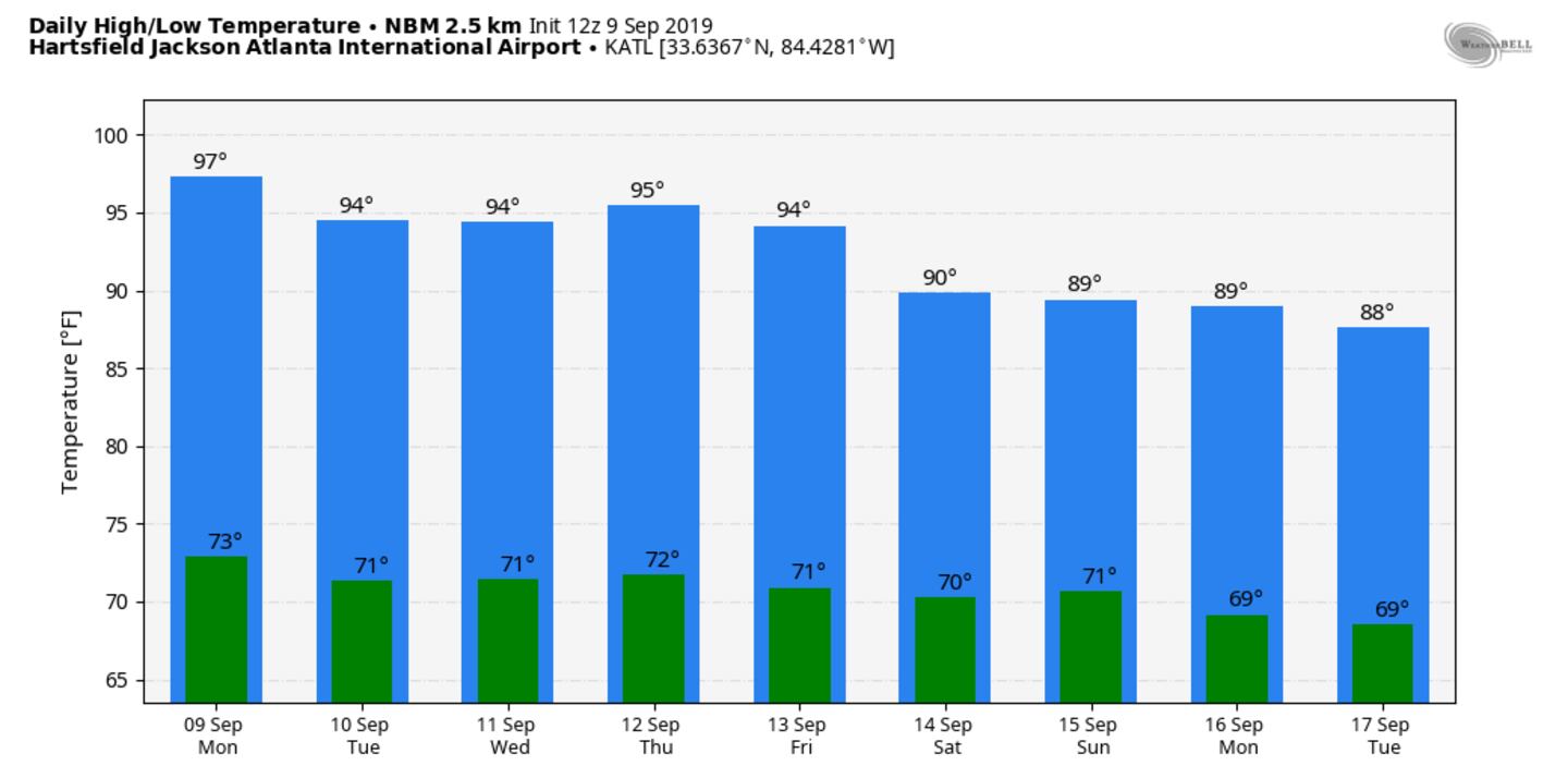
The average number of 90 days for Atlanta in a year is 37, 90 is the record number. Sept 9th marks our 72nd 90 or higher day of 2019 with more to come the rest of the week. The record high today is 100 in 1925 with upper 90s expected.
For more follow me on Twitter @MellishMeterWSB.


