
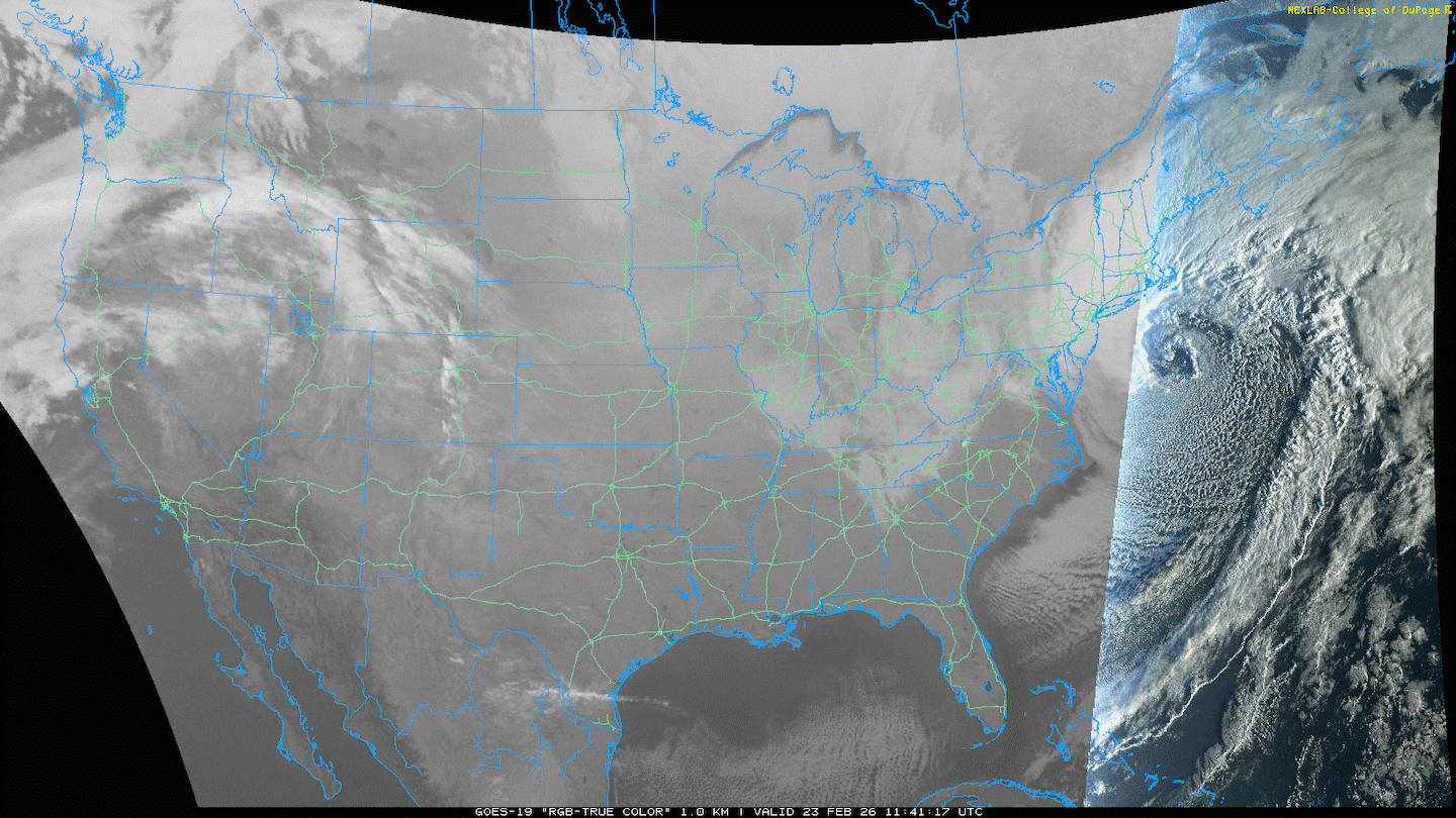
A blizzard is bearing down on the Northeast this morning, and the same storm system dropping nearly 2 feet of snow in Boston is pushing Arctic air as far south as Macon.
The animation below depicts the visible satellite imagery of the New England snow storm as well as the “wrap around” cloud cover moving south through the Great Lakes and into the Southern U.S.
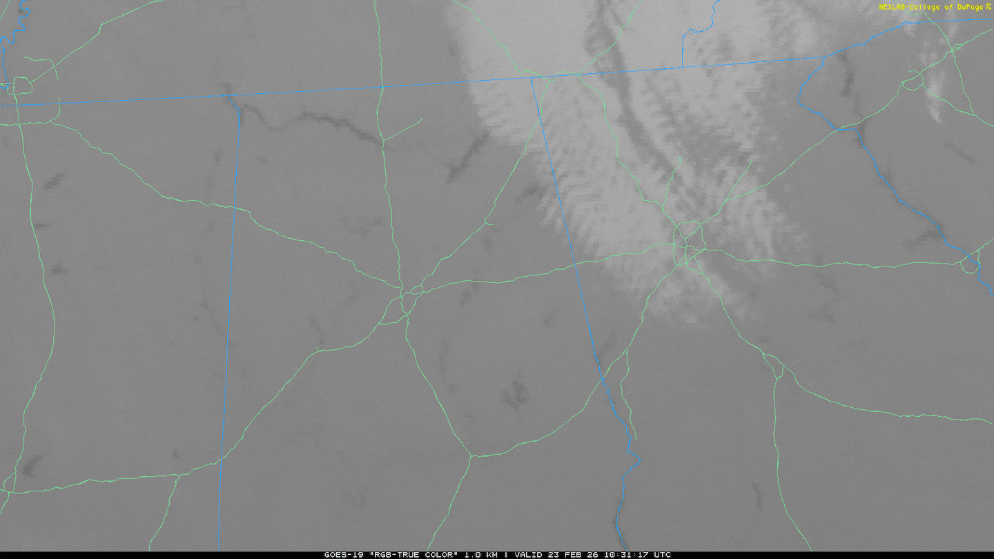
Amongst the cloud cover this morning, a few snow flurries were spotted throughout Cobb, Bartow, Cherokee, and Hall counties.
The animation below illustrates the visible satellite imagery depicting the cloud cover, with light snow flurries mainly along and west of I-575.
The driving force between the New England snowstorm -- as well as the intense blast of Arctic air -- is the jet stream, located about 30,000 feet or 5.5 miles above the ground.
The jet stream is a ribbon of fast moving air where wind speeds are often 80 mph or greater, with some portions of the jet stream exceeding 200 mph during stronger storm systems.
The animation below illustrates Futurecast Jet Stream winds through Wednesday. The strong dip in the jet stream over the Southeast -- known as a trough -- starts to flatten out as it moves over the Atlantic Ocean.

As the jet stream flattens, it then rounds into a ridge over the central U.S. This ridge will allow temperatures to warm as the source of the Arctic air is now shunted from the rest of the U.S.
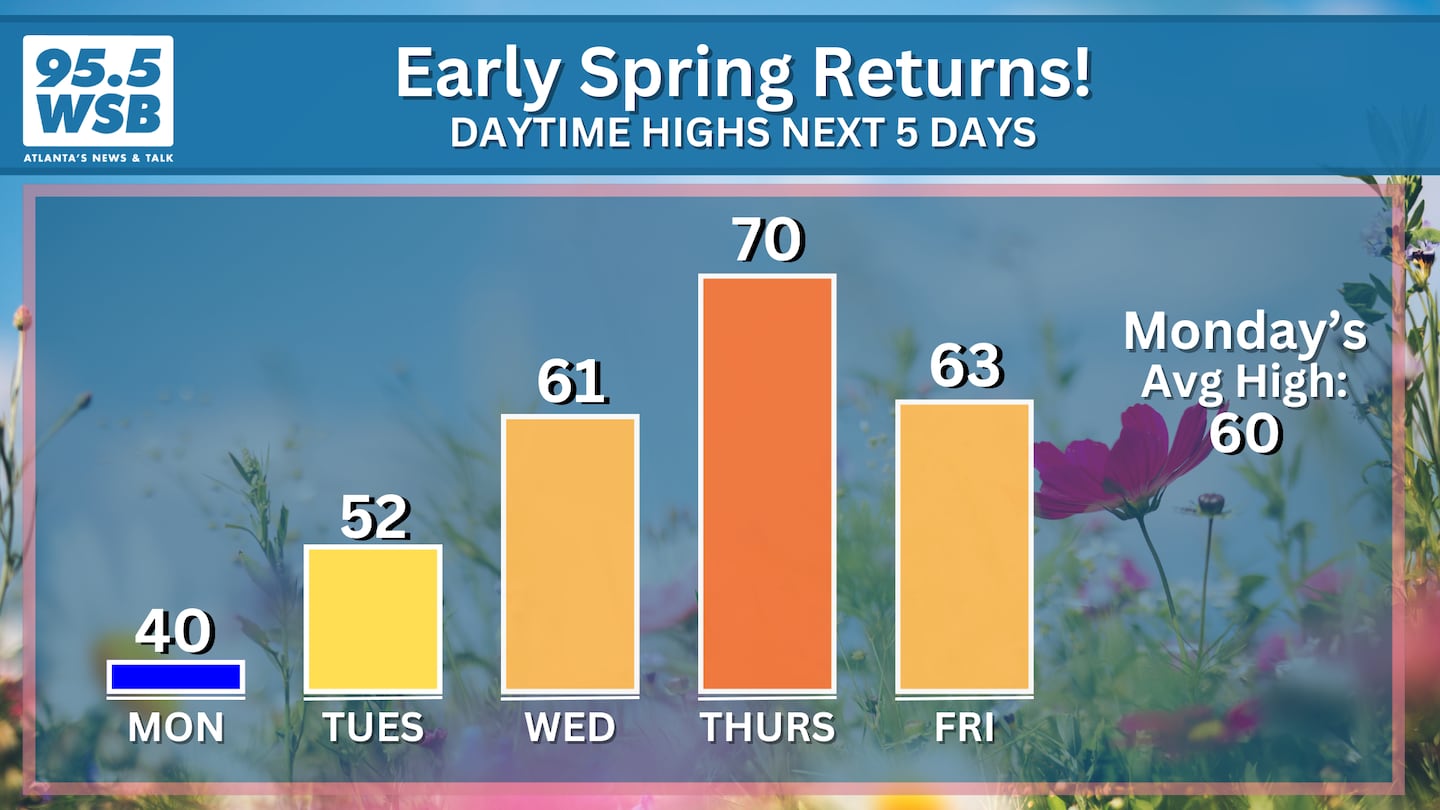
Here in Metro Atlanta, afternoon temperatures will warm into the 60s to low 70s this week, approaching the average high for this time of year, if not a few degrees warmer.
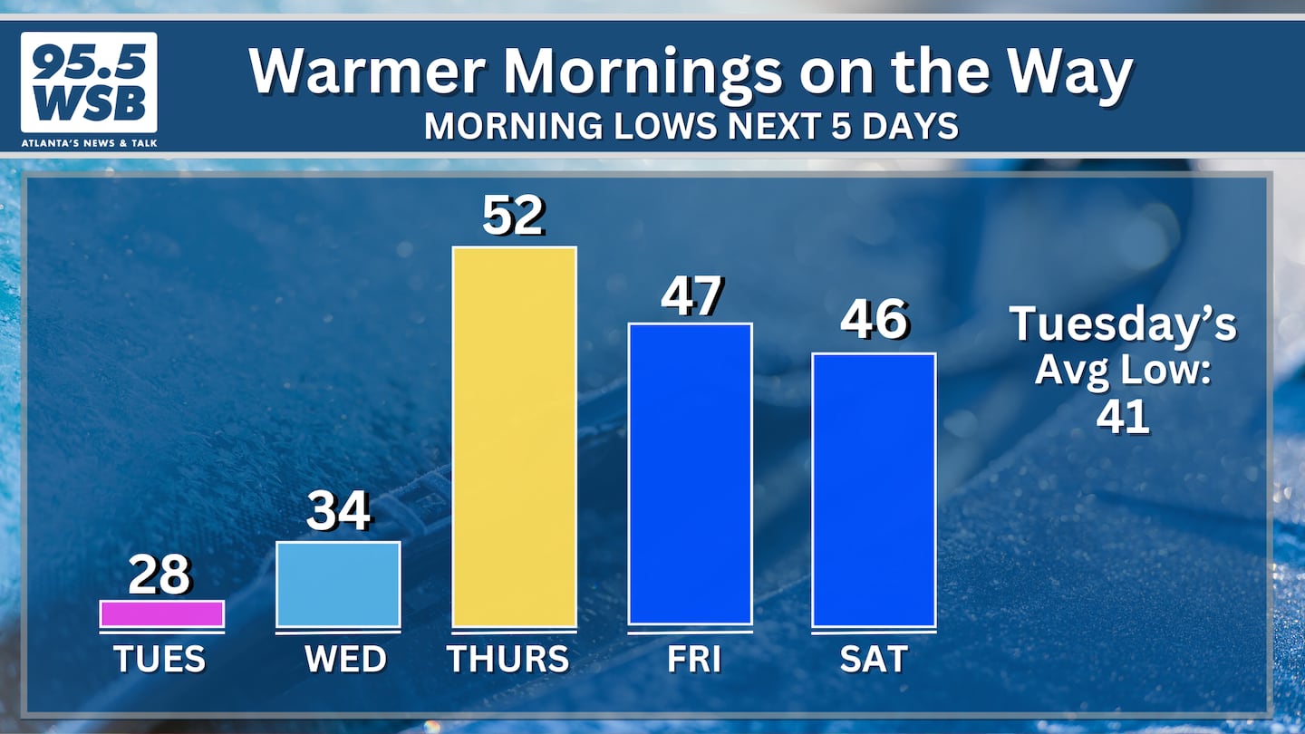
Morning temperatures will also improve, climbing out of the 20s and into the 40s to low 50s by the end of the week.
Connect With Me!
Facebook: Christina Edwards WSB
Instagram: ChristinaWSBwx
Twitter: @ChristinaWSBwx
©2026 Cox Media Group


