
Rain has been missing from the forecast for the past 3+ weeks, but it finally returns on Wednesday as a cold front sweeps through the Southeast.
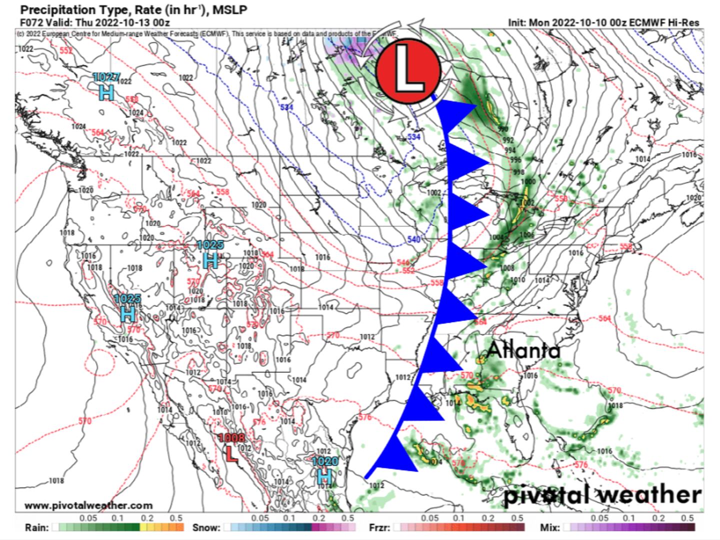
Ahead of the cold front, scattered showers and a few thunderstorms will develop over North Georgia, including Metro Atlanta. These rain showers will potentially develop after 12pm Wednesday and continue through Midnight Thursday, with the heaviest rain likely Wednesday evening.

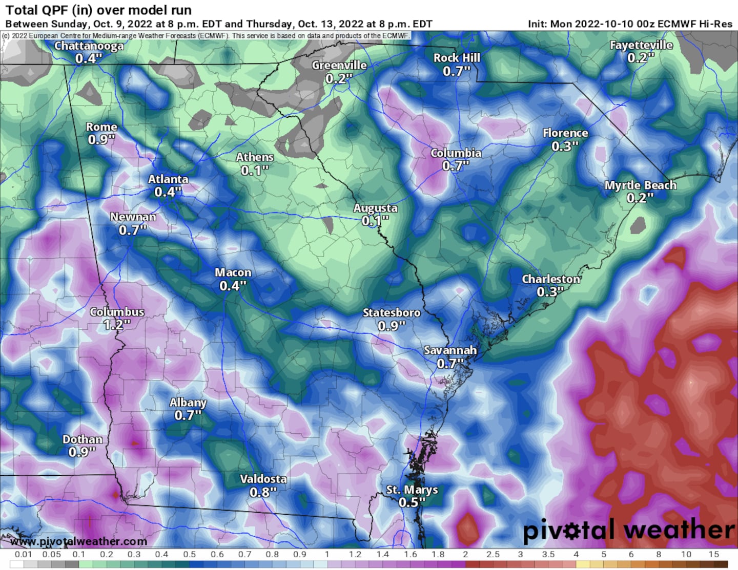
While Wednesday won’t be a complete washout, rainfall coverage will be enough to provide up to half an inch of precipitation for the Metro Atlanta area.
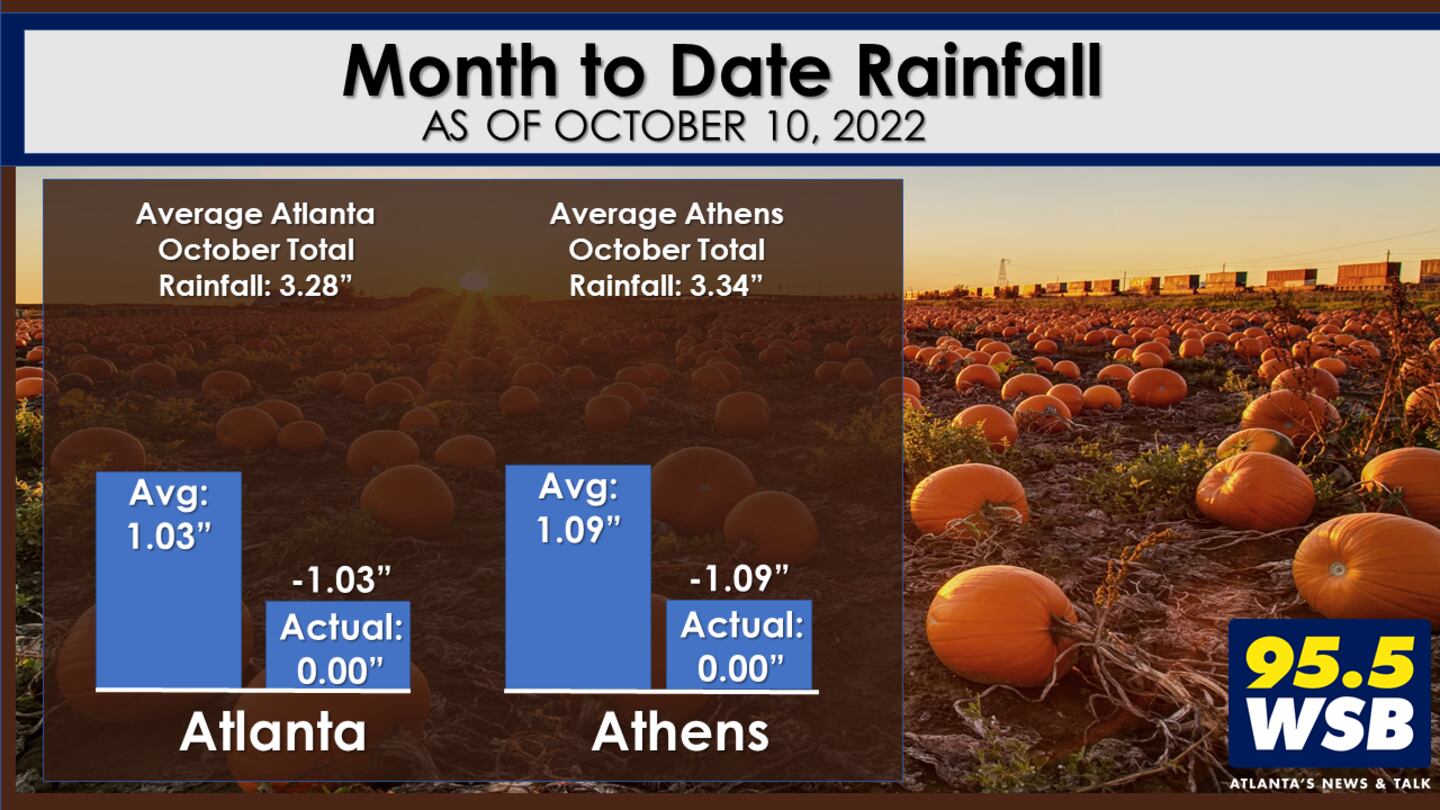
October is one of the driest months of the year for Atlanta, with an average monthly rainfall of 3.28 inches. So far, no rain has fallen for the first 10 days of October, and no rain has fallen for the final 10 days of September, either. It’s been a very dry start to fall here in Metro Atlanta and North Georgia!
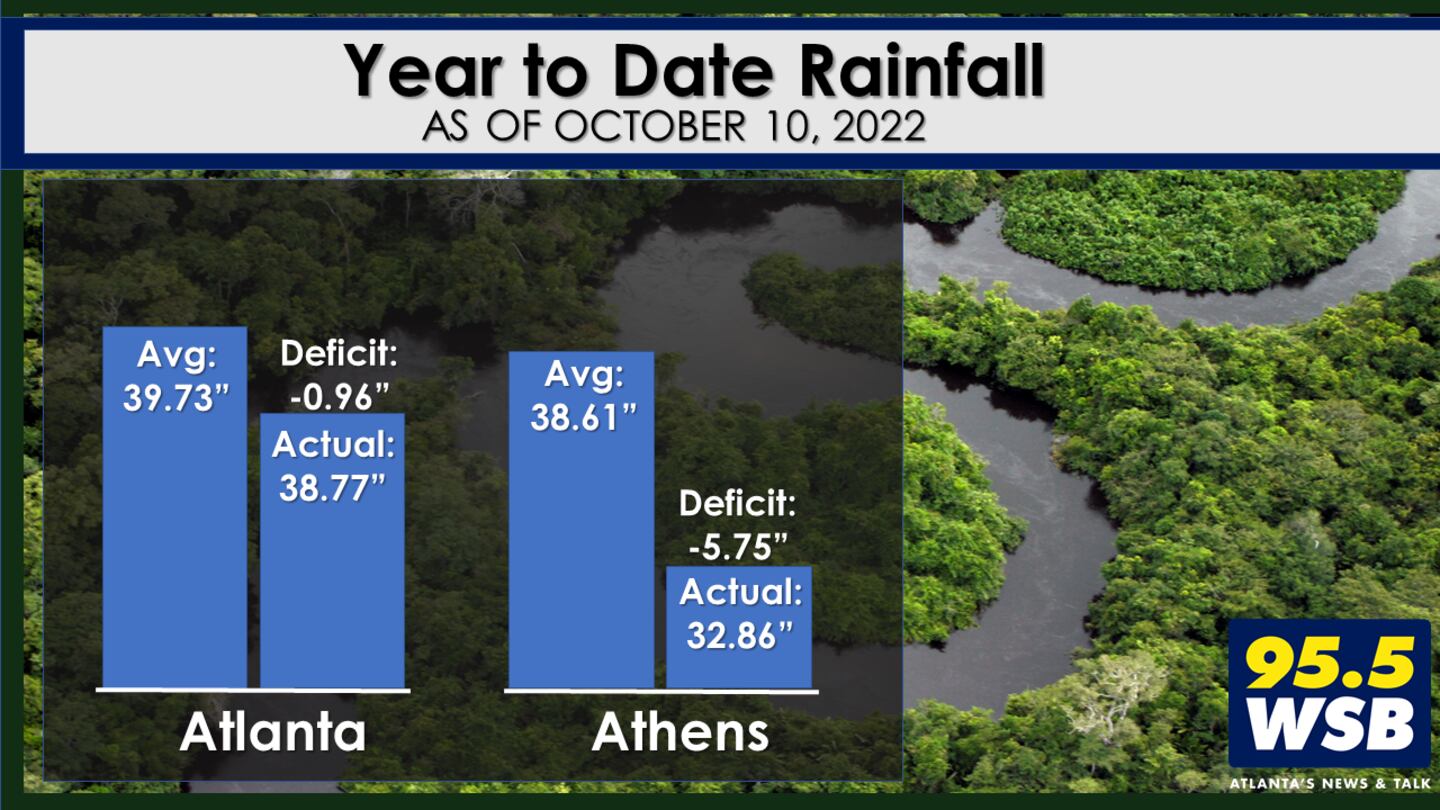
The early Fall dry spell has made an impact on our year to date rainfall data. Atlanta is now running a 1 inch rainfall deficit, and Athens is experiencing a rainfall deficit near 6 inches.
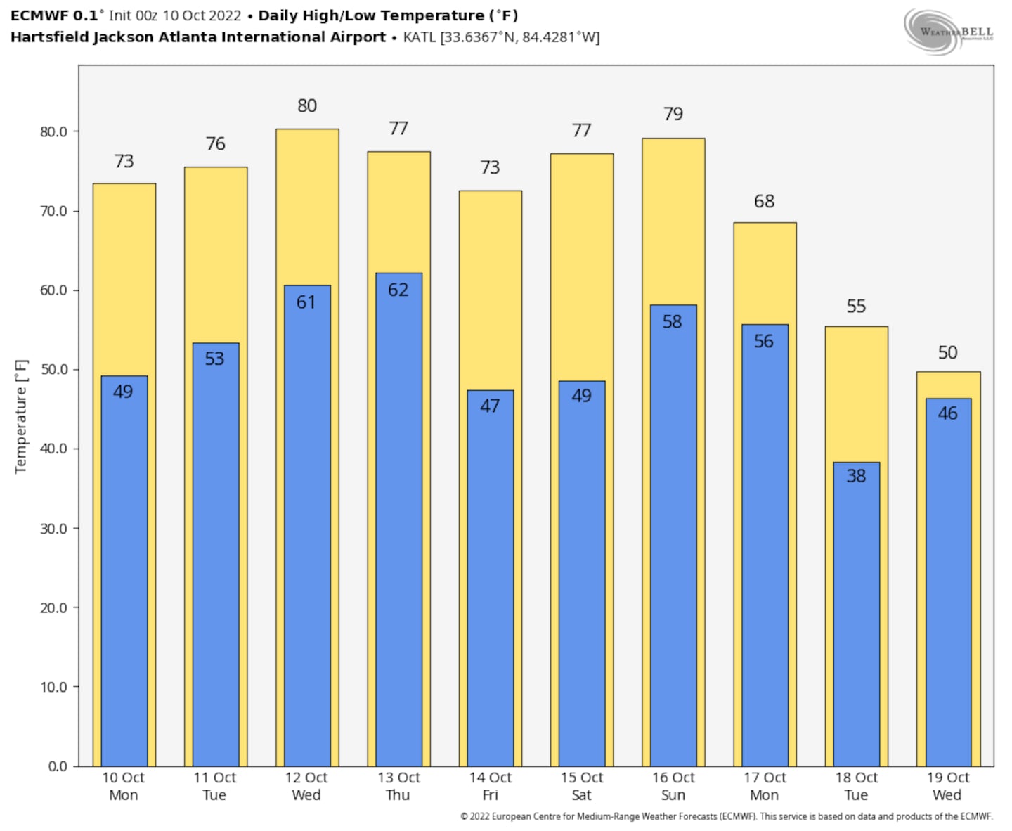
Colder Air Behind the Cold Front?
Temperature-wise, the cold front will reinforce the pleasantly mild conditions we have been enjoying lately! Morning lows will return to the 40s this weekend and afternoon highs will remain in the low to mid 70s.
Connect with Me!
Facebook: Christina Edwards WSB
Twitter: @ChristinaWSBwx
©2022 Cox Media Group


 Sign Up

