
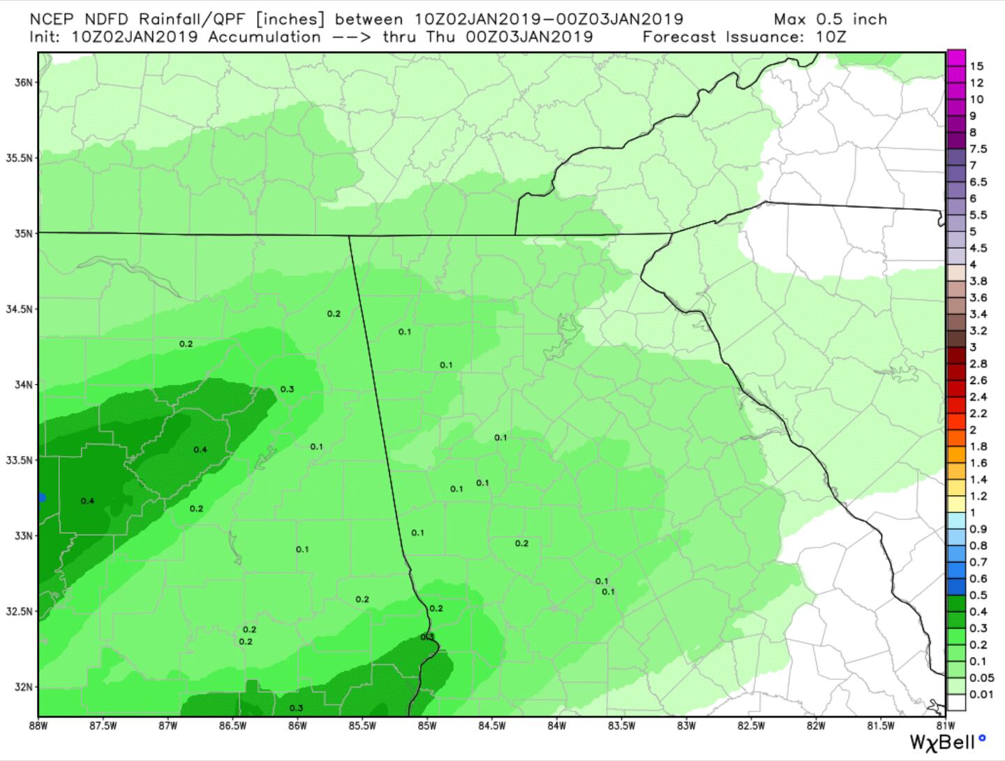
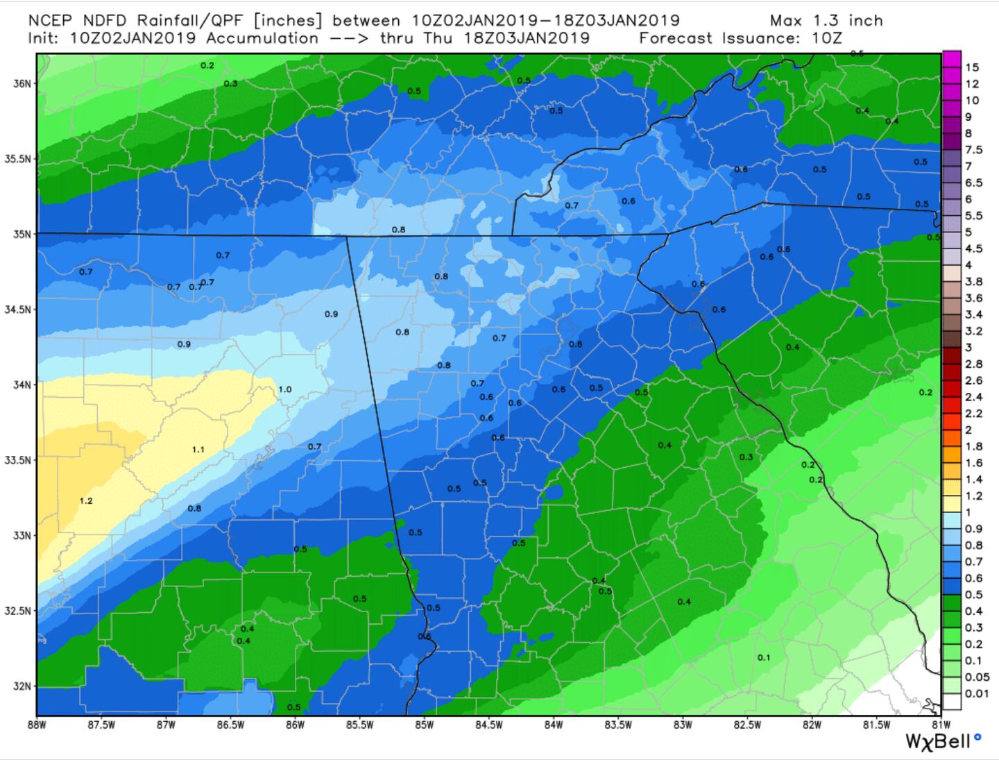
No it will not be ALL wet the next three days. Today will be more dry than wet with a few scattered nuisance showers later this afternoon following some fog and drizzle this morning, with more widespread rain tonight into early tomorrow morning. Rain amounts today a tenth inch or less on average, then a quarter of an inch on average tonight and a tenth of an inch tomorrow.
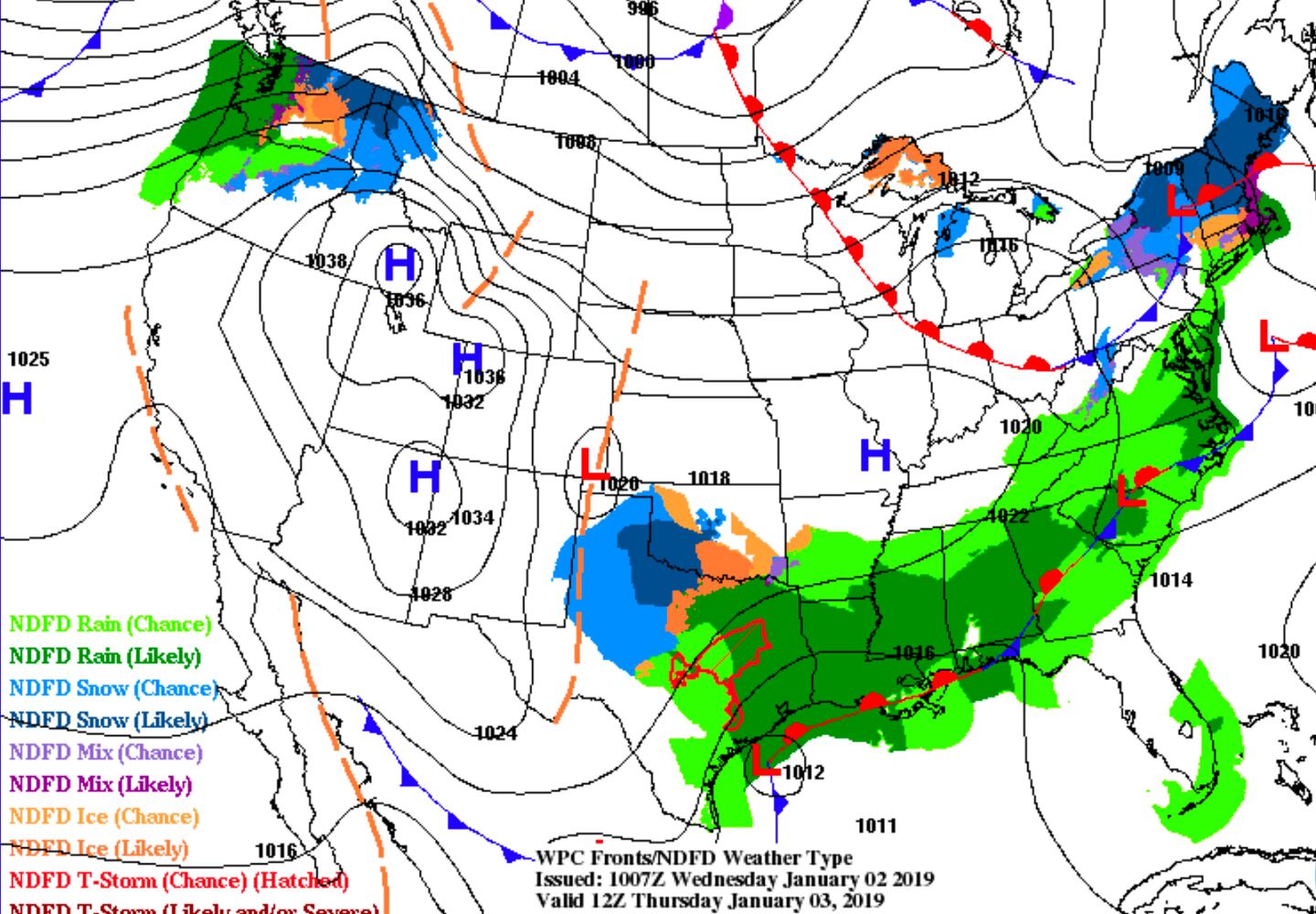
The surface weather map above is valid early afternoon today, the map below is valid at 7am Thursday.
The good news is it looks like a beautiful weekend will follow heavy rain on Friday.
ESTIMATED RAIN AMOUNT TODAY:
ESTIMATED RAINFALL AMOUNTS TONIGHT-THURSDAY MORNING:
THURSDAY AFTERNOON SURFACE MAP:
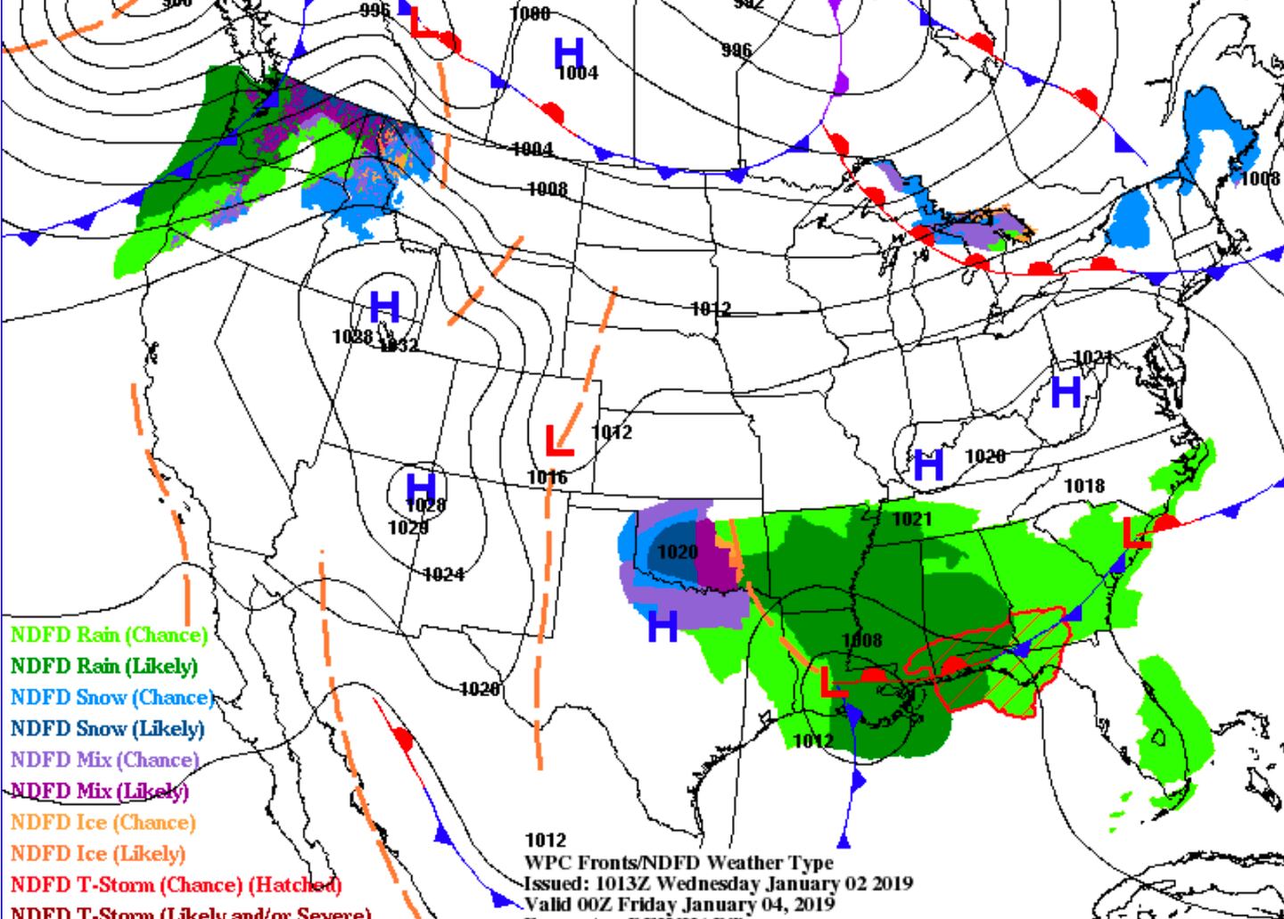
FRIDAY SURFACE WEATHER MAP:
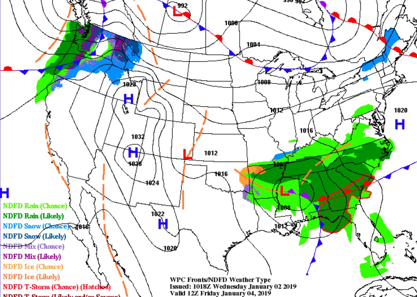
Friday looks to be the wettest day with amounts of a half to one inch on average with isolated 2 inch totals.
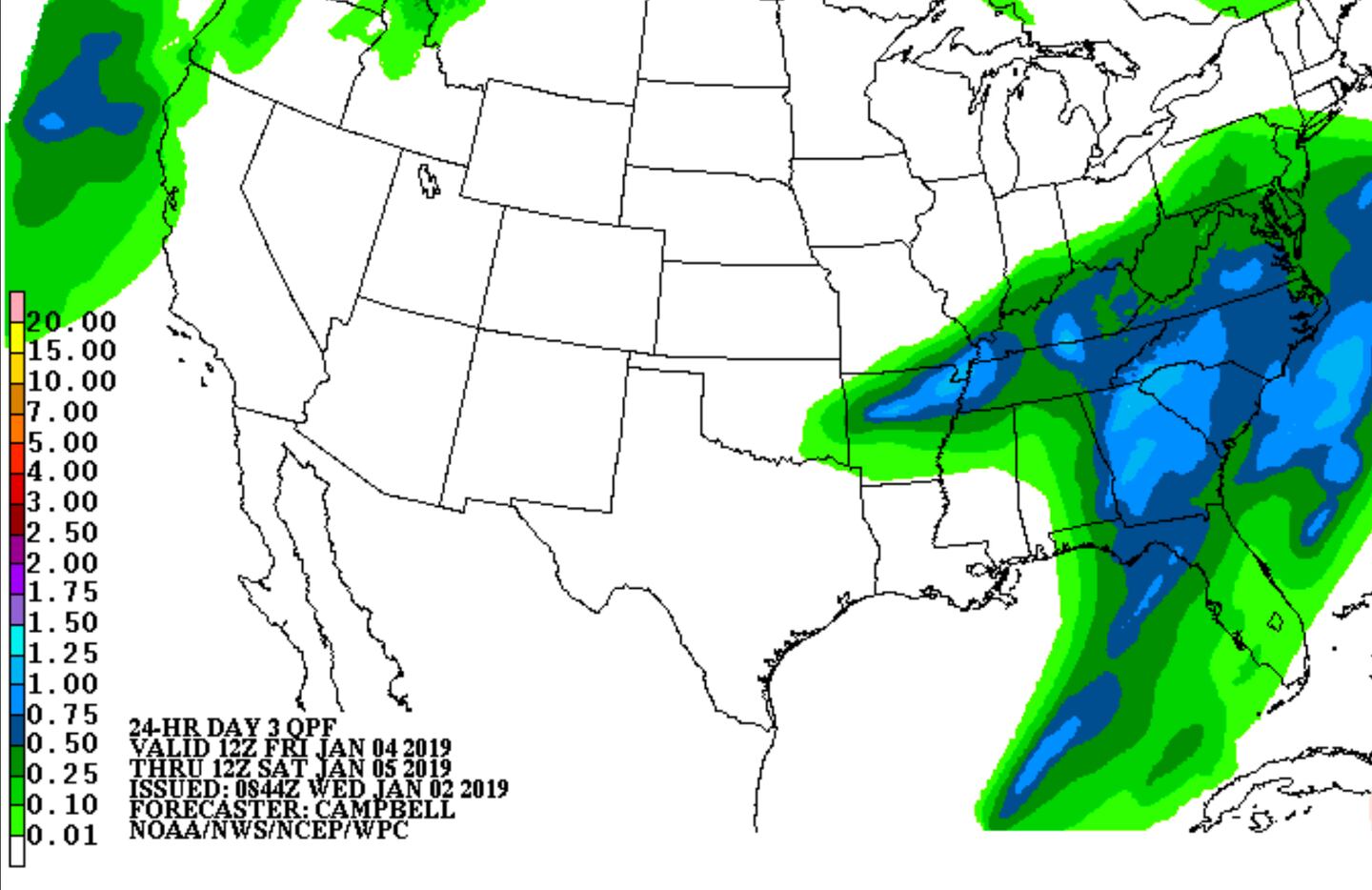
ESTIMATED AVERAGE RAINFALL FRIDAY:
For more Follow me on Twitter @MellishMeterWSB.


