
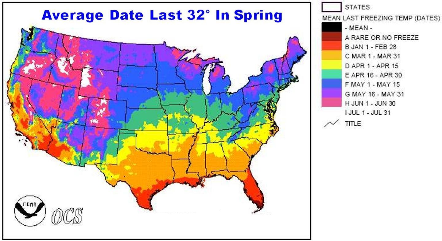
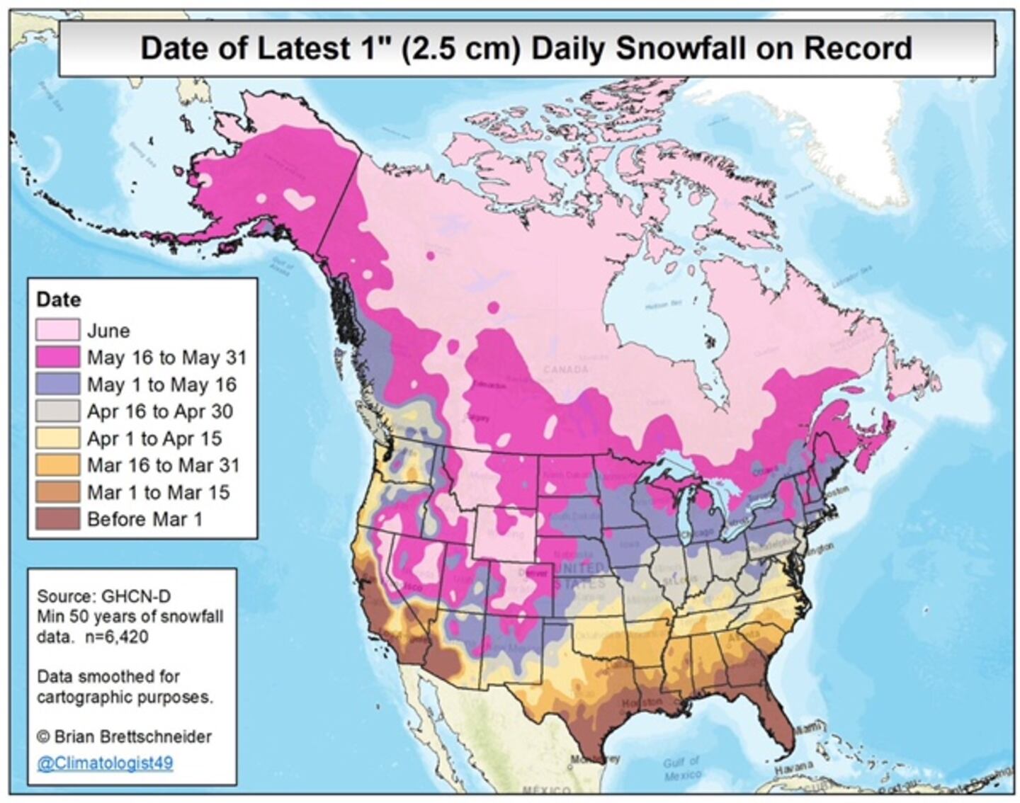
We are days past the average last freeze date based on climatology (past weather history) but a chilly air mass in April is not that unusual.
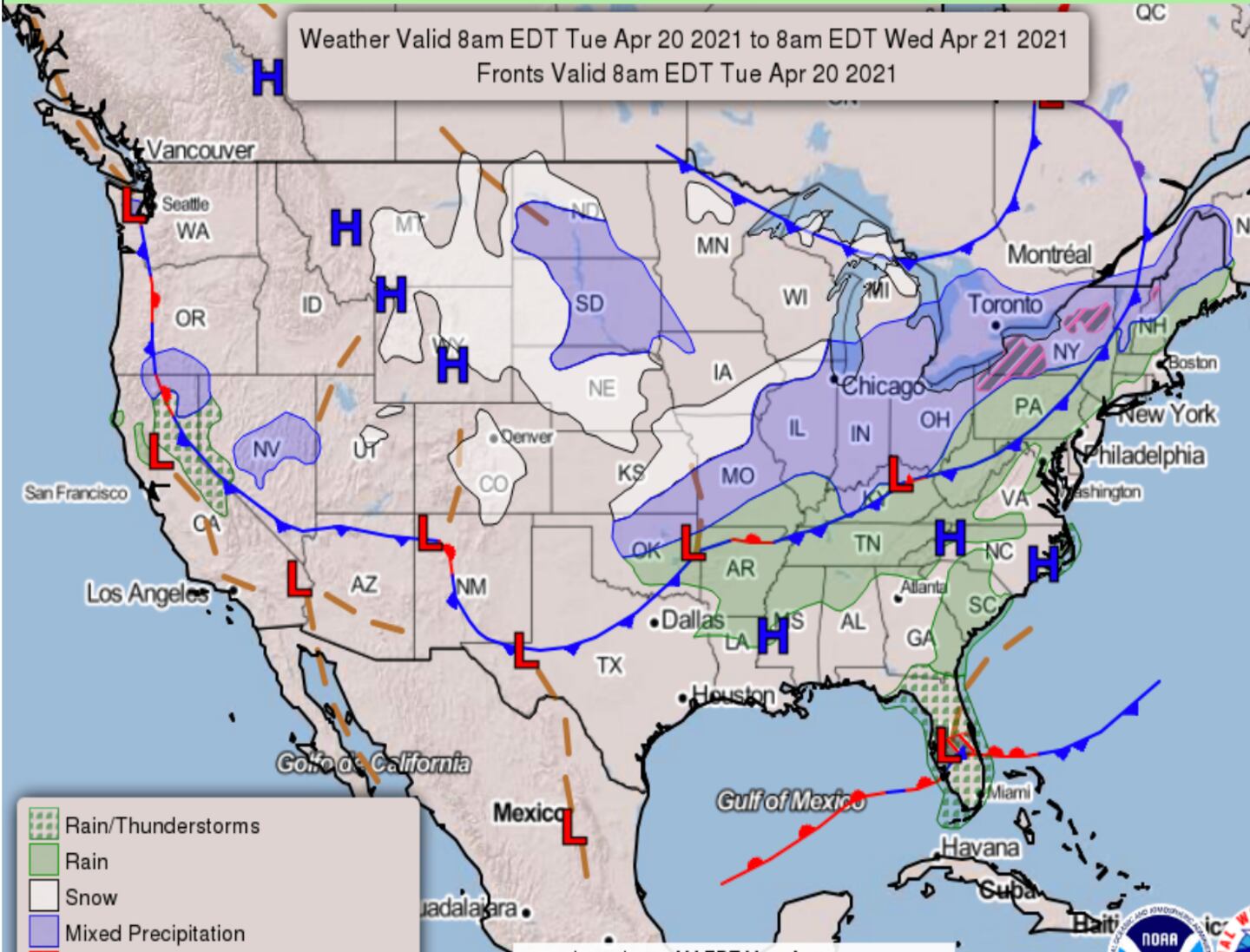
A southward dip in the jet stream is projected with late-season snow expected in some Western and Northern states today into Thursday.
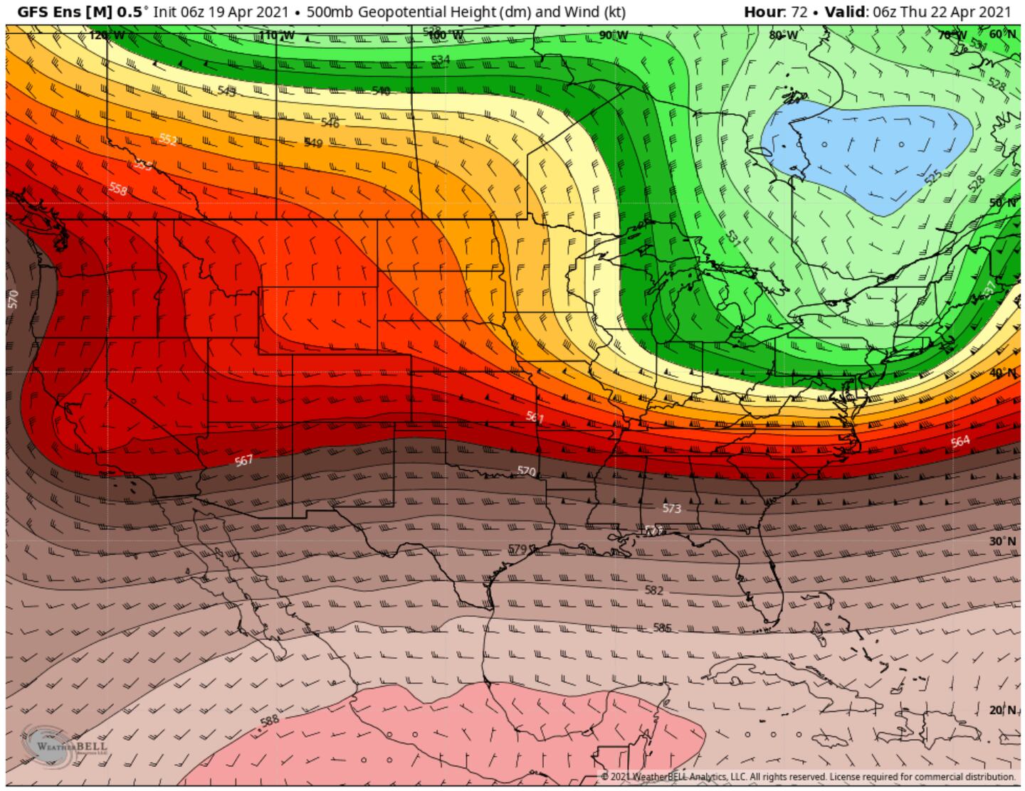
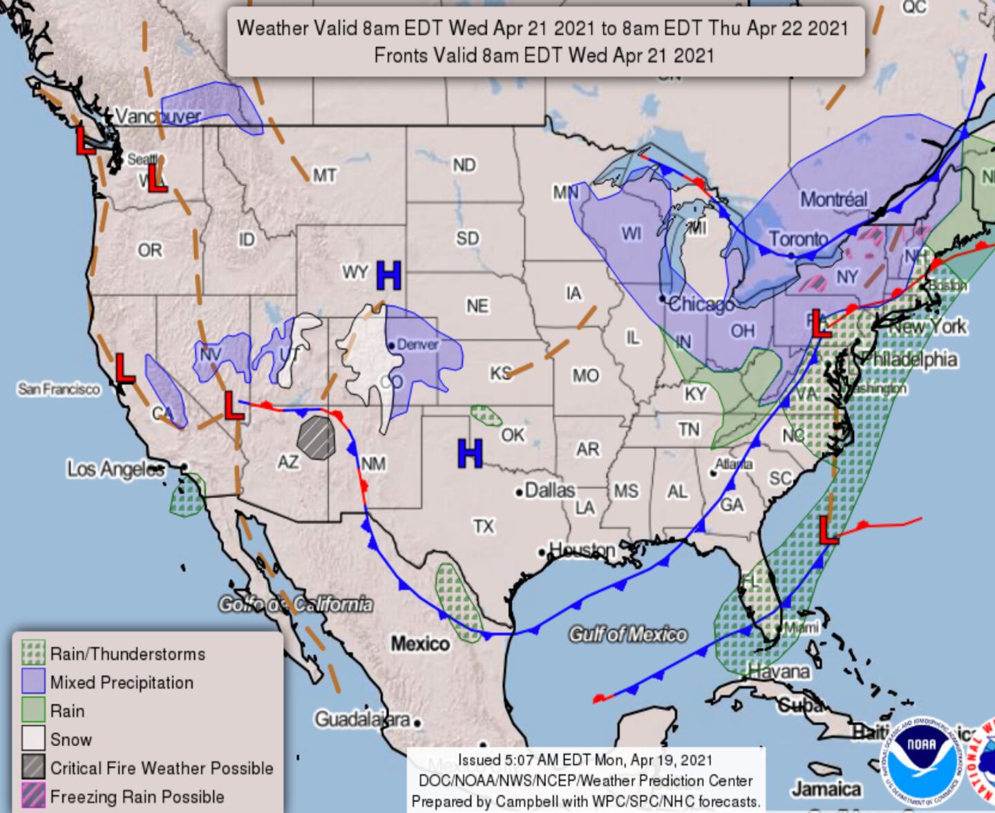
The cold air mass on the backside of that snow system will send a cold front through Georgia Wednesday with below-normal temperatures returning for a few days.
The chance of a shower Tuesday ahead of the front is not zero but is too small to worry about.
Gusty North winds will add a chill to the air on Wednesday.
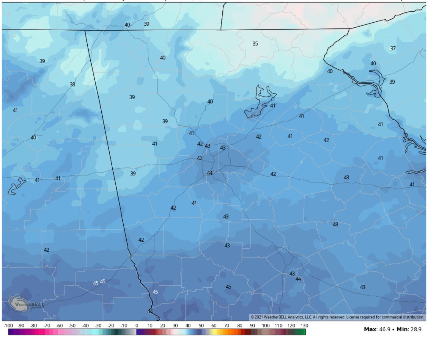
MULTI-MODEL BLEND FORECAST LOWS THURSDAY MORNING:

MULTI-MODEL BLEND FORECAST LOWS FRIDAY MORNING:
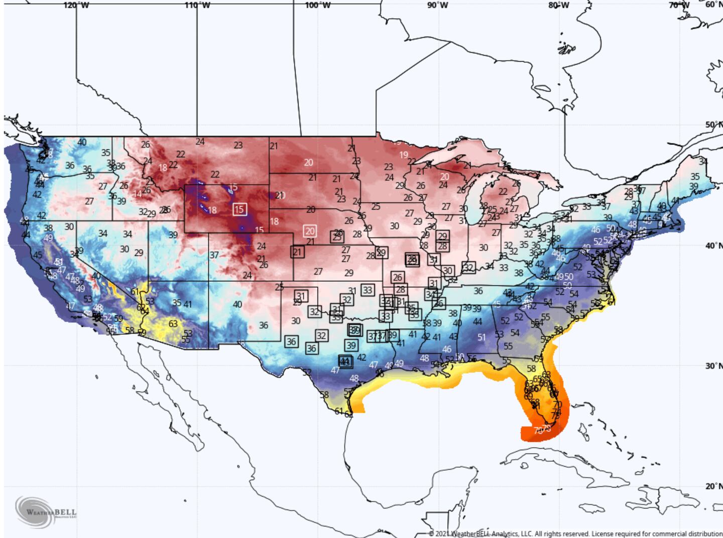
FORECAST RECORD LOWS (in squares) WEDNESDAY:
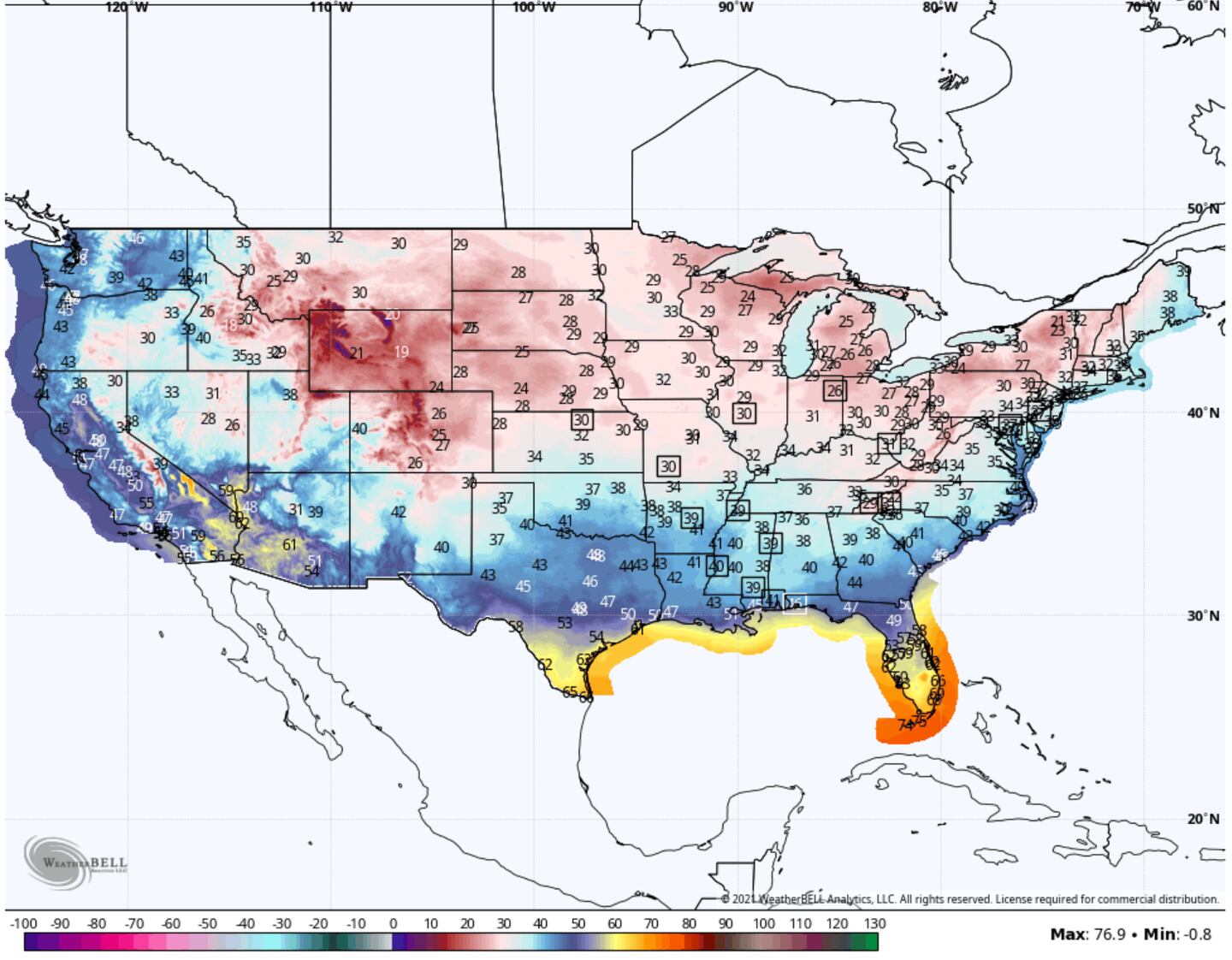
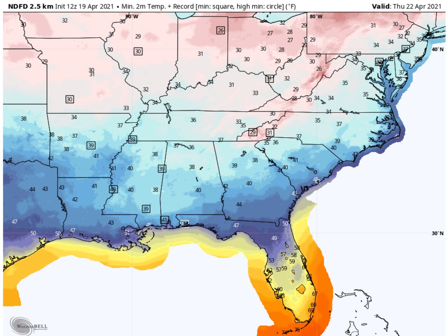
FORECAST RECORD LOWS THURSDAY MORNING (squares):
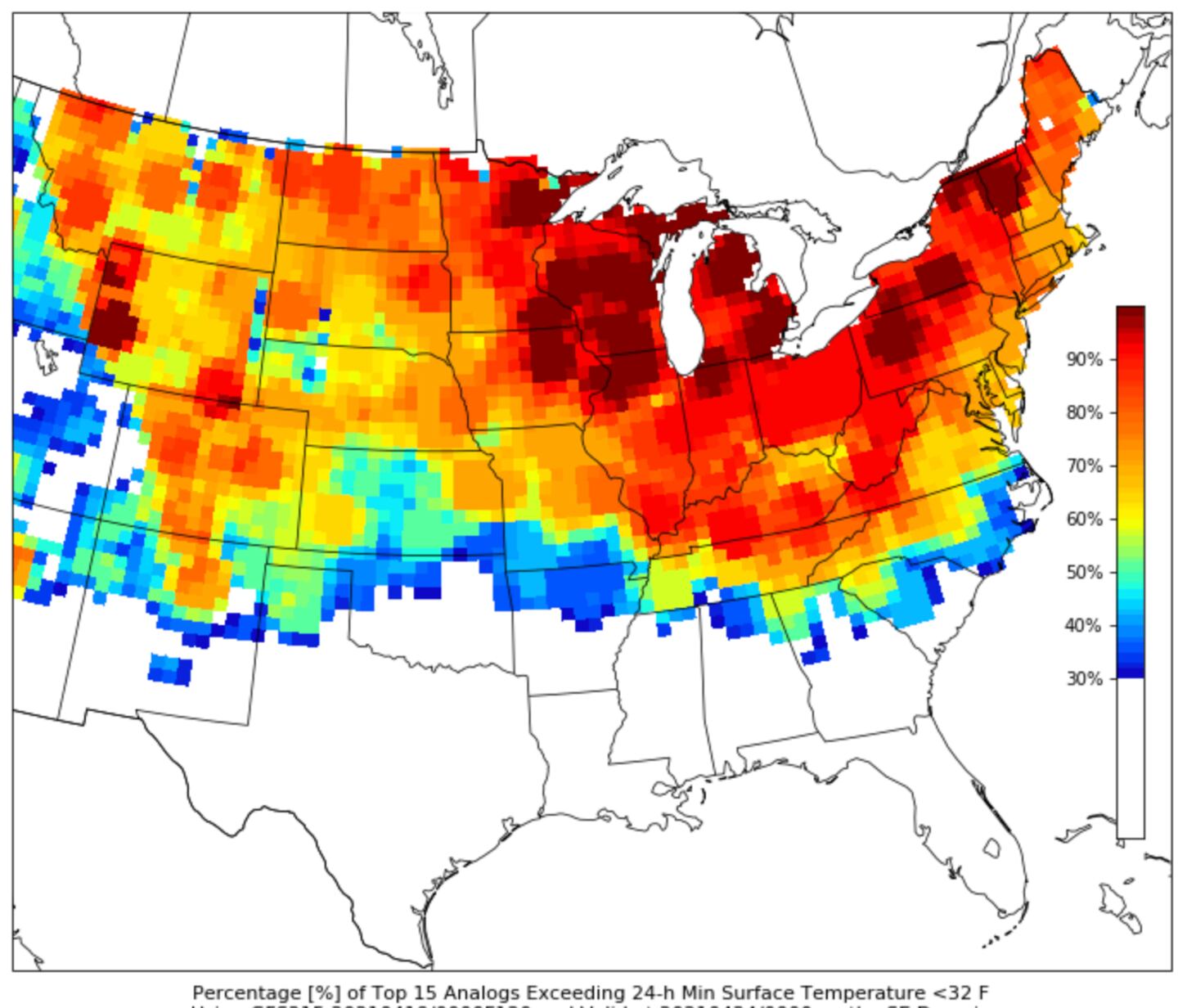
ANALOGS FROM GFS % CHANCE OF <32F:
For updates and more follow me on Twitter @MellishMeterWSB and listen to 95.5 WSB Radio.
Cox Media Group


