
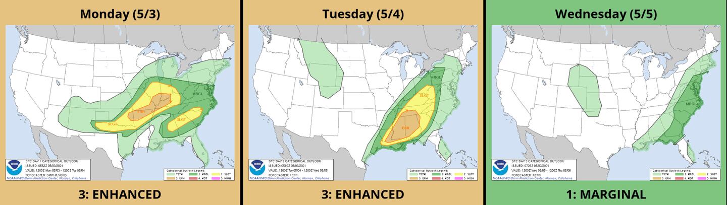
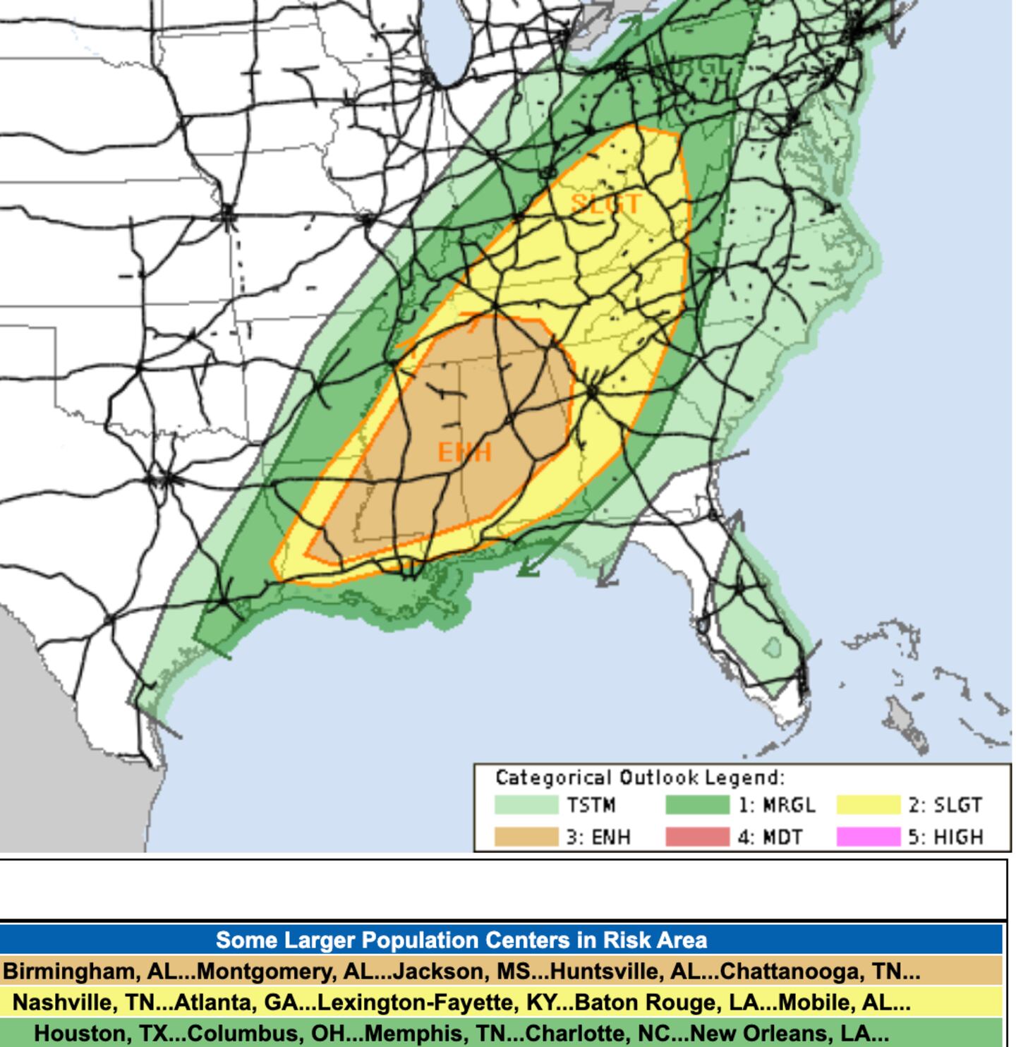
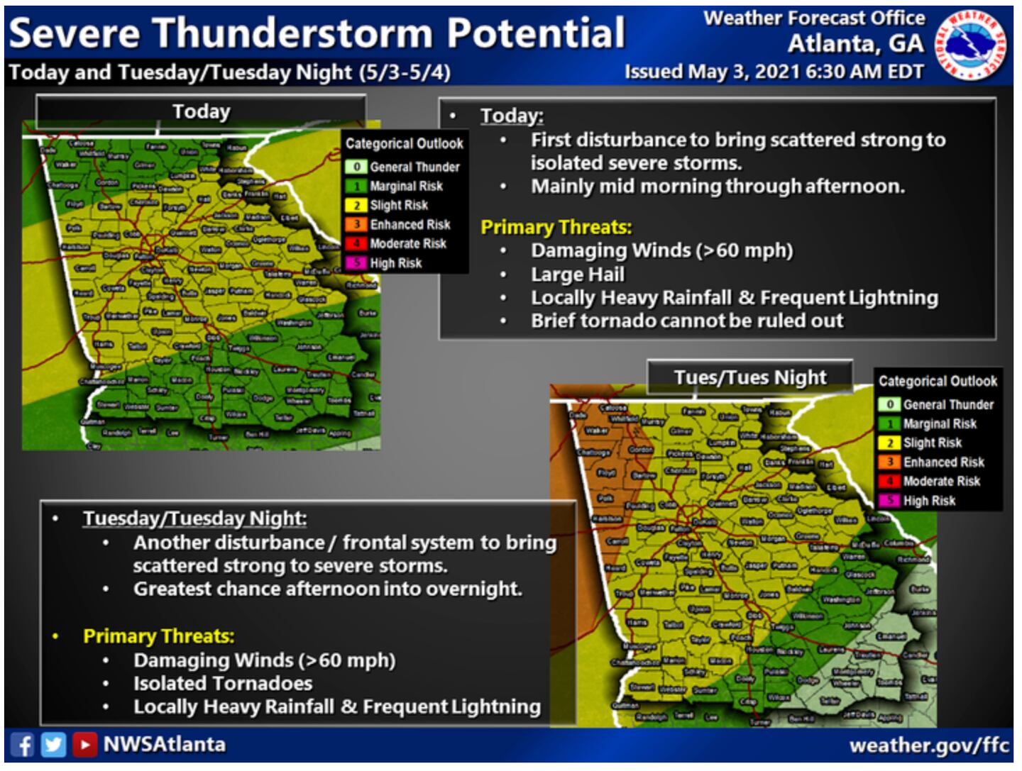
A series of fronts and upper-level disturbances will bring waves of scattered showers and thunderstorms the next 3 days, some heavy or strong with some severe weather in the mix along the way.
It turns cooler and much less humid Thursday-Saturday.
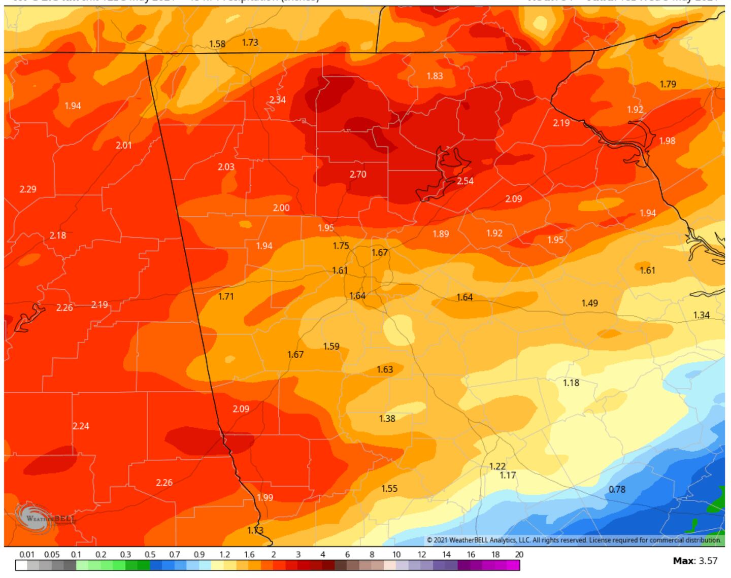
We need the rain since we have a rainfall deficit for the year of 2.5 inches, if we can avoid flooding or damage the rain is welcome.
Tuesday it looks like hit and miss activity in the early morning hours with coverage increasing after 10am give or take a couple hours. Obviously these general outlines can change so stay tuned for updates and listen to 95.5 WSB.
The PROBABILITY OF PRECIPITATION (pop) or “Chance of rain” is high the next couple days 70-100%. But that does NOT mean 70-100% of the day will be wet. It amazes me how many people don’t know that, even though it’s been true and explained for 70 years or so.
Follow me for more on Twitter @MellishMeterWSB.
FORECAST RAINFALL MONDAY-WEDNESDAY AFTERNOON:
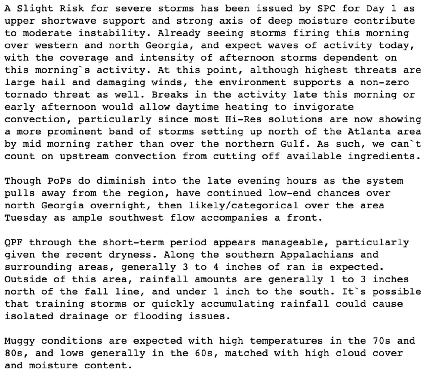
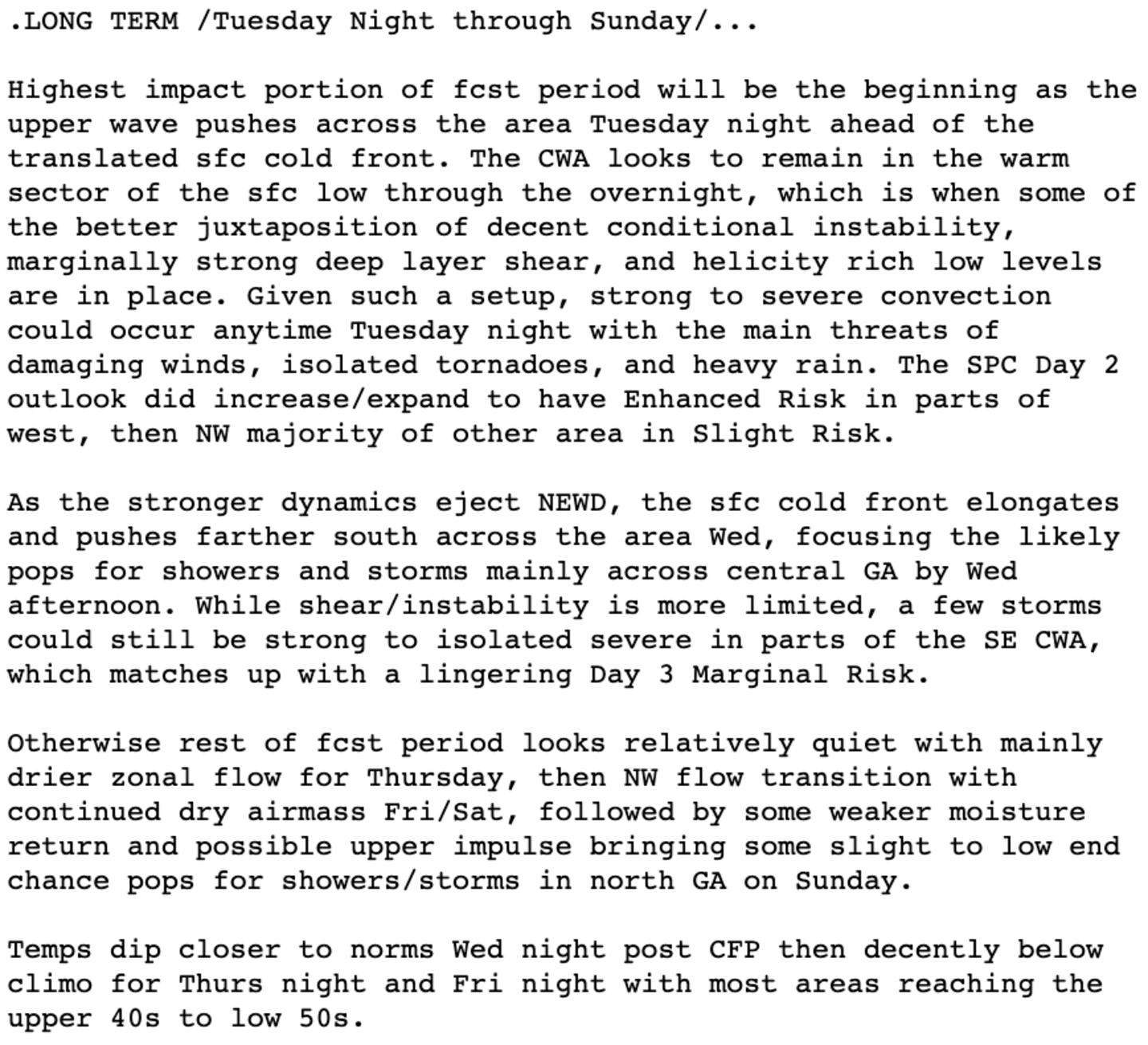
FORECAST TECHNICAL DISCUSSION NWS ATLANTA OFFICE:
Cox Media Group


