
Windy conditions settled into the Southeast this week, and gusty winds have impacted Metro Atlanta Sunday, Monday, and again on Tuesday!
The highest winds occurred on Tuesday afternoon, as anemometers across north Georgia and Metro Atlanta reached the 40-49 mph range.
Rome, Ga. is located 643 feet above sea level, and it is high enough in elevation to register a 49 mph wind gust on Tuesday!
In Metro Atlanta, 41 mph winds were observed at the Fulton County Airport, as well as the Marietta automatic reporting station near White Water and the 120 Loop.
Below are additional wind reports from across Metro Atlanta Tuesday.
Secure your patio furniture and small children/animals, it is windy today🍃!
— NWS Atlanta (@NWSAtlanta) May 2, 2023
A 🚨Red Flag Warning🚨 is in effect for most of Central GA & parts of North GA until 8PM🚩.
A 🚨Wind Advisory🚨 is also in effect for North & Central GA until 8PM💨. #gawx pic.twitter.com/QtIoJ1rXPW
The windy conditions are courtesy of a pressure gradient setting up over the eastern half of the United States.
Over the Great Lakes, a 982 millibar cutoff low continues to swirl over the Great Lakes. Meanwhile, a 1013 millibar high is located in north Louisiana.
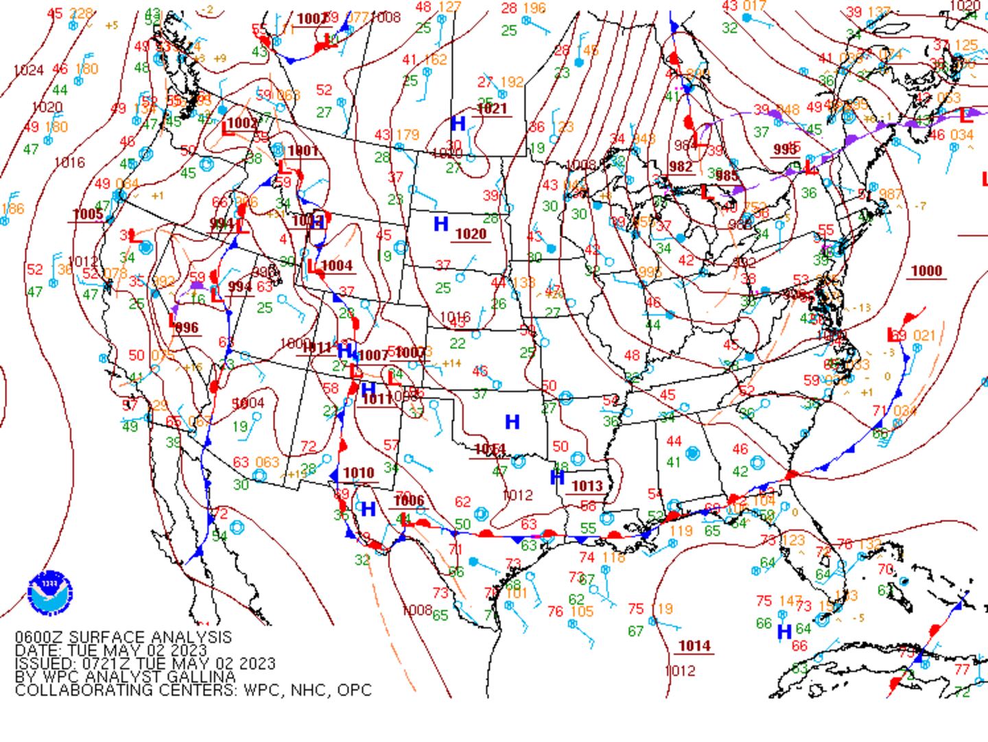
Air flows from high pressure to low pressure -- but instead of a straight line, it curves along the way due to the Earth’s spin, known as the Coriolis Force.

As a result, a pressure gradient develops, where air quickly flow from Louisiana to the Great Lakes, and we experienced it in the form of 35-49 mph wind gusts. Due to the Coriolis Force, the air bends and flows from the northwest, pulling cold and dry air into the Southeast. Temperatures are running about 10 degrees below average for early May!


 Sign Up

