
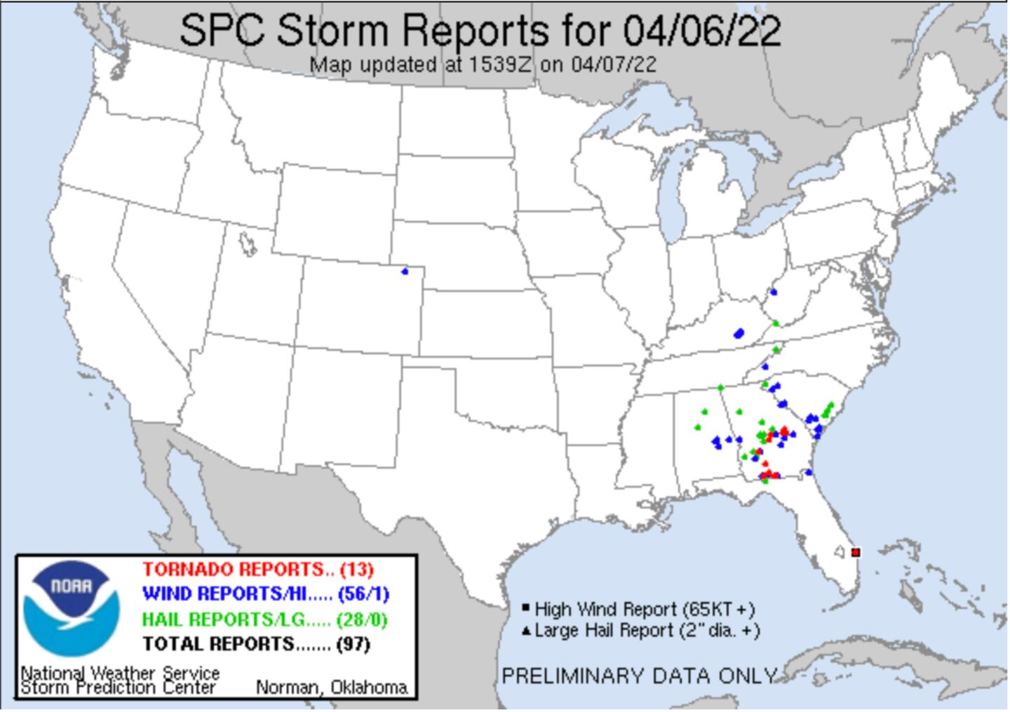
Some good downpours, lightning shows and some isolated large hail in the metro area, but the most widespread wind damage and tornado warnings were in South-central Georgia as anticipated.
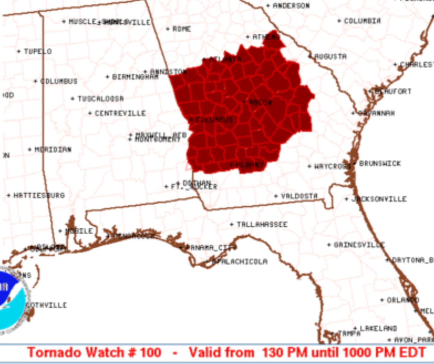
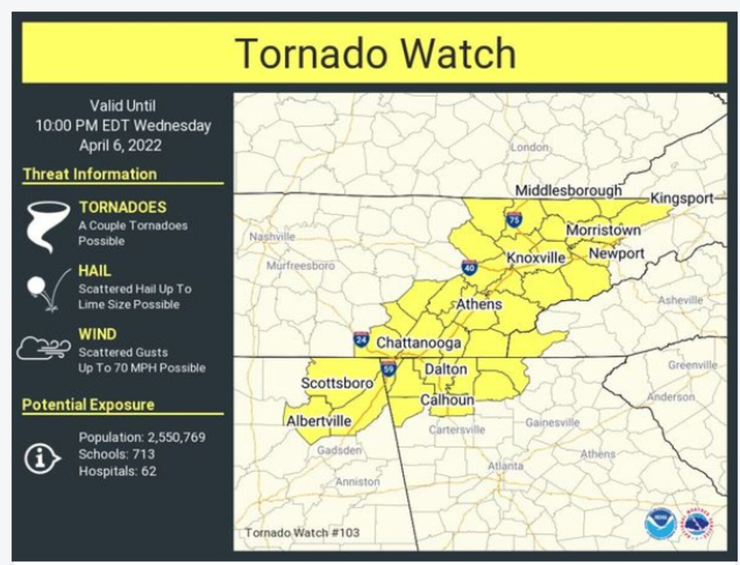
Tornado watches were issued both South of Atlanta (including our far south suburbs) and North of Atlanta yesterday.
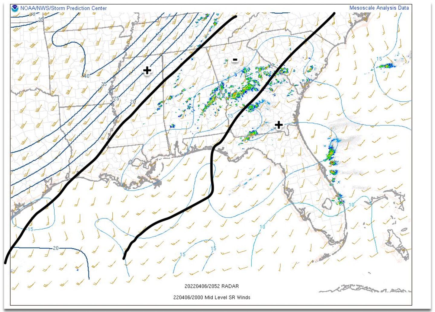
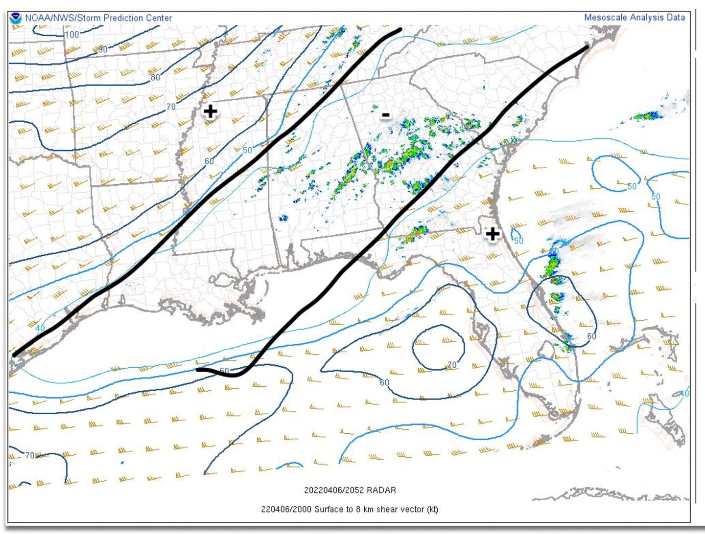
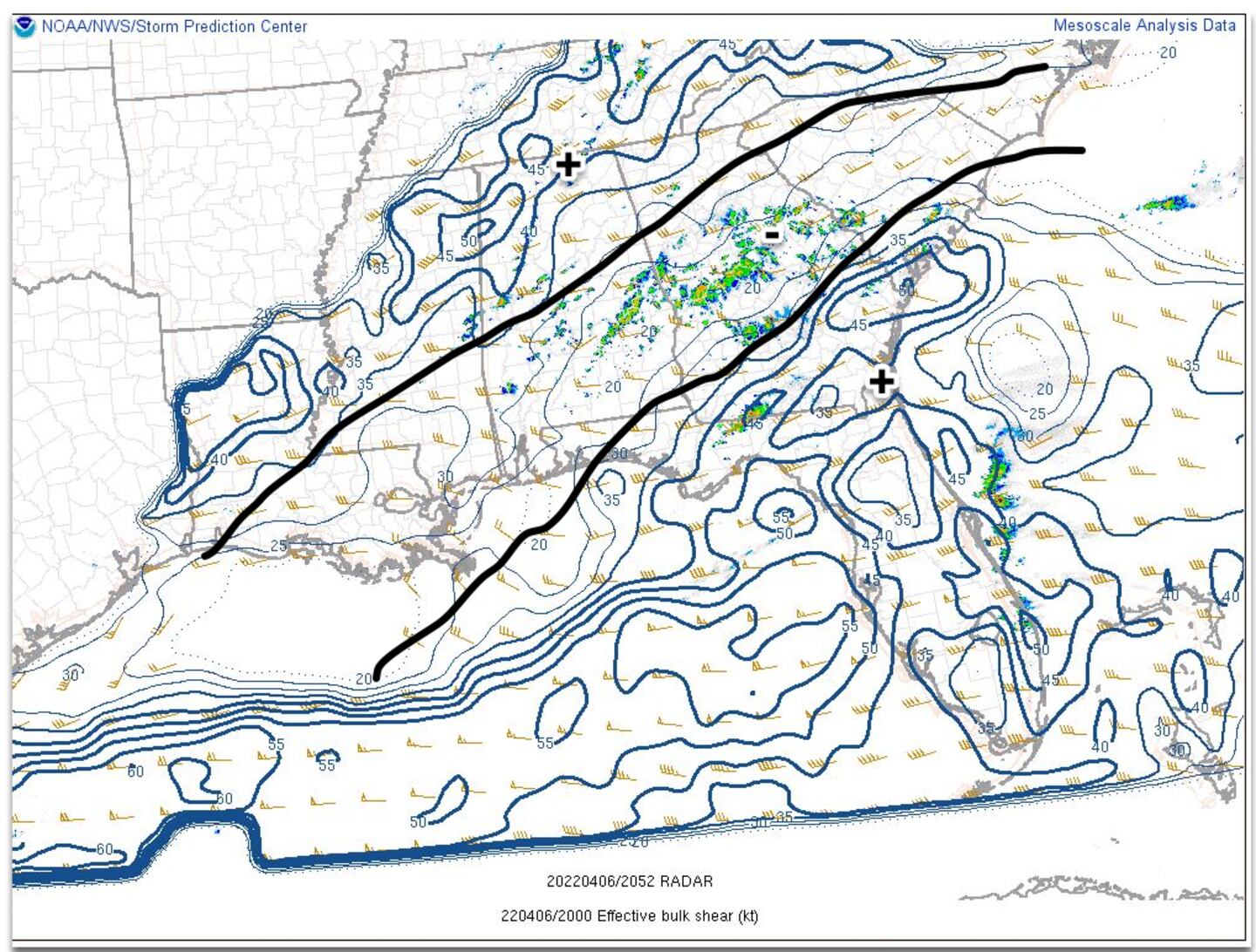
We had ample moisture and some instability, but the best combination of thermodynamics, moisture, and speed/directional wind shear were displaced from each other in most of the Metro Atlanta area as shown in the maps below (+/-):
More favorable kinematics in + areas, less favorable in - areas:
The timing of the front later at night also helped, and the morning fog and low clouds helped to limit sunshine/daytime heating which prevented instability from rising to extremes. That’s probably why there was less thunderstorm damaging wind threat than initially expected in the Atlanta Metro.
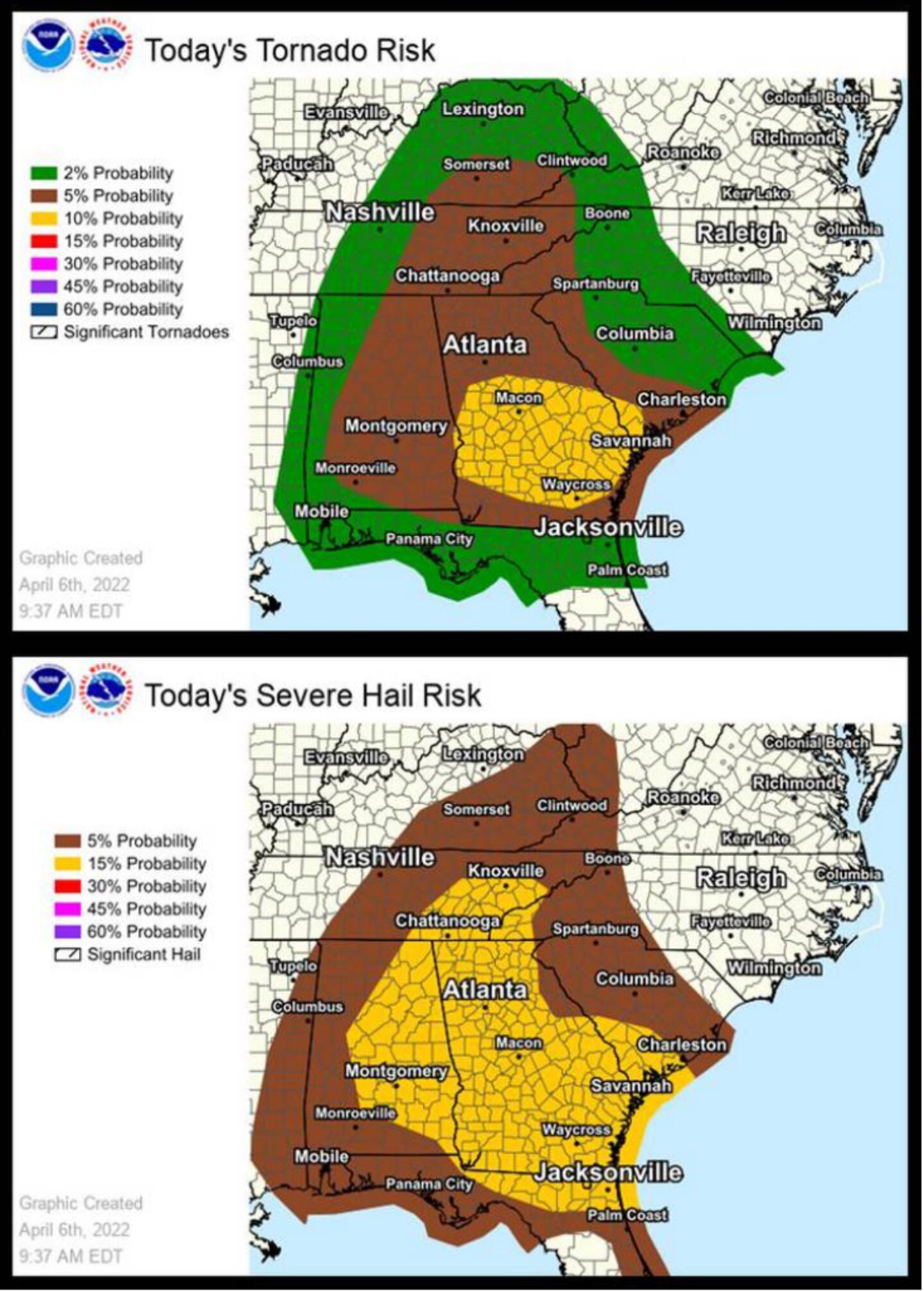
YOU CAN SEE BELOW THE GREATEST THREAT WAS FORECAST TO BE DOWNSTATE:
The next chance of severe weather looks a long way off as of now. More on that later.
For more follow me on Twitter @MellishMeterWSB.
©2022 Cox Media Group


