
No surprise since I’ve been talking about the big weather changes coming since last Sunday. Above is the surface low storm track expected that will bring the snow and ice storm to the Midwest and New England states this weekend and bring rain and some thunderstorms to Atlanta Saturday with a temperature plunge Sunday.
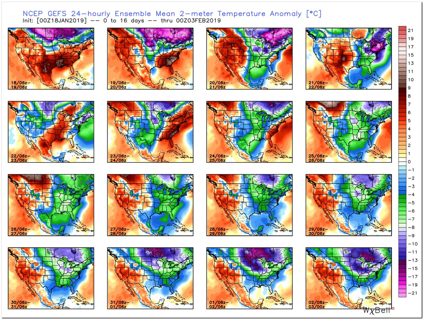
We go from much above-normal temperatures Friday and Saturday to below-normal temperatures Sunday into Tuesday.
Most of us will not see snow flurries Sunday morning but if you see any it wont last or matter. Some light accumulation is possible in the far North mountains.
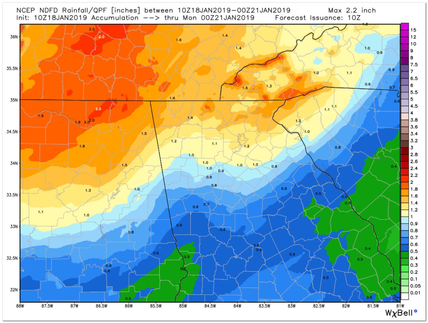
Heavy rain at times Saturday especially afternoon and night. An isolated severe thunderstorm with damaging winds is possible afternoon or evening but nothing widespread. As of now the highest risk looks to be West and South.
Temperatures during the day Sunday will have trouble rising much especially North of I-20, and NW winds will gust to 30 mph at times making the wind chill factor make it feel like it’s in the 20s during the day and a wind chill factor in the upper teens or lower Monday morning.
A hard freeze Sunday night with lows in the low to mid 20s.
The see-saw temperature pattern will continue the rest of the month and we will have to remain vigilant for any surprise brush with snow or ice the rest of the month and next month as well, as discussed in previous blog posts.
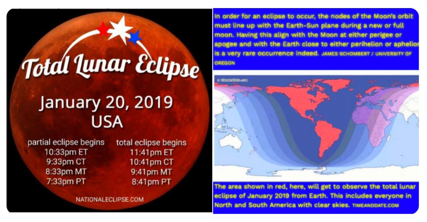
As of this writing it looks like clearing skies in time for the so-called “Super moon/Blood Moon” TOTAL LUNAR ECLIPSE Sunday night.
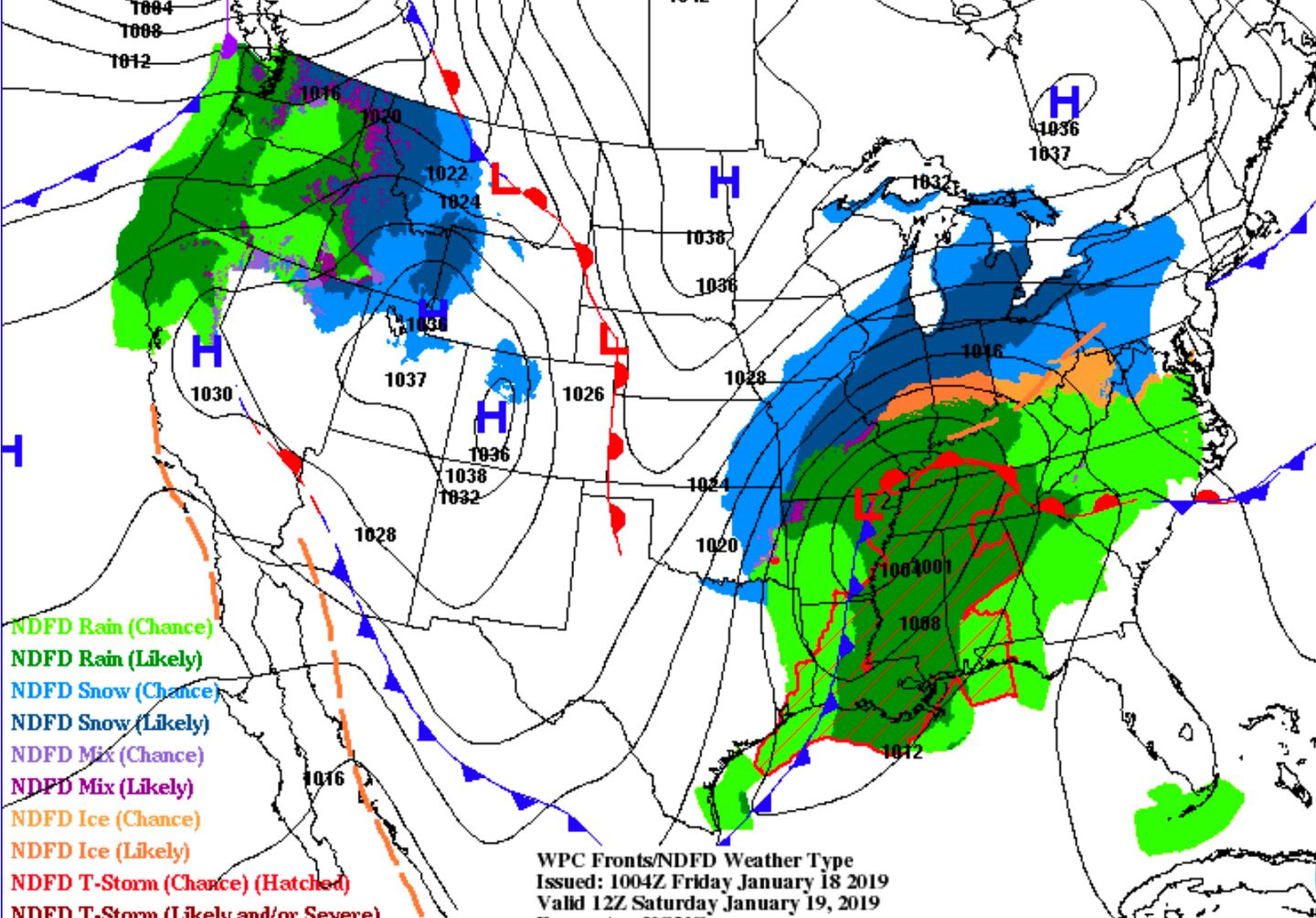
FORECAST SURFACE WEATHER CHART SATURDAY MORNING:
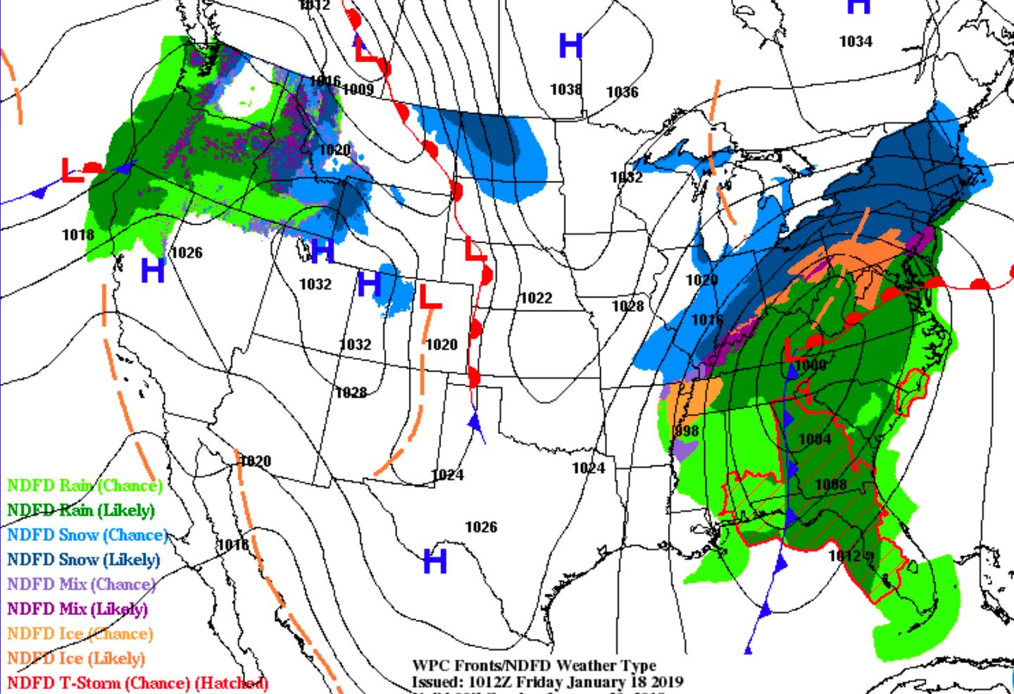
FORECAST SURFACE WEATHER CHART SATURDAY AFTERNOON AND EVENING:
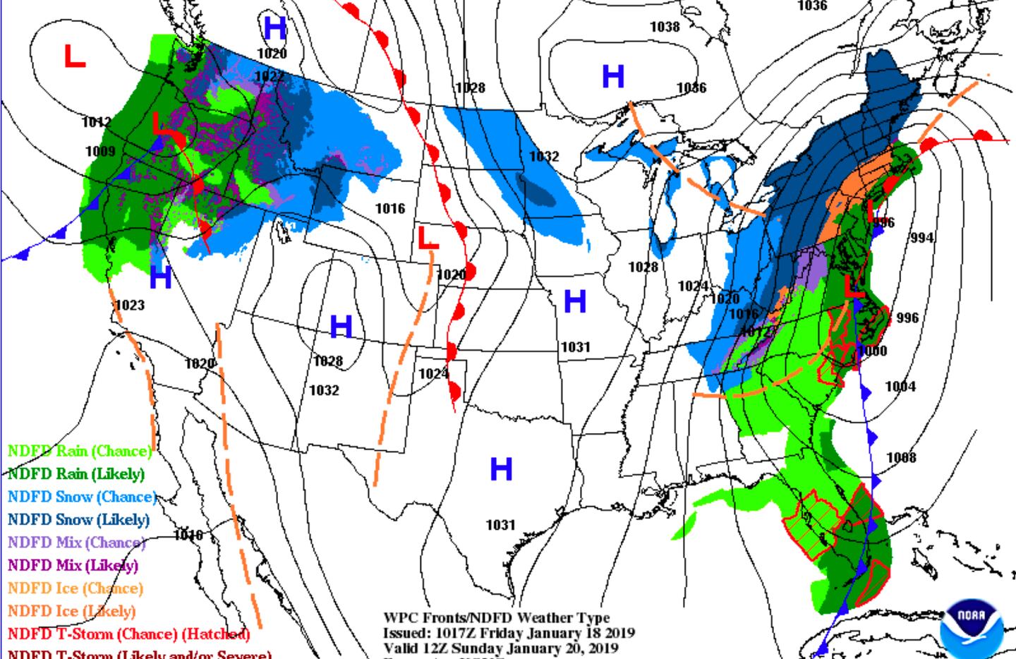
FORECAST SURFACE WEATHER CHART SUNDAY MORNING:
SEVERE WEATHER RISK SATURDAY AFTERNOON AND NIGHT:

ESTIMATED WEEKEND AVERAGE RAINFALL:
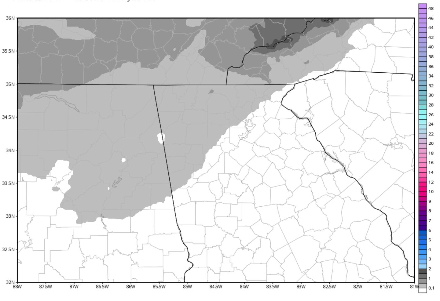
SNOWFLAKES NOT OUT OF THE QUESTION IN GRAY SHADED AREA SUNDAY MORNING, MOST OF US WONT SEE ANY:
FORECAST WIND CHILL FACTOR (”feels like”) SUNDAY:
FORECAST WIND CHILL FACTOR MONDAY MORNING:

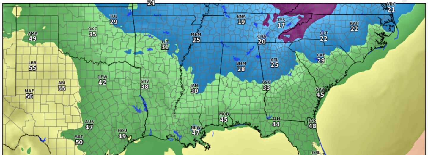
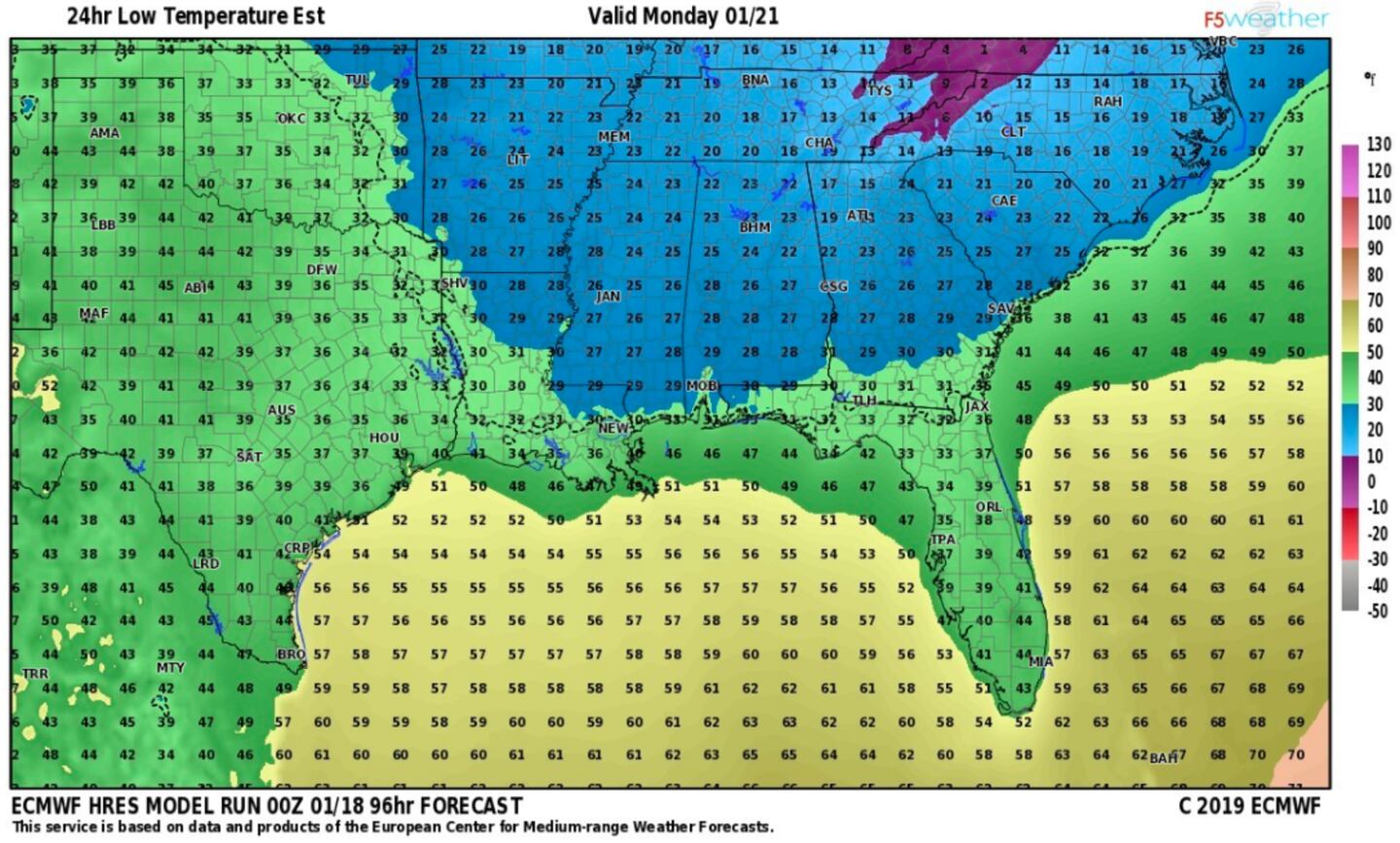
FORECAST LOW TEMPERATURES SUNDAY NIGHT:
15-DAY TEMPERATURE ROLLER COASTER RIDE CONTINUES:
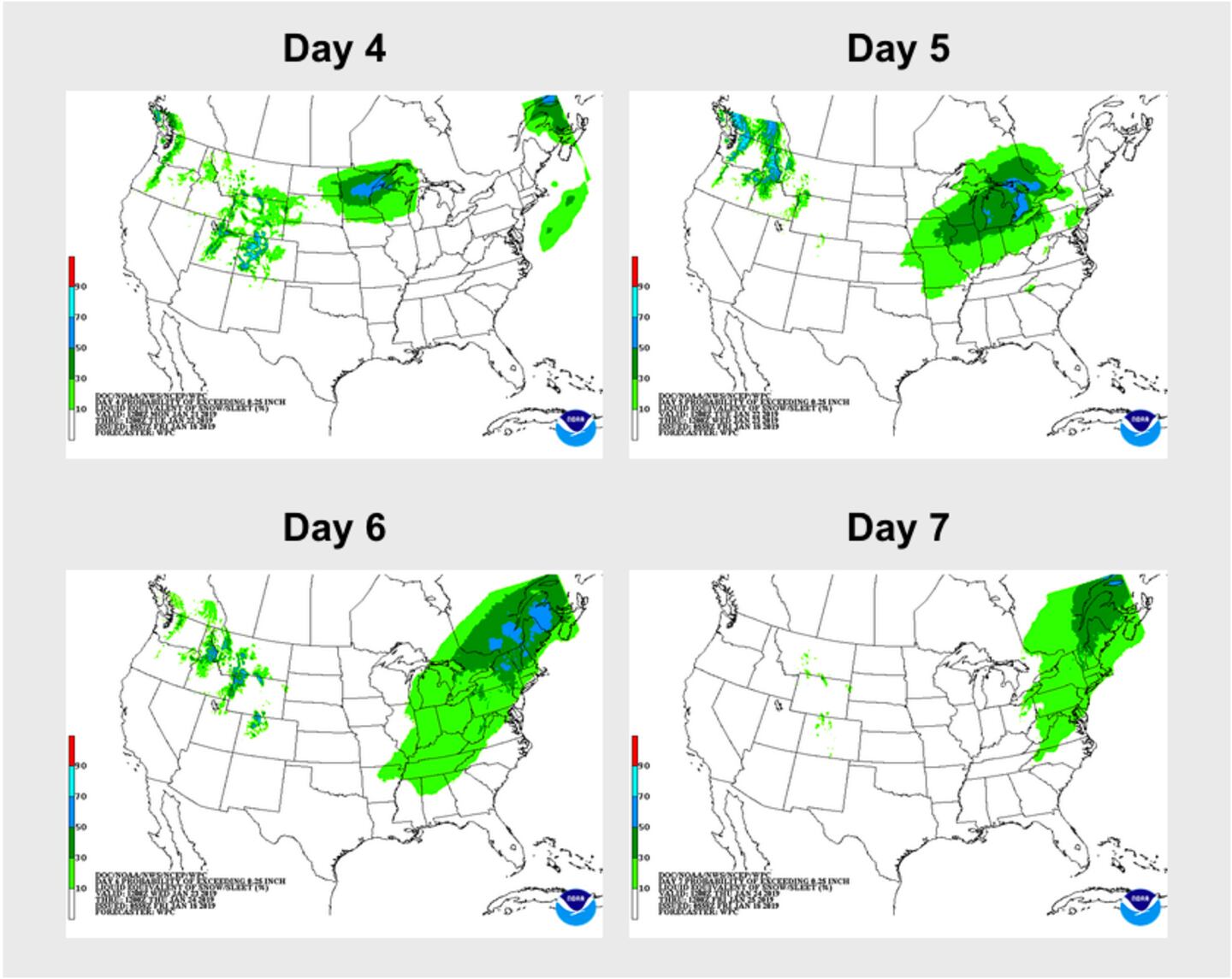
EXTENDED WINTER PRECIPITATION OUTLOOK THROUGH DAY 7 ACCUMULATION OF SNOW OR SLEET IN GREEN SHADES:
For more follow me on Twitter @MellishMeterWSB.


