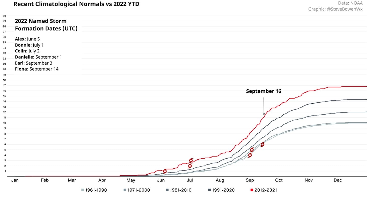
TROPICAL STORM FIONA has been designated by the NHC, this is late for a 6th named tropical storm and there are no signs of a very active 2nd half of the season so it will probably end below-average, near-normal at most. Despite forecasts PRIOR to the start of the season (way back in April/May) that it would be an above-average season. (The consensus of all forecasts was NEVER for a “hyperactive” season as some have falsely claimed on social media).
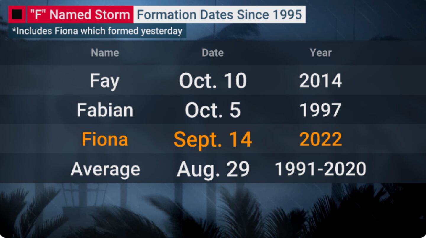
It’s been an unusually slow start to the Atlantic hurricane season, especially since the active era starting in 1995. Fiona marks the 3rd latest date of the “F” named storm since 1995, the average formation of the “F” storm is August 29th.
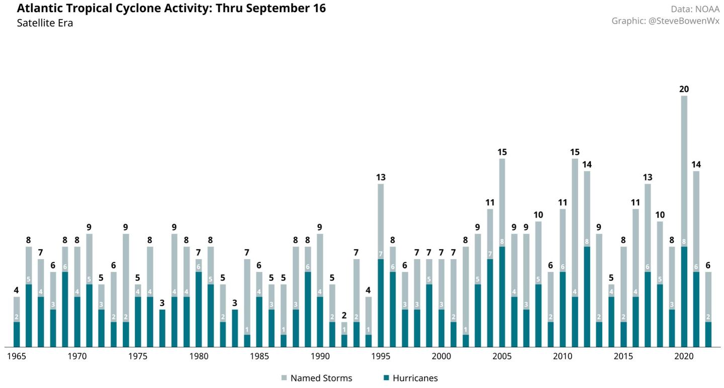
The average number of named storms by Sept 16th is 9. This is the fewest by now since 2014. The fewest YTD in the satellite era is 1992 the year of horrible Andrew.
Why the slow start and low and late hurricane season so far?
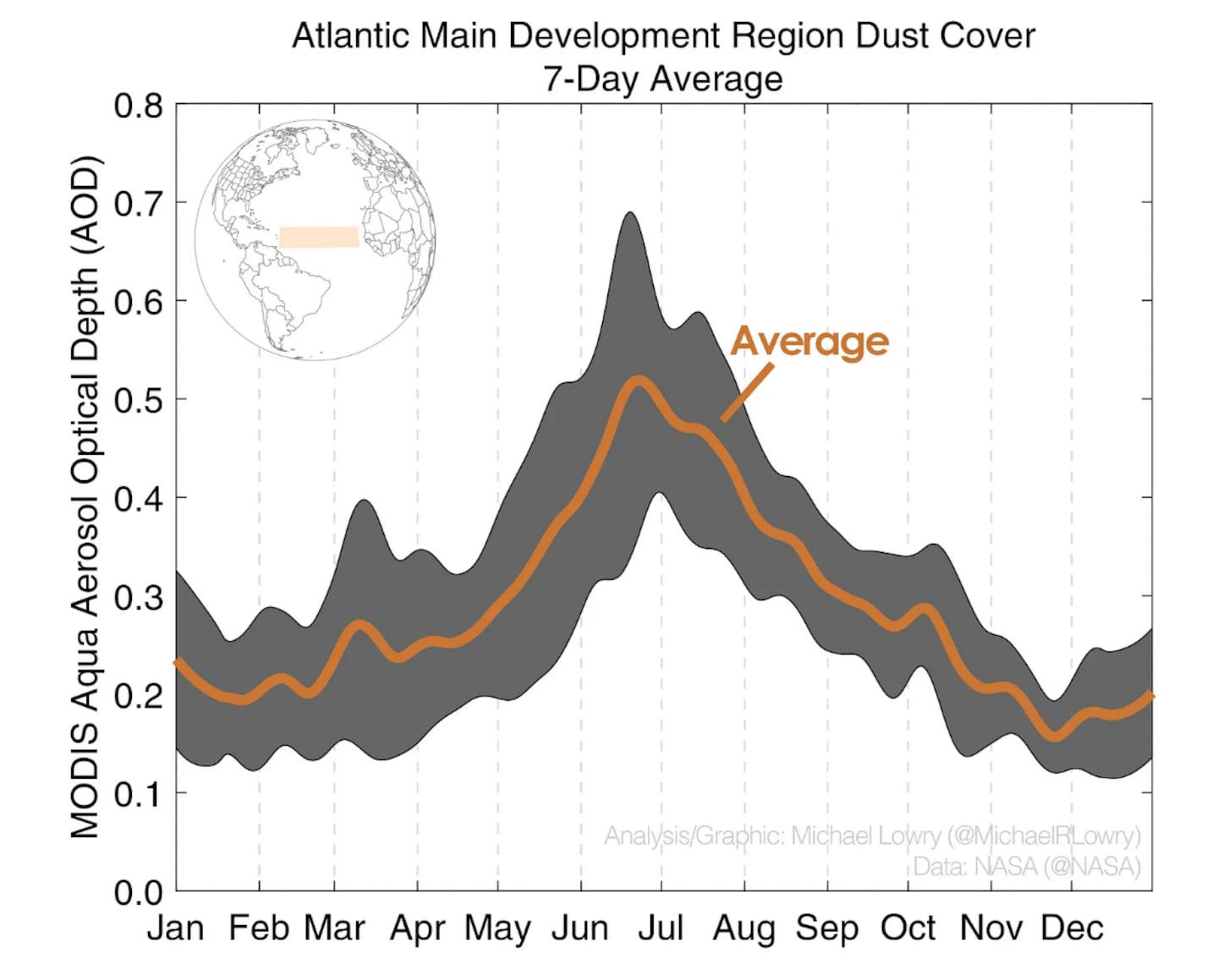
It’s not enough to say the Atlantic is dusty and therefore it’s quiet. Other factors like rising or sinking air, upper-level winds, and the configuration of warm and cool Atlantic waters are more important to regulating overall tropical activity. The dust can have indirect impacts on hurricanes including cooling of ocean waters during summer. The dust from Africa is present to one extent or another every year every season!
The Saharan Air Layer or SAL – the scientific term specific for the warm, dry, dust-laden layer of the atmosphere extending 5,000 feet to 15,000 feet up – is ever-present during the hurricane season. The dusty SAL usually ramps up during the spring and peaks over the tropical Atlantic in late June or early July. The great plumes that roll off Africa every three to five days – like a colossal ocean wave crashing ashore – ride on the backs of the same tropical disturbances that often grow into our strongest hurricanes. Naturally, when our would-be tropical systems get mixed up in these great dust outbreaks, it stands to reason their development odds, like the surrounding humidity, drop. Ongoing research suggest it’s not that simple so dust alone does not automatically equal a quiet season and does not guarantee a given storm will get weakened or killed off.
For example, in 2019 the SAL was off to a slow start through August even though dust was at record LOW levels. Yet 2005 was a famously active season despite dust levels running above-average!
Let’s look at the MANY factors being considered as hampering the formation, development and lifespan of tropical systems or tropical seedlings so far this season...
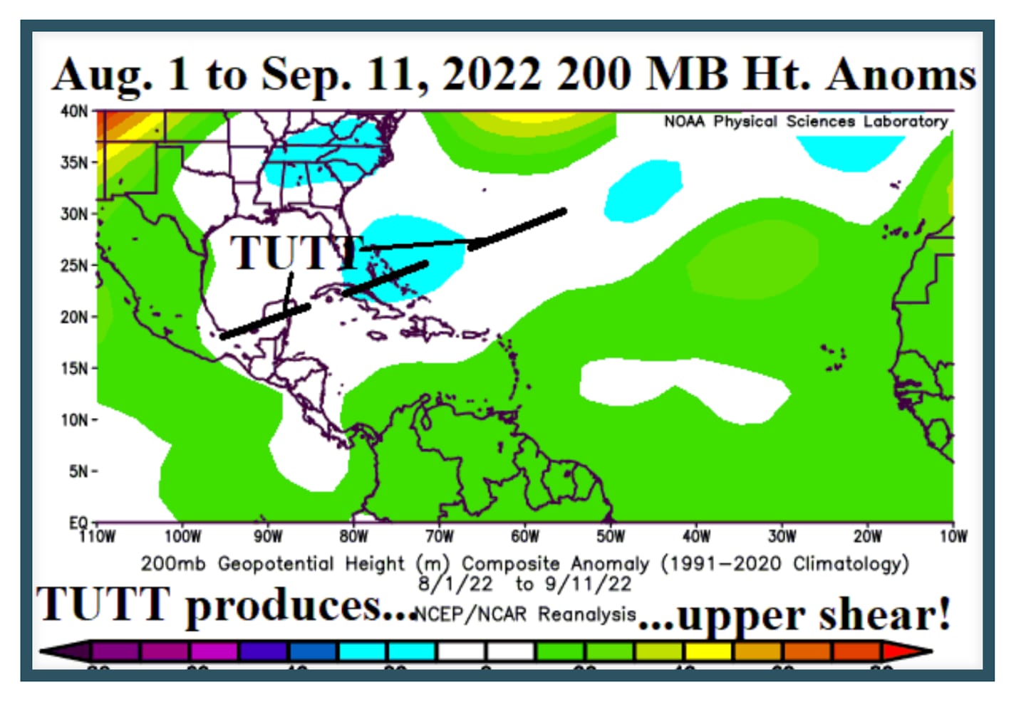
Tisk, tisk on the Tutt TUTT (Tropical Upper Tropospheric Trough):
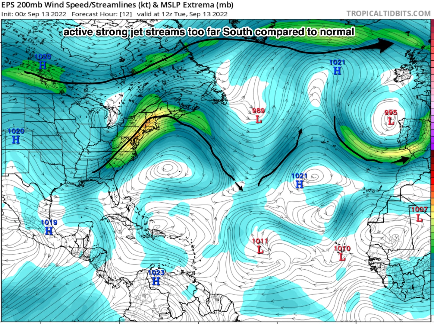
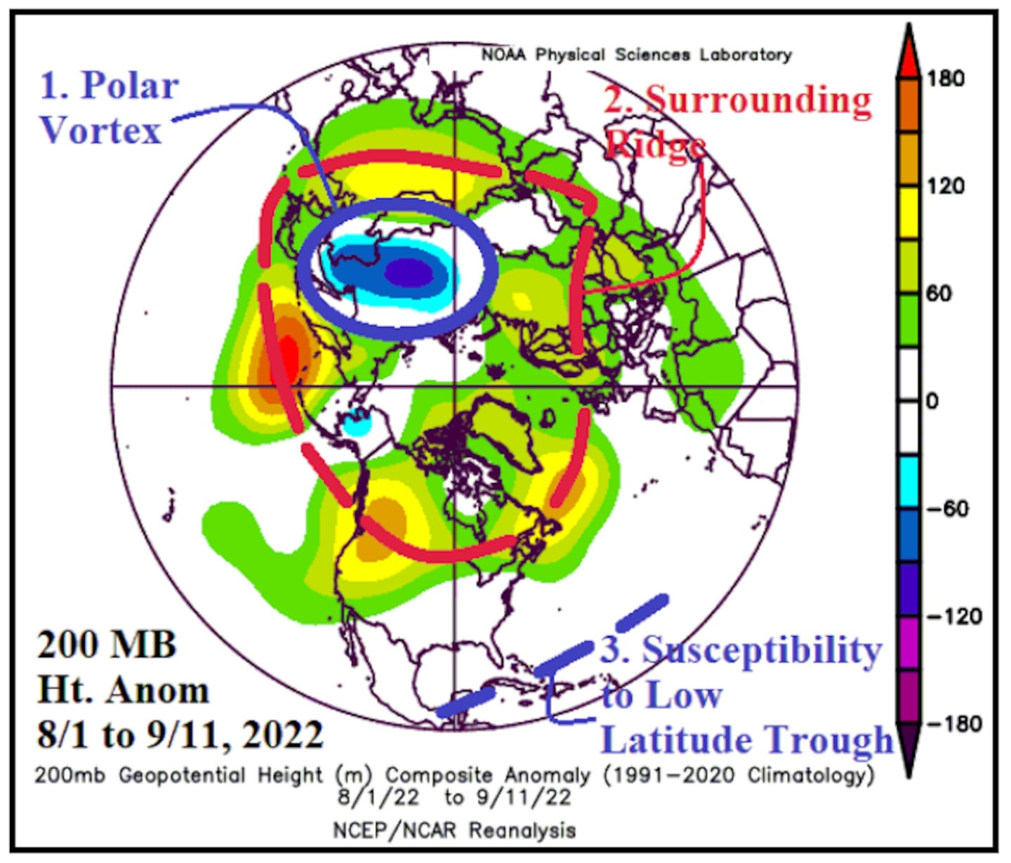
Presence of an upper-level low-pressure trough in the upper troposphere developed late last spring and lingered through meteorological summer stretching from the Bahamas southwestward. The TUTT pattern is the one way to knock down the otherwise strong correlation between La Nina and active hurricane seasons, we last saw this in 2013.
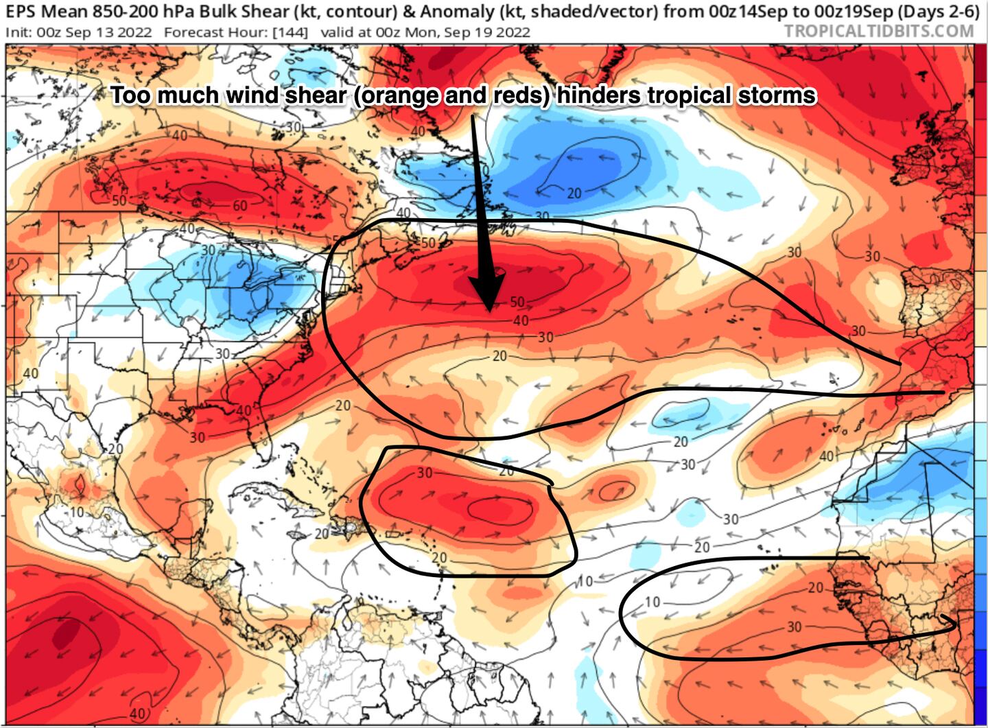
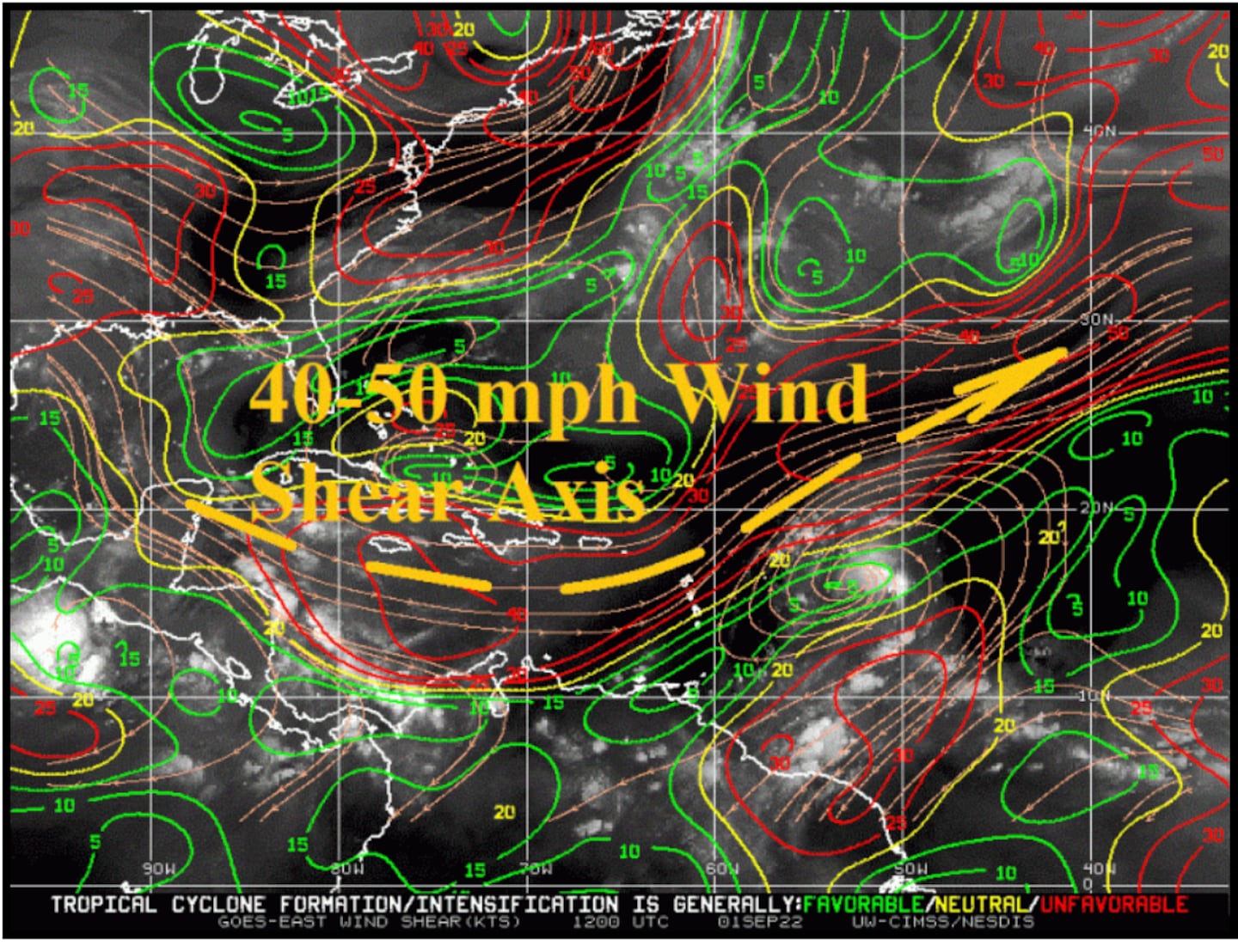
The TUTT pattern is responsible for mid-level tropospheric wind shear which inhibits tropical cyclone development. Wind shear “shreds” thunderstorms as they try to organize into a tropical cyclone.
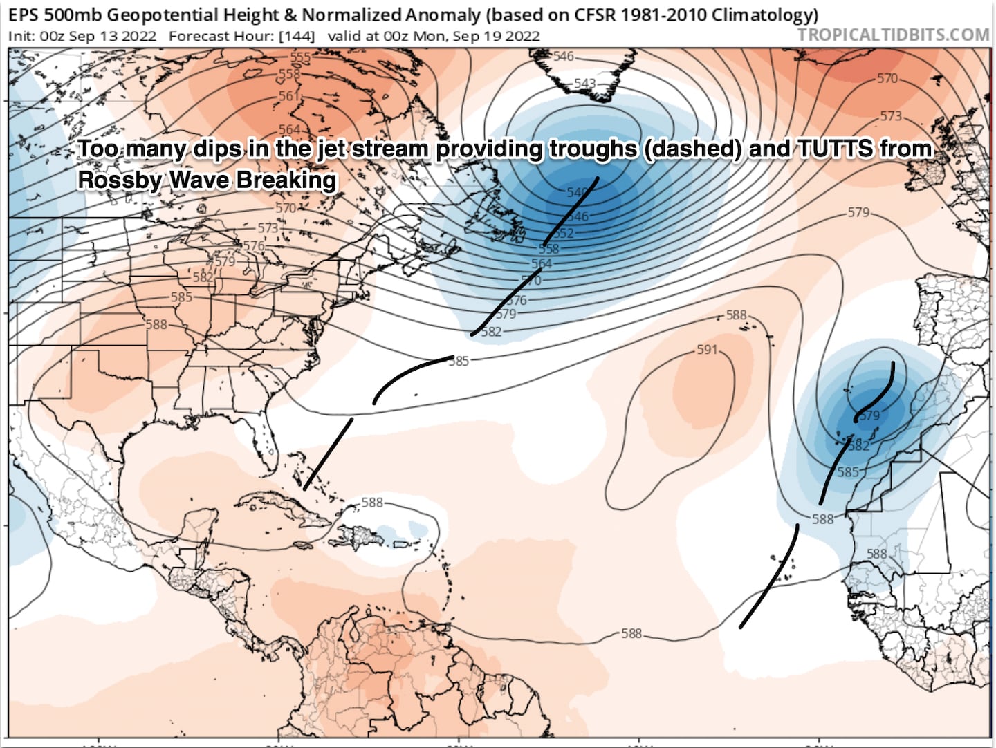
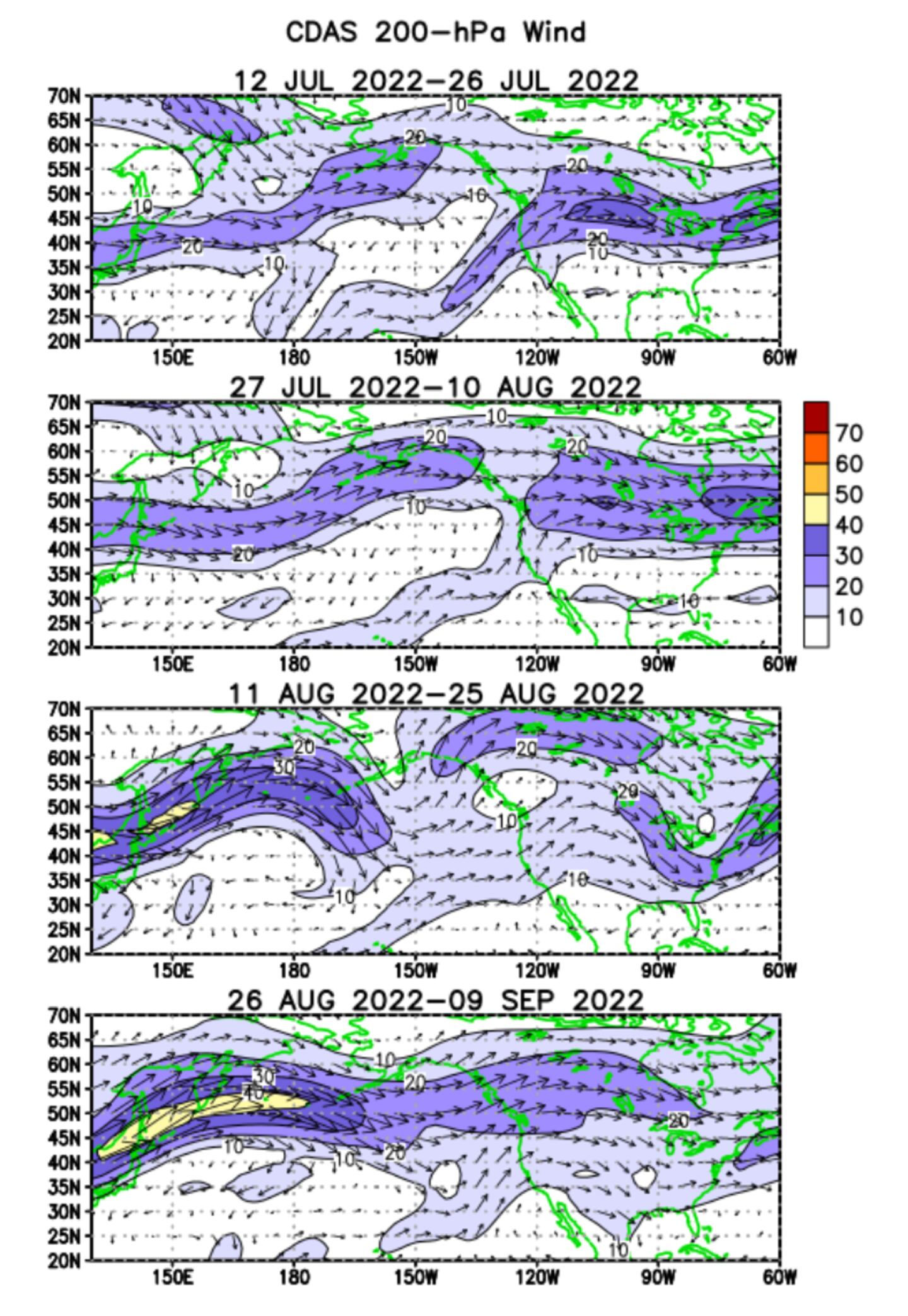
The TUTT is related to the broader hemispheric jet stream pressure patterns and wind flow...
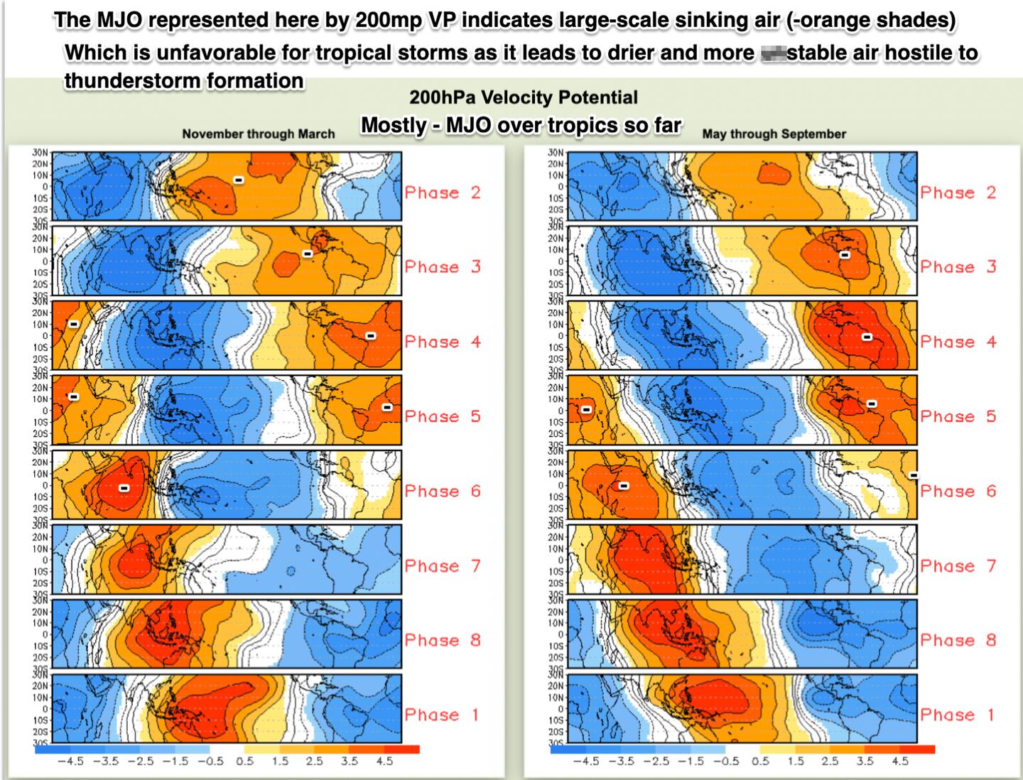
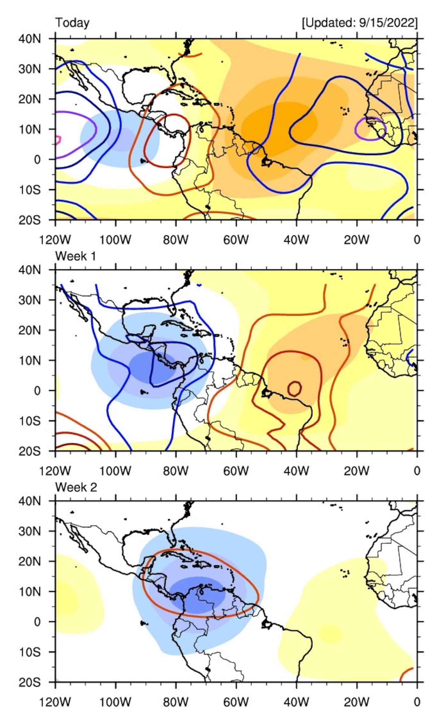
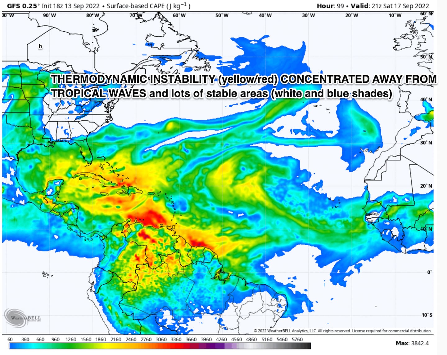
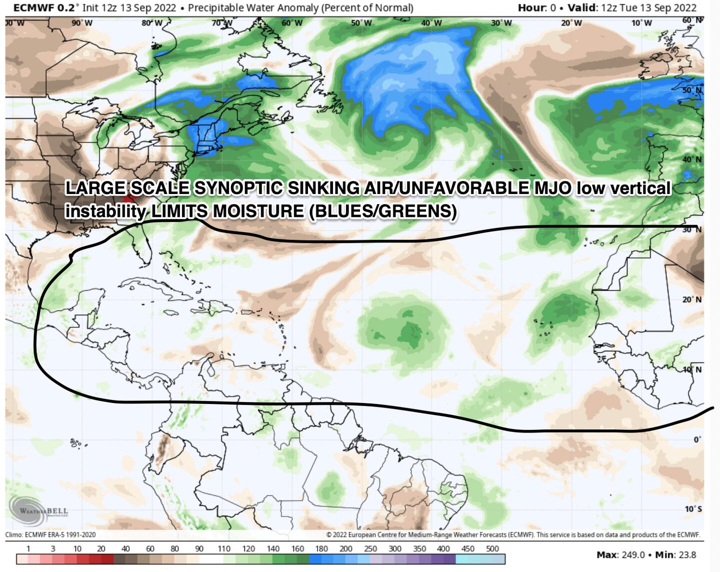
Large-scale synoptic downward air motions (-MJO) have prevailed over Africa and the Atlantic/Caribbean which is the very opposite of the upward air motions (+MJO) you want for a favorable environment for topical systems. In short, the MJO has been hostile to the Atlantic basin:
The upward air motions (yellow/orange shades AND red contours of CCKW) and the downward air motions (blue shades/blue and purple contours) show favorable and unfavorable large-scale synoptic forcing for convection related to tropical cyclones. CCKW stands for Convectly Coupled Kelvin Wave. A topic for another day! MJO stands for Madden-Julian Oscillation:
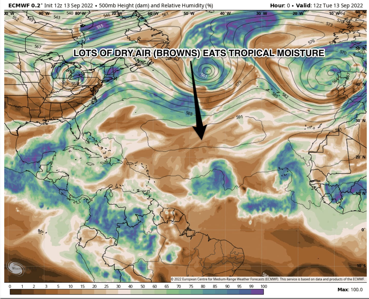
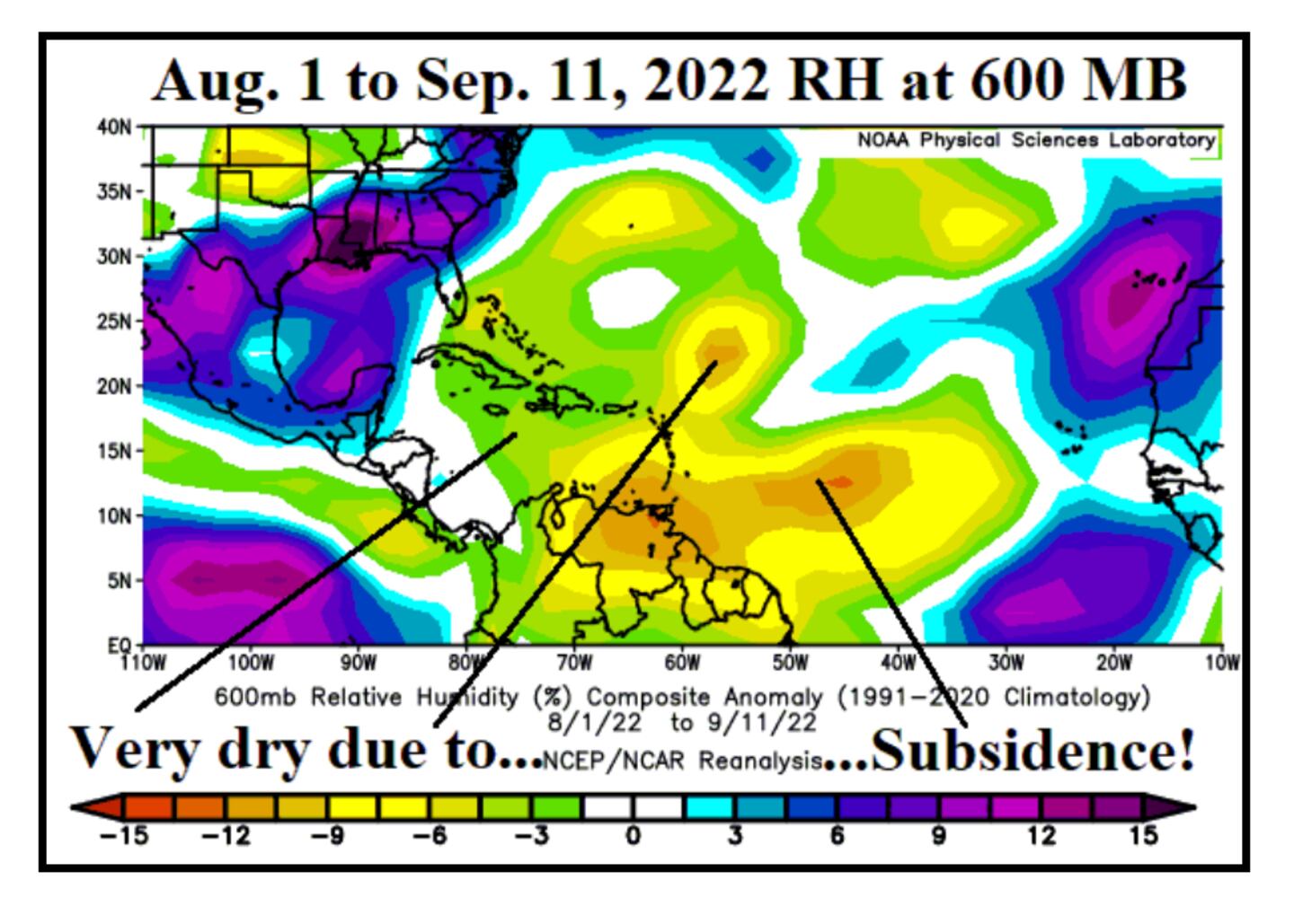
A negative or suppressed state of Kelvin Waves and MJO helps lead to drier air and less unstable air:
It all works together for better or worse. Downward sinking air motions from negative MJO Phases is called subsidence...
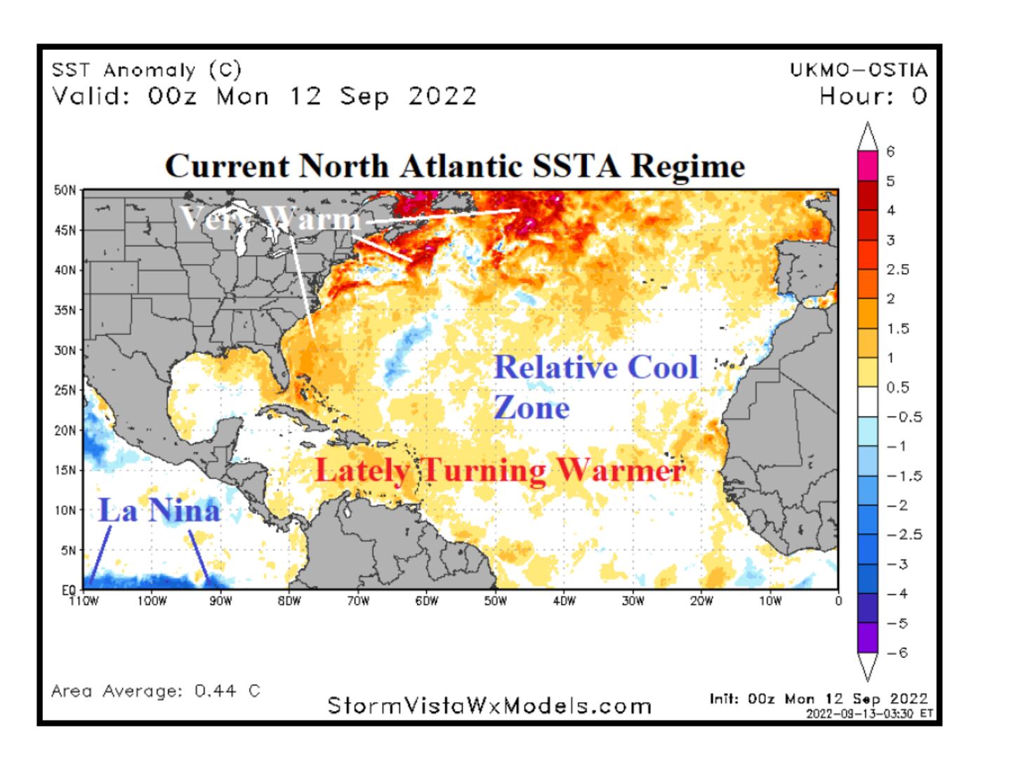
Main Development Region (MDR) sea surface temps have been above-normal but not by that much, have started warming:
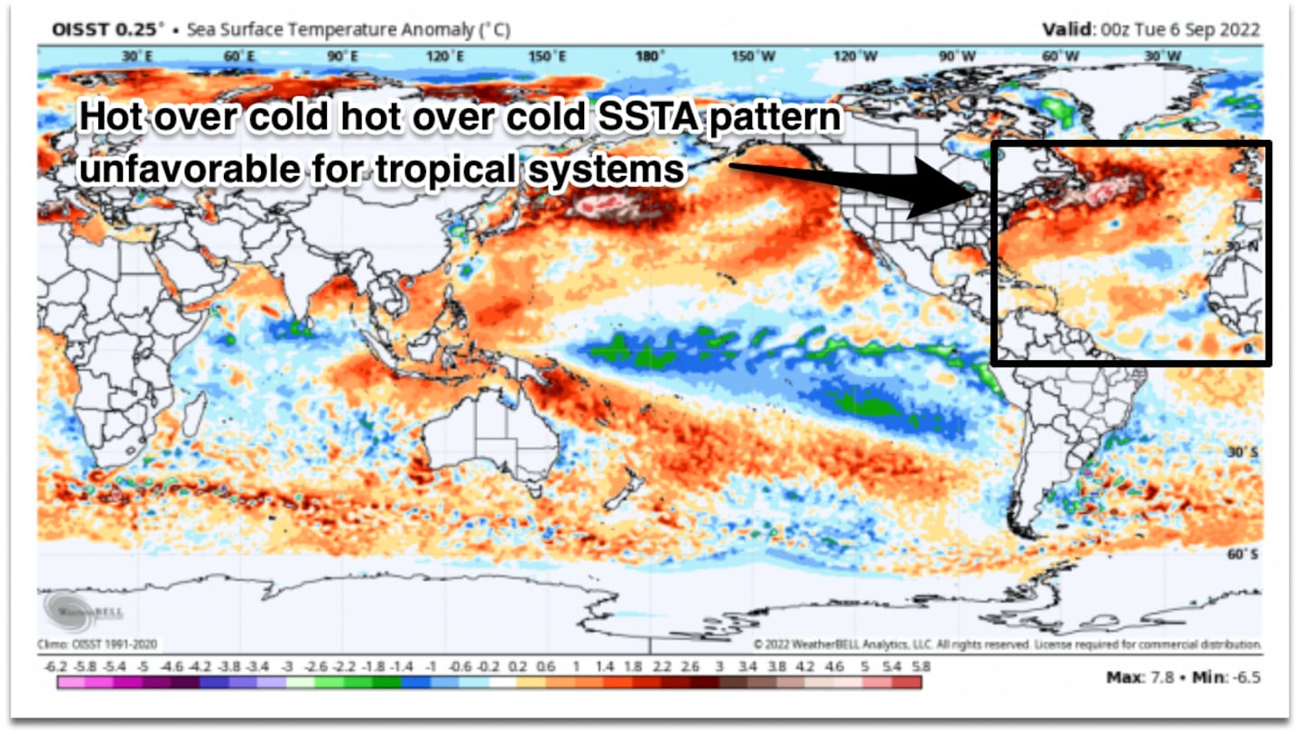
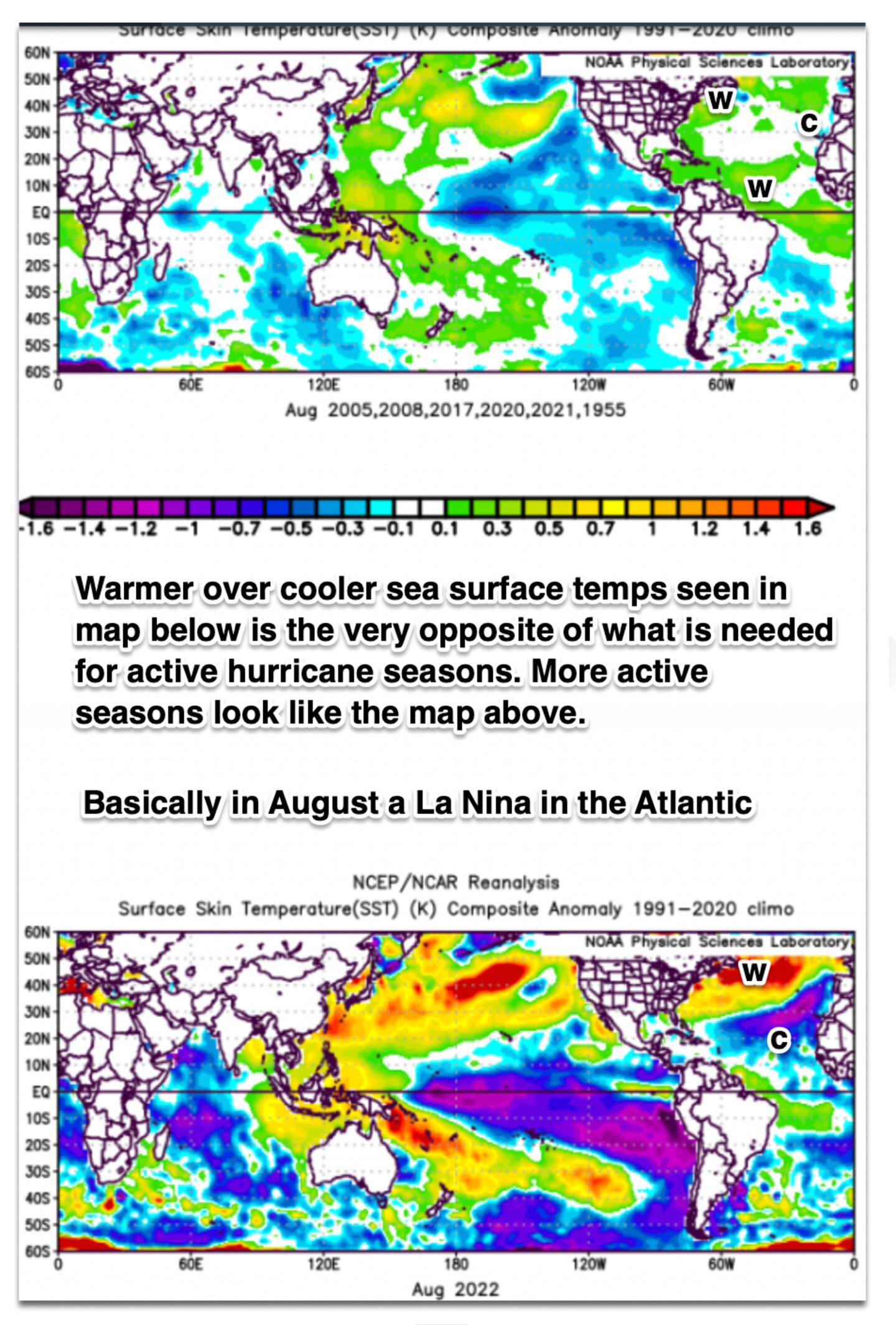
What we have is an Atlantic La Nina and unprecedented at that, the record “Marine Heat Waves” and cold pools are a not seen before severe distortion of ocean temperature patterns, that is a horrible SST pattern in the Atlantic with warm over cold. In fact in both basins its a record breaking difference between the warm and cold pools in an inverted manner. No doubt one of the many factors that have thrown off preseason hurricane outlooks and could well do the same for future winter outlooks this year.
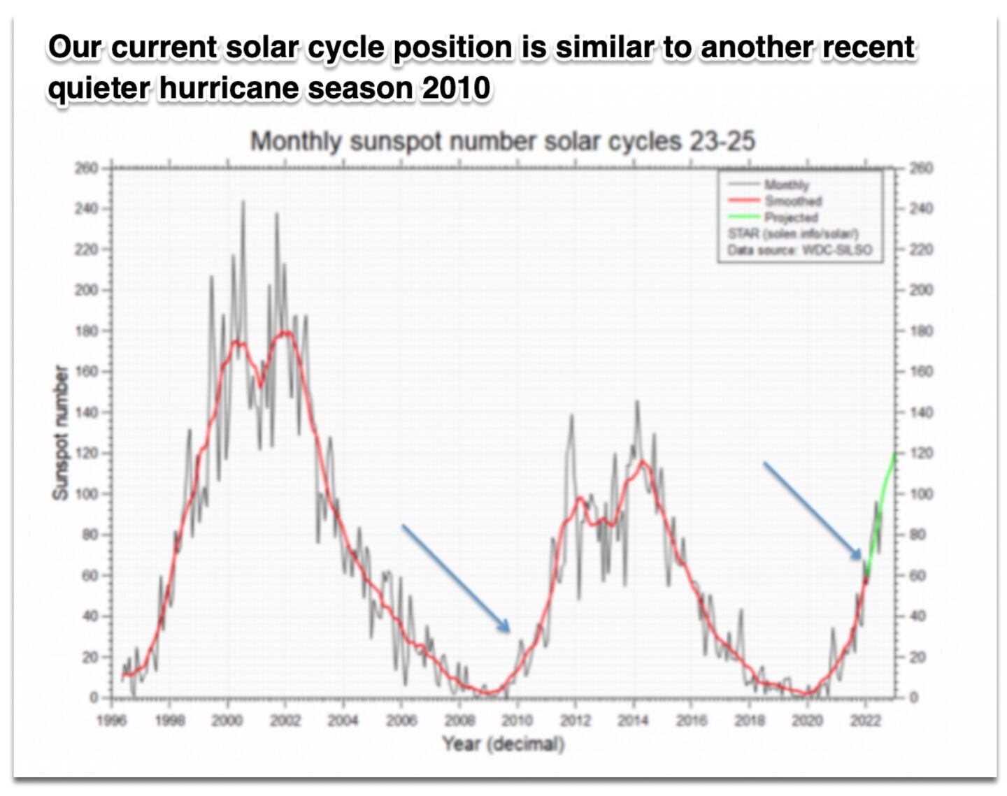
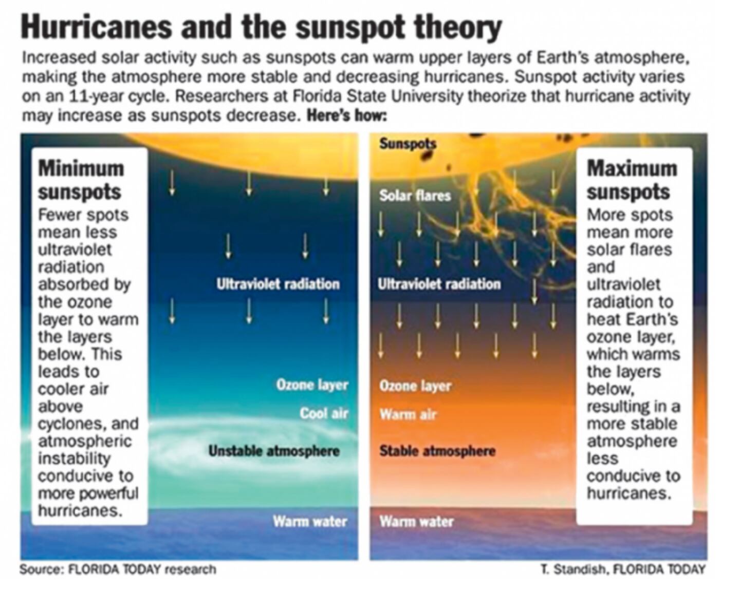
THE SUN IS UP THERE:
Scientists told us decades ago how the cycles of the sun impact weather and climate.
AND THE EARTH IS DOWN HERE:
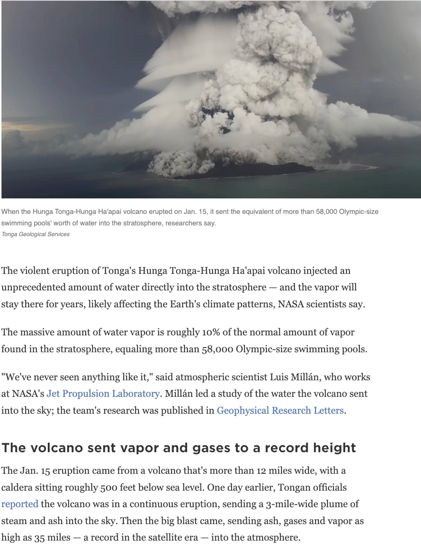
Scientists have long known that volcanic eruptions impact weather and climate, but each one is different depending on where they are located, what they spew, how high they spew it and how much. More research is needed and is ongoing.
One 2019 study was not able to find a clear signal in the data for impacts on hurricane seasons due to data pollution (noise) from El Nino, but a more recent study did find a relationship sorting El Nino out.
Some have speculated that the January 15th 2022 eruption of the Hunga Tonga Volcano may also be a factor this season in altering the stratosphere-troposphere in ways that are impacting the hurricane season by changing (in negative ways for formation and development) the moisture-temperature composite and thus instability and wind shear/pressure patterns including the ITCZ (Intertropical Convergence Zone) which is tied up with tropical cyclones.
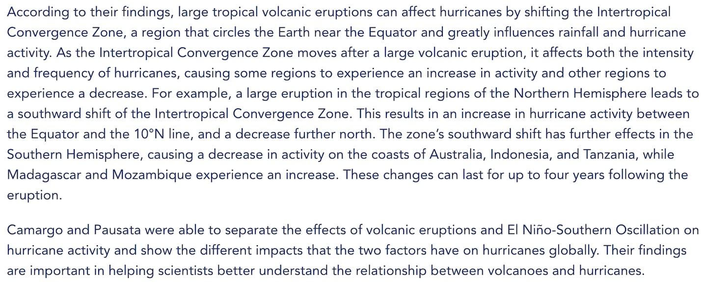
A team of researchers led by Lamont-Doherty Earth Observatory Columbia University researcher Suzana Camargo and Université du Québec à Montréal’s Francesco Pausata found that large eruptions in either the northern or southern hemispheres served to push the Intertropical Convergence Zone (ITCZ) away from its usual position -- further into the southern hemisphere in the case of a northern hemisphere eruption, and the opposite for an eruption south of the Equator.
The ITCZ is the band near the Equator where the trade winds converge, known as the ‘doldrums’ -- so named by sailors because the surface winds are calm at this convergence point. This region plays a key role in the formation of tropical cyclones when the boundary drifts north or south out of the doldrums and into regions more favourable for cyclone development, be they Atlantic hurricanes or Pacific typhoons.
More succinctly, the study found a major eruption in the northern hemisphere pushes the ITCZ south, and the hurricanes go with it. The reverse is also true.
As I covered in prior blogs in July and August history shows us that a slow start to a hurricane season does not automatically correlate to a slow finish, sometimes mother nature flips the switch the other way.
For frequent comments on the weather follow me on Twitter @MellishMeterWSB.
©2022 Cox Media Group


