
If next weekend will have any light rain, a few flakes of snow somewhere, or stay dry is uncertain right now. What is certain is that it will NOT be warm!
You will see in the maps below a big change in the upper-level air flow from the start of the week (from the Southwest) to the weekend (out of the North/Northwest) as a big jet stream trough develops over the Eastern U.S.

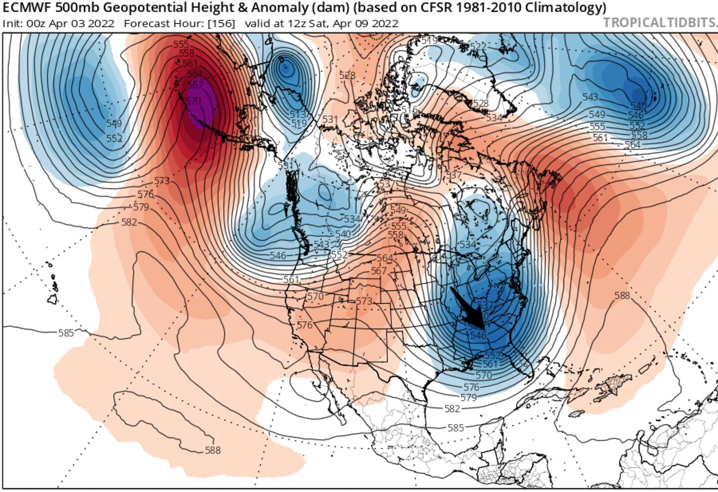
That’s quite a change!
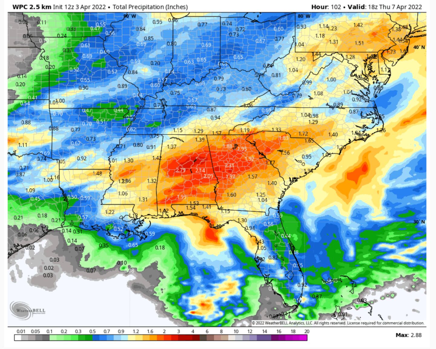
Some heavy rain and perhaps some hit and miss strong or severe thunderstorms in the transition Tuesday and again Wednesday evening. Details TBD by those not retired.
PRELIMINARY EARLY ESTIMATE ON RAIN TOTALS FOR THE WEEK AHEAD:
Previous blogs and tweets have already talked about that, so moving on...
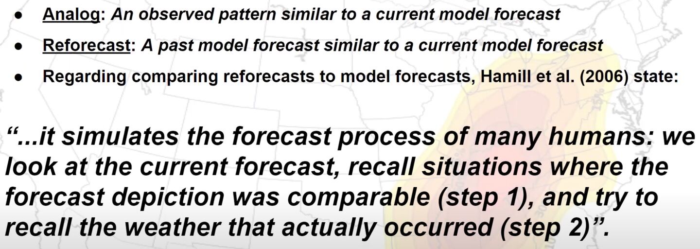
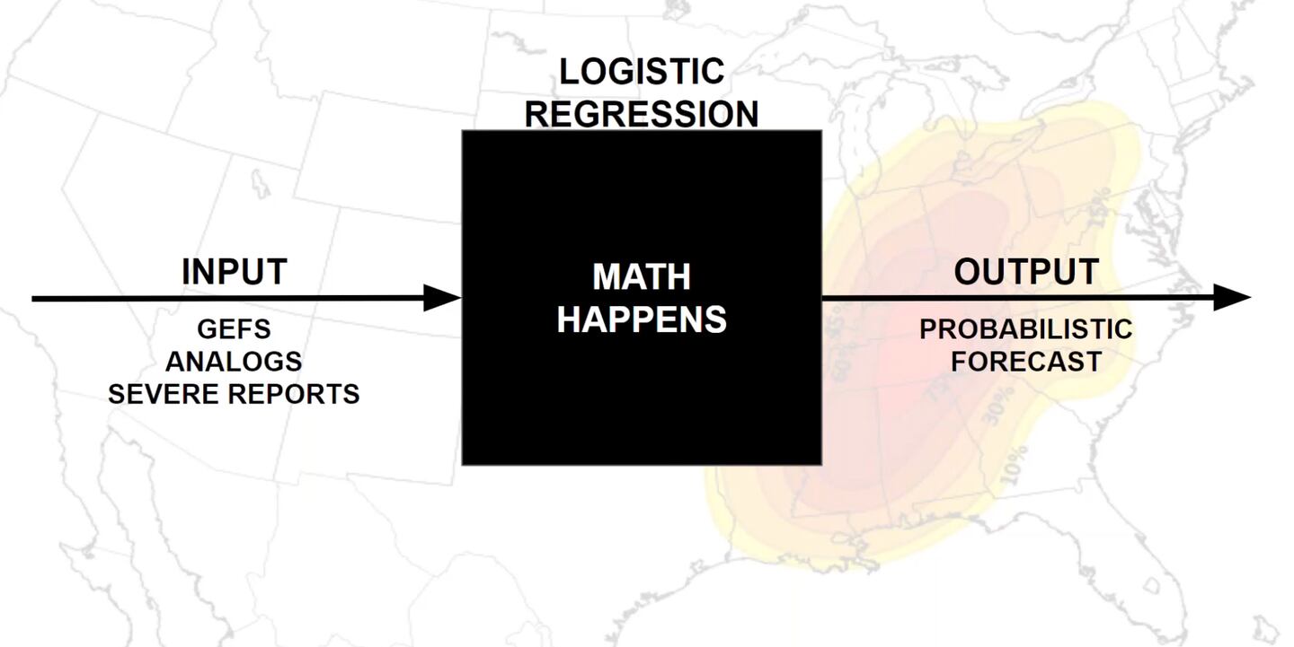
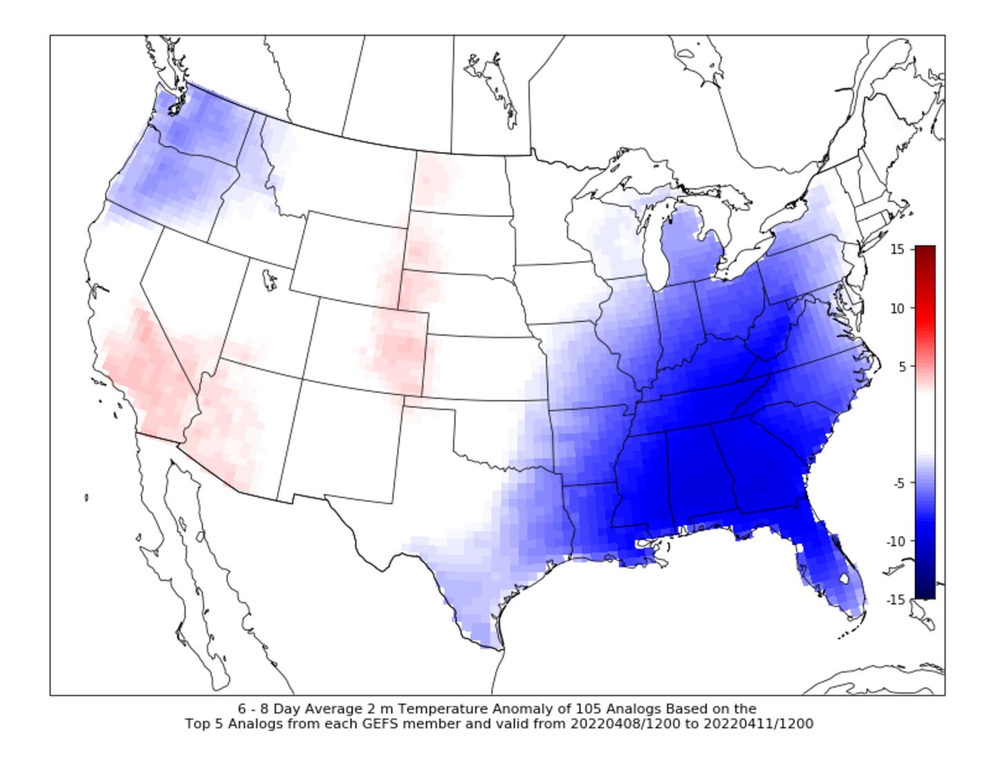
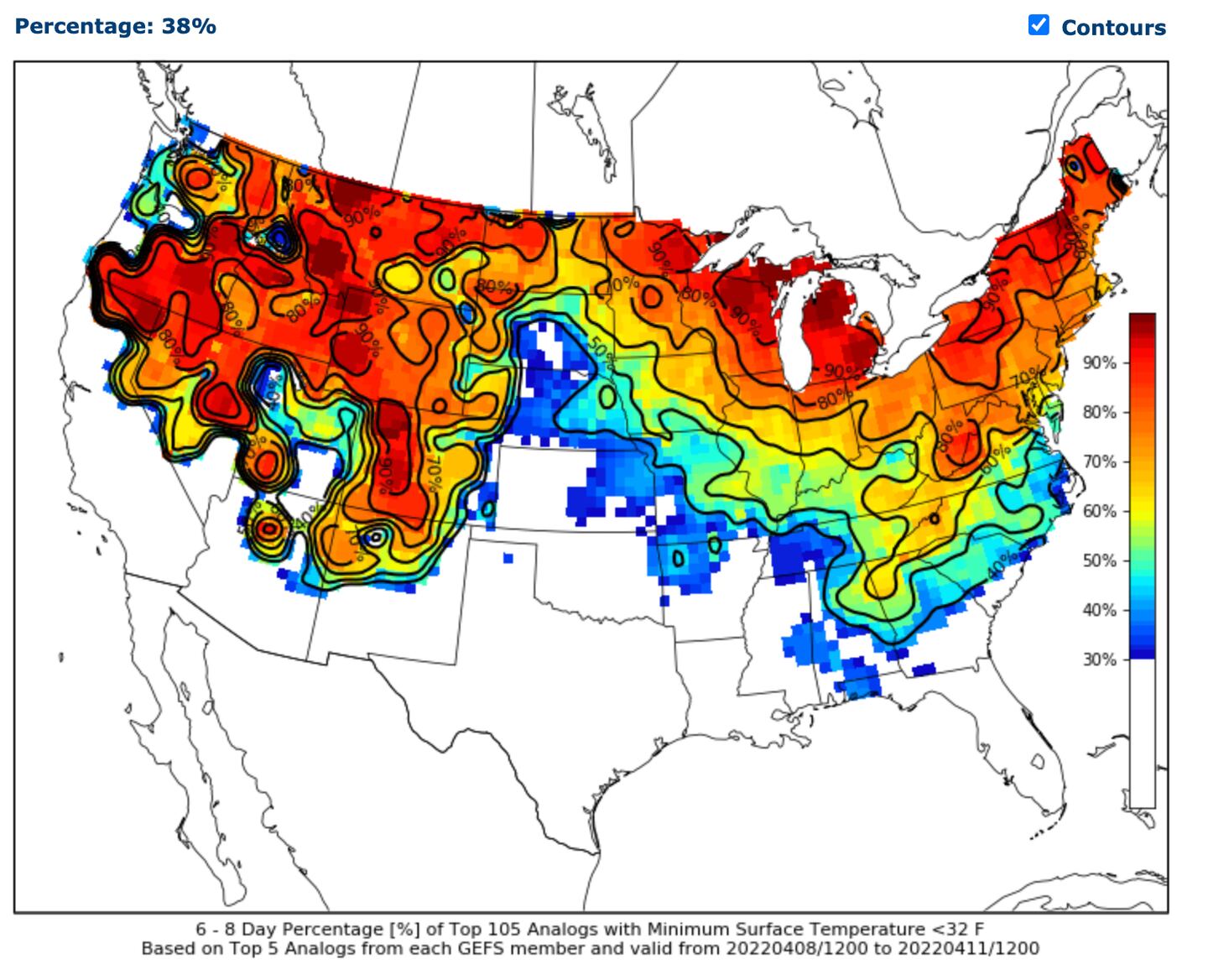
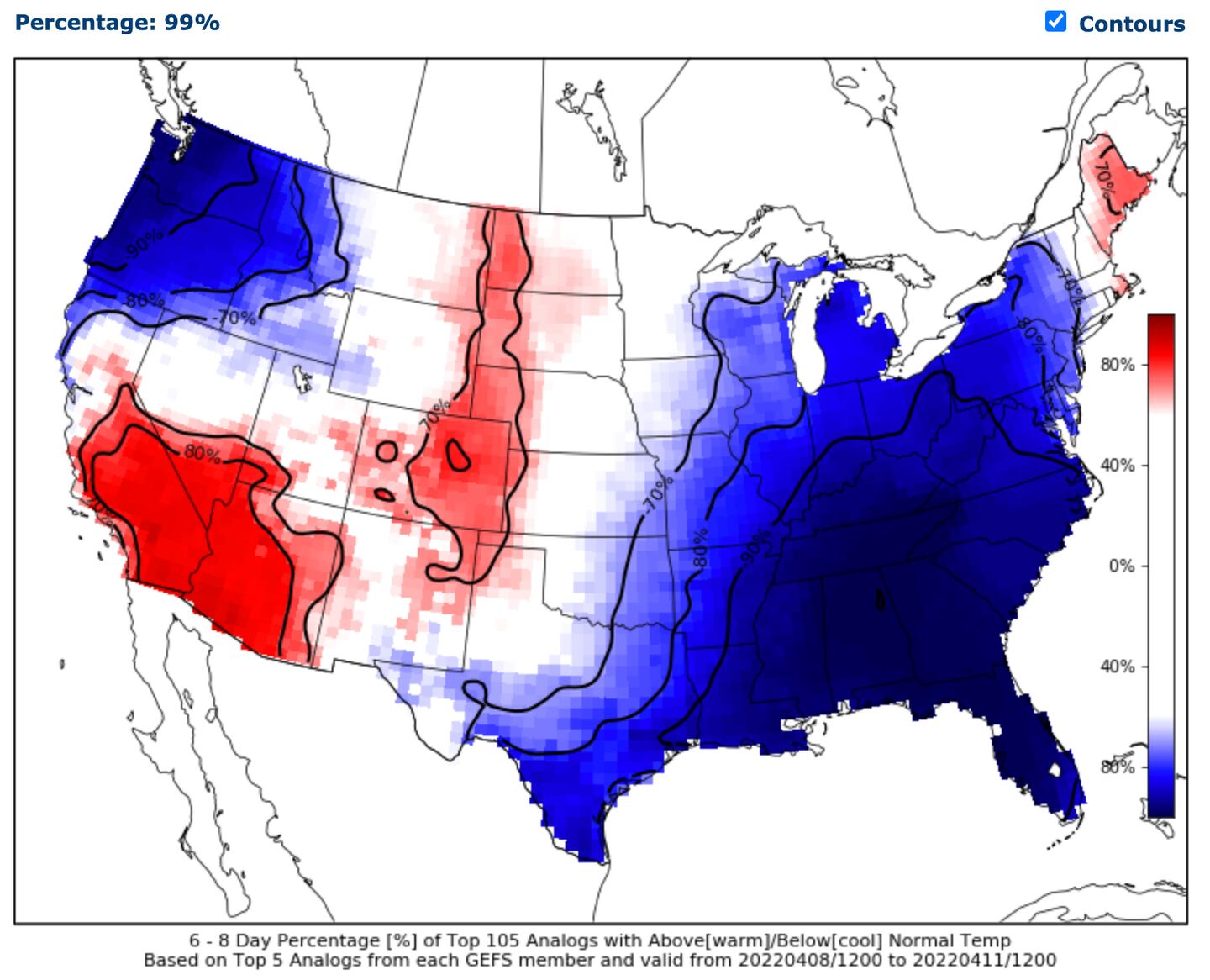
Let’s look at the CIPS ANALOG-BASED probability guidance for the coming weather pattern change for next weekend. This tool compares current forecasts to historical weather events with similar environmental conditions which helps provide forecasters with some historical perspective for pending weather events.
The automated system uses the top 15 closest matches to the past. So if it showed about 5 of those 15 analog years had X occur that would be about a 30% chance analog-wise using logistic regression based probabilities from machine-learning.
BUT IT DOESN’T LAST LONG AS A BIG TURN AROUND IS PROJECTED AFTER:


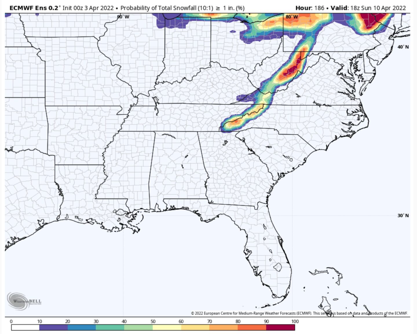
Even some April mountain snow possible next weekend. Earlier GFS model even hinted at some flakes of snow possible in parts of the Metro area but that is gone today. Perhaps it will come back in future model runs. Either way there should be some clouds and chilly breezes.
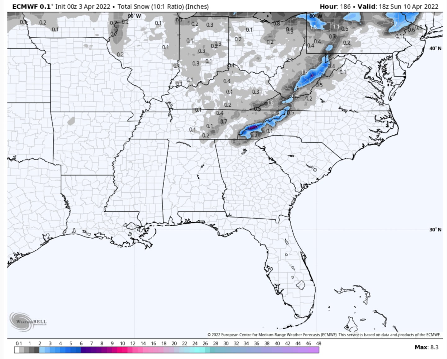
A risk of a frost or freeze will exist with this spring cold snap as current model consensus shows weekend low temps of 37ºF or colder for much of the area. This will be fine-tuned of course as we get closer to next weekend.
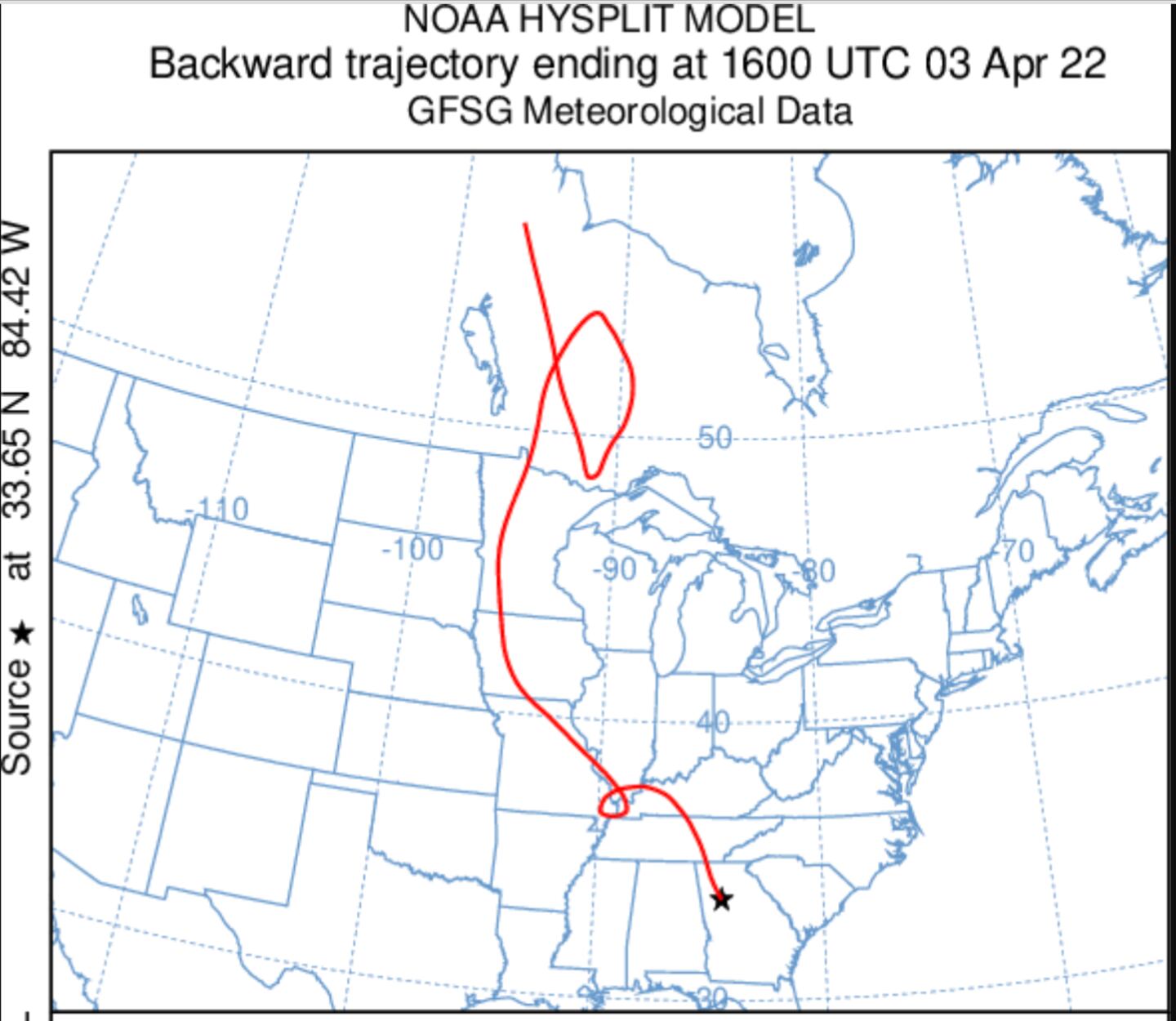
You can see the SOURCE REGION of the air mass for next weekend from the GFS trajectory forecast:
For more follow me on Twitter @MellishMeterWSB.
©2022 Cox Media Group


