
In attempting a long-range outlook I use the analog method. I do not just go by computer models or just show the NOAA/CPC outlooks.
Over the past several months I’ve already shown you what various computer models are showing for the summer of 2022, and way back on April 28th I showed you what La Nina sometimes means for summer.
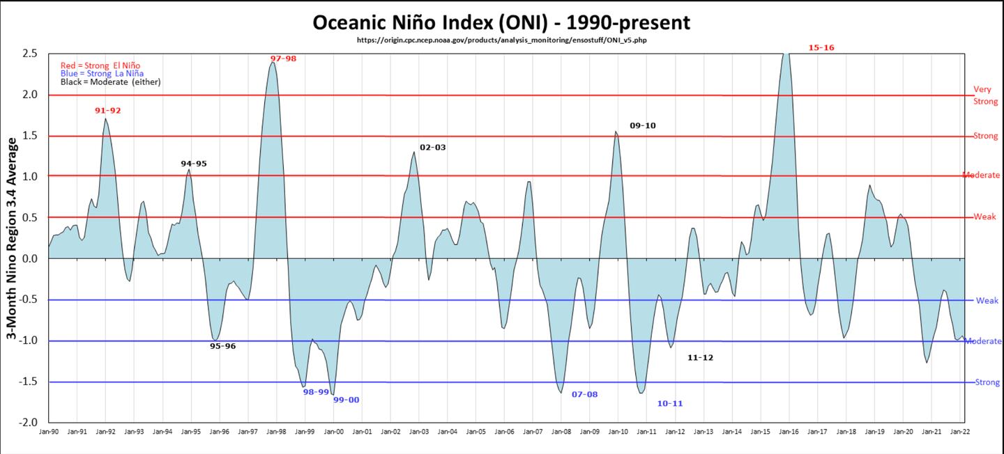
The El Nino Southern Oscillation (ENSO) comprises the cycle in the equatorial Pacific Ocean of sea-surface temperatures going from warmer than normal (El Nino) to cooler than normal (La Nina) or neutral.
It is a MAJOR CLIMATE DRIVER in all four seasons but especially winter and summer. However, as long time followers know it is NOT the ONLY driver of monthly or seasonal weather. It tilts the odds, but not all La Nina will deliver the same!
LA NINA STATUS AND FORECAST:
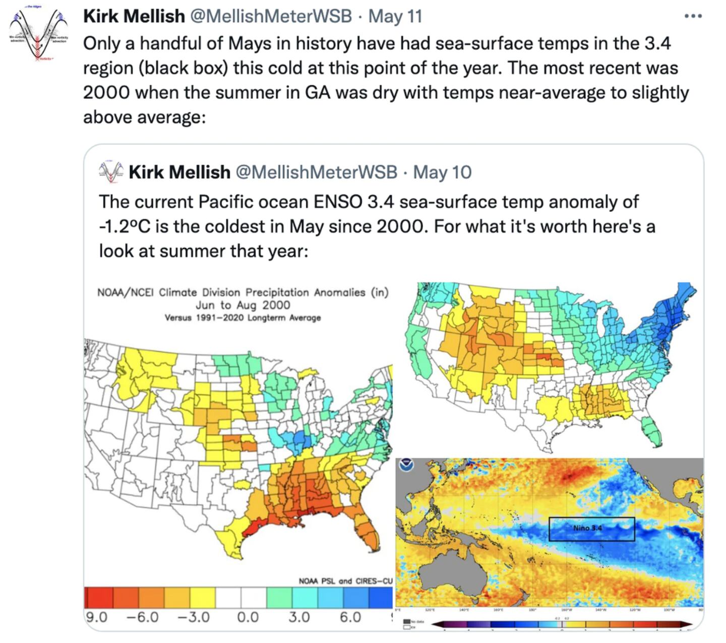
My May 11 Tweet:
Numerical/dynamic and statistical equations were considered to some extent in making this outlook, but most of the weight is placed on the non-model analog methodology.
MOST MODELS show the negative ENSO (-ENSO) or LA NINA continuing BUT WEAKENING TO NEAR-NEUTRAL by the autumn months. If it does continue it would be a 3rd summer in a row with a La Nina in the Pacific.
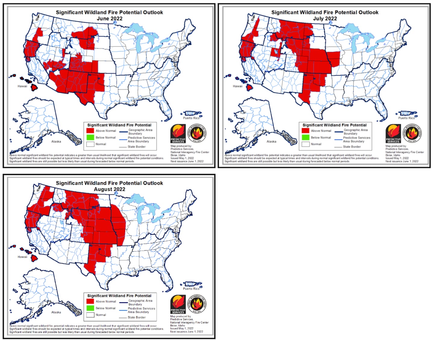
Historically a 3rd consecutive La Nina summer points to a hostile summer drought scenario focused mostly on the Great Plains. Due to the presence of established drought across most of the West U.S., the summer 2022 drought pattern is likely to be most-focused on the West-Central U.S. but with influence almost certainly extending to the U.S. West Coast AND toward the Mississippi River.
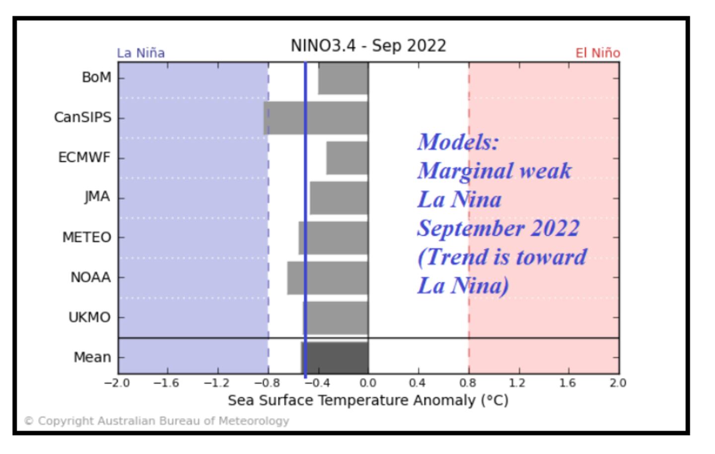
ENSO FORECASTS (La Nina in blue, neutral white, El Nino in red):
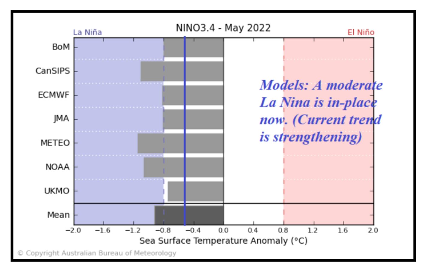
Solid La Nina this month, becomes neutral to weak La Nina in September according to most models:
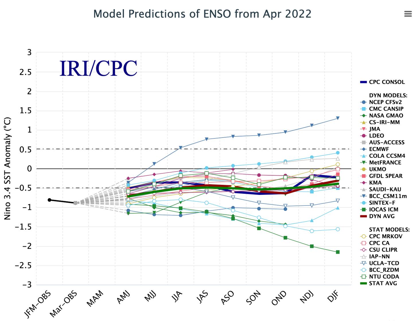
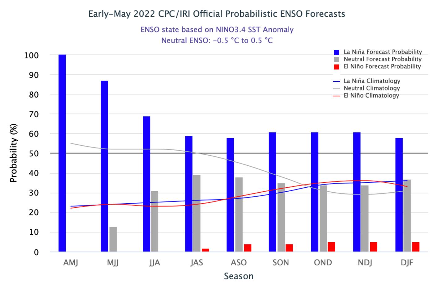
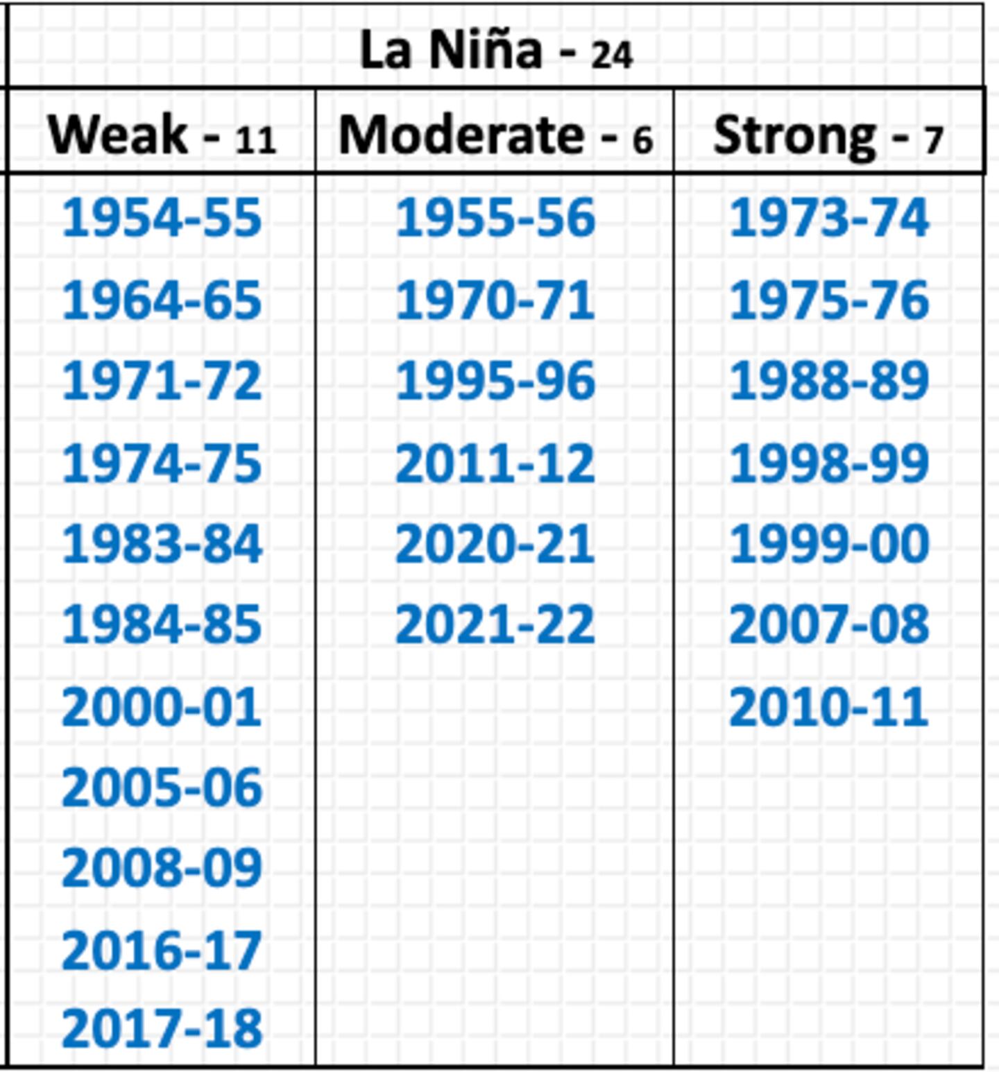
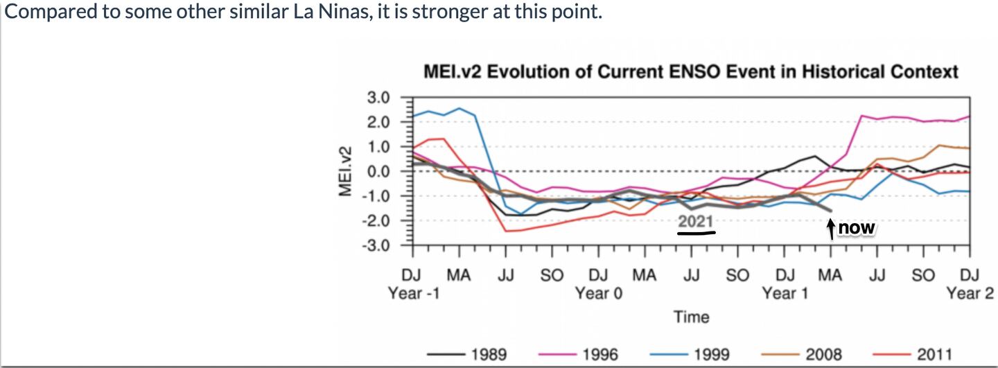
You may have seen me Tweet about the unusual weekly May sea-surface anomaly (SSTA) in the ENSO 3.4 region. It came in with a value that was among the coolest in monitoring history ranked with only a handful of others (1985, 1988 and 1989), the most recent being the year 2000 which was a 3-year La Nina. This combined with modeling, suggests we may be in for a rare triple-dip or 3rd year La Nina. The others are 1956, 1975, 1985, 2000, 2012. But it is BY NO MEANS CERTAIN that La Nina will continue. If it fades or reverses it will throw off this outlook, or likewise if it stays stronger than expected.
Thus the base state of La Nina will be one of many factors weighed to find a list of analogs (or analogues)--- past years which may give us clues to the future for the summer.
“What’s past is prologue” is a quotation by William Shakespeare from his play The Tempest. In contemporary use, the phrase stands for the idea that history sets the context for the present.
OTHER FACTORS USED TO IDENTIFY ANALOG YEARS IN MAKING THIS SUMMER OUTLOOK:
* Persistence and climate trends both synoptic weather patterns and soil moisture
* Drought patterns over the past couple decades
* Storm track tendencies: Constructed analog from winter-spring-summer favorable storm track precursors
* Tropical forcing signals such as the -IOD (negative Indian Ocean Dipole) and MJO
* Warm and cold pools in the Pacific Ocean, currently negative Pacific decadal oscillation/Pacific Meridional mode (-PDO/-PMM)
* Summer trends over the past 5-10 years
* April -SOI (Southern Oscillation Index)
* MEI evolution (multivariate enso index)
* Atlantic Multi-Decadal Oscillation (+AMO) global sea-surface temp patterns (SST)
* ENSO and PDO evolution including 3rd year -ENSO
From these comparison sets a list of best analog years is compiled as input for the summer of 2022 outlook.
As you might imagine there are CONFLICTING SIGNALS from these various analog years thanks to the inherent chaos of the atmosphere. Therefore, a preponderance of evidence is used to reach a conclusion where signals contradict each other.
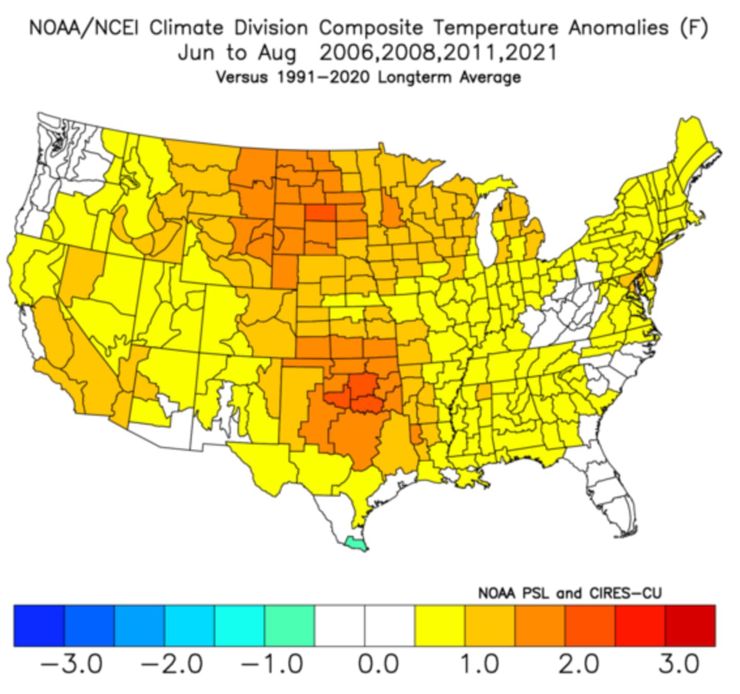
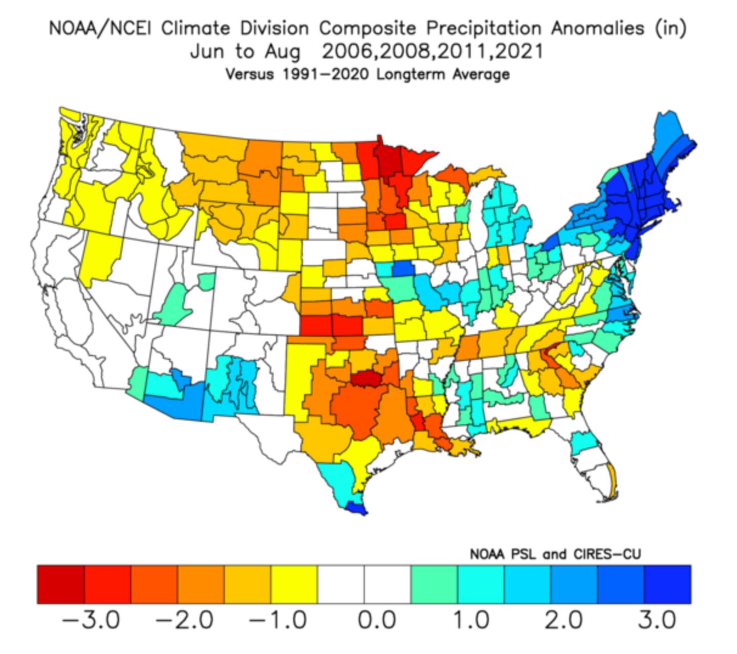
Triple dip La Nina Summer 500mb composite:
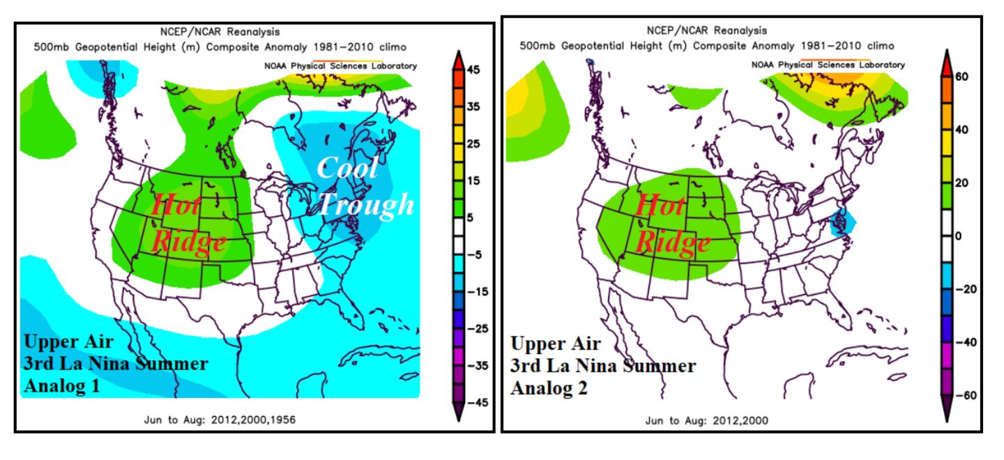
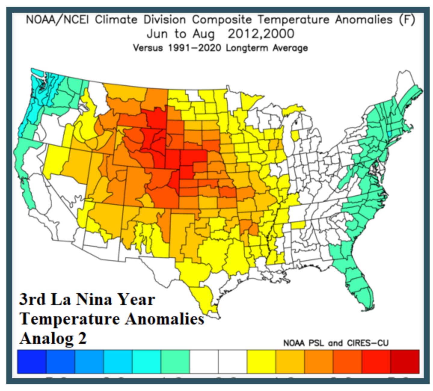
STRONGEST HOT AND COLD SIGNALS FROM TRIPLE DIP LA NINA:
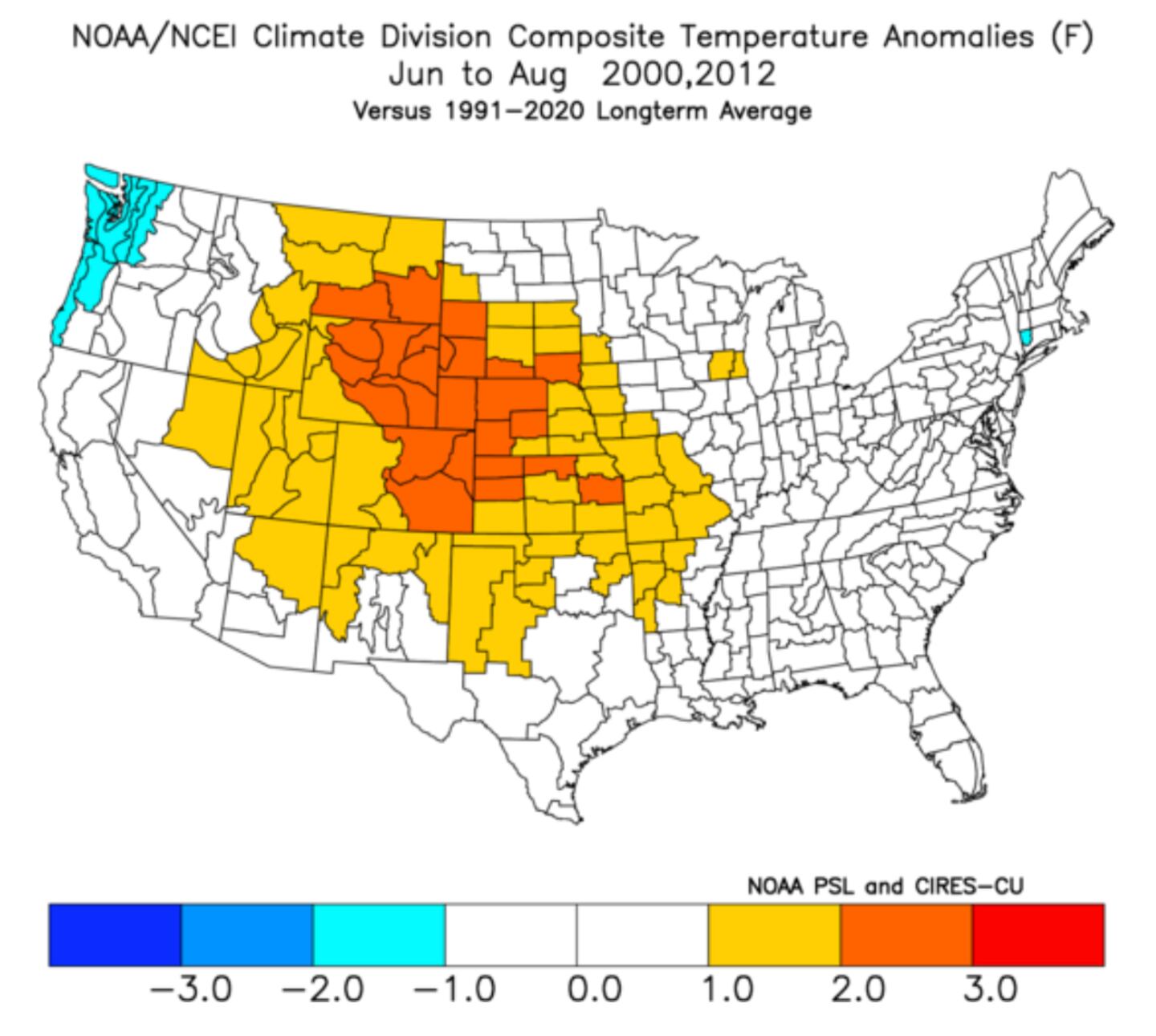
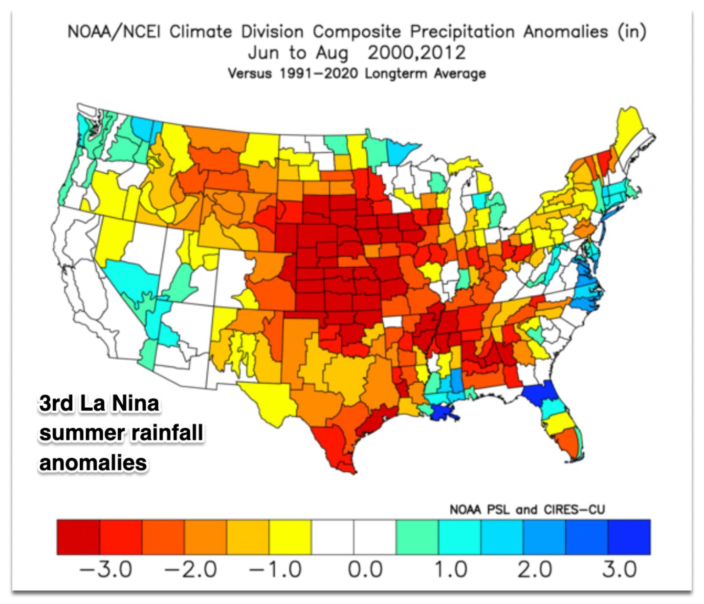
TOTAL ANALOGS:
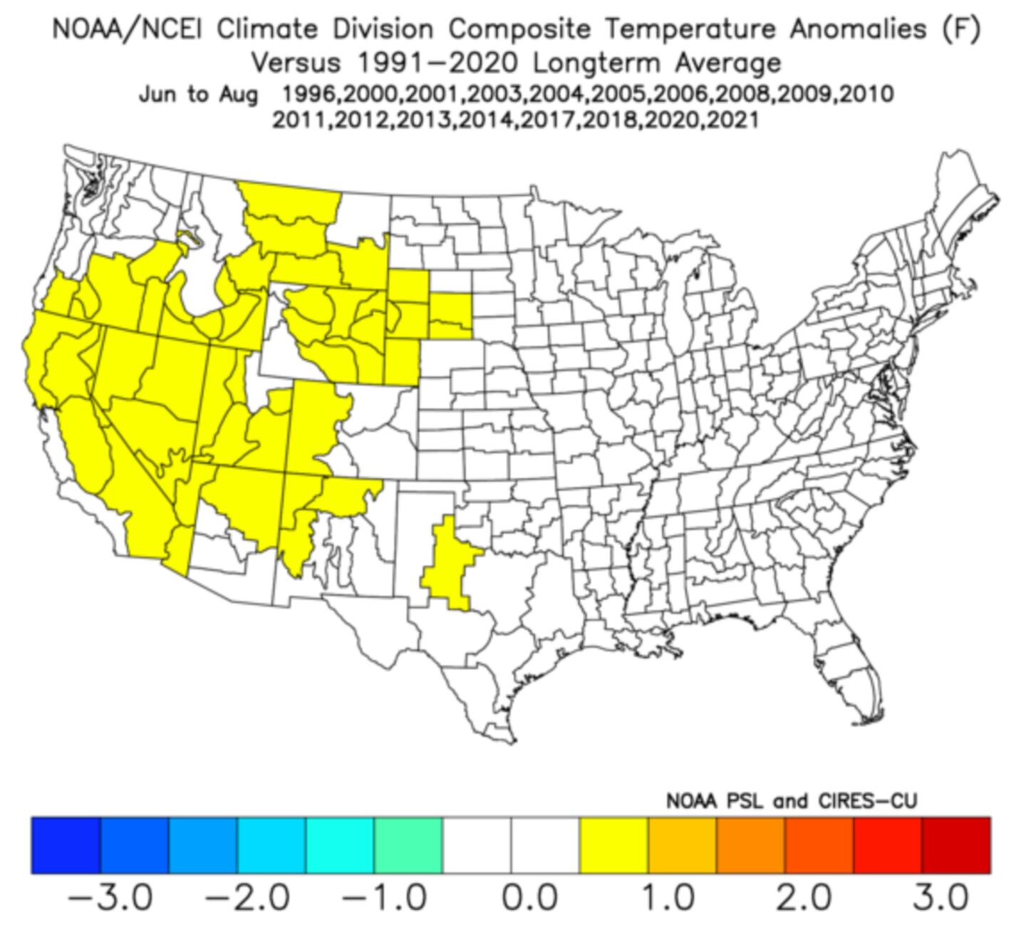
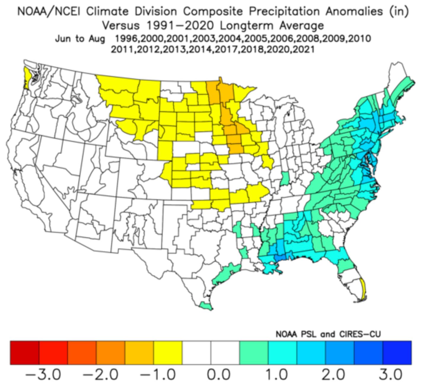
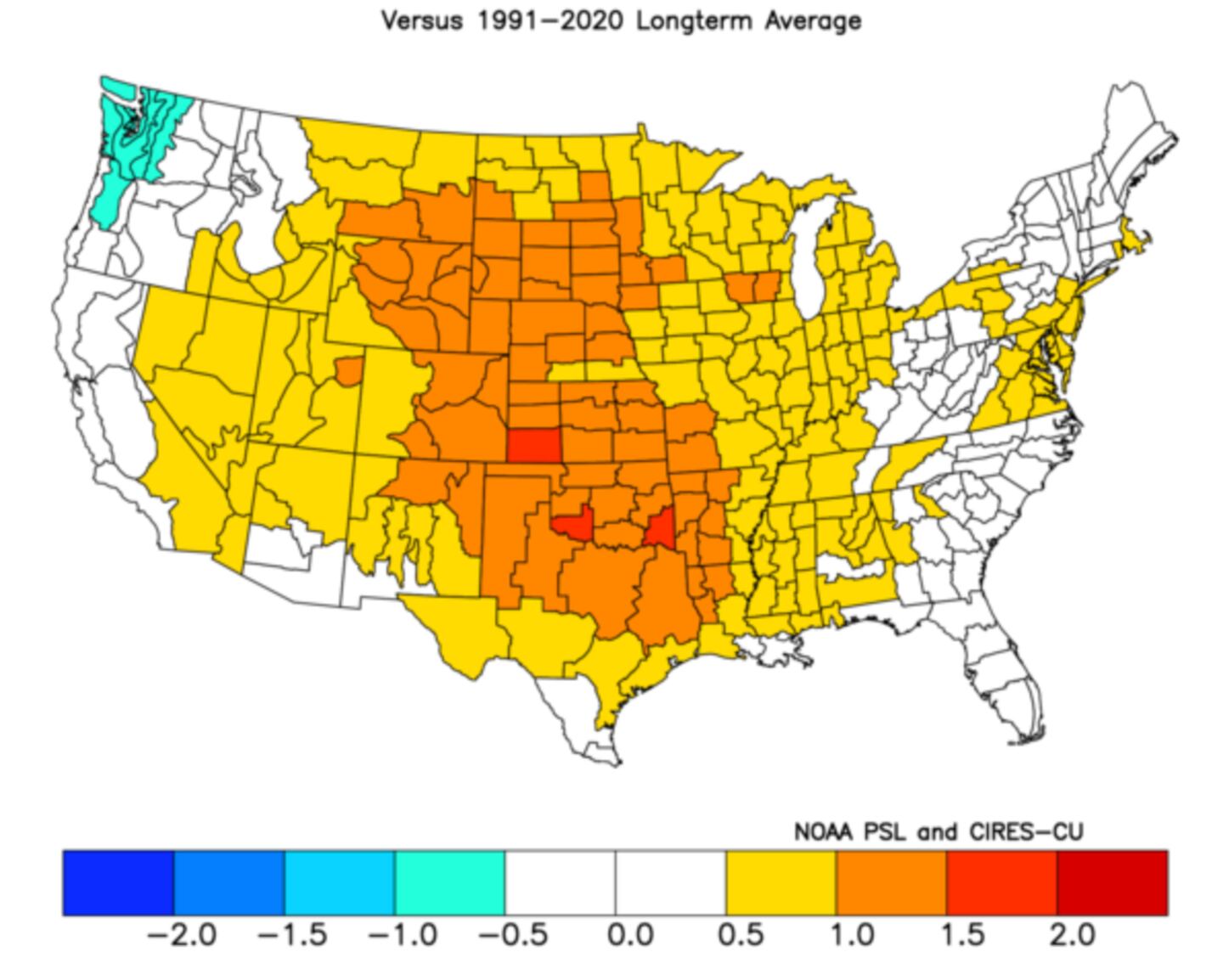
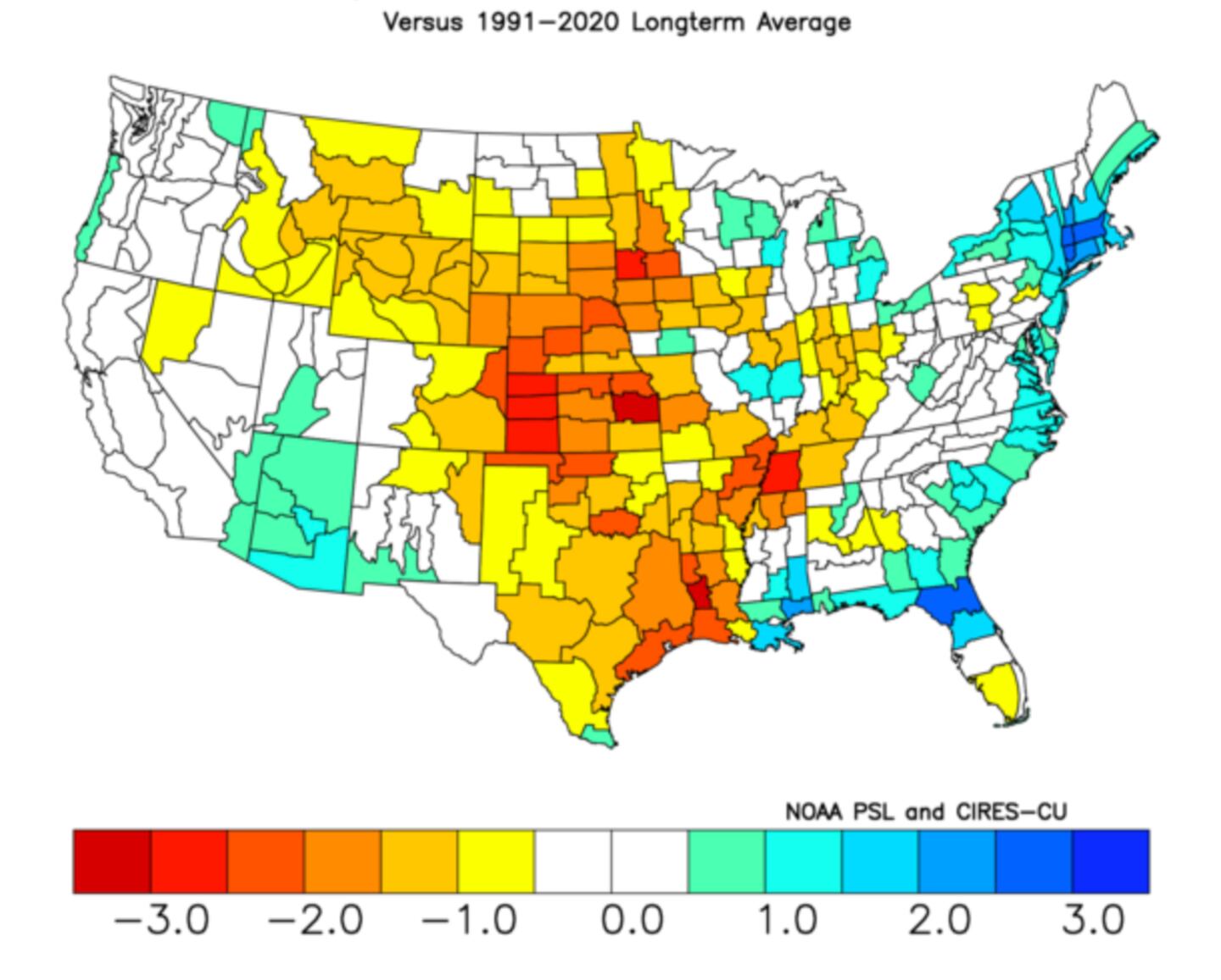
THE SUMMER OUTLOOK, STRONGEST MATCH ANALOG YEARS TO THIS SUMMER:
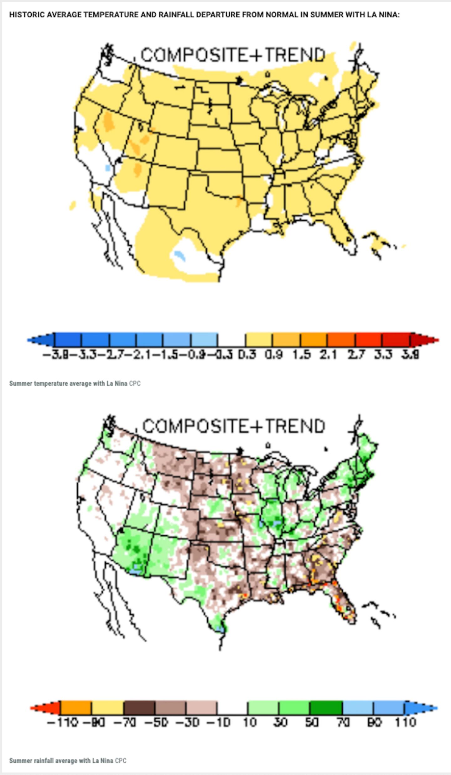
BEST FIT ANALOG COMPOSITE FOR SUMMER 2022 TEMPERATURE AND RAINFALL AVERAGE DEPARTURE FROM NORMAL:
CONCLUSION:
Clearly most indications point to THE WORST COMBINATION OF PERSISTENT HEAT AND DROUGHT WEST OF THE MISSISSIPPI RIVER this summer.
So as of this blog date anyway, the coming summer for the Atlanta area looks to average a little warmer than normal with rainfall near-average to a little below average. This indicates not having an extremely long brutal summer, and indicates rainfall that is not very wet nor very dry with temps averaging a little above-normal if the analogs are correct.
Remember, this is a 3-month average NOT what every day or every week will be like.
We do get heat waves and temp extremes in most summers, even ones that average cooler than normal.
I will do an update later in June if needed, after the inputs from the month of May become available.
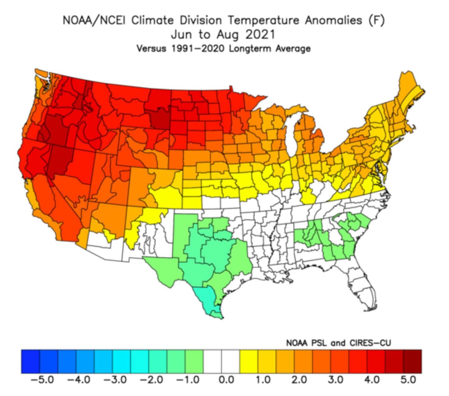
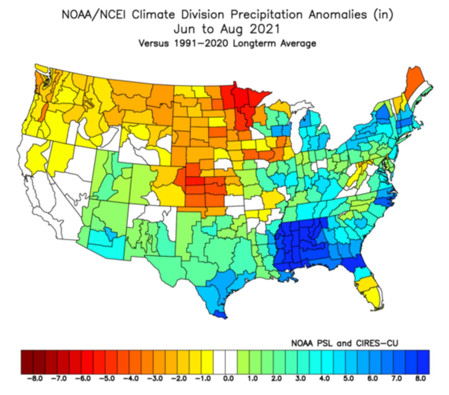
IN CASE YOU FORGOT... last summer was cooler than normal and wet:
For more follow me on Twitter @MellishMeterWSB.
©2022 Cox Media Group


