
Severe weather is moving through Georgia, potentially bringing damaging winds to parts of metro Atlanta.
Warm, humid air will stream into the Southeast, providing fuel for a line of thunderstorms that will march through Alabama into Georgia Thursday afternoon.

Track the storms with our interactive radar below.
Timing Out the Storms
The line of heavy rain and thunderstorms will enter Northwest Georgia around 12pm, and it will march southeast into Metro Atlanta around 2pm. The line will continue to move through the Perimeter area around 4pm before exiting the east-southeast portion of the Metro around 6pm. Heavy rain and storms will come to an end no later than 7pm.
The animation below illustrates the Futurecast Radar for Thursday afternoon into early Thursday evening.

Impacts From the Storms
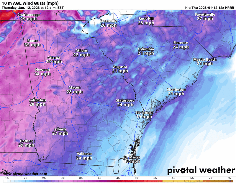
Ahead of the storms, environmental winds will be quite strong with wind gusts as high as 35 to 40 mph possible Thursday afternoon. A Wind Advisory is in effect for North Georgia, including Metro Atlanta, through 11pm.
The animation below illustrates the Futurecast wind gusts for Thursday afternoon and evening.
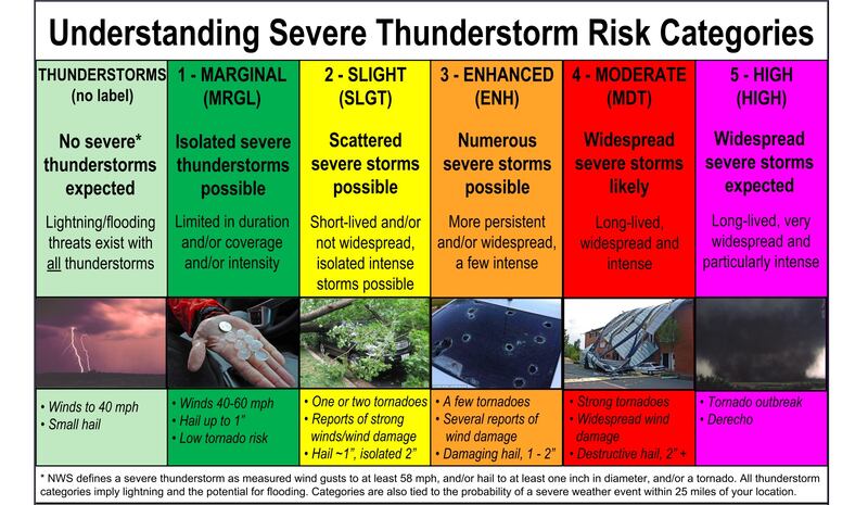
Within the storms, strong bowing segments may produce damaging wind gusts as high as 58 mph or greater, at which the thunderstorm would be considered “severe”. The radar imagery below illustrates some of the damaging wind gusts the Atlanta area experienced during a severe weather event last week -- a similar set up is expected for Thursday.
Public Information Statement from @NWSAtlanta regarding the EF0 tornado that moved through Newnan, Georgia with 80mph winds yesterday. Radar screenshots below. #ATLwx #GAwx #Atlanta https://t.co/7qmsMrEhaM pic.twitter.com/rRzgtlQldP
— Christina Edwards (@ChristinaWSBwx) January 4, 2023
Wind gusts that are 58 mph or greater are strong enough to knock down trees and powerlines, causing power outages and potentially structural damage.

Keep your cellphone and tablets charged in the event of a power outage, that way you can continue to stream updates on 95.5 WSB.
Flood Concerns?
Fresh off the heels of last week’s flash flood heavy rain event, this system will also bring another 0.5 inch to 1 inch of rainfall to the Atlanta area on Thursday.

The storm system is expected to quickly move in and out of the region Thursday, so while localized torrential downpours are possible, widespread flash flooding is not expected.
Share Your Storm Reports With Me!
Facebook: Christina Edwards WSB
Twitter: @ChristinaWSBwx
©2022 Cox Media Group


