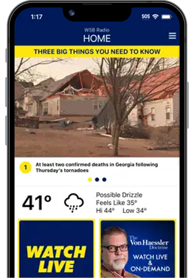
I’ve been talking about this active storm pattern since last month and did a blog on the severe weather April 1st so the recent weather is no surprise to followers.
YESTERDAY:
I am not in the daily forecasting game anymore but of course, it’s in my blood, my very DNA. So I still keep an eye on it for personal use, and as you know sometimes share some quick thoughts on Twitter or here in this blog. Spring is the prime severe weather season and much of the South has been above-normal in activity for a while now.
There are hundreds and hundreds of data points and parameters that meteorologists use to analyze and predict thunderstorm development and intensity.
I don’t have a lot of time today so here’s just a quick look at a few of my favorite parameters I use to evaluate severe weather risk.
A google search will locate plenty of forecast sources for them and further explanations.
I also like the CWASP formula. I couldn’t find a descriptor but In a nutshell, the CWASP parameter is able to diagnose tornado favorability from a number of indices, combined into one. Keep in mind this and most other parameters do not predict if a severe thunderstorm or tornado WILL form, but rather the potential of what storms can do IF they form.
Here is a look at the GFS and NAM models CWASP forecast for today April 6 as of this morning (it will change and be updated as input to public forecasts):
So clearly both models suggest that IF, IF a supercell thunderstorm forms the potential for a tornado is very real in the region.
I also like to look at forecast HODOGRAPHS from the weather balloon soundings and forecast hodographs. Simply put when the line is long and strait line damaging winds are a threat, when the line curves a tornado threat is greater.
OFFICIAL SEVERE WEATHER OUTLOOK FROM THE STORM PREDICTION CENTER IN NORMAN, OK:
SPC EXPLANATION OF THREAT:
...SUMMARY... Severe thunderstorms capable of producing swaths of damaging gusts, large hail, and several tornadoes are expected across the Southeast States and near the southern Appalachians this afternoon and evening. ...Southeast/Southern Appalachians ... A complex scenario is expected to evolve today across the Southeast states, with multiple instigators in place for convective initiation. Recent surface analysis places a remnant outflow boundary from about 15 miles north of AUO in east-central AL east-northeastward across central GA to AGS. Some deeper cumulus and a few lightning flashes have been noted along this boundary over the past hour amid persistent southwesterly flow and limited low-level moisture convergence. A second feature is the approaching cold front, which currently extends from western TN back southwestward into far southern AR. A well-defined gravity wave precedes this front, with the leading edge of this wave currently extended from middle TN southwestward through far northwest AL and central MS. Lastly, a compact shortwave trough just off the LA coast is readily apparent in recent water vapor imagery. All of these features will result in the potential for complex convective evolution within the moist and buoyant air mass over the Southeast today. Current expectation is for initial development across central AL along and ahead of the gravity wave this afternoon. Additional development appears possible within the warm sector across central GA as well, particularly later into the afternoon as the gravity wave approaches. Furthermore, in situ initiation is also possible along the outflow boundary. All this development appears likely to occur around the same time this afternoon, with more of a linear mode favored on the gravity wave and more cellular development ahead of it. Thereafter, the outflow could then act as a corridor for further storm intensification/organization as all of these thunderstorms move eastward/northeastward. All severe hazards are possible with this evolution. Relatively dry mid-levels will contribute to an outflow-dominant storm structure within most of the cellular development. Steep mid-level lapse rates will promote hail in any robust updrafts. Veering low-level flow with height, while not overly strong, is strong enough to support the potential for QLCS tornadoes. Farther north (from middle TN into the southern Appalachians), initiation appears more probable along the cold front itself, and not the preceding gravity wave. Clearing is already occurring across parts of middle TN and the expectation is for moderate buoyancy to develop ahead of the front, with initial scattered development across middle TN before becoming more widespread over eastern TN and adjacent parts of northeast AL/northwest GA and eastern KY. As with areas south, all severe hazards are possible. Given the strong mid-level flow, hail is expected to be a risk throughout the afternoon and evening. Damaging wind gusts are possible within any bowing segments and a tornado or two may also occur, particularly if a robust updraft can mature ahead of main line of storms.
TORNADO SIRENS ARE NOT INTENDED FOR PEOPLE INDOORS!
Connect with me on Twitter @MellishMeterWSB.
©2022 Cox Media Group

:quality(70)/cloudfront-us-east-1.images.arcpublishing.com/cmg/JLYKHIUBQFBCNEM2HUZTSQW7OI.jpeg)
:quality(70)/cloudfront-us-east-1.images.arcpublishing.com/cmg/GVISZCLXZ5A2JA3IXPFJKPWY2A.png)
:quality(70)/cloudfront-us-east-1.images.arcpublishing.com/cmg/ZXUPGPAOI5GNHPJGKX7JNQT35A.png)
:quality(70)/cloudfront-us-east-1.images.arcpublishing.com/cmg/KYNFVWPXX5BR7JC7XTHD35CIAU.png)
:quality(70)/cloudfront-us-east-1.images.arcpublishing.com/cmg/4NMZEAN26FF5BFF7GNIWRV3TDU.png)
:quality(70)/cloudfront-us-east-1.images.arcpublishing.com/cmg/C3LPZXZ6CRGWVNRUZXK3QPRY54.png)
:quality(70)/cloudfront-us-east-1.images.arcpublishing.com/cmg/KQJCJYN6AZH7RFJL2YDBY657XE.png)
:quality(70)/cloudfront-us-east-1.images.arcpublishing.com/cmg/YOEZYAZC2JHCNERDD6R2APZCXM.jpeg)
:quality(70)/cloudfront-us-east-1.images.arcpublishing.com/cmg/4EKL5N5JRJFFFOEDLBUL7KAA2I.png)
:quality(70)/cloudfront-us-east-1.images.arcpublishing.com/cmg/LUQDJPY53FBCFOBDUAGBM7XAMI.png)
:quality(70)/cloudfront-us-east-1.images.arcpublishing.com/cmg/FWFYJJJUFBDPFFXEESDPMAEZDA.jpeg)
:quality(70)/s3.amazonaws.com/arc-authors/cmg/b44dfad3-bd6e-4c0d-a172-df9a3e6fa914.jpg)


:quality(70)/cloudfront-us-east-1.images.arcpublishing.com/cmg/66BTAV2N5VH5ZHHAT5DZQ34B2Y.jpg)
:quality(70)/cloudfront-us-east-1.images.arcpublishing.com/cmg/7CFNDFAAHRB3ROBZWR5ALXOB3U.jpg)
:quality(70)/cloudfront-us-east-1.images.arcpublishing.com/cmg/B37R2VTNWVD57NTYCB5ODGDOUQ.jpg)
