

Isaias made landfall as a strong Category 2 Hurricane Friday night around 9:30 pm Eastern Time near Destin, Florida.
Use the Interactive Radar Tracker below to stay ahead of the storm.
Rainfall Update
As Isaias moved inland, drier air arriving from the south allowed for rapid weakening of the storm.
The animation below illustrates the water vapor satellite imagery. An upper level jet stream is feeding dry air (yellow) into the remnants of Isaias (darker blue, white and green).

However, tropical rainbands continue to move north through Metro Atlanta, providing heavy downpours that will lead to flash flooding through the course of the day.
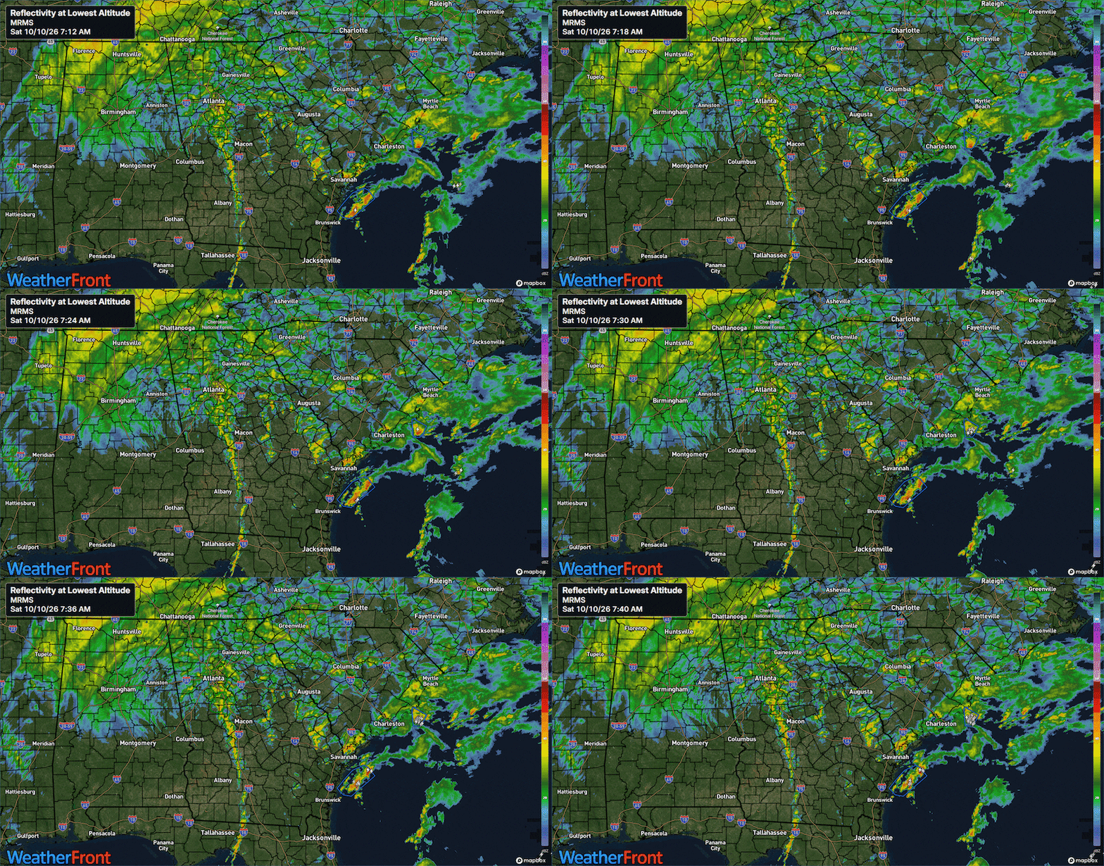
Already, 1 to 3 inches of rain has fallen from Sandy Springs to Peachtree City this morning, and rainbands will continue to travel through this area through the next few hours.
As a result, a Flash Flood Warning is in effect through 1:15pm for Clayton, DeKalb, Fulton, Gwinnett, Henry and Rockdale counties.
FFC issues Flash Flood Warning [flash flood: radar indicated] for Clayton, DeKalb, Fulton, Gwinnett, Henry, Rockdale [GA] till Oct 10, 1:15 PM EDT https://t.co/n10XO8mLpn pic.twitter.com/Igx4WVCx0a
— Christina Edwards (@ChristinaWSBwx) October 10, 2026
A separate Flash Flood Warning is in effect through 11:45am for southwestern Henry County, Pike County, and Spalding County.
FFC issues Flash Flood Warning [flash flood: radar indicated] for Henry, Lamar, Pike, Spalding [GA] till Oct 10, 11:45 AM EDT https://t.co/Z0nMeGKfqS pic.twitter.com/nagSEBcLei
— Christina Edwards (@ChristinaWSBwx) October 10, 2026
A Flood Watch remains for the entirety of Metro Atlanta through Sunday morning.
Wind Gusts Update
Gusty winds will continue to impact Metro Atlanta through midday, with winds subsiding through the afternoon from south to north.
The strong winds in Metro Atlanta and North Georgia are indirectly due to Isaias. A combination of an upper level jet stream as well as a pressure gradient between Isaias and a surface high in New England will generate stronger wind gusts through the afternoon.
Here are the highest wind gusts observed so far this morning:
- 40 mph in Gainesville
- 39 mph in Austell
- 38 mph at the Atlanta Airport
- 33 mph in Covington
Wind gusts as high as 35 to 45 mph are to be expected in Metro Atlanta through North Georgia through 12pm. Winds will diminish from south to north through the evening hours.
Wind gusts this strong and for this long of duration will be capable of knocking down trees and powerlines through the course of today.
Tropical Tornado Threat?
When a tropical system -- like a tropical storm or hurricane -- makes landfall along the Florida coast, the rainbands from the tropical system have the potential to produce quick-spin up tornadoes within them.
For that reason, the Storm Prediction Center has outlined an area of Slight Risk for severe thunderstorms throughout Middle Georgia, and a Marginal Risk for severe weather in Metro Atlanta.


Metro Atlanta is right on the edge of “air too cool” for tornadoes, and warmer air to the south in Middle Georgia.
If afternoon temperatures warm to the low 70s this afternoon, then a low-but-not zero tornado threat remains until early evening.
Stay tuned to 95.5 WSB for updates as the storm system rolls through.
Connect with Me!
Facebook: Christina Edwards WSB
Instagram: ChristinaWSBwx
©2026 Cox Media Group