
Research that dates back to the 1960s and 70s through the 1990s has shown that warm and cold spots (relative to average) across the oceans impact the prevailing jet stream patterns and atmospheric pressure patterns above and downstream of their location. These are called teleconnections because they connect ocean to atmosphere and telegraph patterns (ridges and troughs) that often persist for weeks or months at a time.
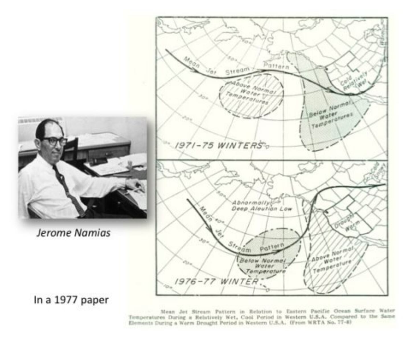
Because most of the earth is covered by water and the ocean heat content is a major source of energy to the atmosphere (thermodynamics) it stands to reason the oceans are a major driver of long term climate and shorter term weather.
El Nino and La Nina are just one example.
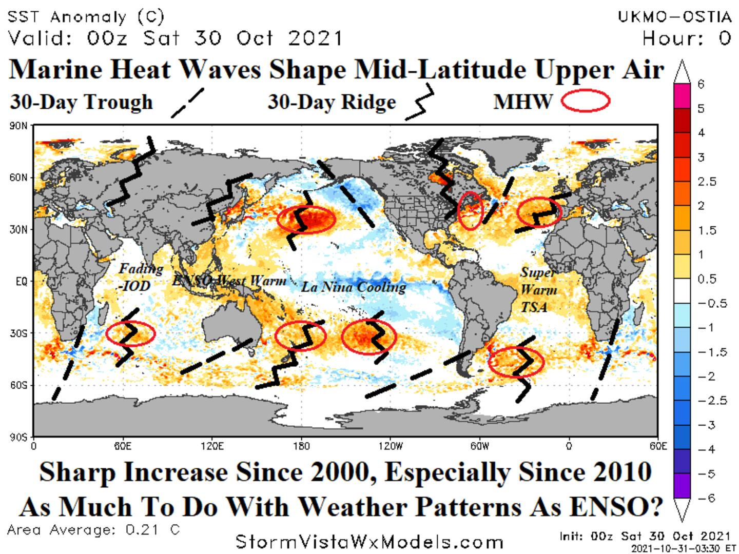
Weatherbell and the commodity weather group have brought attention to these to the general public over the past decade:
LA NINA WITH STRONGER COOLING IN CP AND MORE WIDESPREAD IN BASIN/DOWN SOUTH AMERICAN COAST:
CONFLICTING INDICATORS:

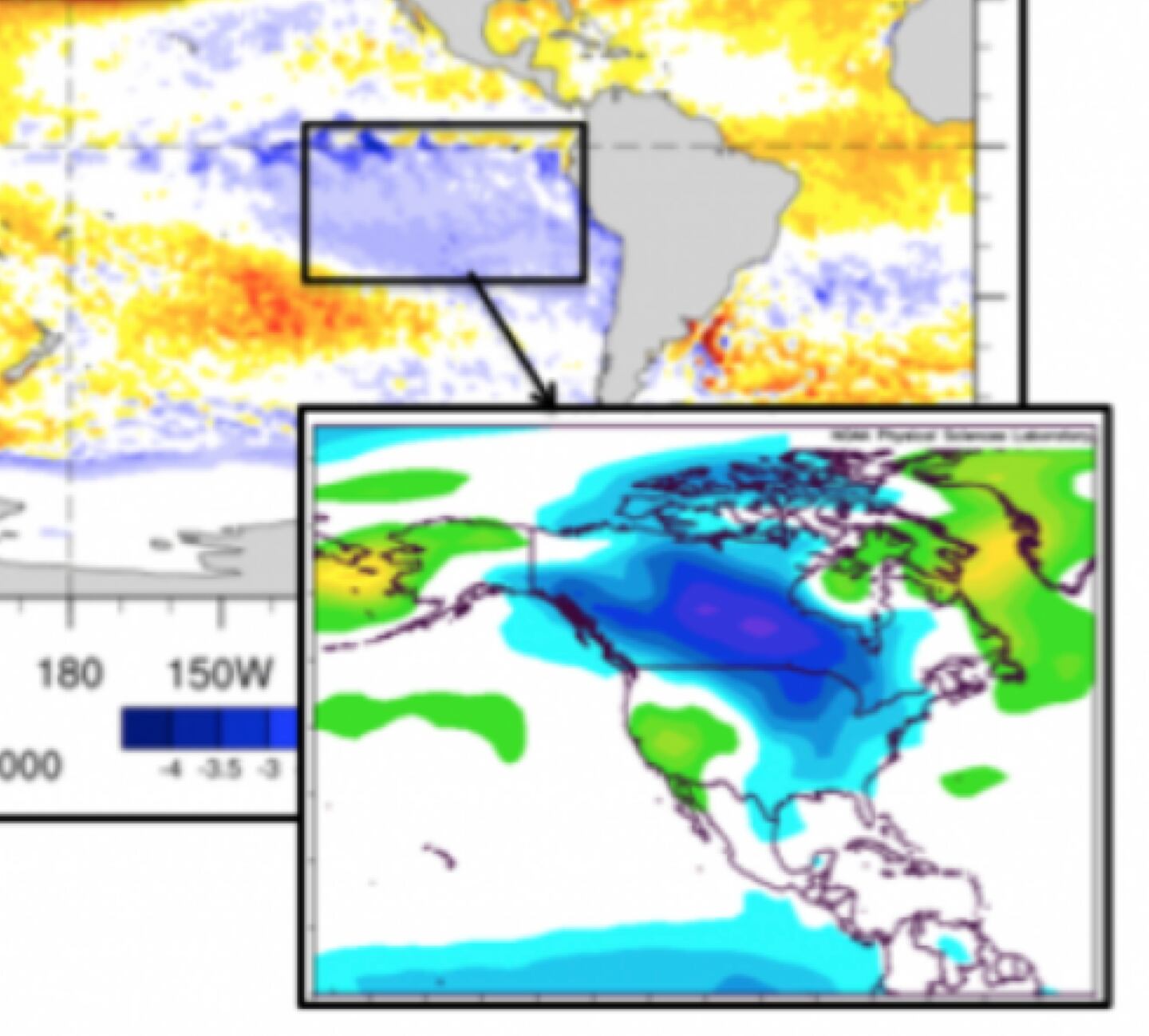
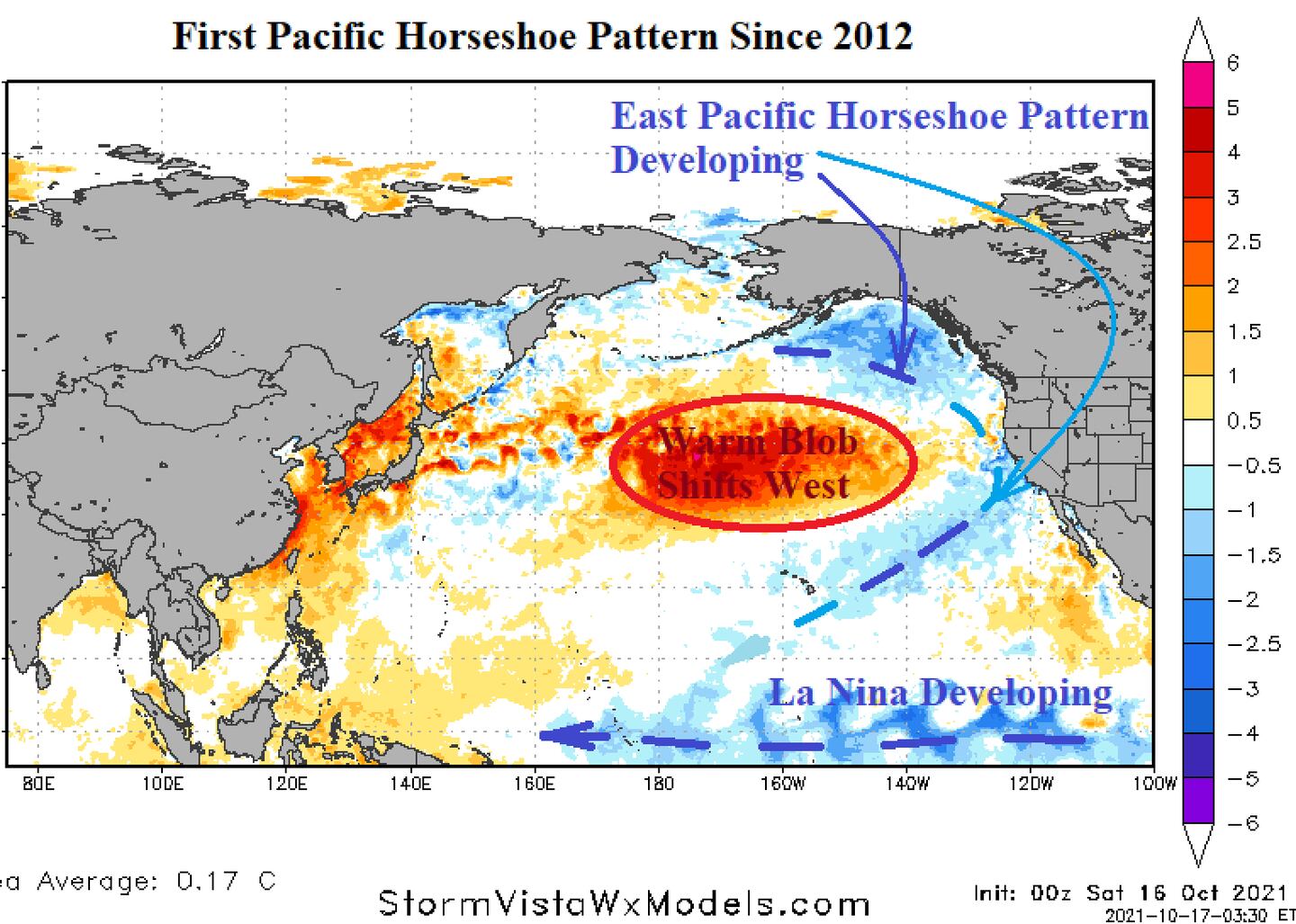
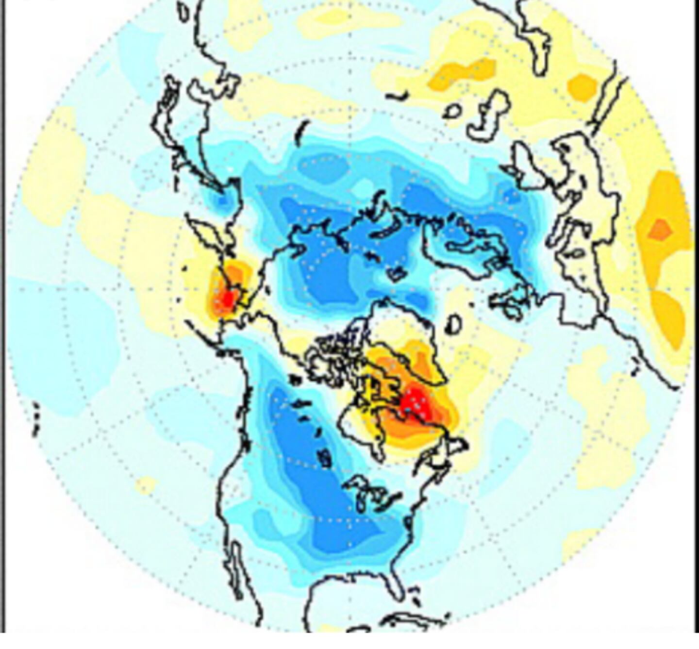
Horseshoe cool anomaly related to enhanced La Nina impact in winter:
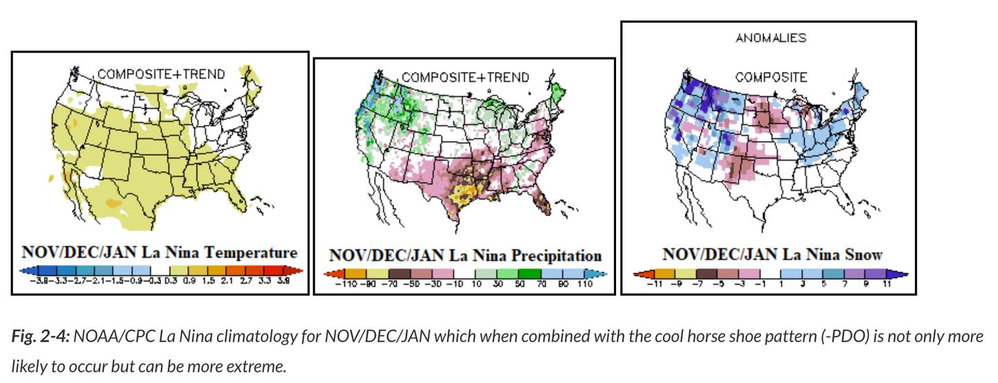
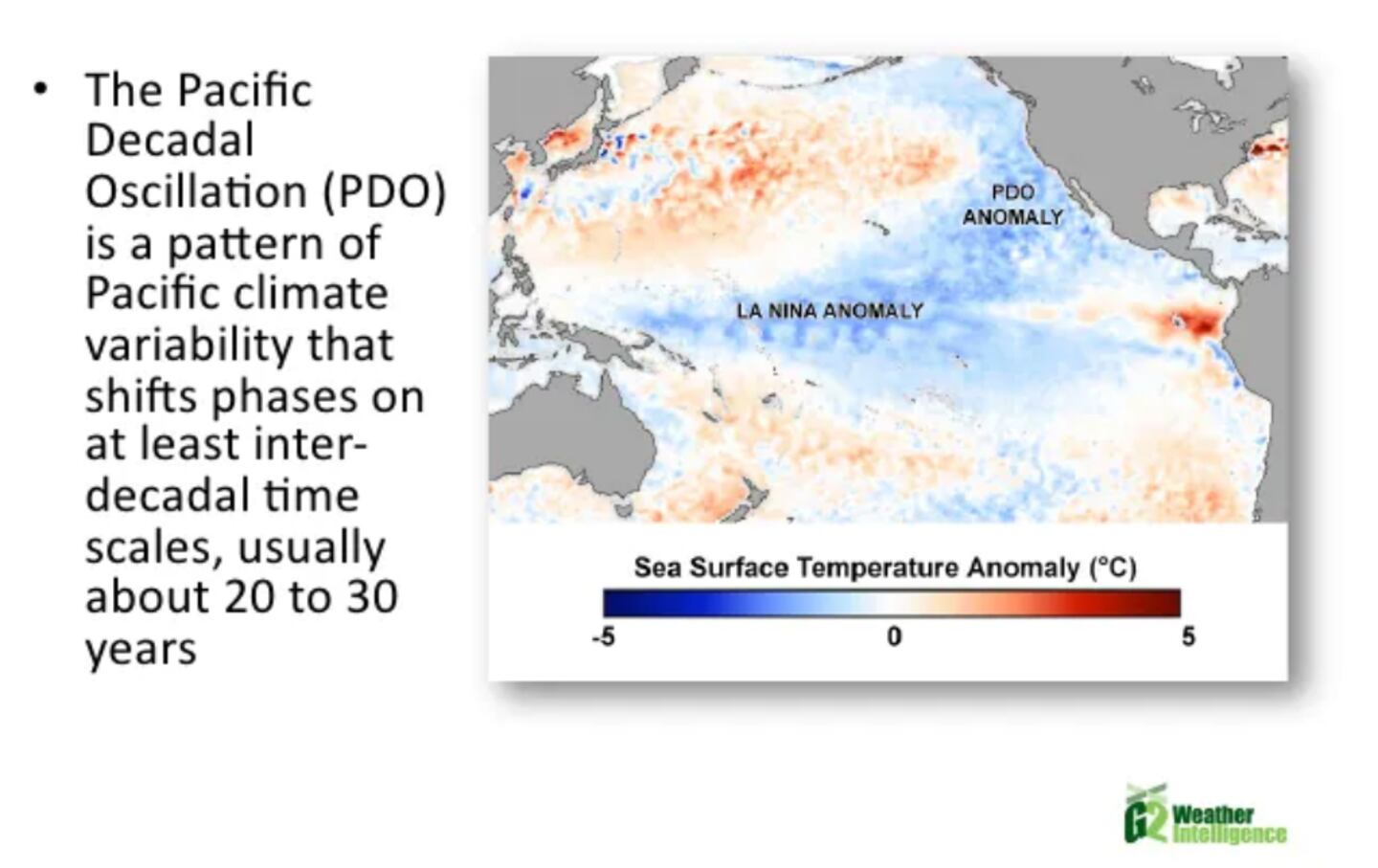
The developing cool horseshoe pattern off the West Coast around the warm pool NW of Hawaii is emblematic of a strengthening negative Pacific Decadal Oscillation (-PDO):
PDO:
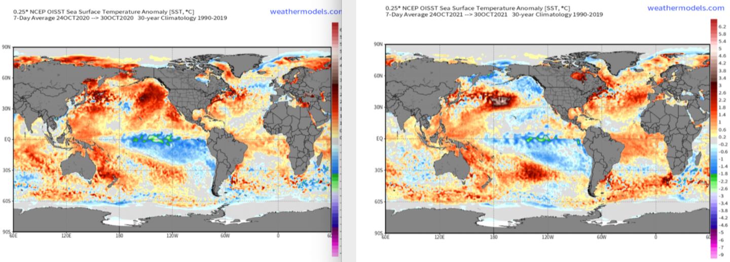
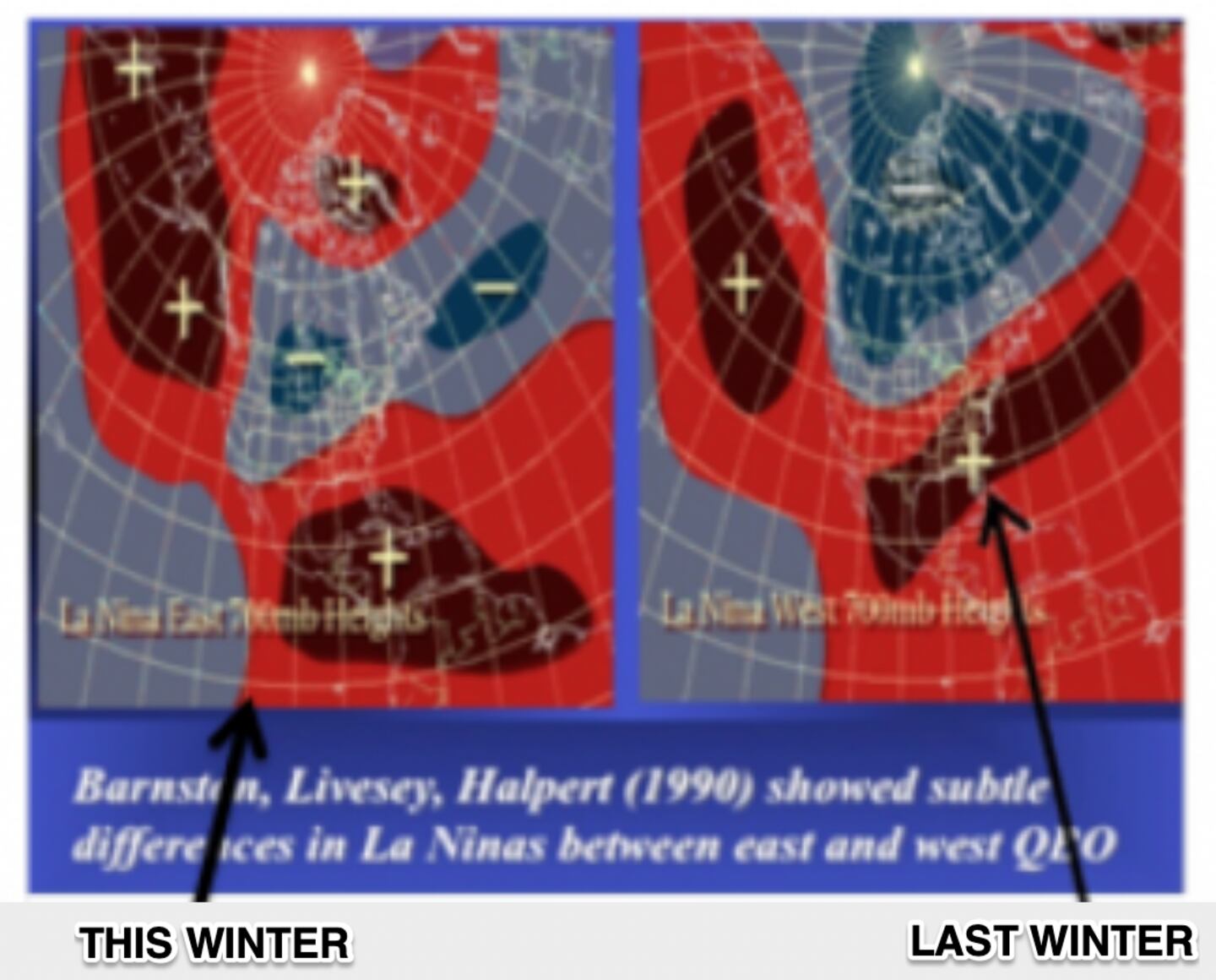
At the start of November the sign of the La Nina is opposite that of the year 1 La Nina last winter. Global Sea Surface Temperature Anomalies (SSTA) compared to the same time last year are similar in the East Pacific BUT are MUCH COOLER in the North and Northeast Pacific including off the West Coast of the U.S. In the Atlantic waters are warmer this year than last near the Equator and Europe:
Less warm water off Southern California and Mexico with the chilly horseshoe may mean a less prominent sub-tropical jet stream in winter and if it remains could spell an active tornado season next spring in traditional tornado alley.
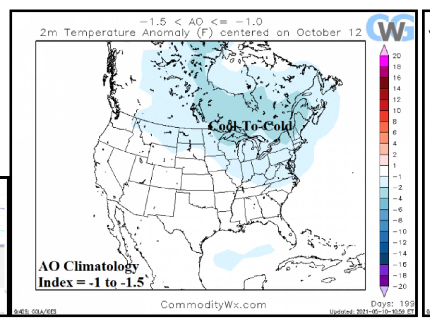
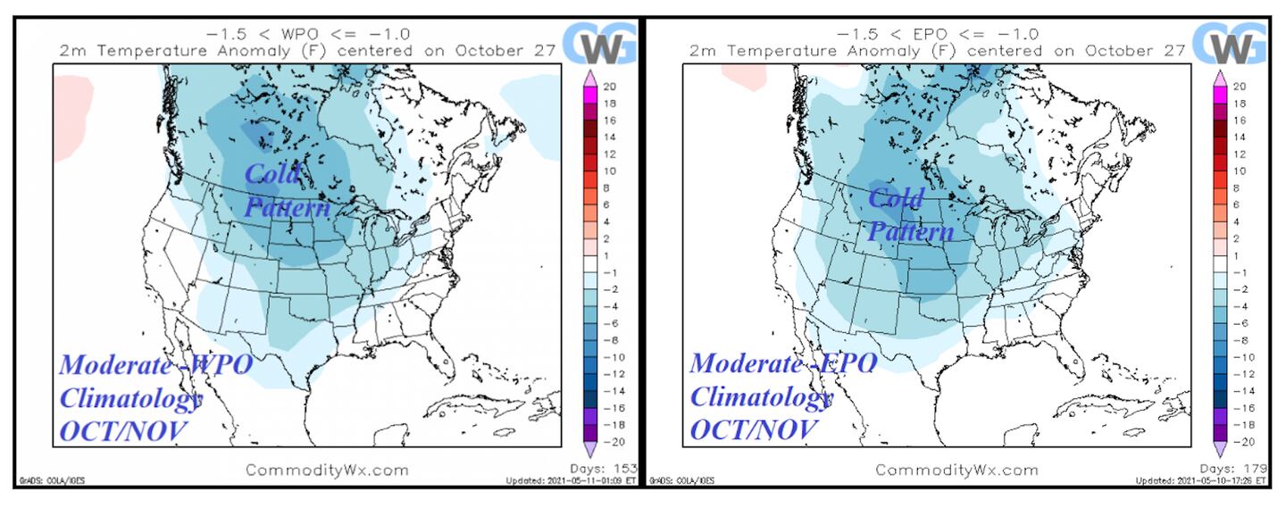
AO/WPO/EPO:
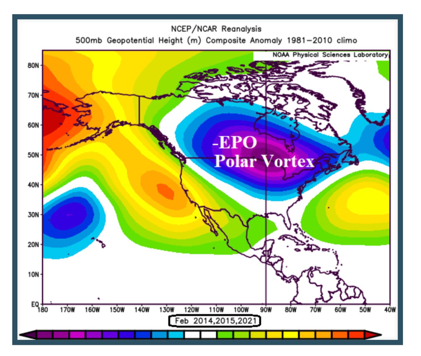
500MB -EPO PV JET STREAM PATTERN:
Not only do the oceans impact the lower atmosphere but the stratosphere near outer space above the equator does also.
This year the QBO in the stratosphere is reversing from West positive last winter to East negative this winter:
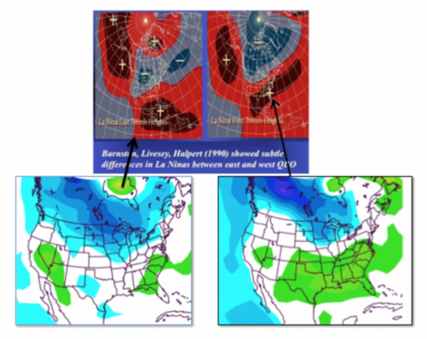
The QBO impact is seen on the strength and location of low pressure and high pressure, including the Southeast ridge which can block cold air and storms away from Georgia OR when it’s weaker allow some cold air to make it farther South. LAST WINTER RIGHT PANELS, EXPECTATION FOR THIS WINTER LEFT PANELS:
A -QBO FAVORS MORE COLD WAVES IN A LA NINA YEAR ESPECIALLY WITH SSW OR OTHER HIGH-LATITUDE BLOCKING:
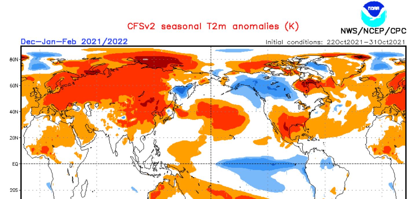
THE AMERICAN CFSv2 MODEL STILL HAS A WARMER THAN NORMAL WINTER IN THE SE:
LA NINA COOLING HAS BEEN STRENGTHENING:
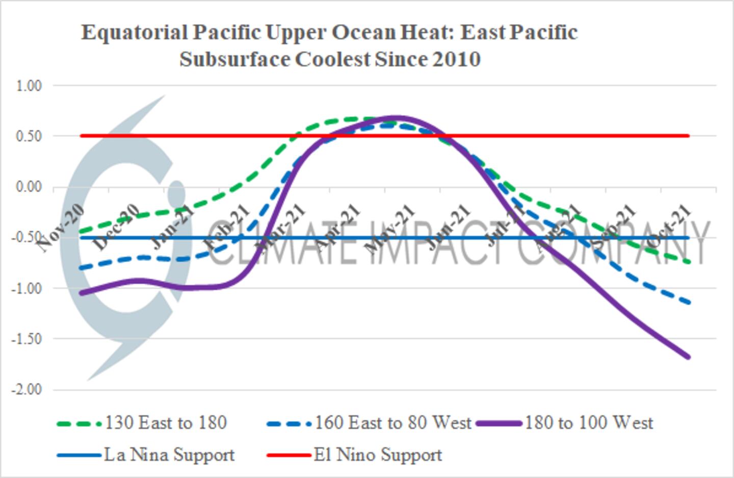
The CFSv2 ENSO model forecast shows a stronger LA NINA than last winter and projects it to peak in December as a STRONG La Nina event:
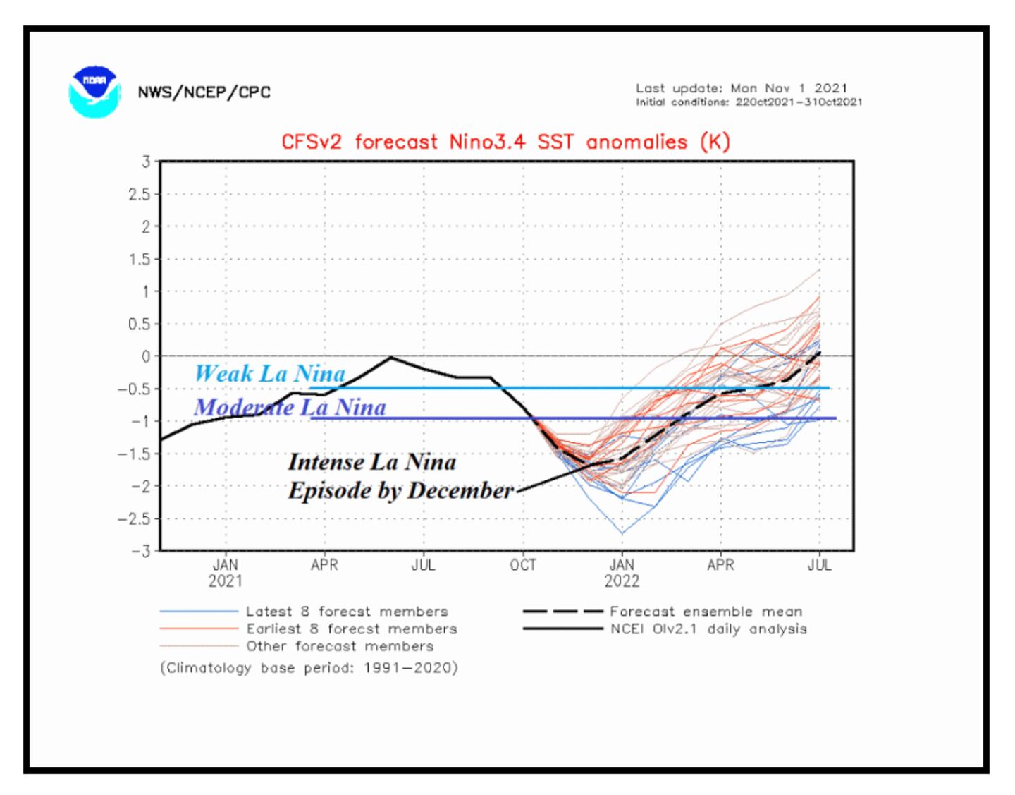
However, I am not a fan of this model so I prefer to look at multiple models.
MY WINTER OUTLOOK WILL BE ISSUED SOON.
Connect with me on Twitter @MellishMeterWSB.
©2021 Cox Media Group


