
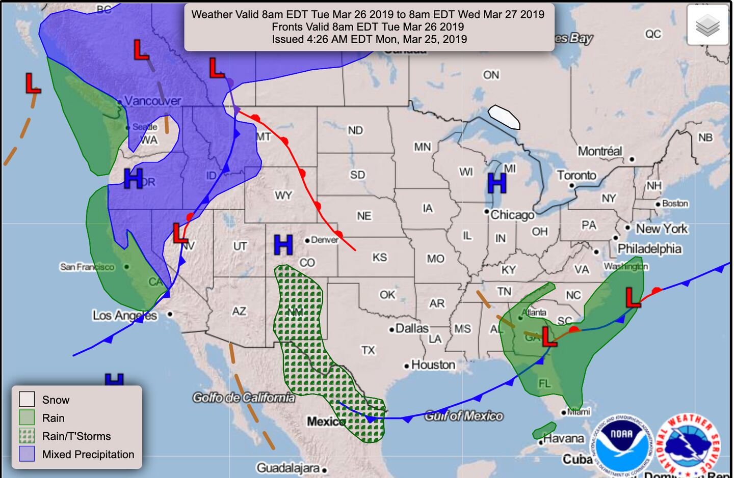
The Surface weather map expected this afternoon and early tonight above. The warm weather continues one more day with a shower possible before noon and a better chance for scattered showers and thunderstorms later this afternoon and evening.
A low pressures system will drag a cold front through the area next 24 hours and it will be followed TUESDAY by below-normal temperatures and an upper-level disturbance:
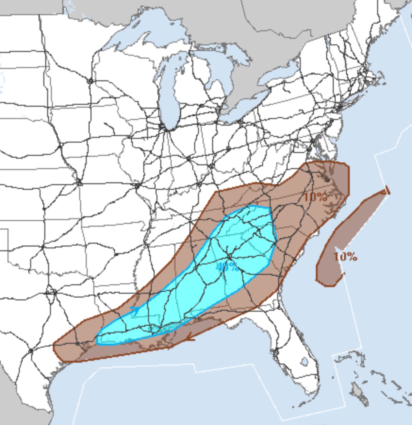
A few spotty light showers are possible Tuesday and it will be noticeably colder.
A couple storms this afternoon or evening could be strong or severe with possible hail and damaging winds:
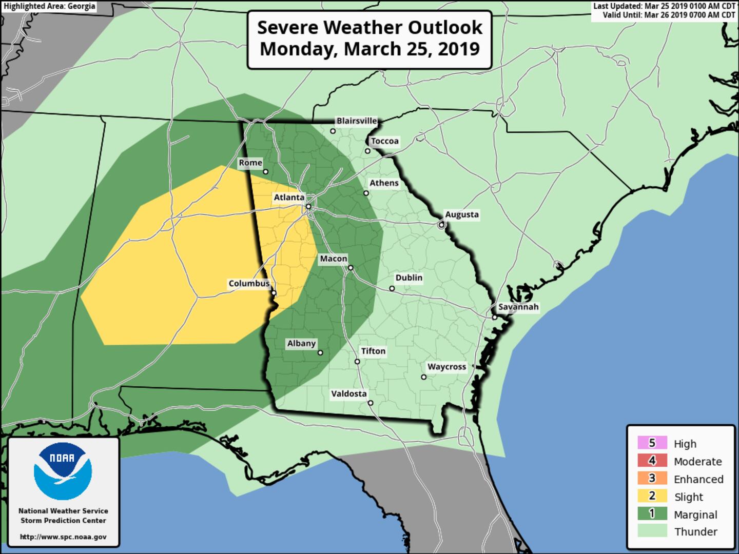

MONDAY THUNDERSTORM TARGET AREA NOON-4PM:
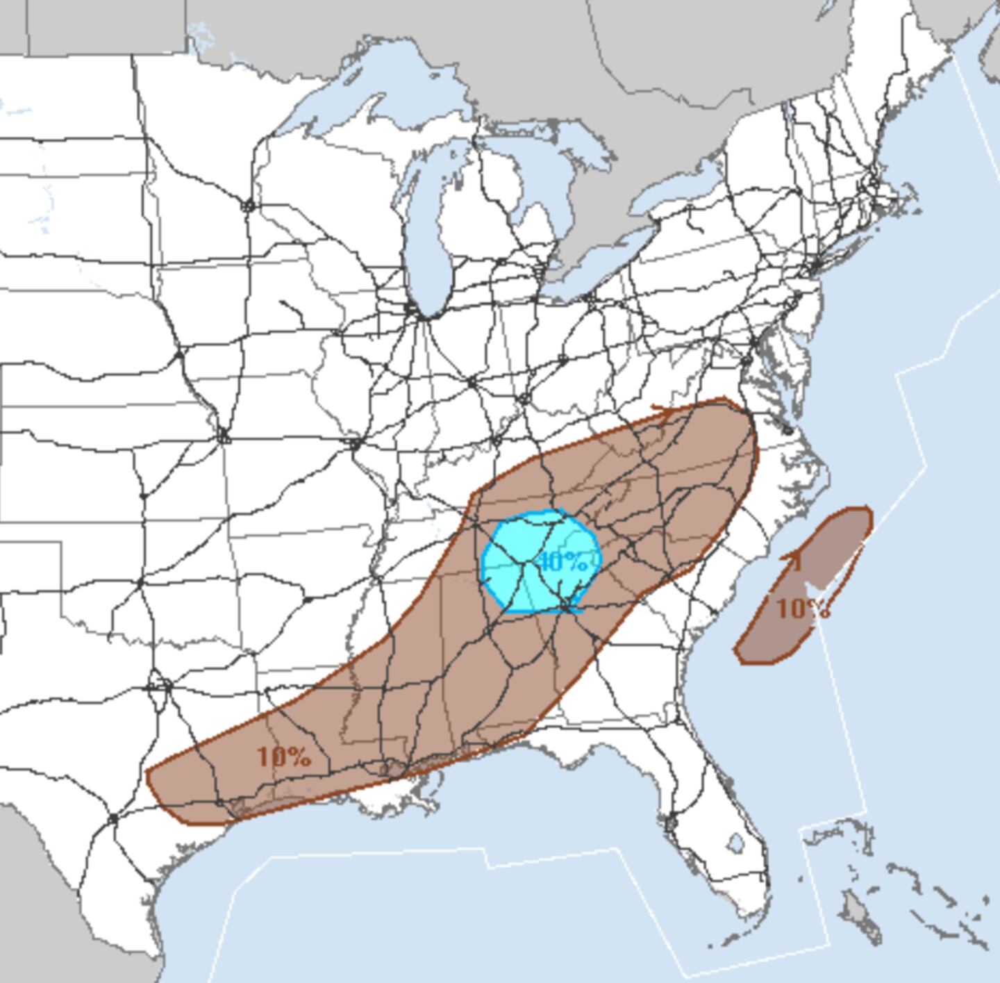
MONDAY MAIN THUNDERSTORM TARGET AREA 4PM-8PM:
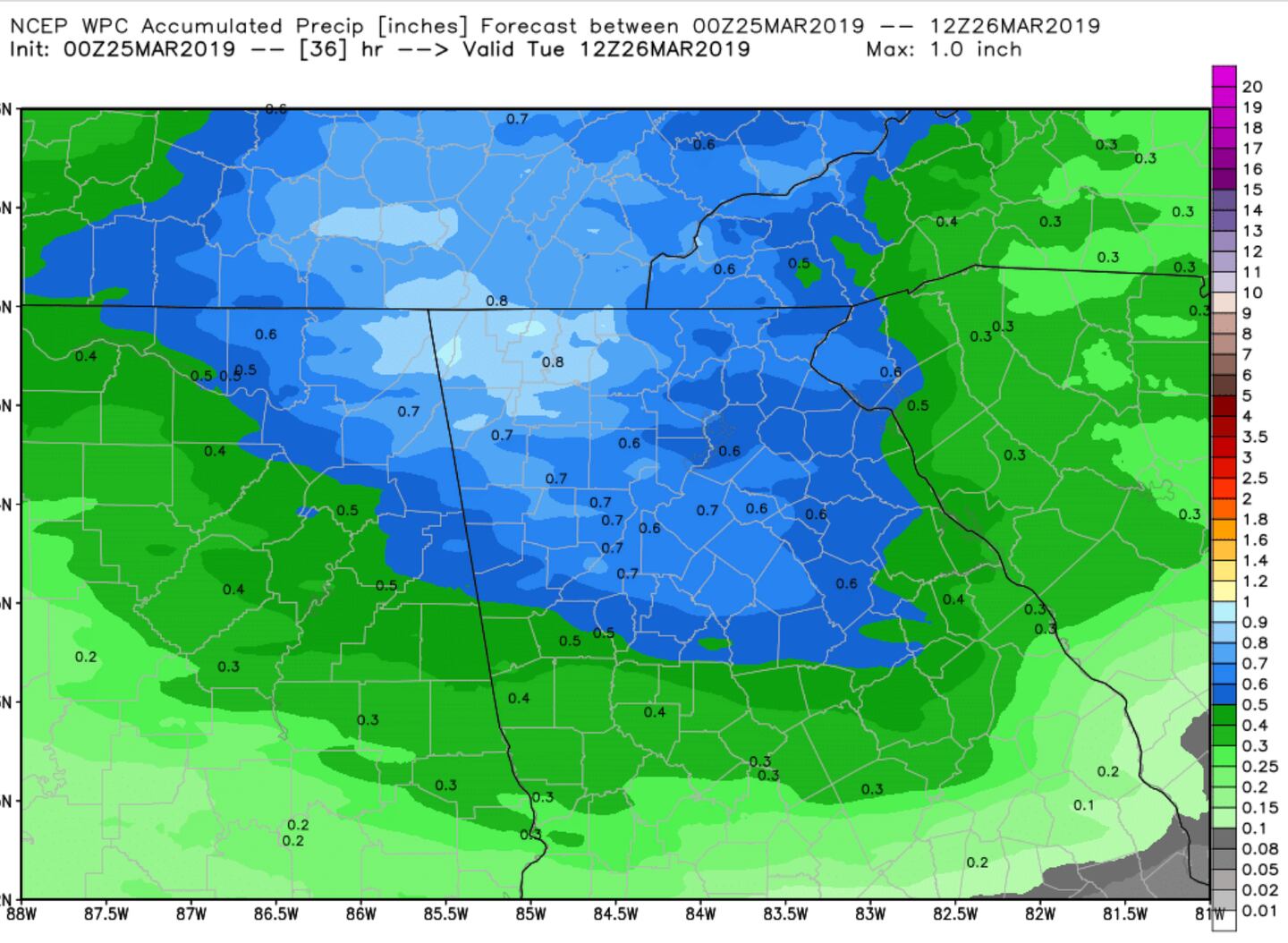
ESTIMATED RAINFALL AMOUNT AVERAGE NEXT 24 HOURS:
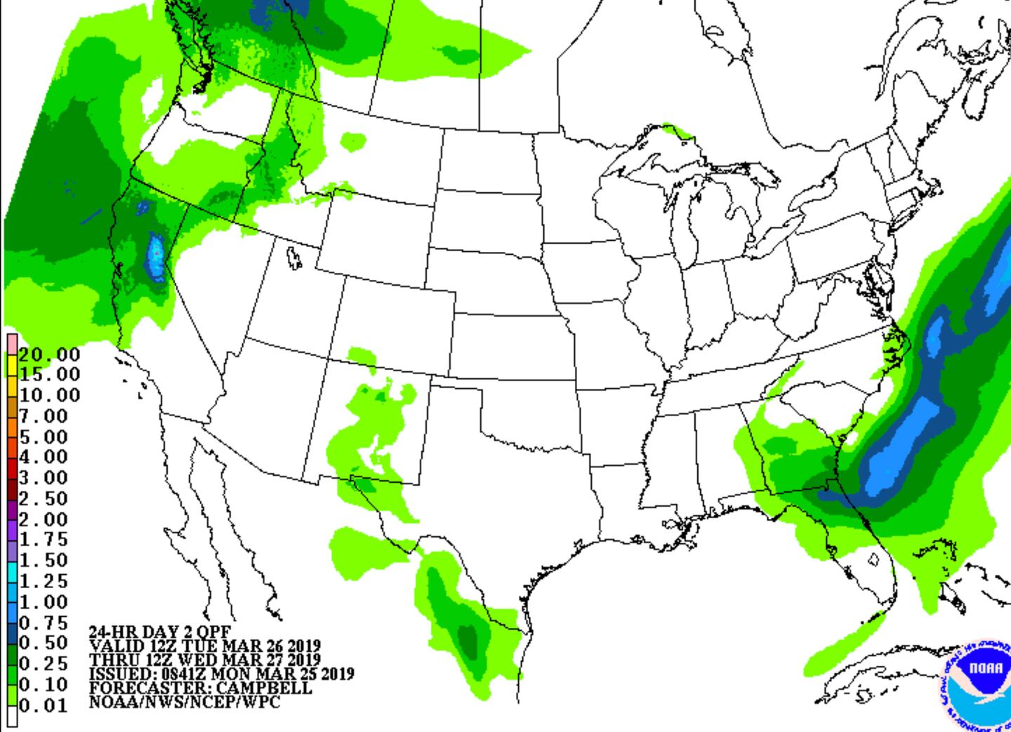
ESTIMATED RAINFALL AMOUNT AVERAGE TUESDAY:
The rest of the week Wednesday-Friday looks dry with a gradual warming trend.
For more Follow me on Twitter @MellishMeterWSB and download the WSB RADIO APP.


