

A cold front is slowly moving through North Georgia today, and cloudy skies will prevail until late this evening.
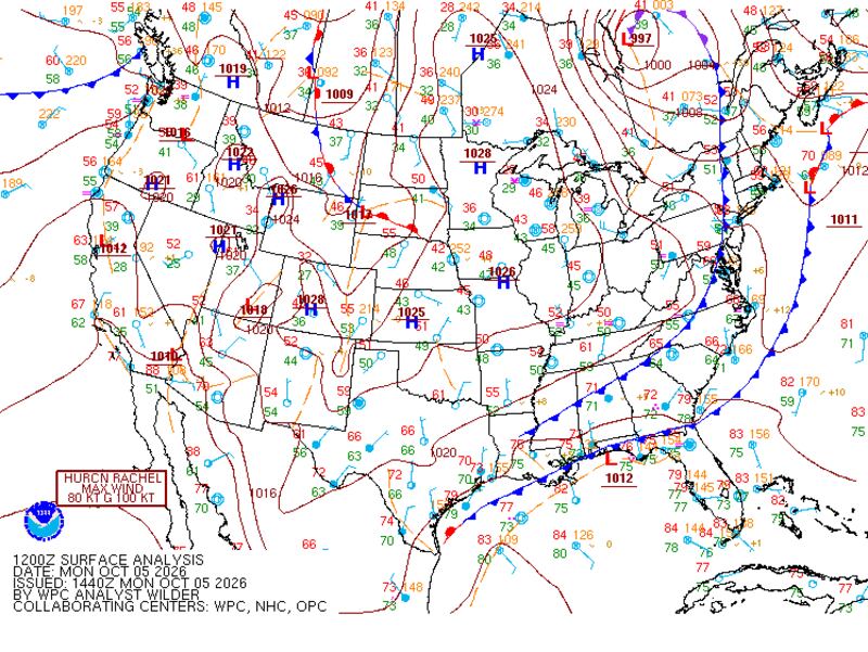
As a result, some areas of fog and low cloud cover will set the tone for much of Monday afternoon, limiting daytime highs to the mid to upper 70s.
However, clouds will thin out overnight into early Tuesday morning, and clear skies will allow temperatures to drop into the mid 50s to low 60s by sunrise.

Through the week ahead, lower humidity and calm morning winds will allow temperatures to drop into the mid 50s throughout the Metro Atlanta area, ushering in fall-like conditions that may prompt you to grab a jacket or sweater.
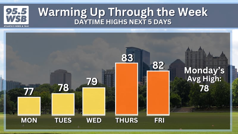
Sunshine will prevail Tuesday afternoon, but it will remain comfortably cool as an east breeze continues to usher in dry air from the Appalachian Mountains. As a result, afternoon highs will remain in the upper 70s for Tuesday, and they will remain in the upper 70s to low 80s through Friday.
Tropical Development Later This Week?
The National Hurricane Center has outlined an area of possible development later this week, and a tropical depression may form by Friday.
As of Monday, the area in red (below) has a 70 percent chance of developing into a tropical system through the end of this week.

Long-range weather model data indicates that this tropical low may swing northeast towards the Florida Panhandle before moving through the Southeast U.S., potentially bringing an additional round of heavy rain to Metro Atlanta this coming weekend.
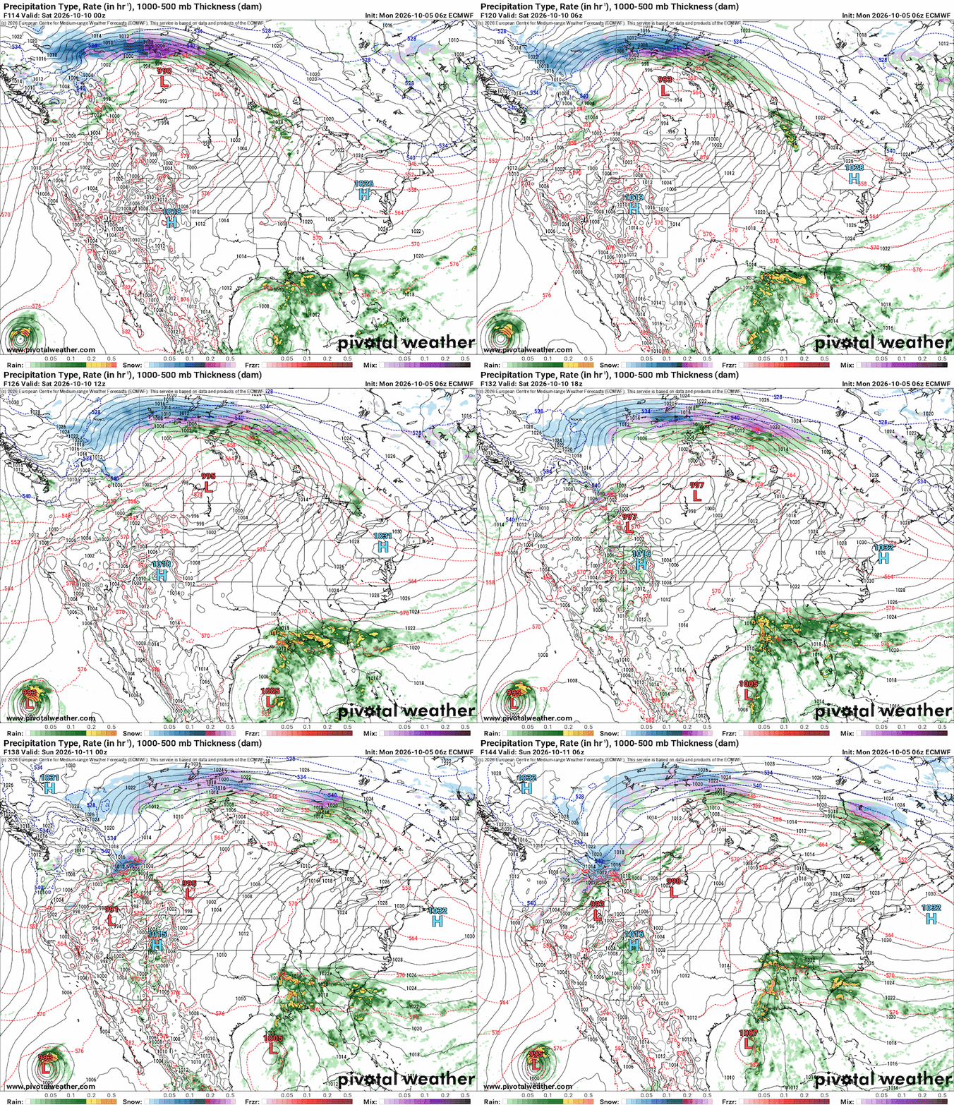
Bear in mind that the details of timing, location, and forecast rainfall totals will vary between now and the end of the week. However, if weekend plans bring you outdoors, monitor the weather forecast here on 95.5 WSB.
Share Your Temperature Reports with Me!
Facebook: Christina Edwards WSB
Instagram: ChristinaWSBwx
©2026 Cox Media Group