
This type of close-in development is somewhat rare but certainly not unprecedented.
Forecasters always keep and eye on any front or upper level disturbance that makes its way into the Gulf of Mexico OR the Atlantic during the hurricane season as they can be the genesis for a tropical system when they stall over the warm water.
It could increase Atlanta's rain odds next weekend into the follow week but we'll know more in a few days.
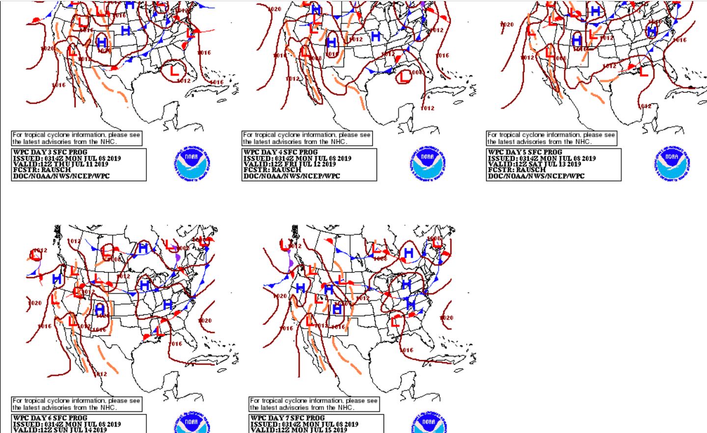
The future PATH AND INTENSITY of this system is very uncertain.
Below you can see the best estimate over the next 7 days as of now but expected changes in the days ahead:
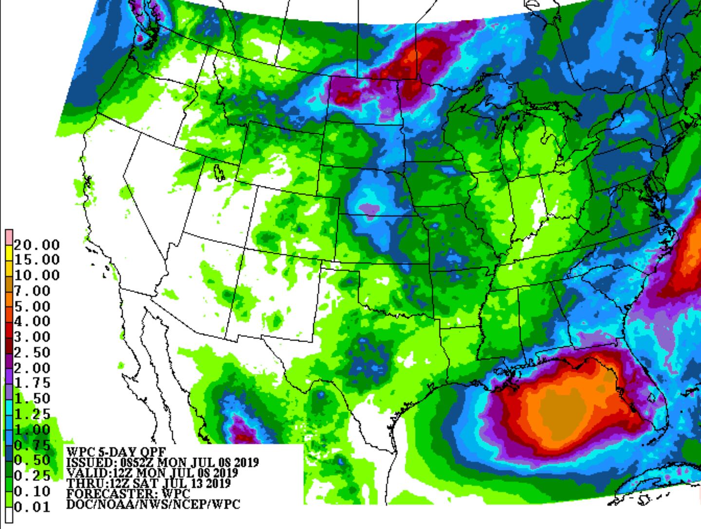
5-DAY AVERAGE RAINFALL ESTIMATE:
The DETERMINISTIC OPERATIONAL VERSION OF THE ECMWF has a different idea:

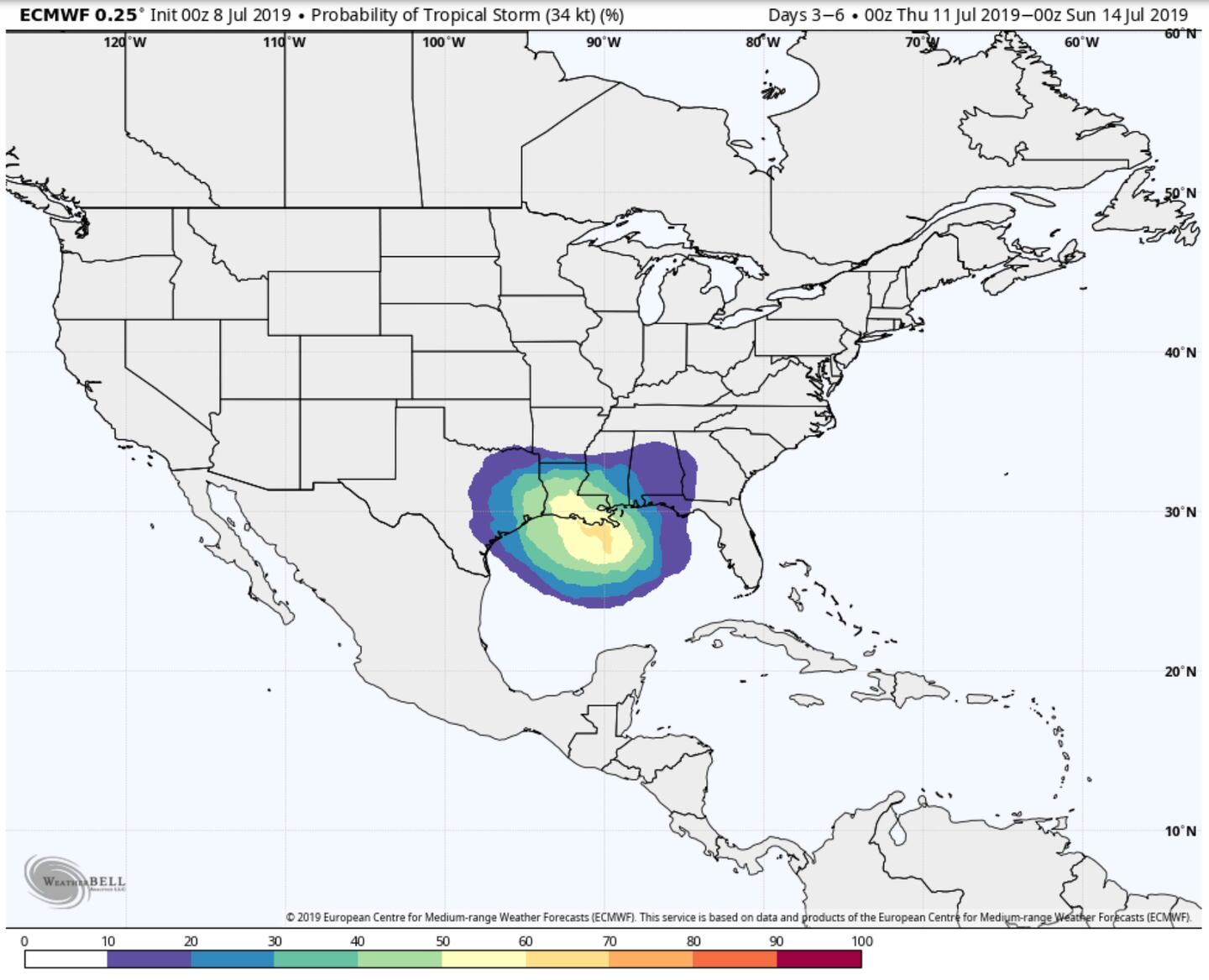
However, a bit different tune from the ECMWF ENSEMBLE TROPICAL STORM PROBABILITY:
Stay tuned.
For more follow me on Twitter @MellishMeterWSB.


