Over the past 3+ weeks not only has it been abnormally hot but it has also been unusually dry with very few of the usual scattered pop up thunderstorms. August only had about 9 days with rain and none of it was widespread and most of it was not too heavy.
My home rain gauge picked up over one-inch last Saturday the 14th and there were a few stray thundershowers Monday and Tuesday in the area but much of the region has been bone dry so far this month.
The MAP ABOVE shows the percent of normal precipitation the last 90 days revealing only a few pockets of normal rain shaded green.
The official rainfall deficit for Hartsfield airport is over 2 inches for the month and about 5 inches since January 1st.
The abnormal heat with the long streaks of 90s to 100 and only modest humidity has meant extra evaporation from plants and soils.
We've been mostly free of rain even when it was humid, and on top of that we've been mostly rain free even when it was cooler.
That pattern looks to continue the next 5-15 days unless we get some tropical system to come along our way.
Autumn officially arrives on Monday with the Fall equinox, but that’s when we start our next extended heat wave as highs in the 90s return!
HOW WARM HAS IT BEEN?
79 days with a high of 90 or above this year compared to the average of just 37. The record is 90 set in 2002.
So far September is IN FIRST PLACE for the warmest on record in Atlanta!
September is in FIRST PLACE for most highs of 95 or above. We are tied for 5th place for SUMMER (June-August) days of 95 or higher.
The past 6 months are the 2nd warmest on record in Atlanta!
And year to date since January 1st we are also in 2nd place for the warmest year on record through Sept 18th.
DROUGHT MONITORING:
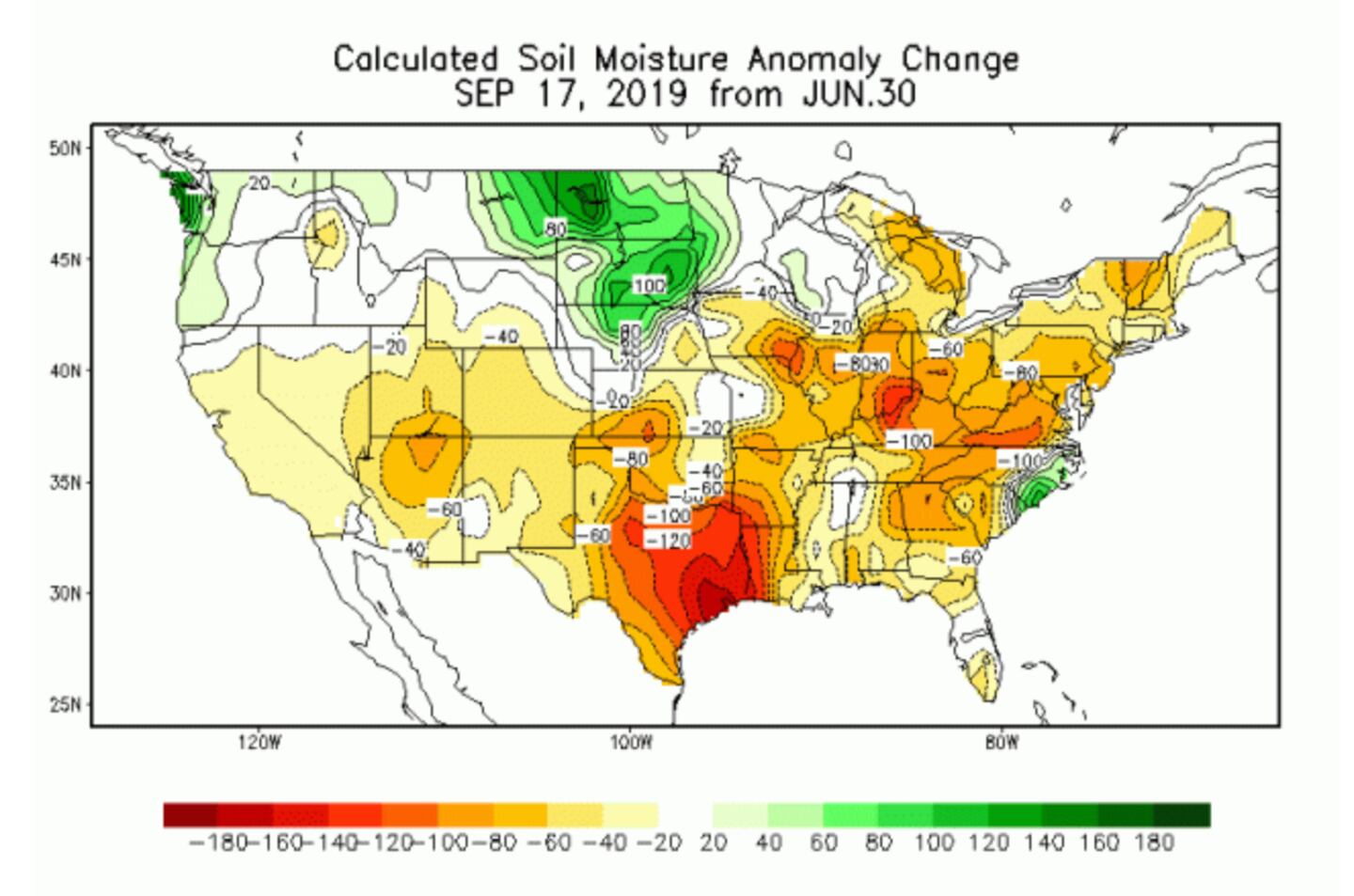
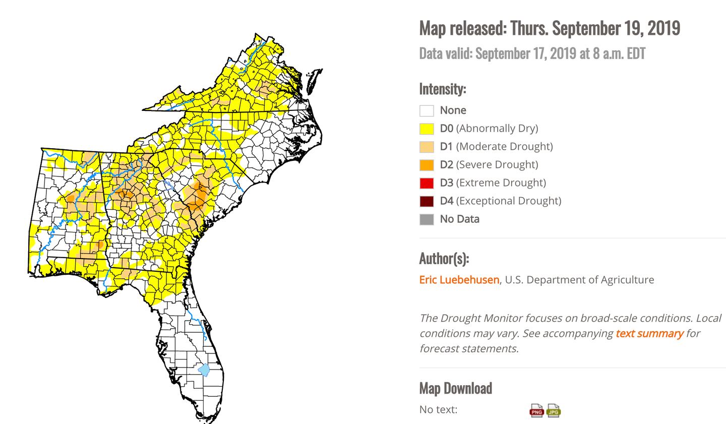
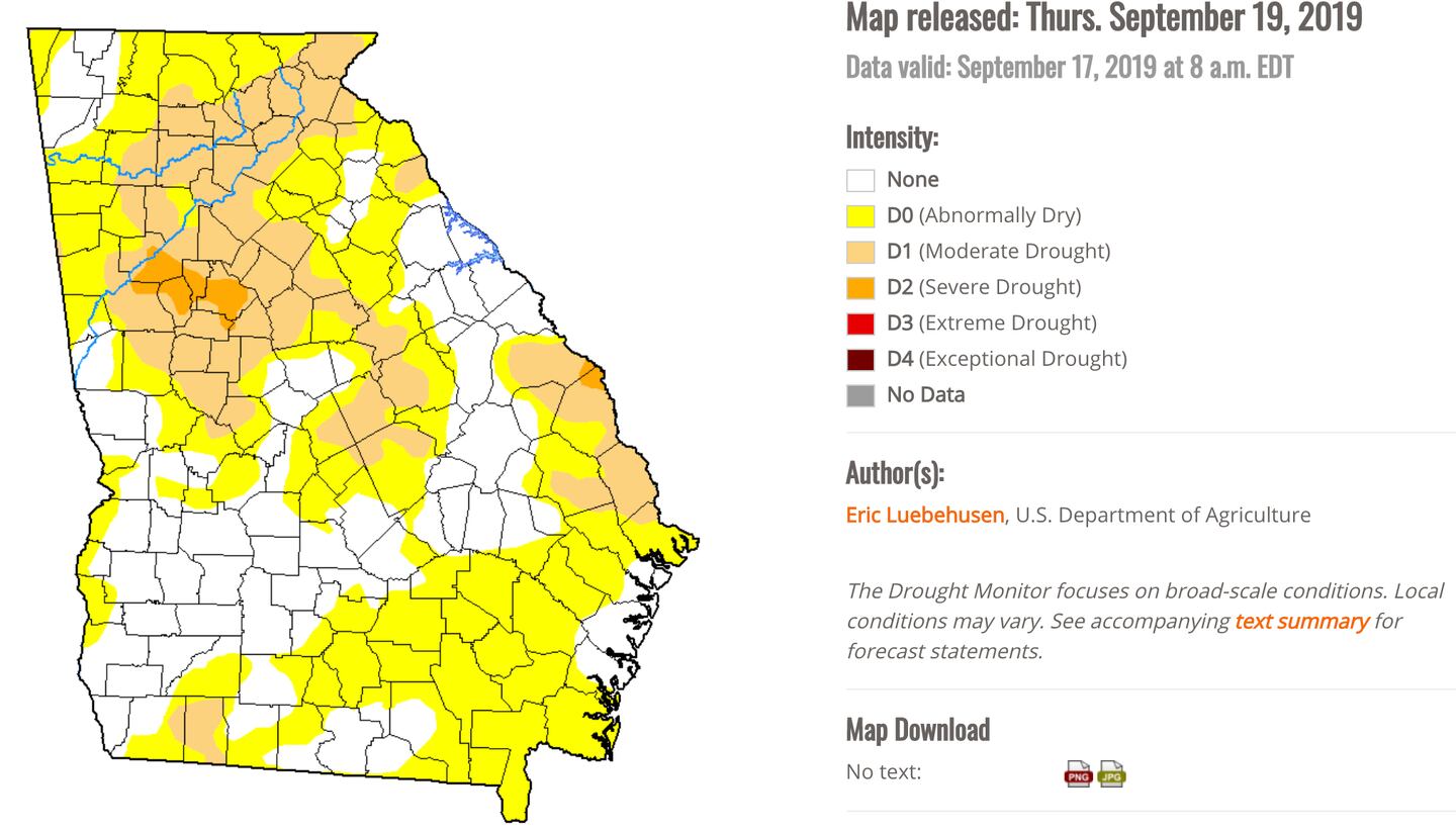
65% of Georgia is now involved in some level of drought. That’s an increase of 25% in one week. Areas in the state in moderate to severe drought is 22%. Drought now impacting over 5 million Georgia residents (5,069,204). Topsoil moisture was rated as 73% short to very short.
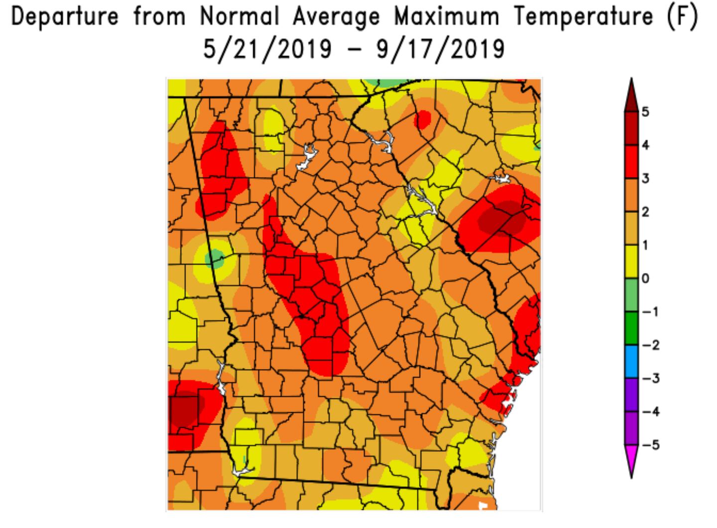
AVERAGE DEPARTURE FROM NORMAL HIGH TEMPERATURE THE LAST 120 DAYS:
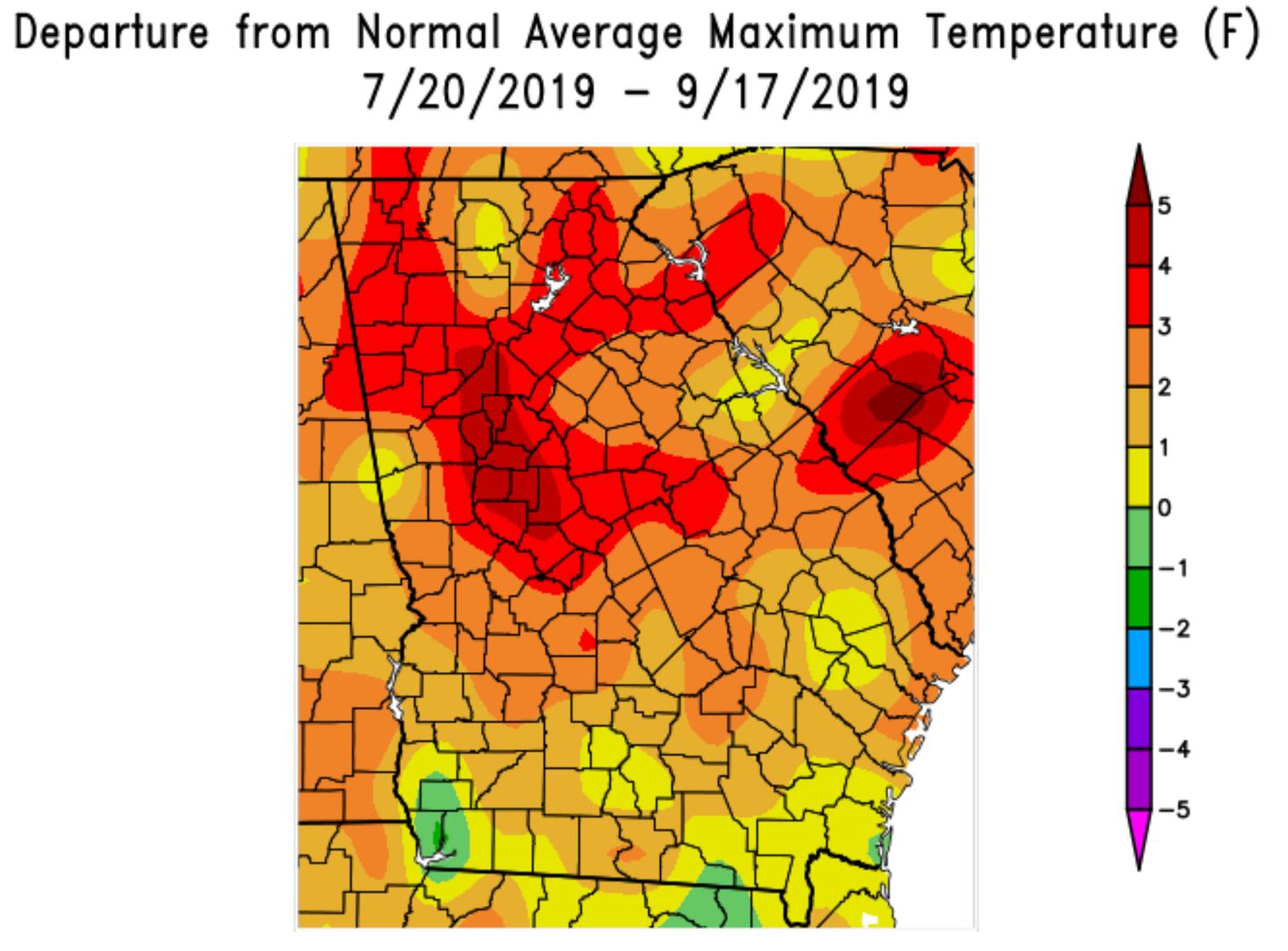
AVERAGE DEPARTURE FROM NORMAL HIGH TEMPERATURE PAST 60 DAYS:
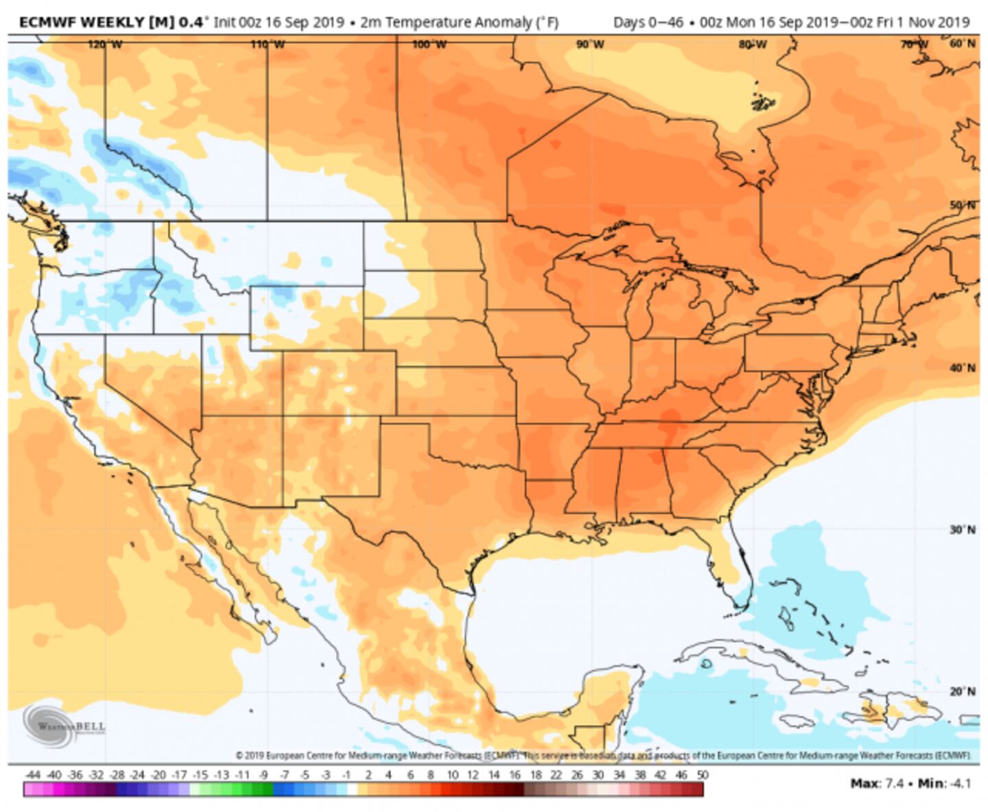
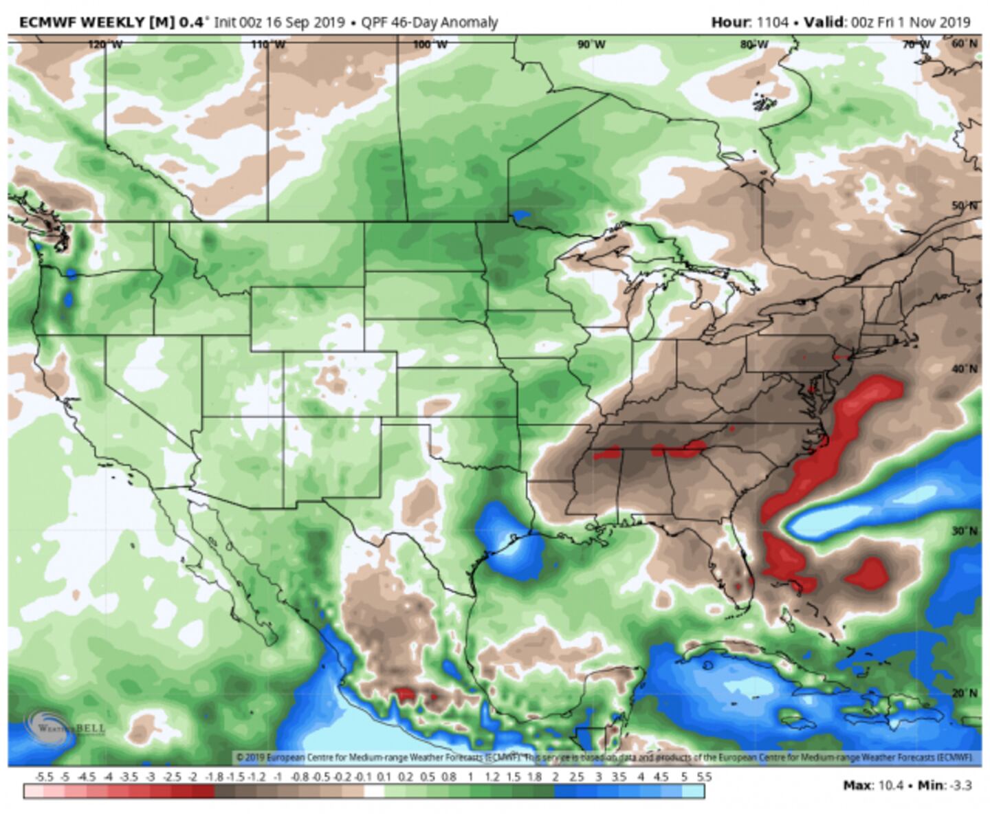
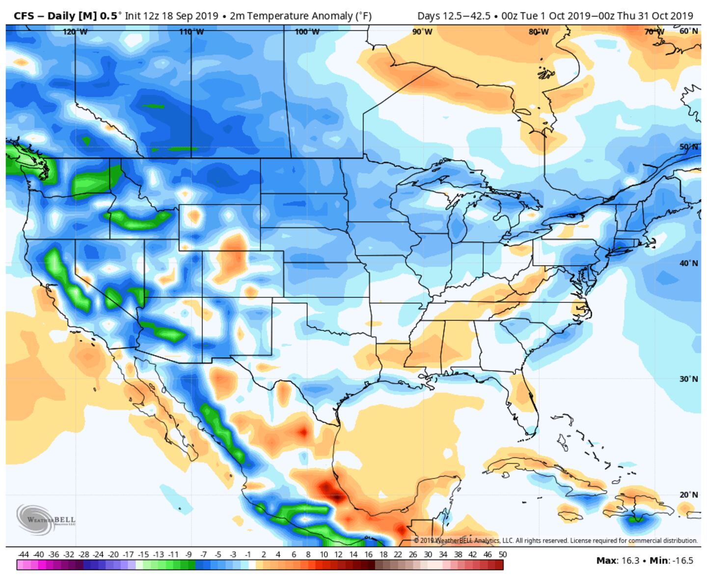
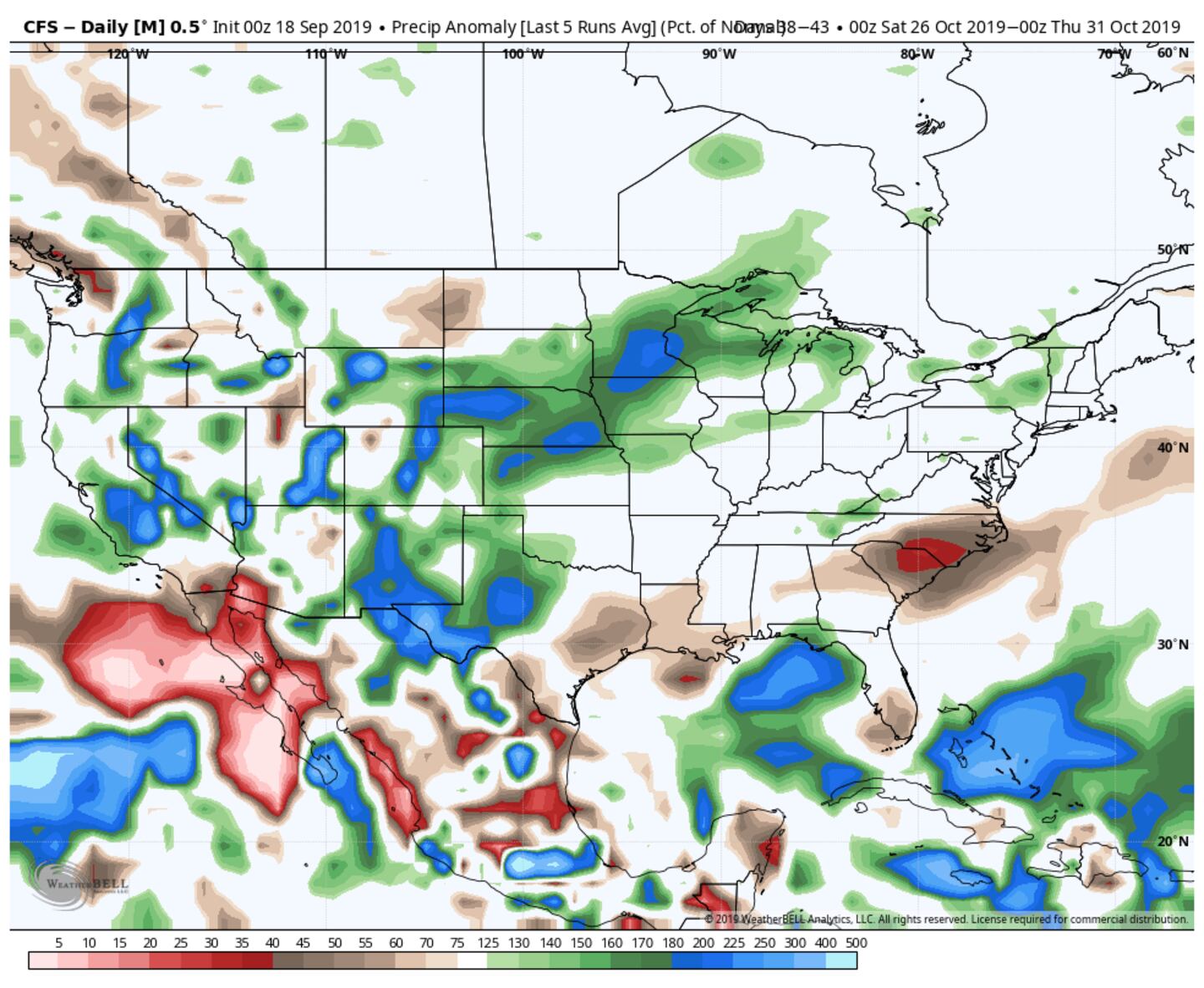
The models suggest below-normal rain and above-normal temperatures will continue for an extended period...
ECMWF MODEL TEMPERATURE AND RAINFALL ESTIMATE DEPARTURE FROM NORMAL NEXT 6-WEEKS:
Remember that is the average of a 46 day period not every day or every week. The same for the CFSv2 model below which is cooler, but both models show below-normal rainfall.
CFSv2 TEMPERATURE AND RAINFALL ESTIMATE DEPARTURE FROM NORMAL NEXT 6-WEEKS:
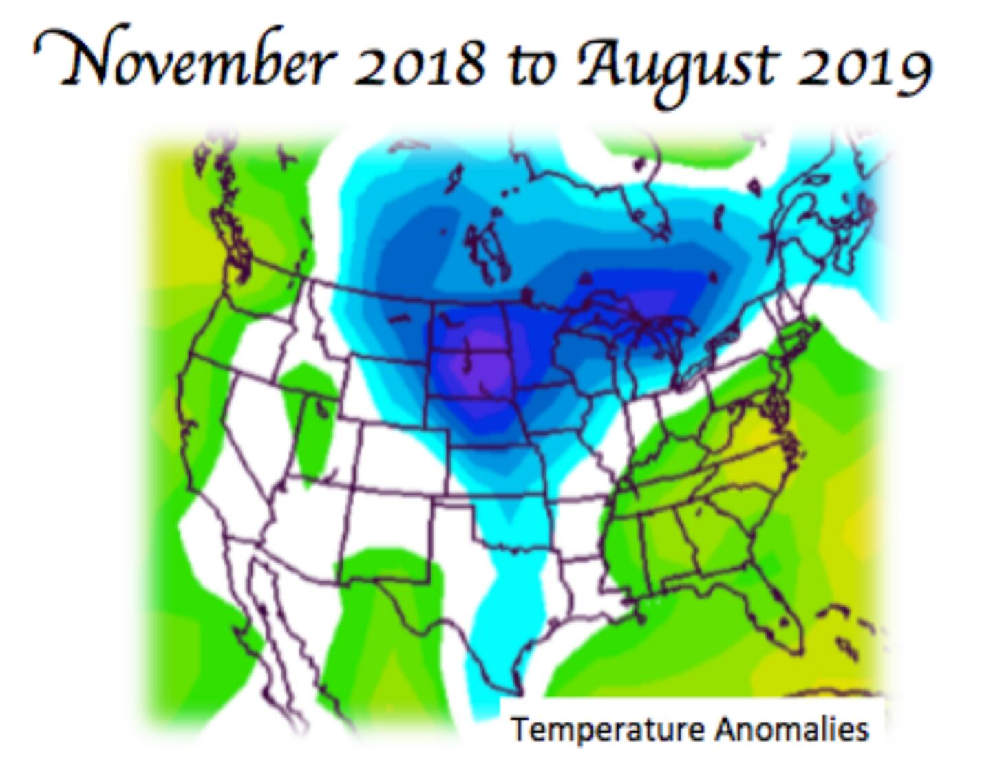
Sure we’ve had our brief cold snaps in Winter and Spring but overall on average as the Weatherbell map below shows, the past 10-months have averaged warmer than normal in these parts while rain went from dry to wet to dry over the same period:
The Canadian model for the next 6 weeks is not much different than the American and European global variants suggesting we may have to wait until November before we get any lasting period of below-normal temperatures.
For more follow me on Twitter @MellishMeterWSB.


