
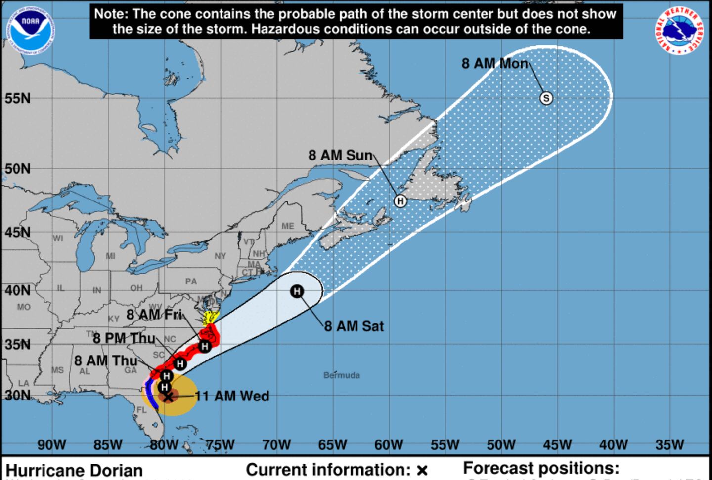
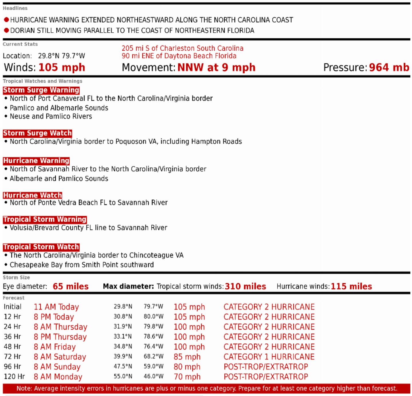
DORIAN STILL MOVING PARALLEL TO NORTHEAST COAST OF FLORIDA. HURRICANE WARNINGS EXTENDED ALONG NORTH CAROLINA COAST
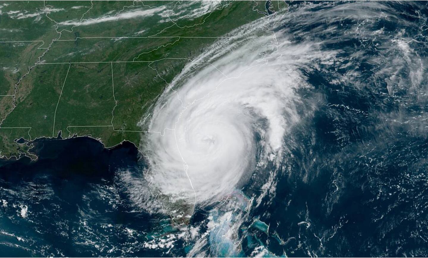
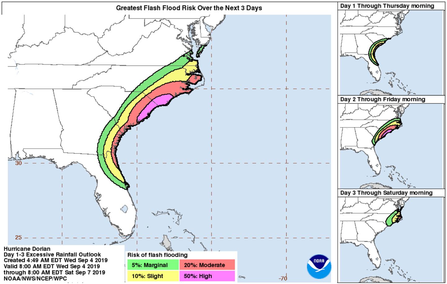
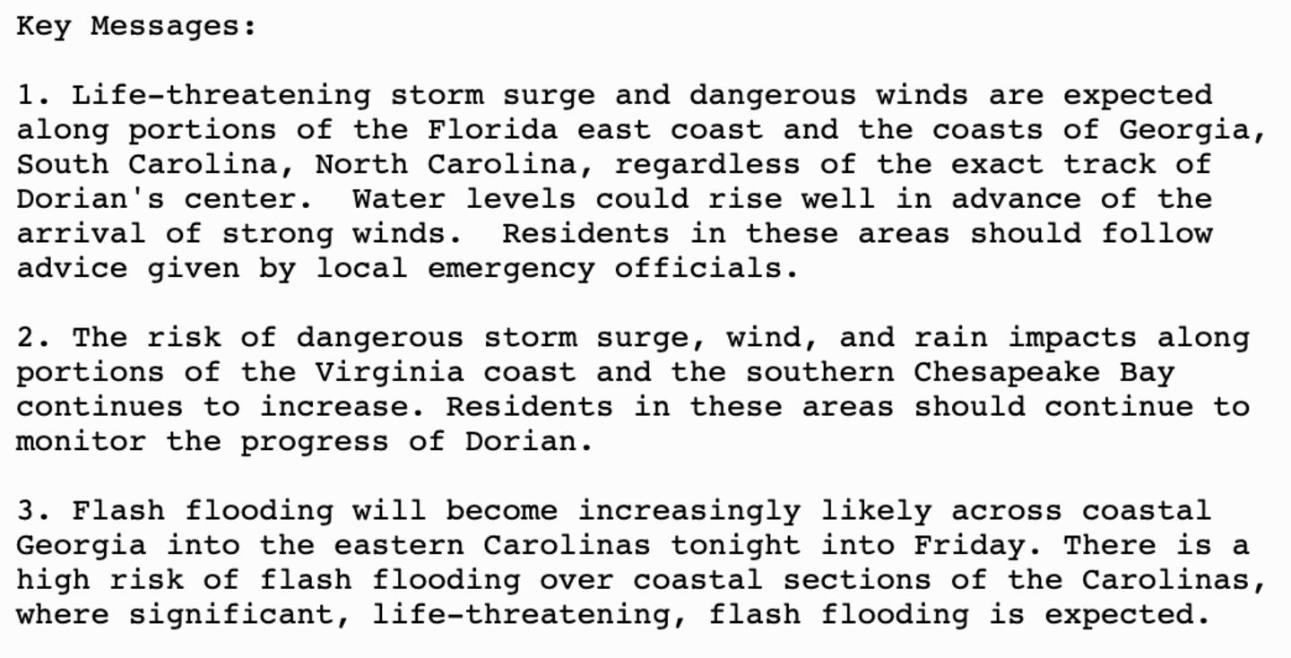
Rainbands from Dorian continue to move onshore in parts of the North half of Florida and Georgia edging to South Carolina despite the eye of the storm being well out to sea. This is why we advise you not focus so much on the single point forecast track line. Size matters and serious impacts can and do occur even outside the “cone of uncertainty”.
The winds may be down near the eye but the size of the storm is growing putting more areas at risk farther North.
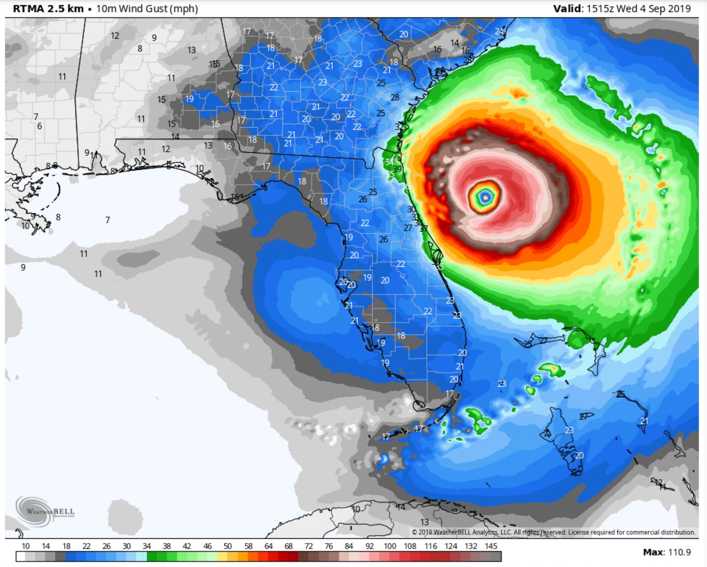
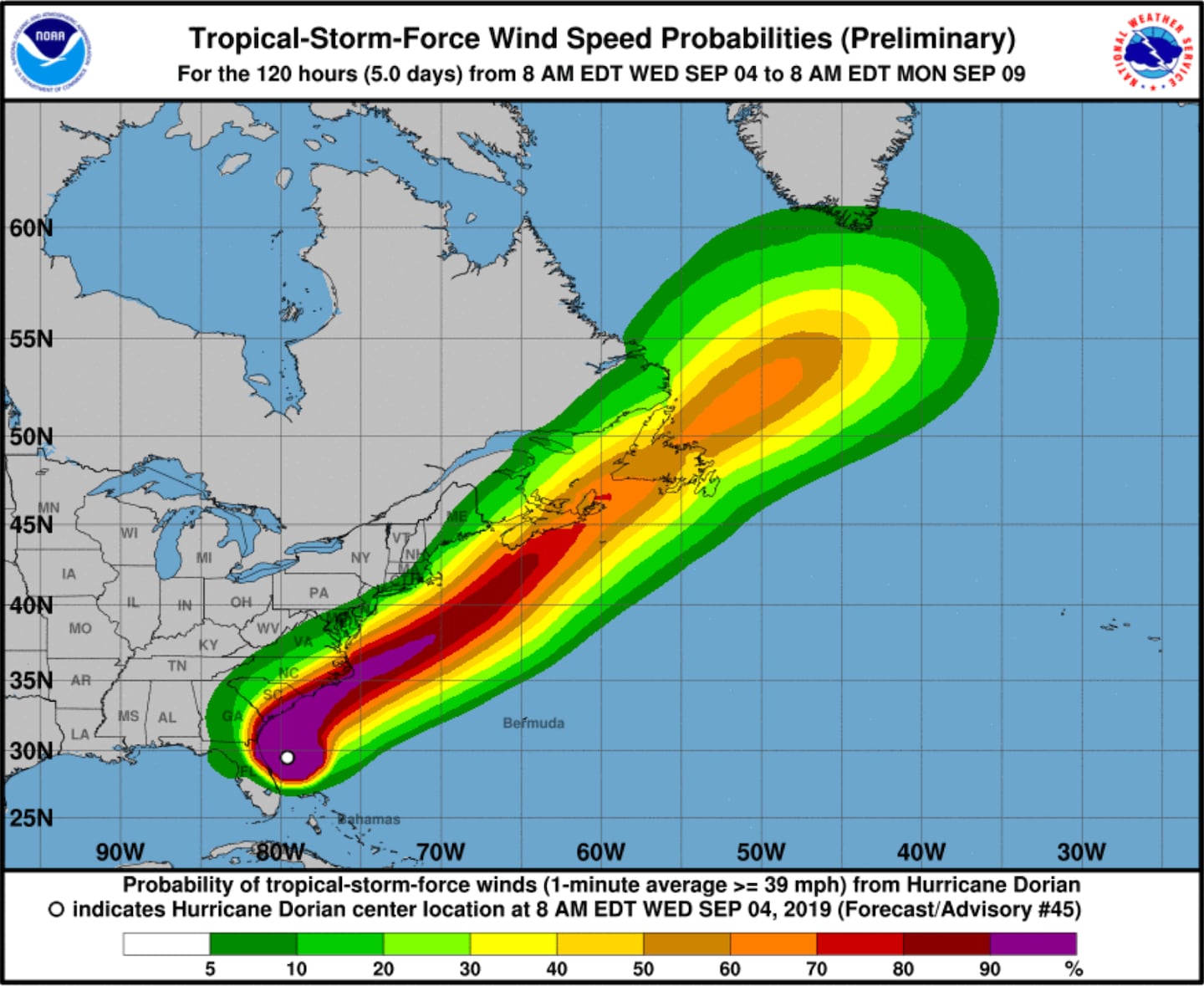
WIND FIELD 1115 AM Maximum 110 mph (estimated):
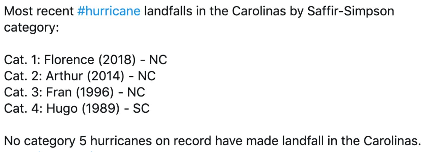
Hurricane gusts are not out of the question even inland in the Carolinas even if the eye does not come onto land, although an eye landfall is becoming more likely somewhere in South or North Carolina as per previous blog posts.
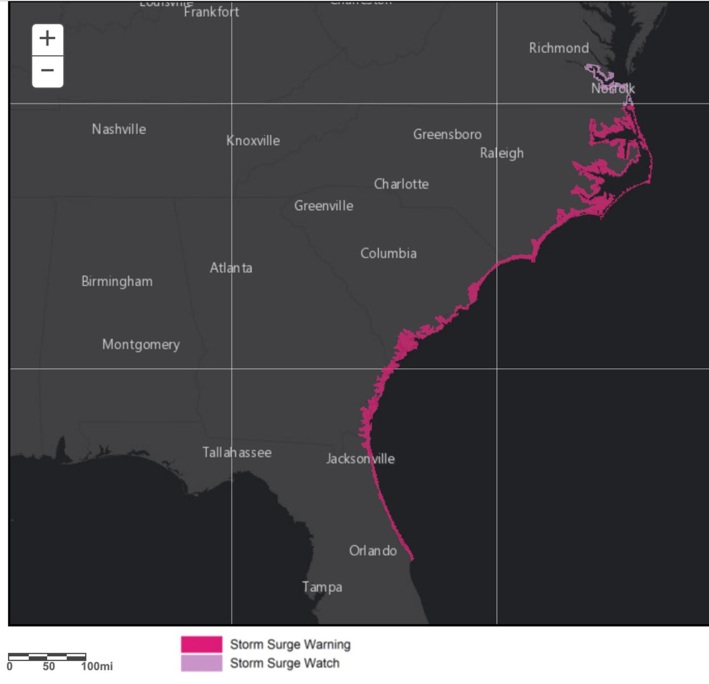
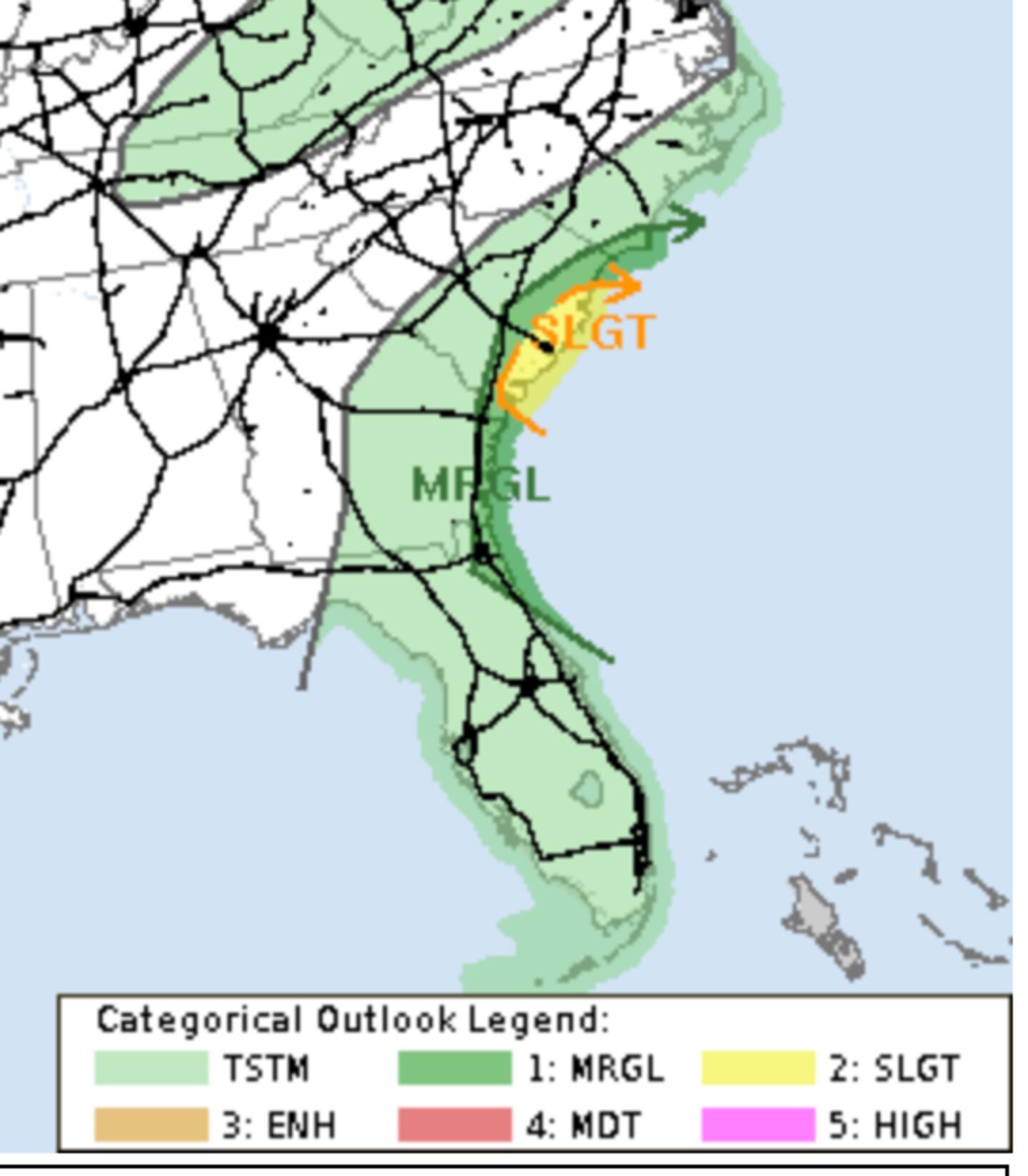
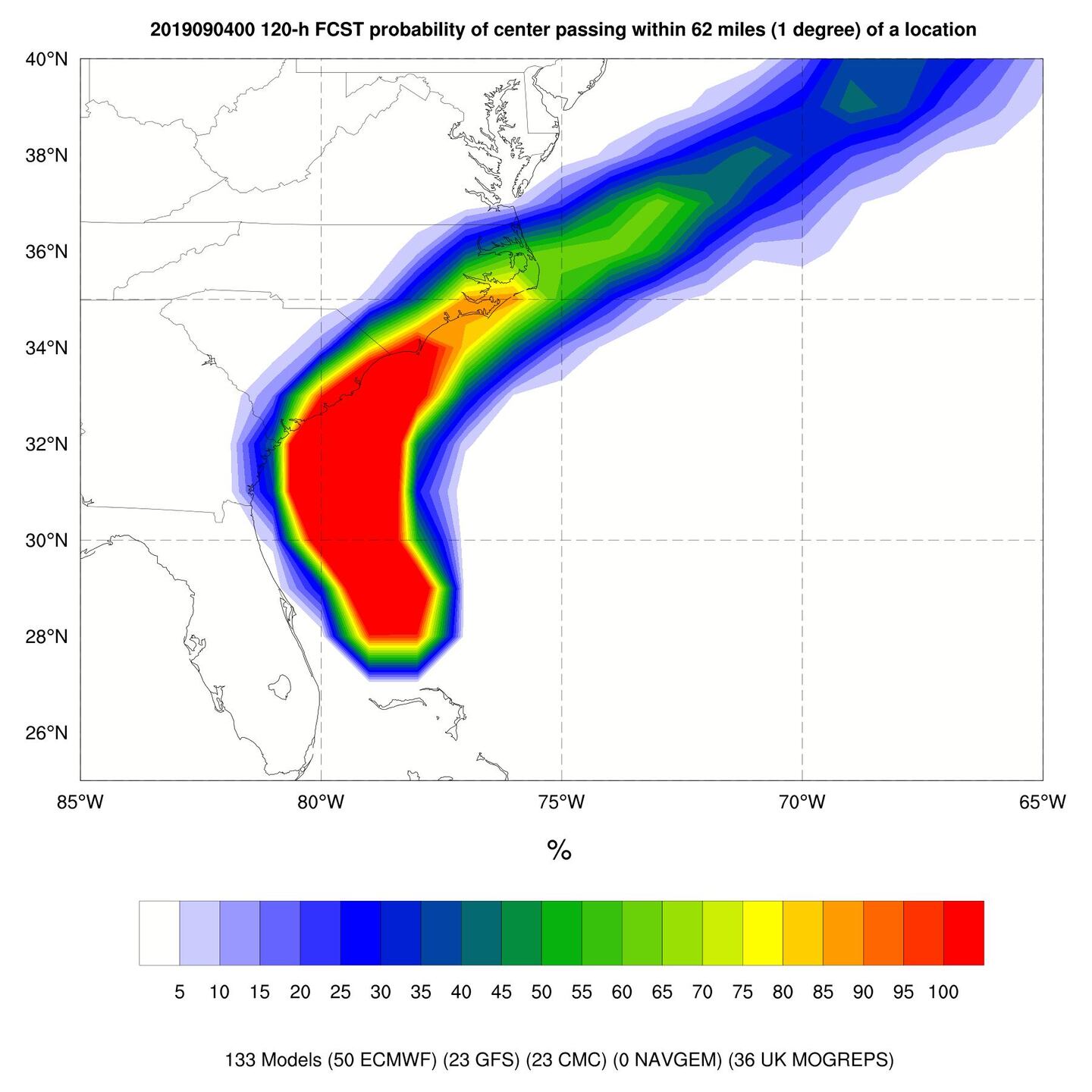
Heavy weather ahead for North Florida, SE Georgia and SC/NC with a close call for a landfall or brush with the mainland at the very least late Wednesday or Thursday, mainly Cape Lookout to Cape Hatteras as a Cat 1 or 2.
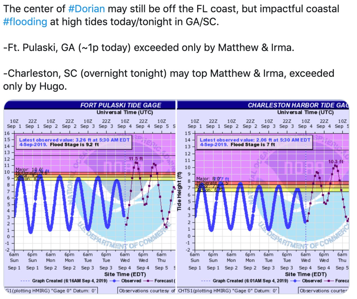
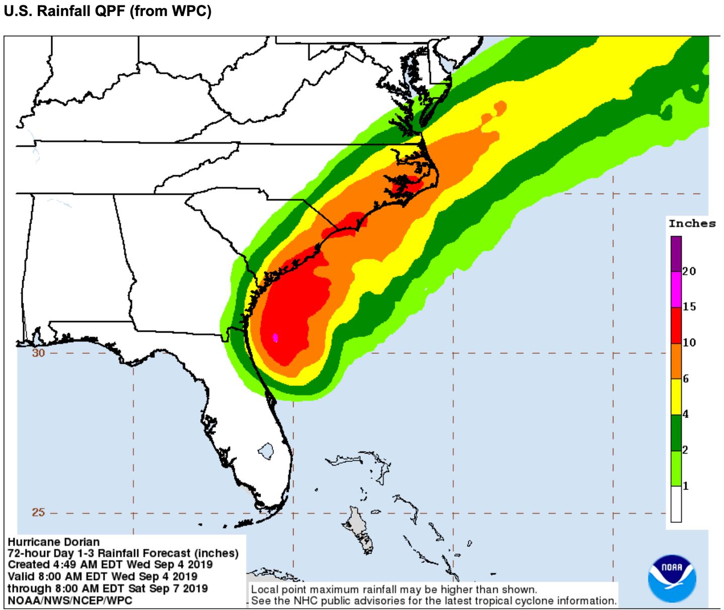
Regardless of exact tract as it wobbles N/NW the rainbands will continue to directly impact the Florida Coast, some strong this will be spreading to the Georgia and South Carolina coasts today and especially Wednesday night and early Thursday.
In addition to heavy rain the risk of isolated tornadoes will grow in the days ahead especially for the Carolinas.
The mid-level jet stream weakness between the two upper-level high pressure ridges I’ve talked about for a week is opening a lane for Dorian toward SC/NC with close proximity to Georgia.
Models continue to take baby steps slower and closer to the Coast as it gets farther North over time. The impact specifics will vary up to the last minute based on future forecast changes.

SEVERE WEATHER OUTLOOK TODAY/TOMORROW:

SCIENTIFIC DISCUSSION NHC:

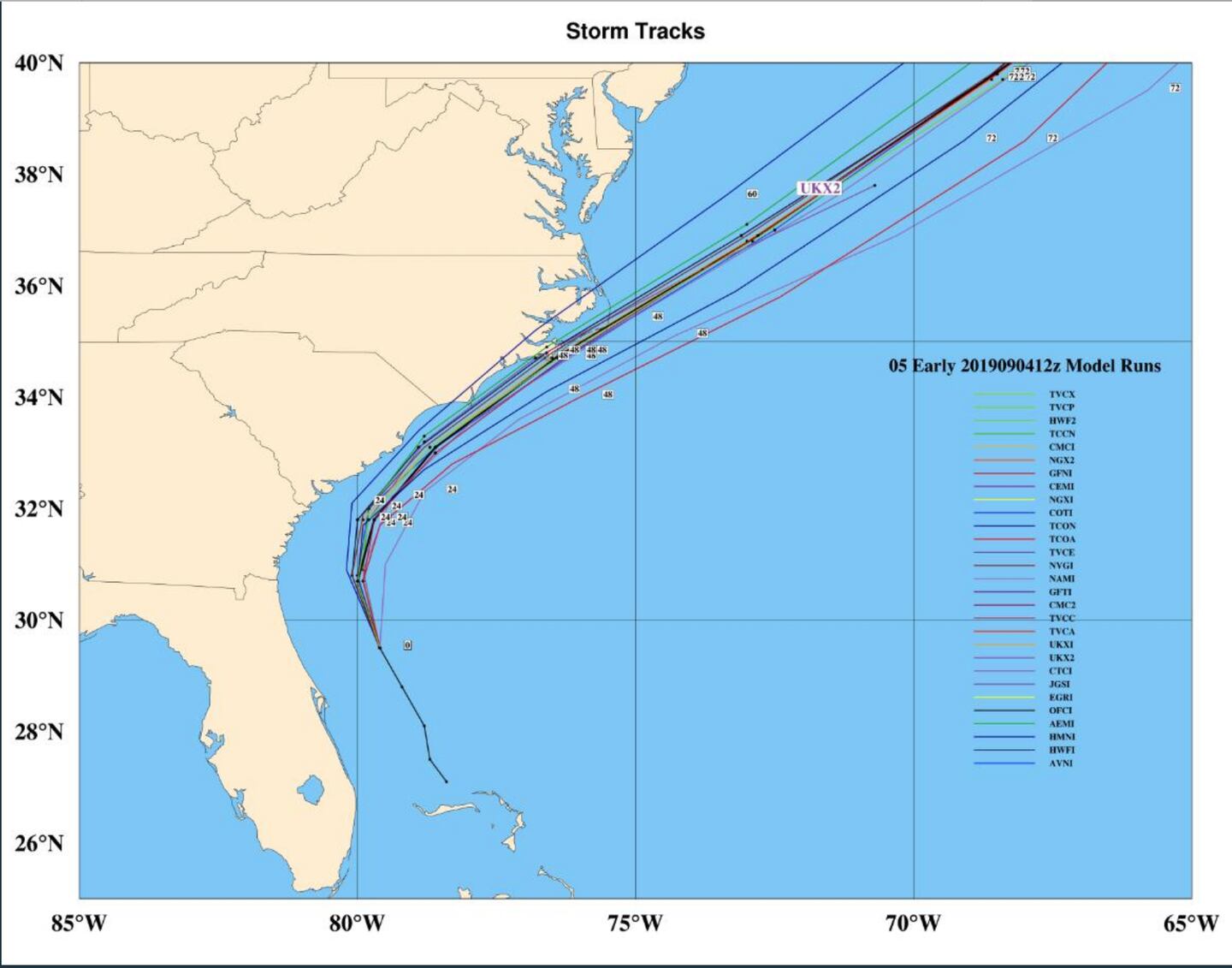
Notice how the spaghetti spread has narrowed because it’s logically easier to predict where something is going when it’s moving than when it’s not, that’s why the uncertainty in past days was much greater than normal: (StormVista)
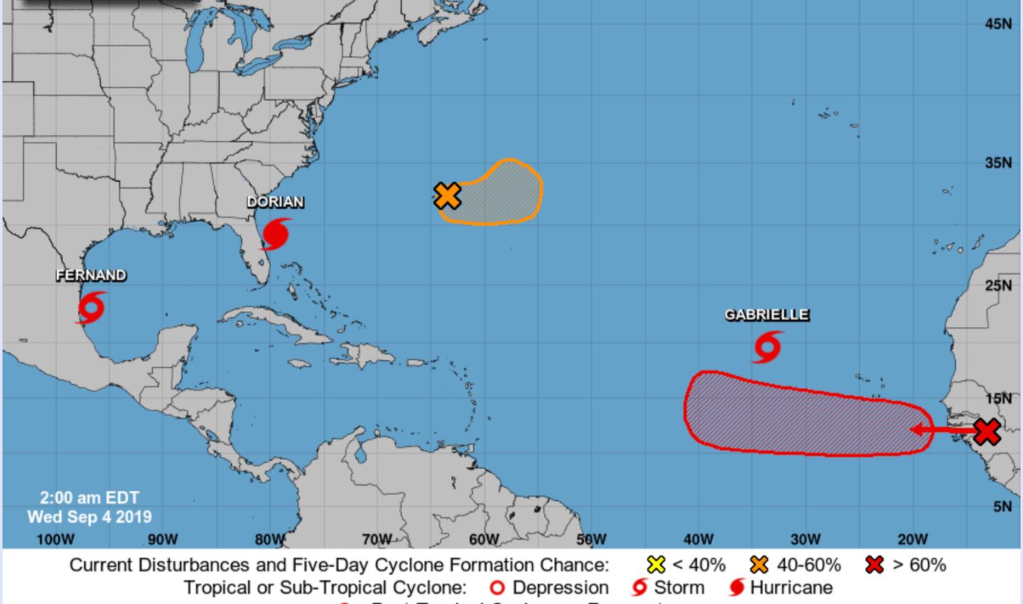
Meanwhile Dorian is not alone, here’s the 5-day Tropical Outlook:
If you have personal interests in coastal surge and waves use this tool to click and zoom on your point of concern. This tool is used by the Dept. of Homeland Security and in the White House Situation room.
For more frequent updates follow me on Twitter @MellishMeterWSB.


