

Dangerous Dorian remains a major threat to the Florida East Coast regardless of whether the eye moves inland or not. Just how bad it gets will depend on when and where the eye of the hurricane makes the expected turn to the North. The excruciatingly slow forward movement of the storm (almost at a standstill) is the reason for the remaining uncertainty, which should become more certain once we see the shift North get underway later today or tomorrow at the latest.
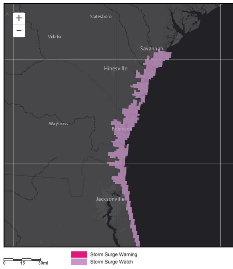
Tropical storm conditions are possible on the GEORGIA COAST and SOUTH CAROLINA COAST by Wednesday with hurricane conditions not out of the question.
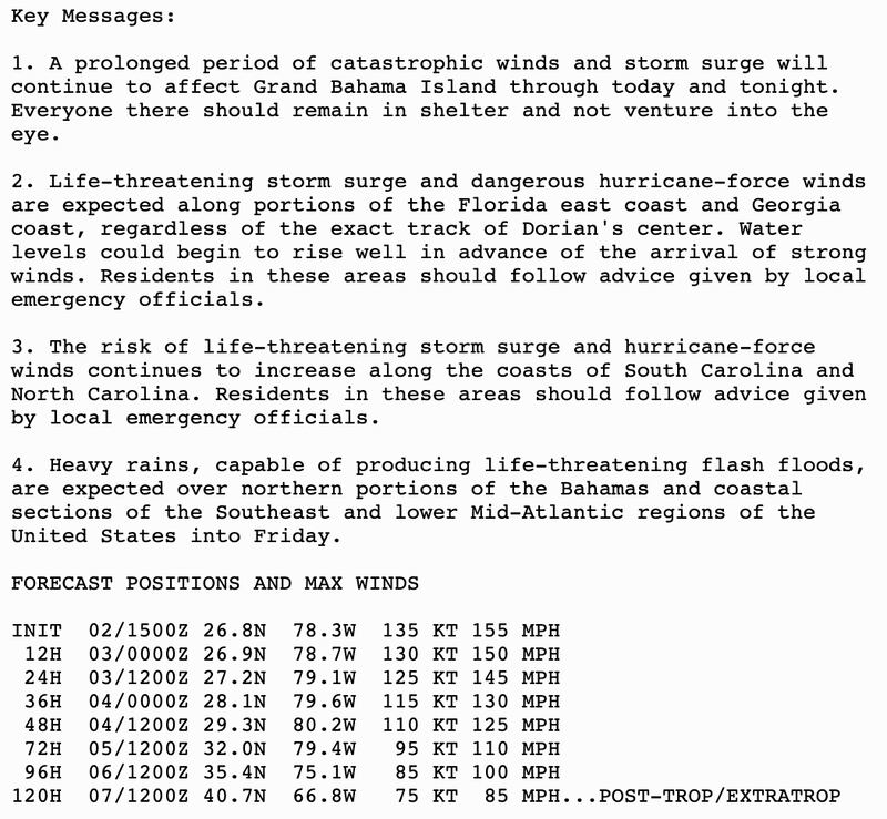
Dorian is expected to continue as a MAJOR HURRICANE the next three days as the eye of the storm moves to East of Savannah by Thursday weakening to a CATEGORY 2 OR 3 as it makes landfall on the coast of North Carolina by Friday heading out to sea Saturday.
It will only take A SLIGHT DEVIATION LEFT OR RIGHT for conditions to be much worse anywhere from North Carolina South through Florida.
The margin is razor thin between millions being hit or millions being missed by the worst.
The storm is not really weaker than 24 hours ago its energy is just spreading out over a wider area.
NO impact expected for ATLANTA as of now except maybe some adiabatic compression heating (dynamic or Katabatic) to keep the unseasonably hot weather going with downward sinking air currents aided by the upper outflow off the hurricane.


For updates follow me on Twitter @MellishMeterWSB.


