The atmosphere across the Northern Hemisphere is one big interconnected system, so it stands to reason what happens in one area can and often does impact what happens elsewhere. First the typhoon pattern signals the heat, then signals the cool off.
Old time forecasters learned to use these teleconnection signals to predict the weather BEFORE computer models became what they are today. Those who learned those tricks of the trade can still use those old timely methods to look at the 6-10 and 10-16 day patterns... ahead of the models for an early heads up of what the models will probably eventually show later. We can also use them to “cross check” the models to see if they have internal consistency with what they are showing and correct them if the answer is no.
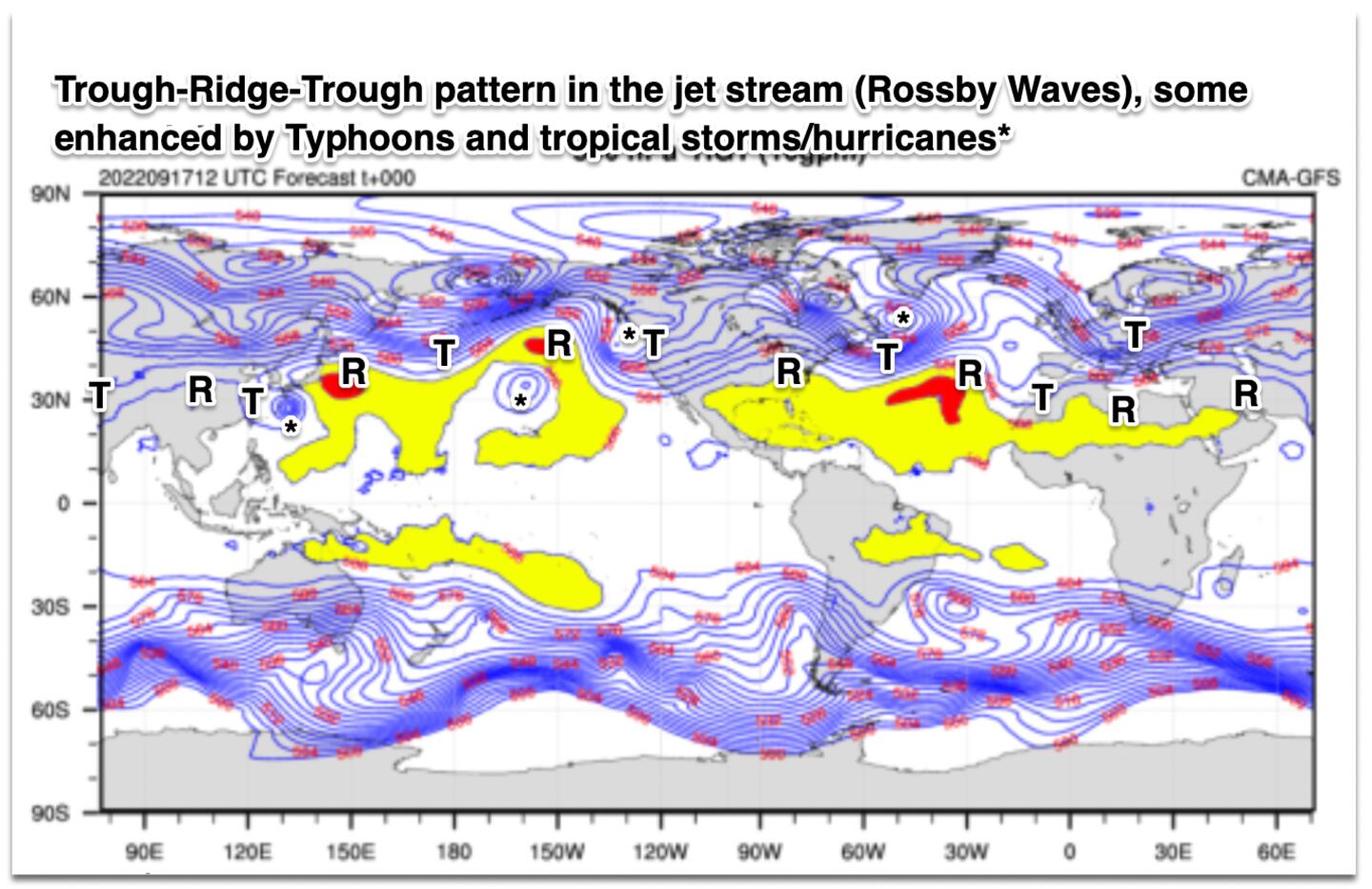
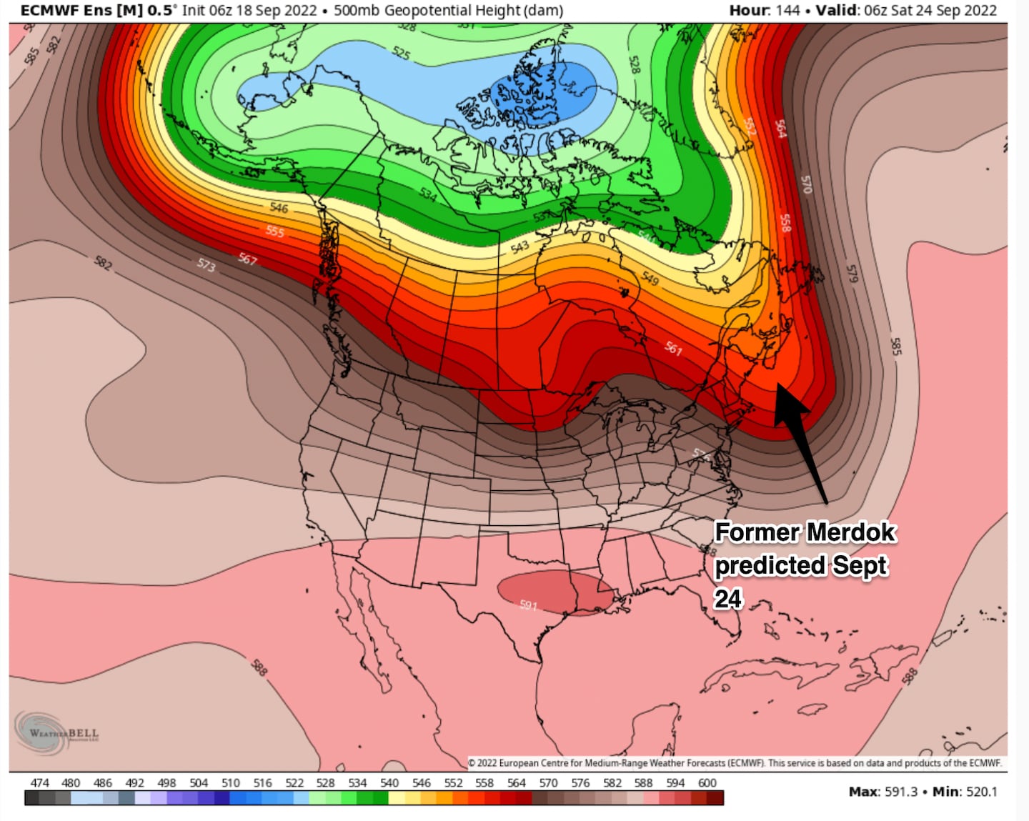
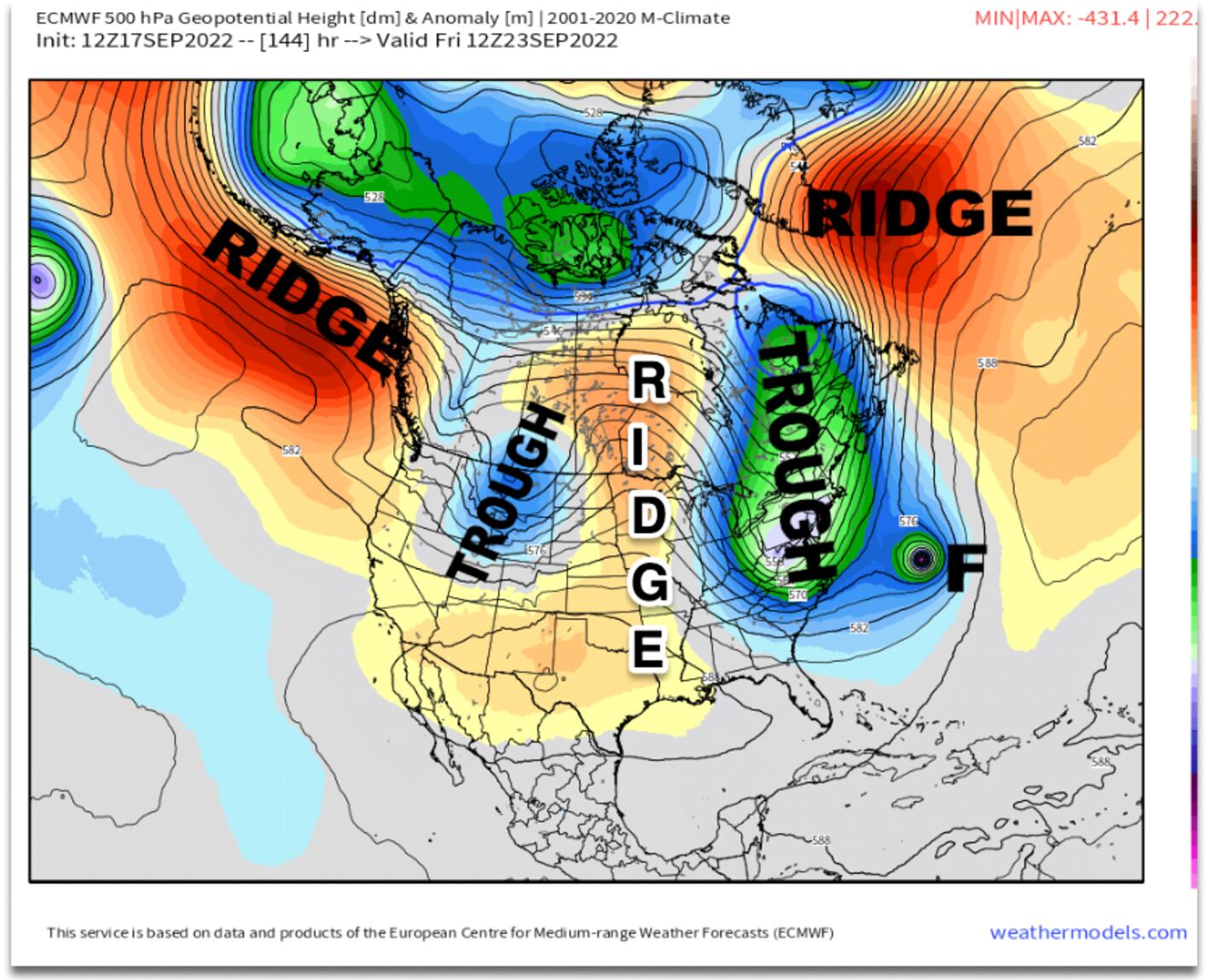
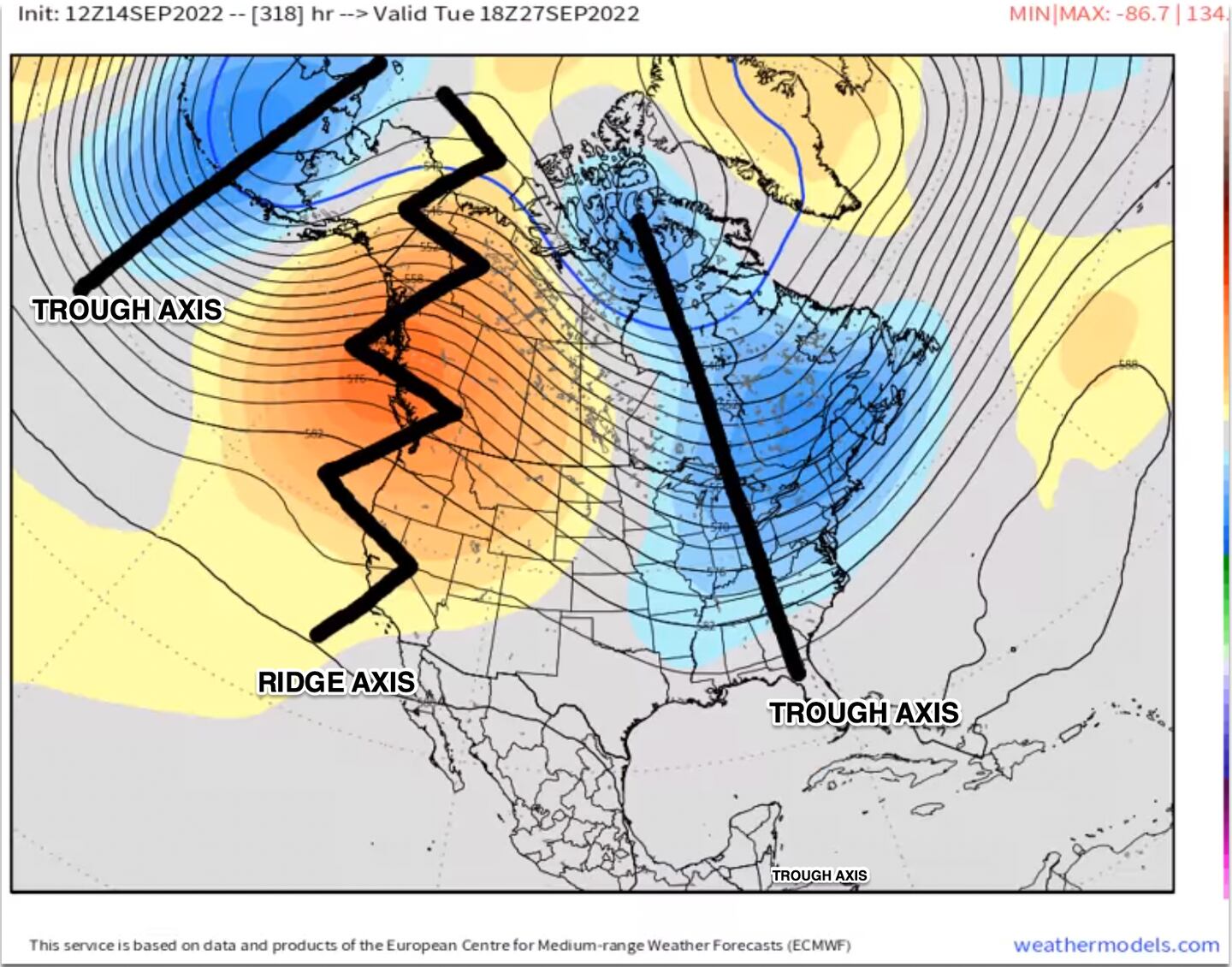
The interconnectedness of the weather/jet can be seen here in the big view of the jet stream across our hemisphere. The map shows the Rossby “long-waves” in the jet stream or the (T)rough and (R)idge pattern:
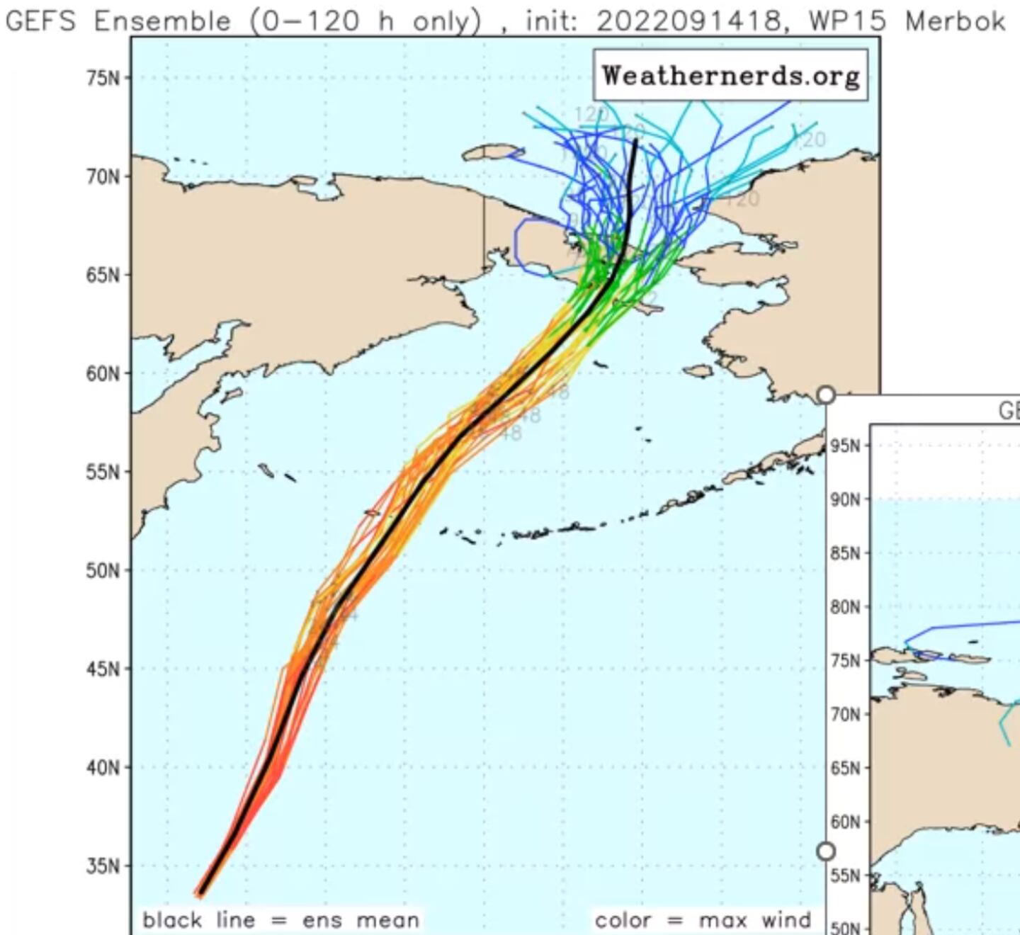
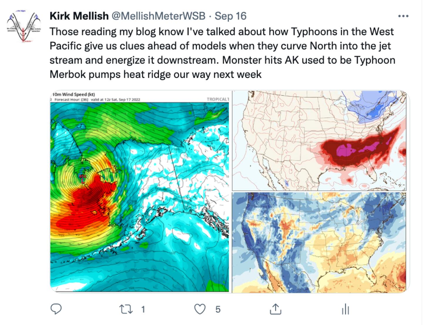
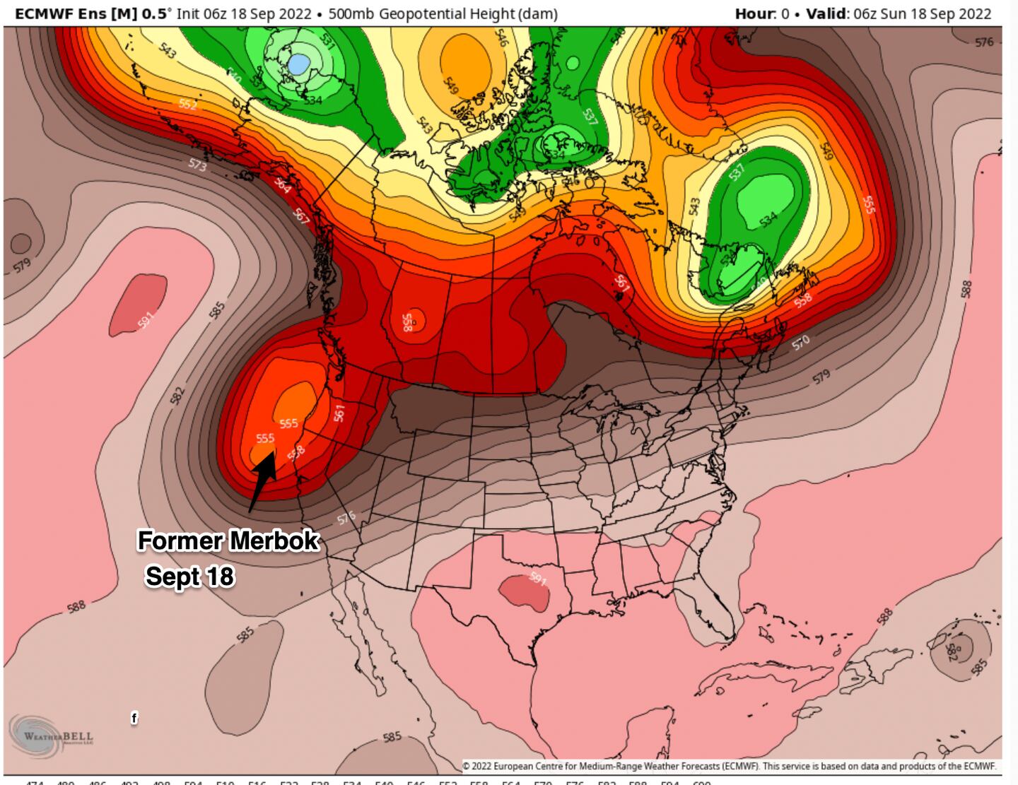
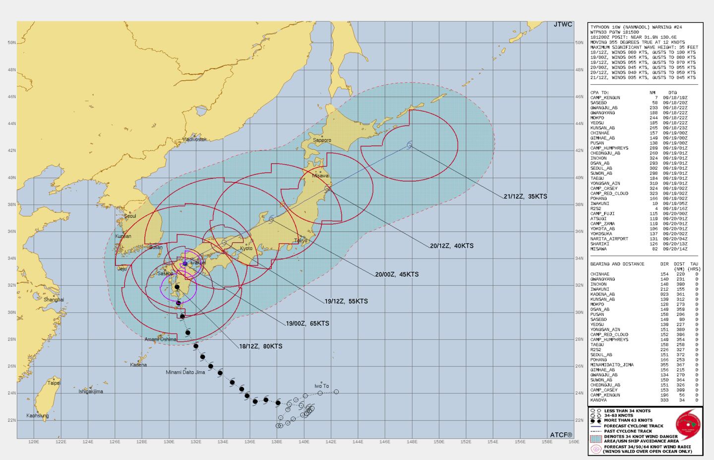
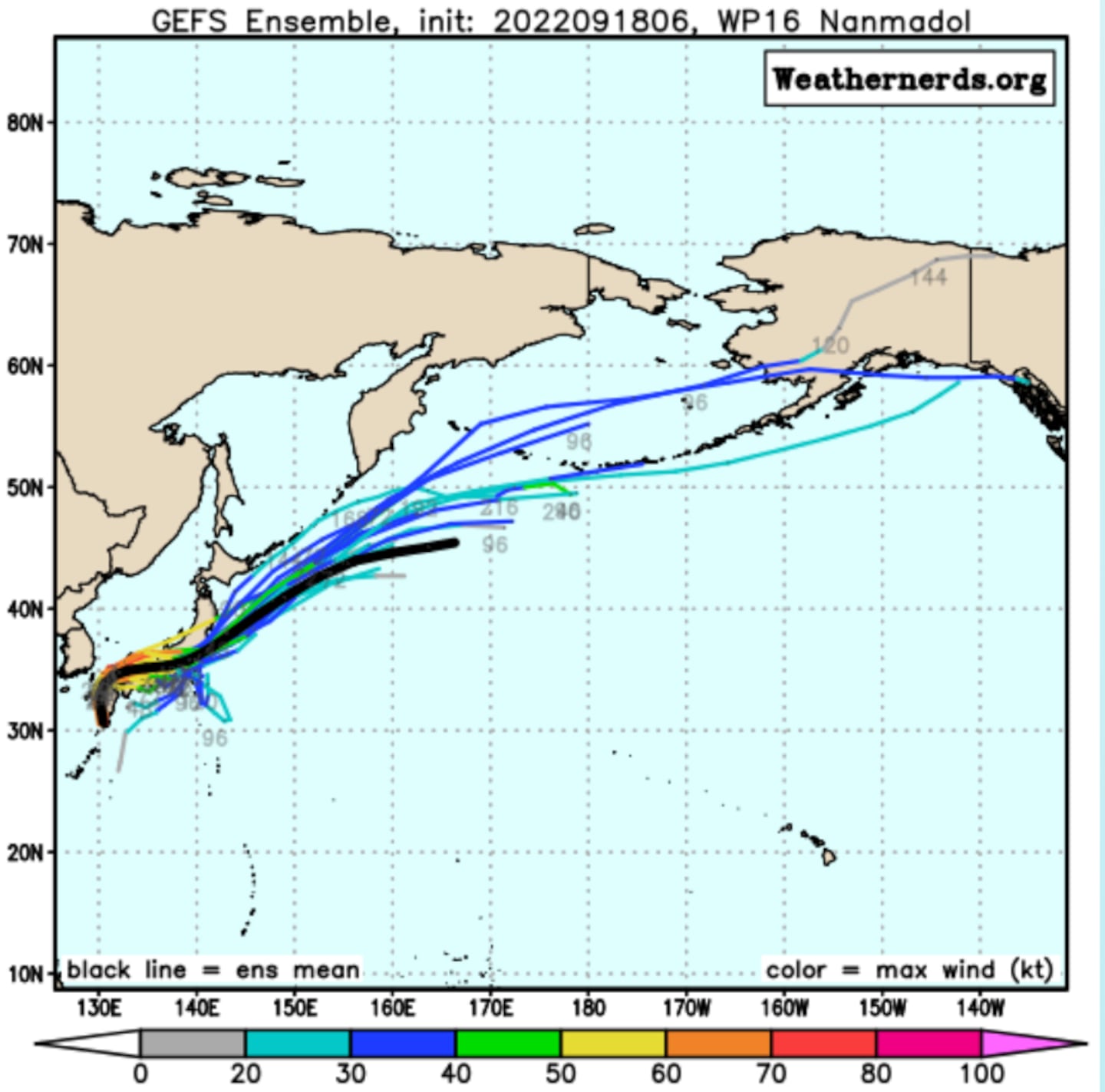
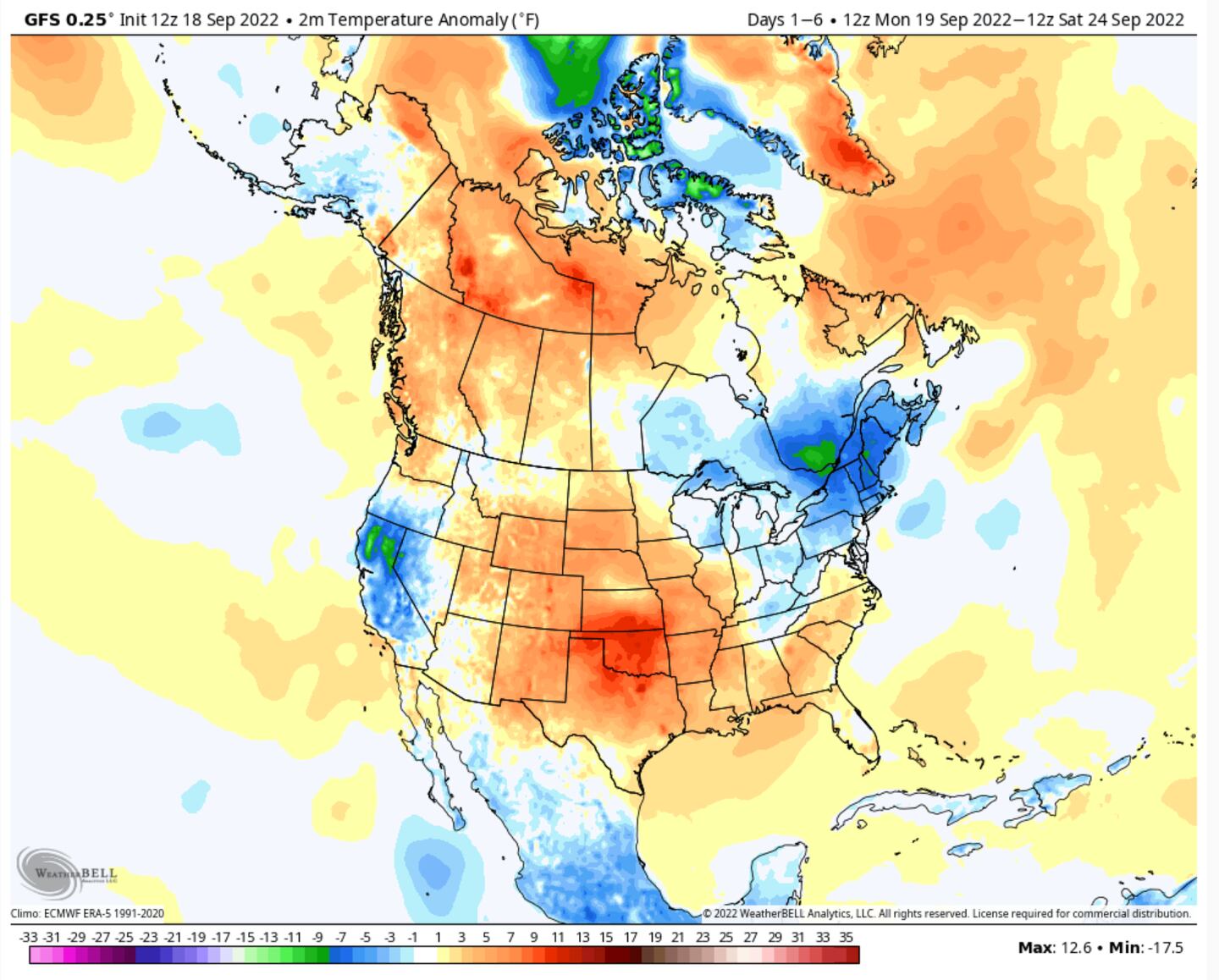
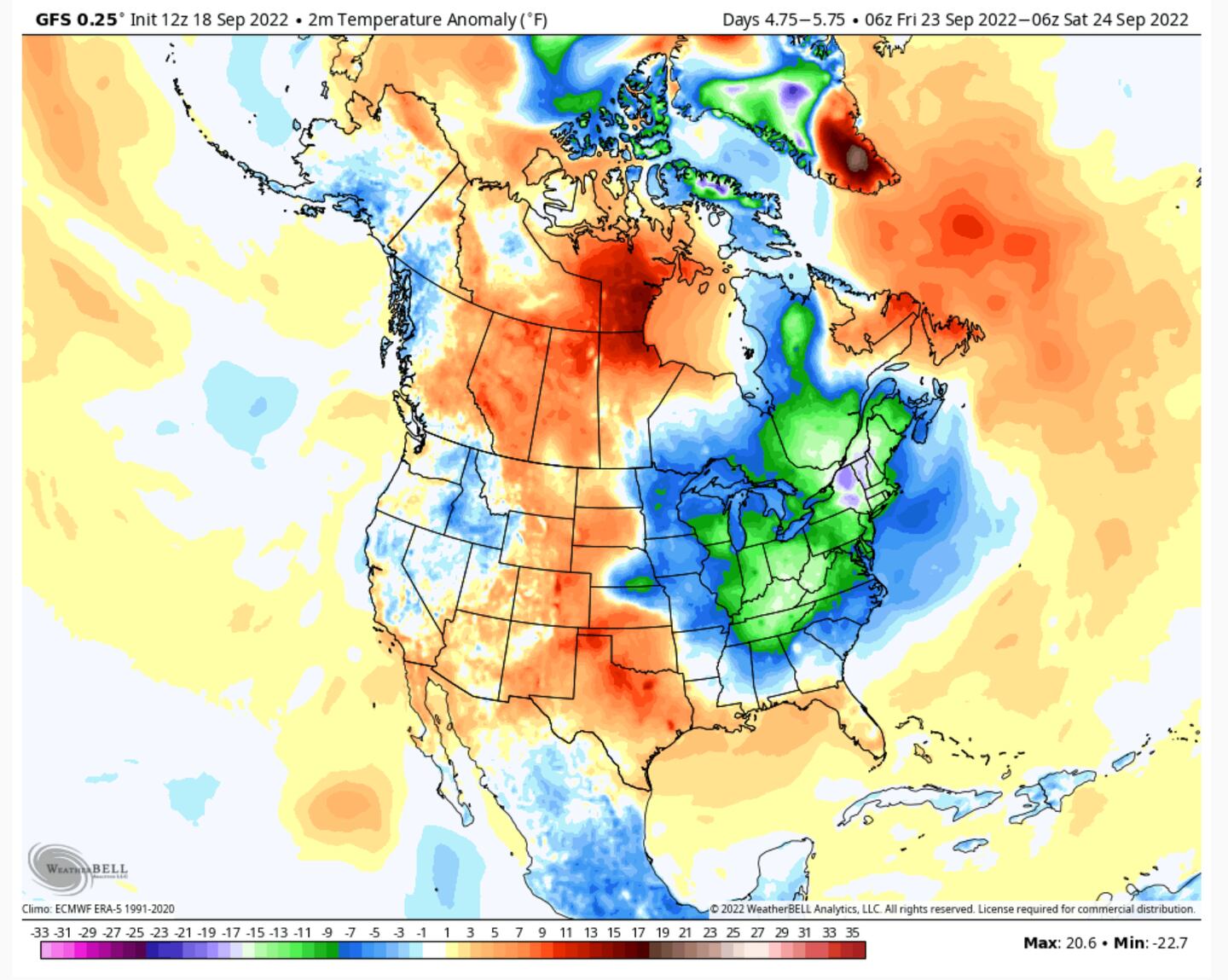
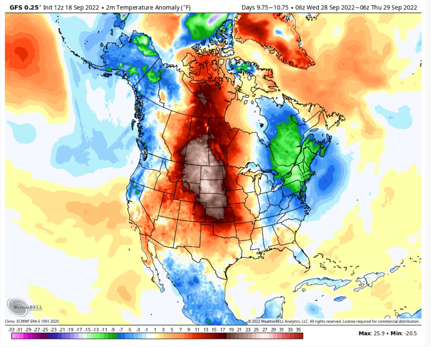
First what was once TYPHOON MERBOK helps pump up a heat ridge/dome over the U.S. but then as it’s remnants continue to progress Eastward it is followed by yet another recurving TYPHOON NANMADOL helps pump up another strong ridge heat dome (+PNA) out West which in turn forces downstream troughing by the end of the month/early October and all of this translates into temperature roller coaster for the Eastern U.S. rest of this month into next month.
From the West Pacific to the Alaska to Northern California to SE Canada and New England
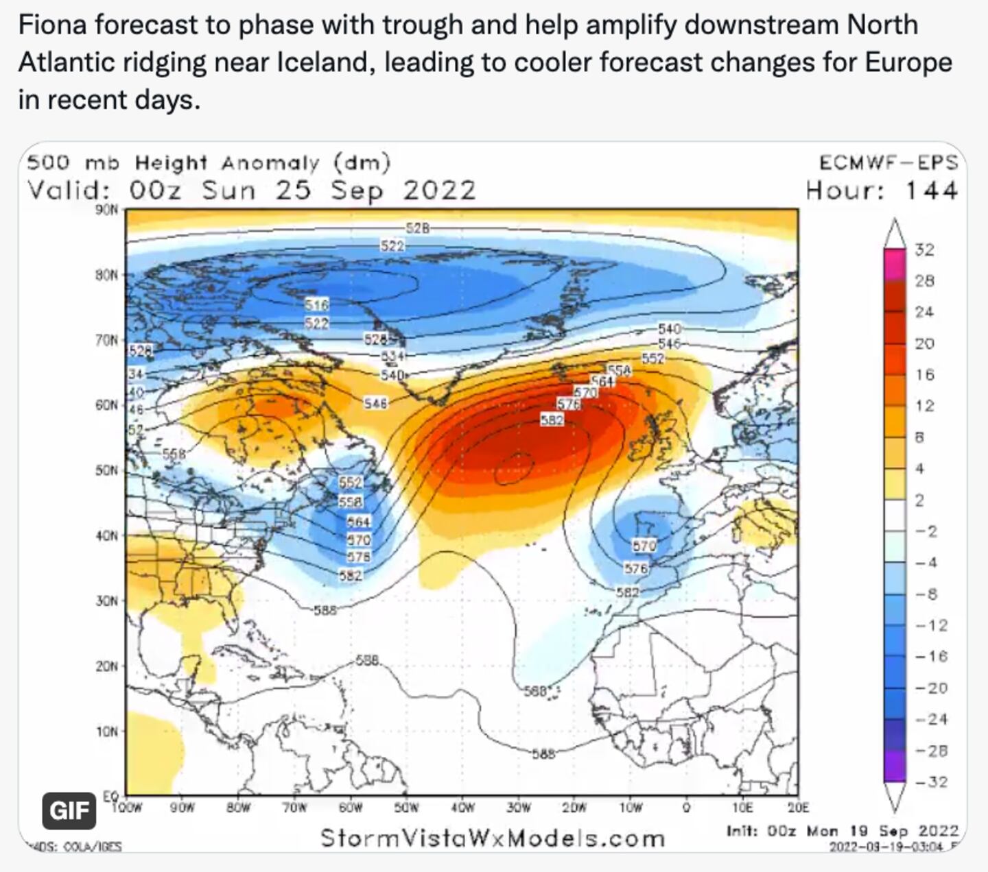
AND YES IT ALSO HAPPENS IN THE ATLANTIC:
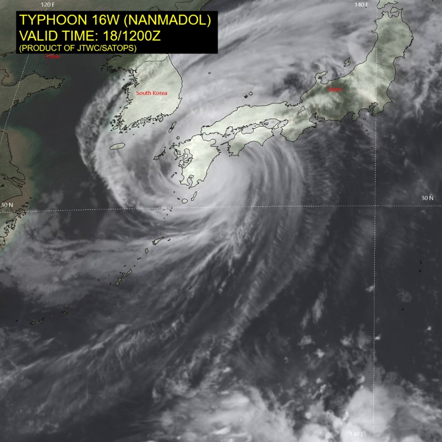
AND NEXT UP, YET ANOTHER PACIFIC ONE!
So in short when West Pacific Typhoons recurve they reorient the jet stream popping ridges over the Western U.S. and troughs over the East or Northeast U.S.
This results in a major amplification of the jet stream pattern across North America because of the big typhoon hitting Japan now, this results in a big trough in the jet stream over the Eastern part of the country to end September ushering in a big taste of autumn air especially to our North as it sends a solid Canadian Cold Front South and East. The JAPAN Typhoon heads North into the jet stream Sept 19/20 and beyond with downstream impacts on the Pacific North America pattern (PNA) pumping up a ridge out West with a compensatory trough East:
AND SO WE SHOULD SEE TEMPS VACILLATE AND ALTERNATE FROM ABOVE-NORMAL BACK DOWN TO NEAR NORMAL OR BELOW-NORMAL AND THEN BACK TO WARMER THAN NORMAL OVER THE NEXT 2-3 WEEKS RINSE AND REPEAT INTO NEXT MONTH.
The models will often underestimate the strength of such fronts and thus temps until closer to the actual days in question.
Some early frost risks for the Great Lakes and New England but not expected here as of now. A couple temp drops expected here over the course of the next 2-3 weeks but nothing too dramatic for us expected so far.
For more frequent weather commentary follow me on TWITTER @MellishMeterWSB.
©2022 Cox Media Group
