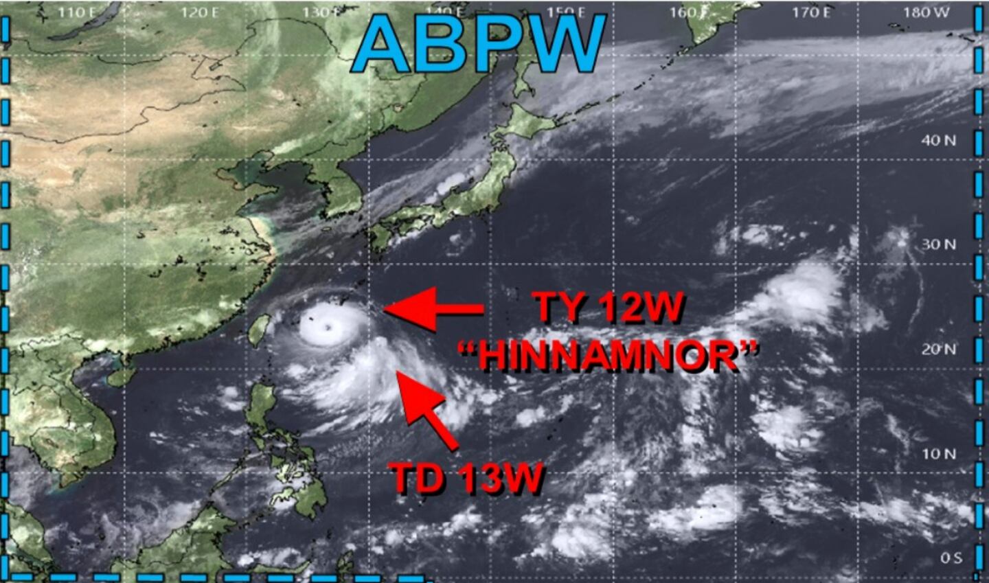
Roughly 80% of the time typhoon action in the Pacific Ocean in the area of China, Korea, Japan will impact the jet stream over North America a couple weeks later.
In case you’ve forgotten high school geography class a reminder that hurricanes, typhoons, and cyclones are all different names for the same type of storm. The storms that rage across the western Pacific Ocean (in the Eastern Hemisphere) are called typhoons, while the ones spawned in the Atlantic and eastern Pacific (the Western Hemisphere) are called hurricanes.
Long before the advent of computers for weather forecasting, meteorologists developed many methods for forecasting based on rules of thumb that came from real world observations. These are often called teleconnections.
I’ve blogged and tweeted hundreds of times about these over the years.
Because the weather across the Northern Hemisphere is all interconnected as the jet stream circles the globe what happens far away can impact our weather here, and we can use those signals or teleconnections to make a forecast without consulting the computers, we can also use those signals to check to see if what the models show for Georgia make sense (are internally consistent) or not, and adjust the model forecast accordingly.
These are old school “tricks of the trade” they stopped teaching long ago sadly.
These tropical cyclones in the Pacific inject extra “juice” into the jet stream and “super-charge” it with extra energy altering the strength of the jet stream and impacting the waveguide pattern downstream for thousands of miles and many weeks altering the shape of ridges and troughs and the wind speeds aloft.
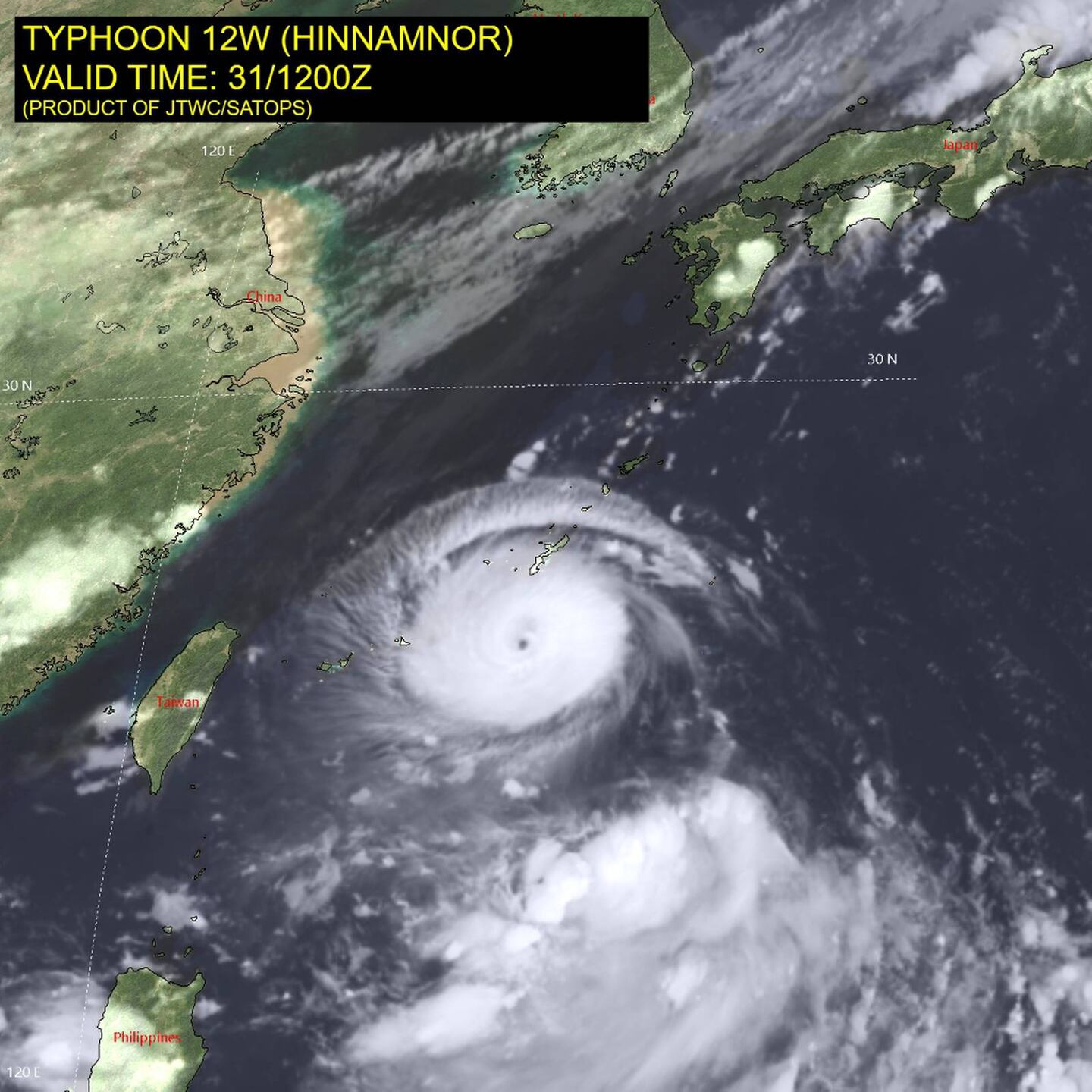
Here is a current and ongoing example related to the outlook for early September based on strong typhoon Hinnamnor:
Where it goes will impact the global jet stream and the weather downstream including across the United States in the weeks ahead.
As of this writing Hinnamnor is expected to stall or move very slowly South of Korea this week, but data agrees it eventually recurves Northward toward Korea early next week. Using the rule of thumb correlation this gives advice on the medium to long range outlook for periods of 6-10 and 10-15 days in the future:
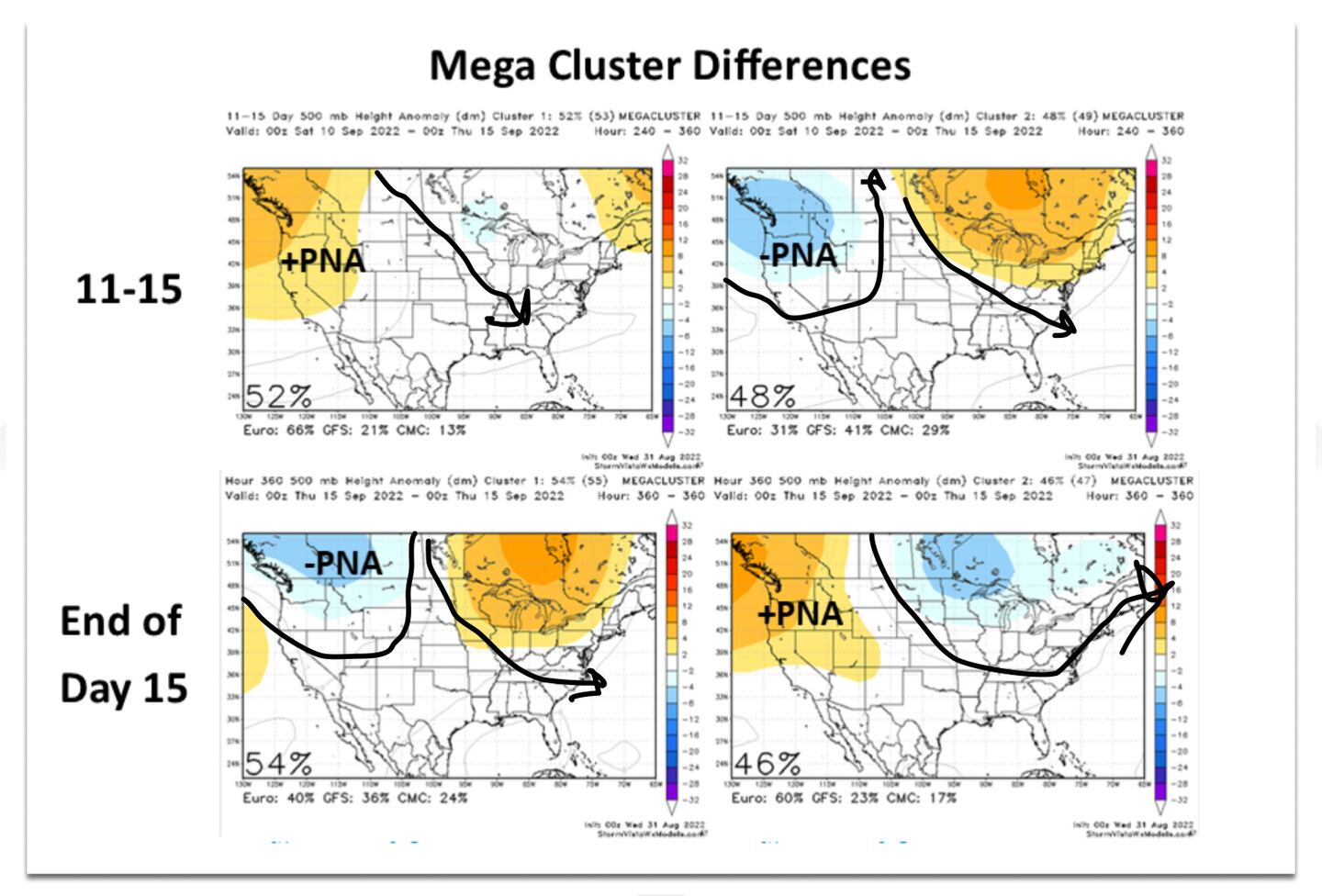
So this indicates 500mb jet stream ridging for the U.S. near-term especially Western and Northern U.S. (orange colors), but the recurve later suggests that pattern would be followed by an Eastern U.S. trough (blue shades) later on as indicated in the maps above, this would shift any warm-up back to another cool down in the East later.
The question of curve or no curve introduces big question marks for the extended range U.S. forecast thanks to the related pattern chaos introducing added uncertainty. The exact behavior of this system will have a great impact on the U.S. pattern for mid-September thanks to the tropical forcing as even small changes can have big implications. If it fails to recurve then the risk is for warmer mid-September weather for much of the country instead of cooler.
Models struggle with downstream pattern in the extended range when they are uncertain of the typhoons future track, breaking down the options into groups or clusters based on where the typhoon ends up going:
In this specific case the greatest impact from the typhoon will be to our North, in our region the next 2-4 weeks are expected to have temperatures running near-normal to below-normal on average (not every day) with rainfall above-normal on average (not every day). A continuation of what we’ve experienced on average during much of August!
For more frequent weather info follow me on Twitter @MellishMeterWSB.
©2022 Cox Media Group


