
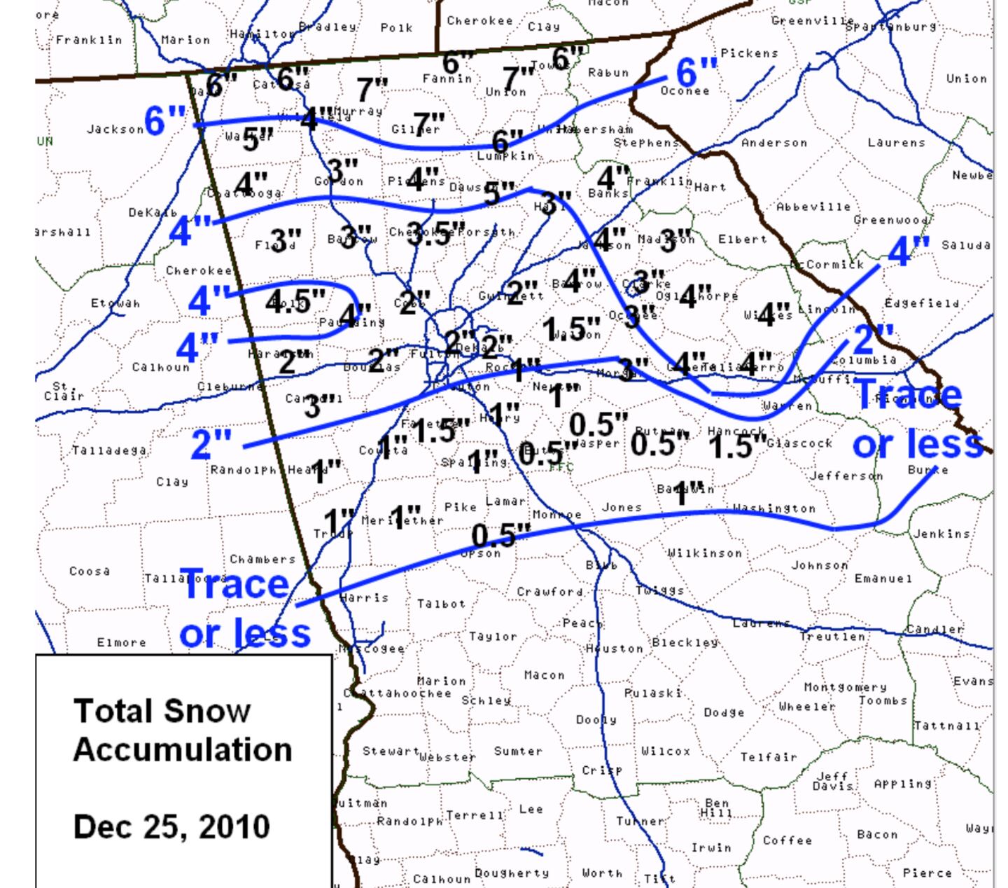
Despite the "Black Swan Event" snow last December in the NW suburbs, and even a White Christmas in 2010 when the
Atlanta Metro area saw between 1-3 inches - the first measurable snow on Christmas Day since 1881, snow is very rare in Georgia in December.
The more common months for it to occur are January-March. I’ve lived here for over 3 decades and over that time there have been more winters with no snow or just a tease than winters with significant snow.
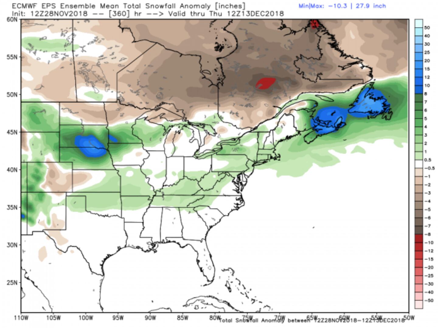
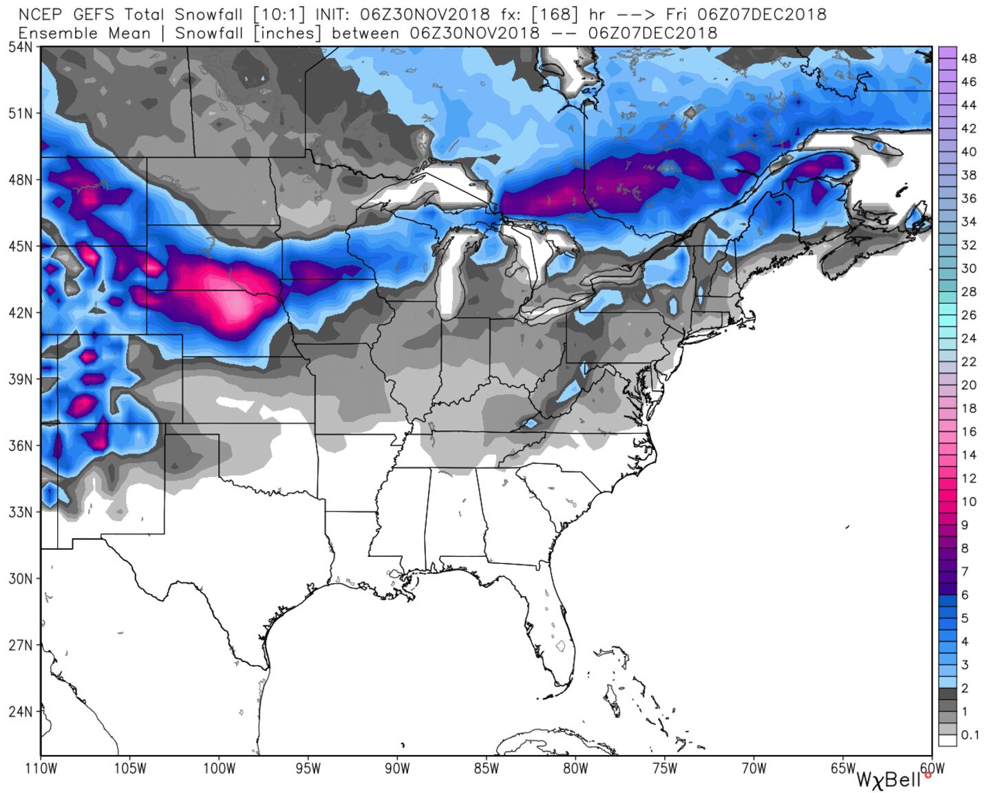
The map above is the American GFS Ensemble snow forecast to December 7th. The map below is the European Ensemble model snowfall anomaly forecast to December 13th showing in green where snow amounts are projected above-normal (it looks right to me):
You already knew if you read previous blogs and tweets that the pattern was trying to be favorable even in the South through the first part of December. But it still looks to me like the most favorable area will stay North of Georgia for at least the next 7 days or so.
GFS ENSEMBLE MODEL SNOW TO DECEMBER 7TH:
ECMWF ENSEMBLE SNOW TO DECEMBER 12TH:

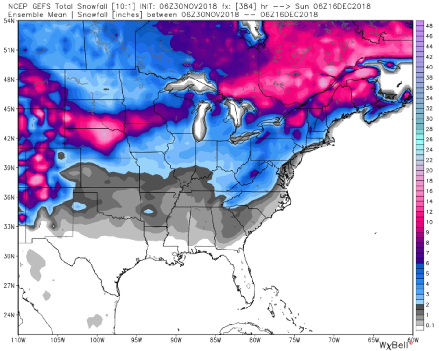
GFS ENSEMBLE SNOW ENDING DECEMBER 16TH:
ECMWF 6-WEEK ENSEMBLE SNOWFALL OUTPUT:
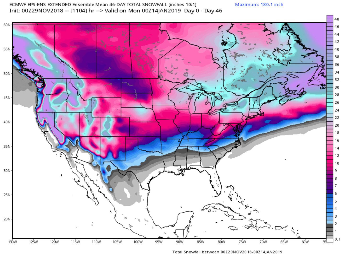
I am NOT forecasting the snow shown in these models as I currently have good reason to doubt them, doesn't meant it can't happen but long time followers know I do not like to be a fear-monger or a rumor starter when it comes to snow and ice just to get attention. Models are a tool but just one tool and I practice METEOROLOGY not MODELOLOGY.
So I DO NOT see snow for Atlanta and probably not for all of Georgia through at least December 7th. Beyond that is more uncertain but I do not buy the model output as of now.
This *potential* has been on my radar (pun intended) for a long while now, here is the email I sent to my bosses November 16th as a behind the scenes heads up for planning just in case:
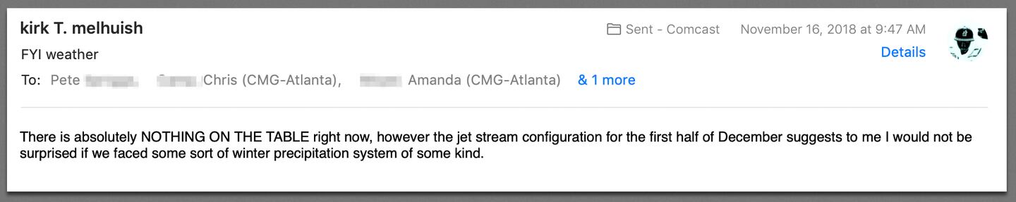
However, with a split-flow jet stream pattern expected to develop there is some potential for ice or snow but there is NO storm to track at this time.
IF it gets to the point I think there’s a realistic chance I will blog about it.
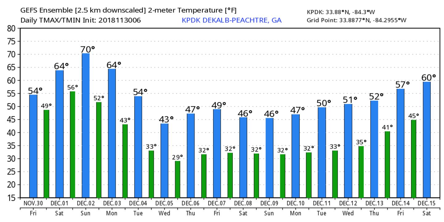
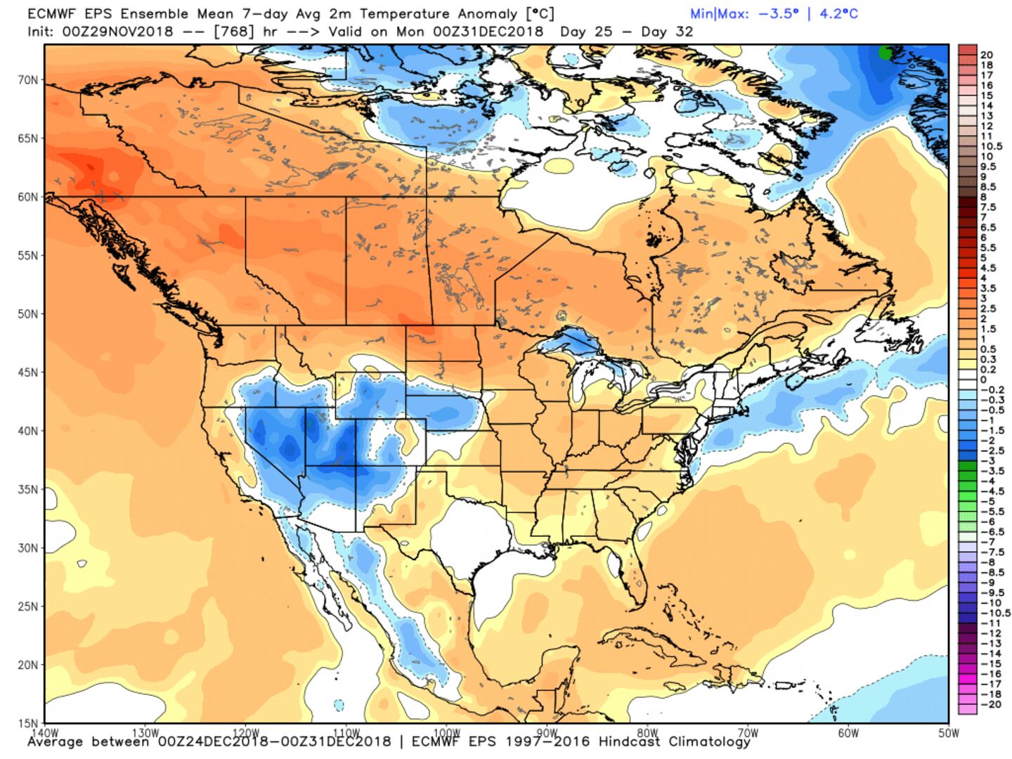
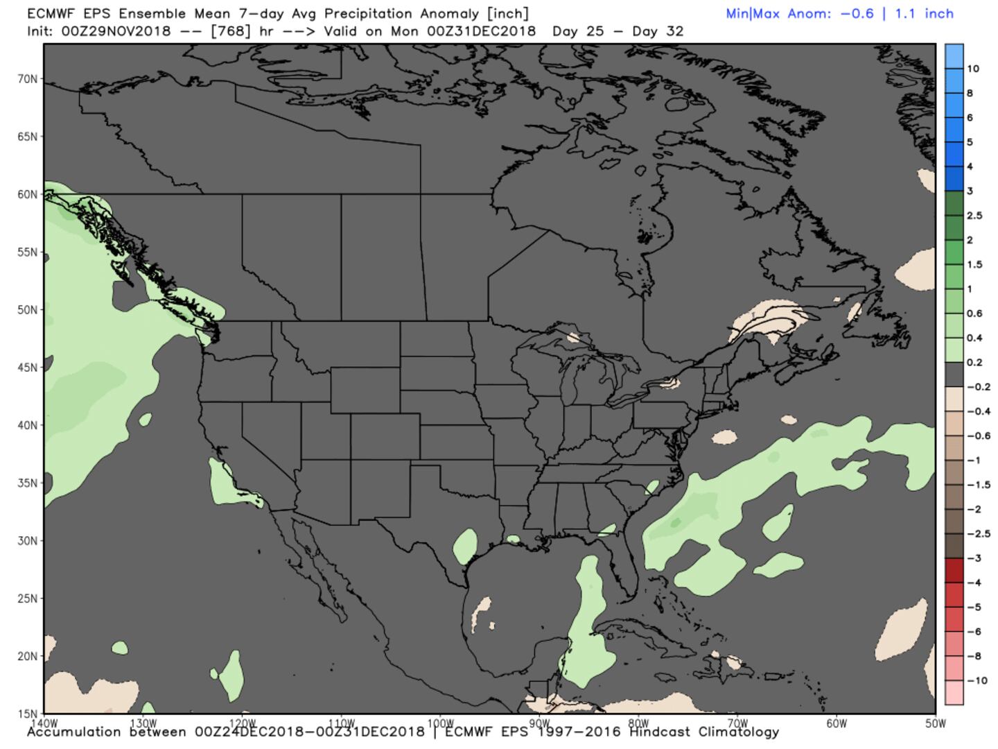
Below is the 15 day temperature guidance from both the GFS and ECMWF ensembles:
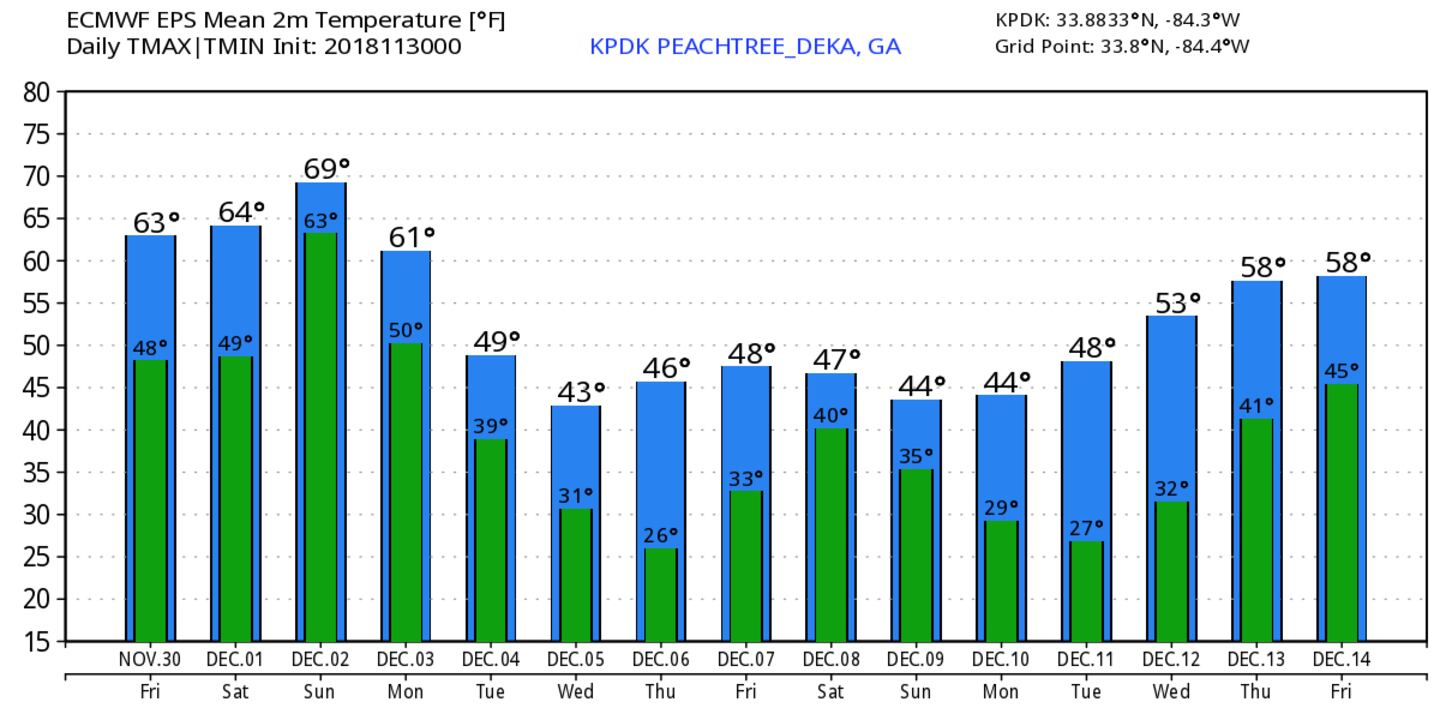
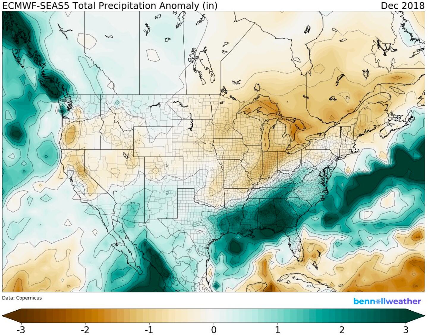
Some discrepancy in the ECMWF climate model and ensemble for DECEMBER:
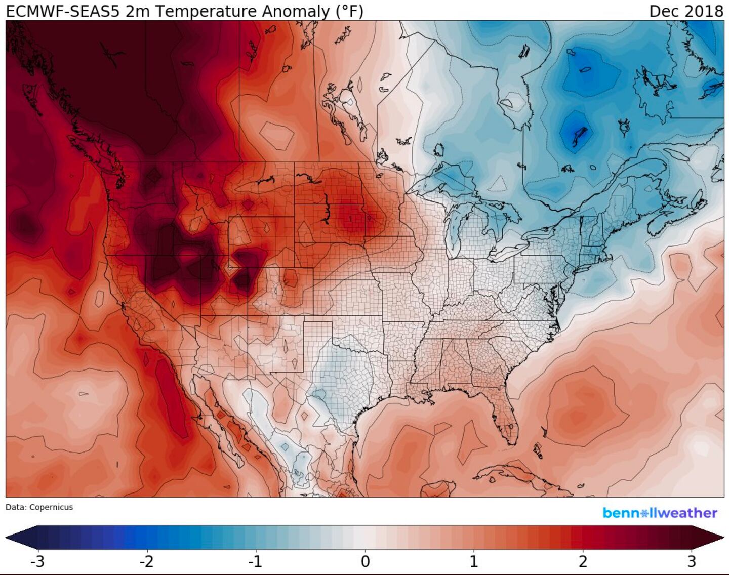
Based on research and analogs on things like Stratospheric polar vortex disruption (weakening then restrengthening), Mountain-torque changes to global angular momentum, and a wave-train in the Pacific jet stream extension it looks like a milder period will return for mid December after a cold start, then it may end turning colder again into January.
“I am dreaming of a White Christmas, just like the ones I almost never know”
For more follow me on Twitter @MellishMeterWSB.


