
The above estimated rain amount chart is between 8am Sunday and 8am Tuesday, so clearly the Labor Day direction that is safest from rain is plans that involve going West and North NOT to Florida OR coastal areas thanks to a front and the Tropical system named Dorian.
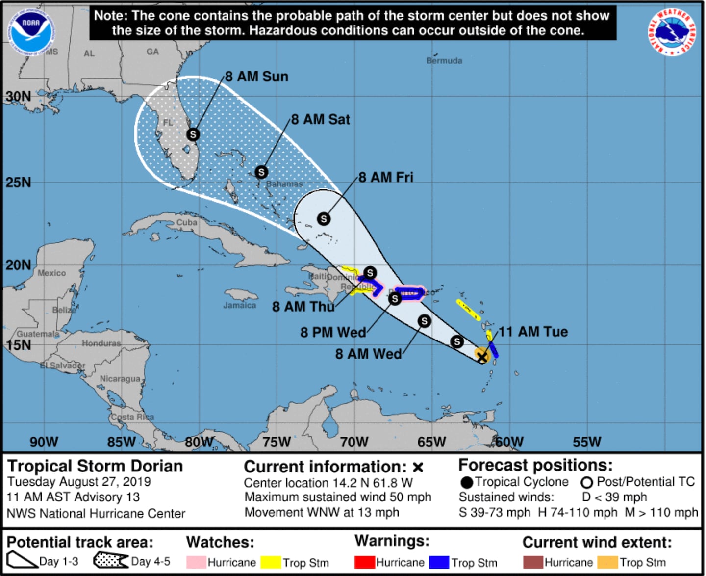
While the National Hurricane Center does not currently have Dorian becoming a Hurricane that could easily change at any time as it is a small compact storm with lots of complexity and the difference between a minimal hurricane and a strong tropical storm is negligible anyway.
For Atlanta no worries from Dorian for at least the next 5/6 days but beyond that all bets are off.
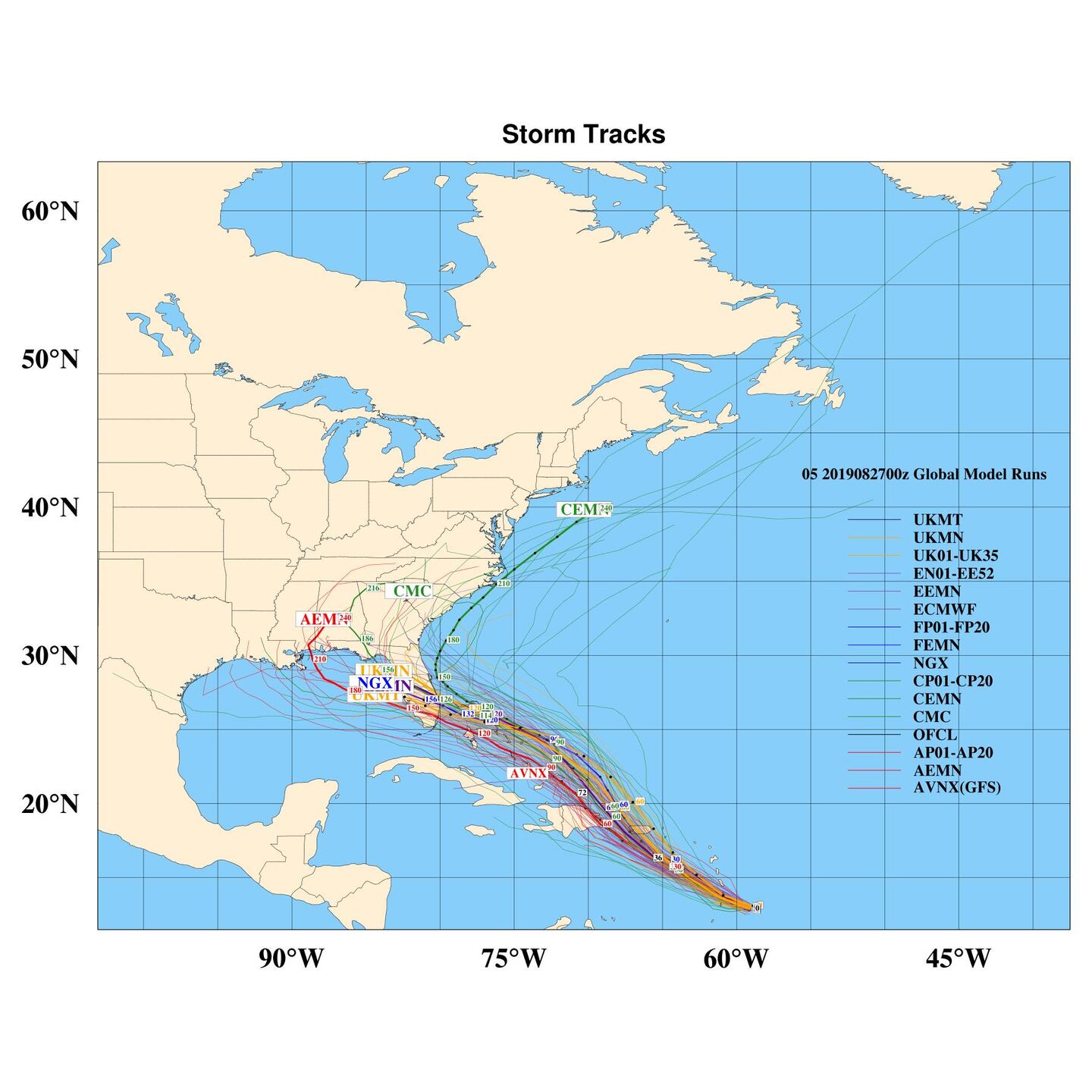
Model Tracks via StormVista next 5 days:
Model data still suggest hurricane strength could be obtained. Confidence of impacts on Florida this weekend continue to grow along with threat SOMEWHERE in the Gulf of Mexico in the longer term.
A compact storm like Dorian has to thread the needle through the Caribbean Islands to not be destroyed by them, also some dry air and wind shear disruption are possible, hence to say this is a tough forecast is an understatement. Even IF it eventually fizzles it could still cause devastating flooding to the islands and/or somewhere in the U.S.
The odds of it falling apart from island mountain disruption or regenerating to a hurricane with a second or even third landfall in the U.S. are equal.
(first landfall possible one or more of the islands, 2nd possible for Florida, 3rd Gulf Coast somewhere).
Most global models keep it a Tropical Storm as it approaches Florida BUT I remind you that intensity forecasting has much less accuracy compared to track predictions.
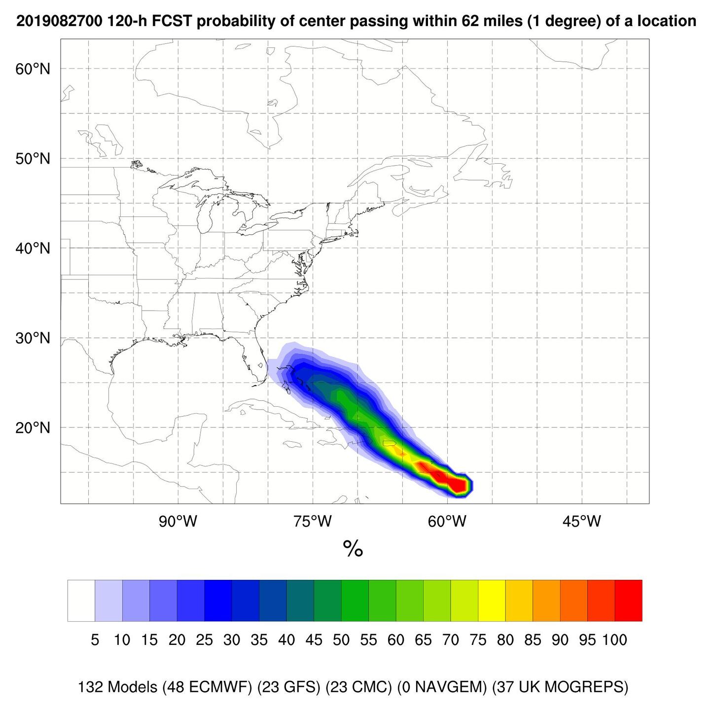
Also bear in mind that the 5-day (120 hour) forecast error on average is a bit over 200 miles on the center track location! Therefore it's silly to lock in on any specific forecast for any specific location this soon. Especially with a small system like Dorian the track error could well be greater than the average.
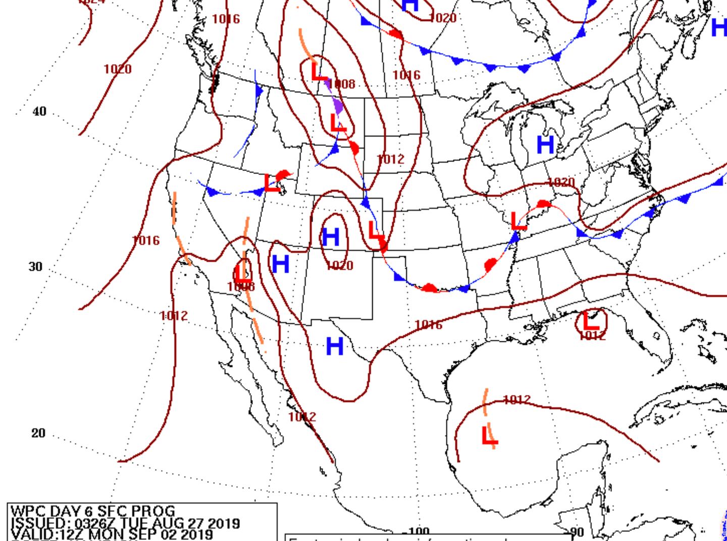
ESTIMATED LOCATION OF LOW PRESSURE CENTER DAY 7 Labor Day Morning near Florida panhandle:
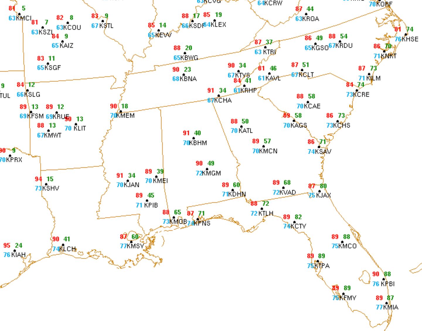
REGIONAL WEATHER FORECAST MONDAY (Green is rain chance):
ECMWF DETERMINISTIC MODEL TROPICAL STORM PROBABILITY 7pm Monday through 7pm Thursday:

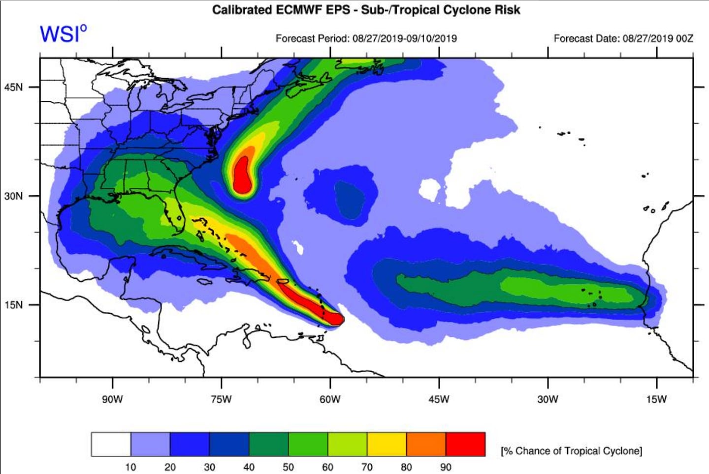
ECMWF ENSEMBLE PROBABILITIES TROPICAL CYCLONE THROUGH SEPT 10TH:
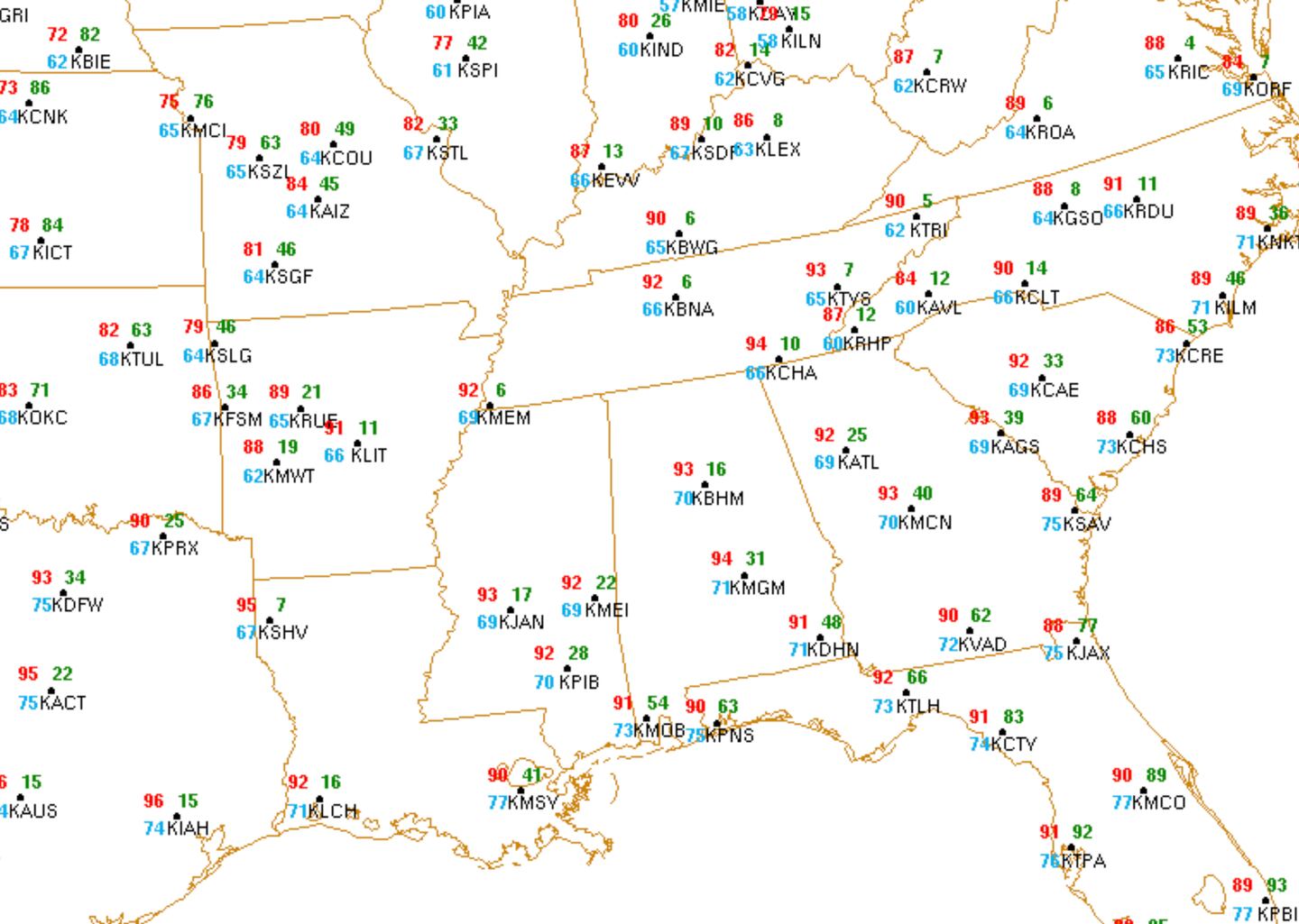
SATURDAY REGIONAL FOOTBALL WEATHER:
For updates follow me on Twitter @MellishMeterWSB.


