
Rain chances remain in the forecast for the next few days courtesy of a cut off low that continues to swirl over the Southeast.
The satellite imagery below shows the low swirling clouds into North Georgia, including Metro Atlanta.
Oooh the Wheel in the Sky Keeps on Turning... Sparking up storms for tomorrow.... #ATLwx #GAwx #ATL #Atlanta pic.twitter.com/k88OmLY415
— Christina Edwards (@ChristinaWSBwx) June 20, 2023
The low is “cut off” from the jet stream, which means it’s not able to move anywhere. The Futurecast upper atmospheric forecast animation below shows the low spinning over the Southeast through the end of the week.

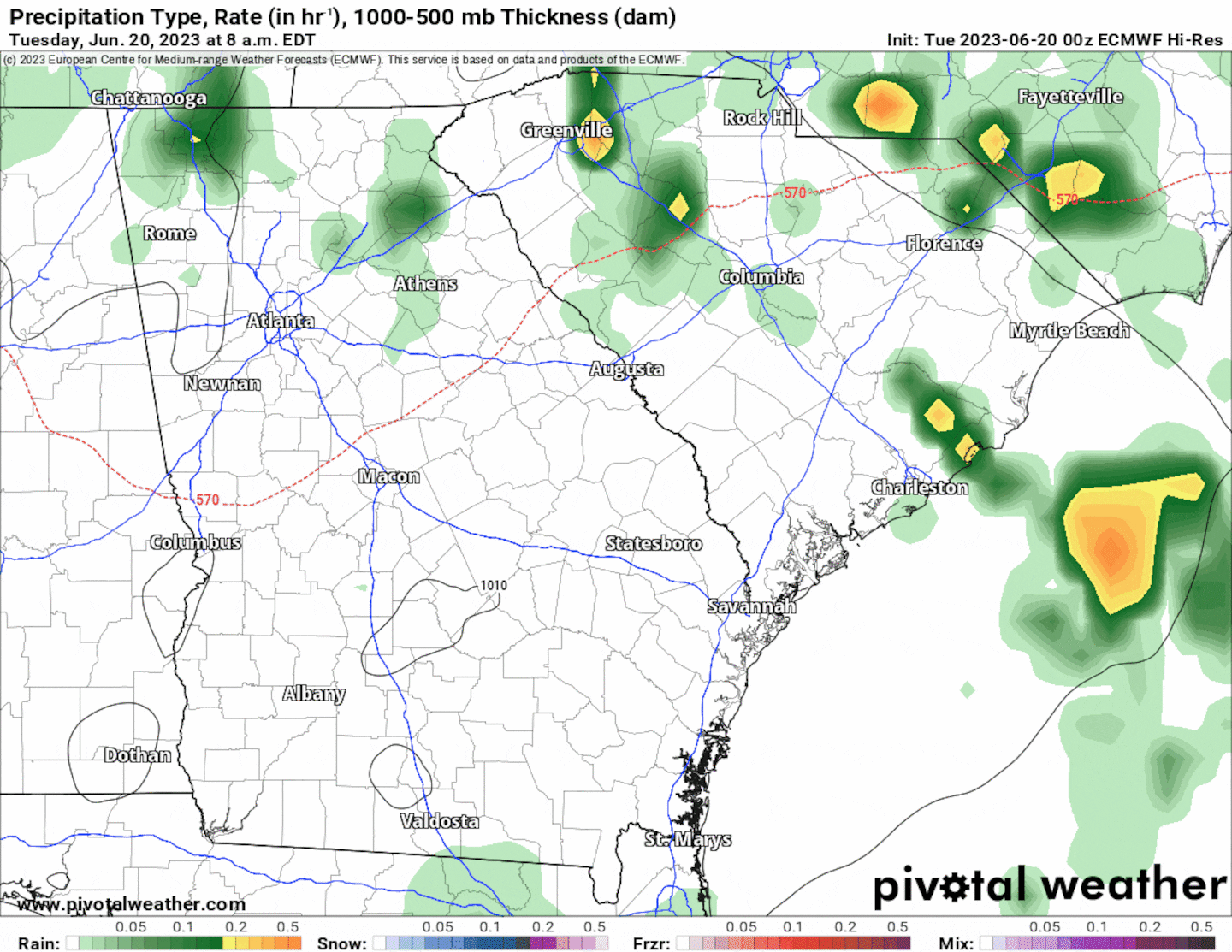
Low pressure is associated with lousy, stormy weather -- and this cut off low is responsible for the nearly daily rain chances this week. The animation below illustrates the daily Futurecast radar through Friday evening.
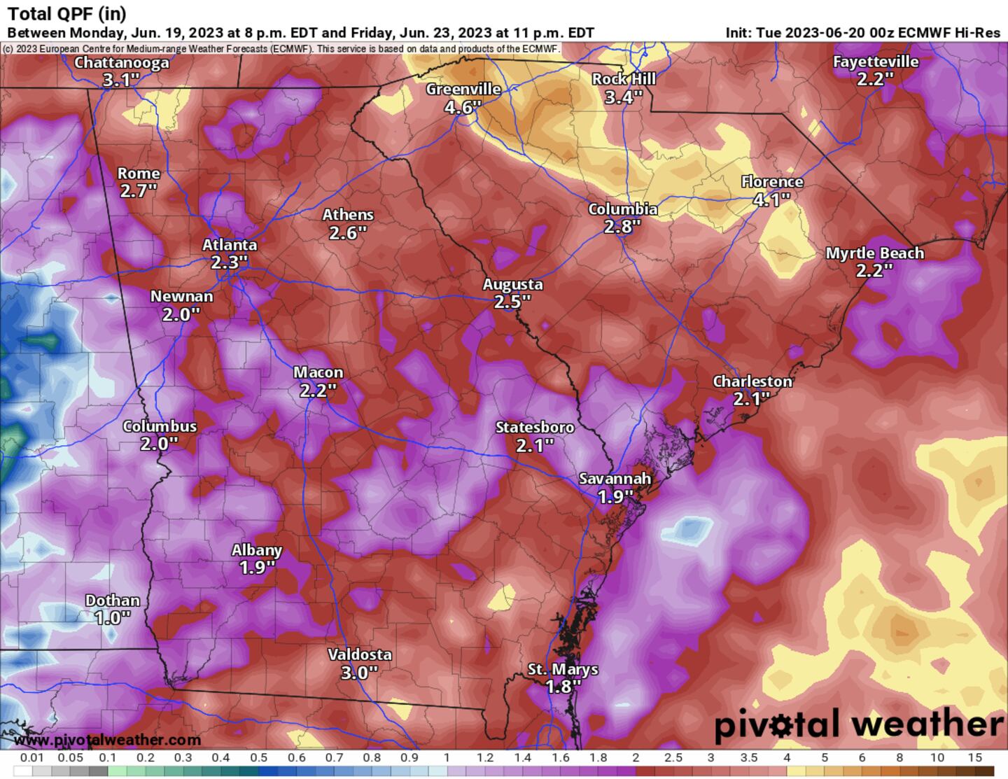
As a result, an additional 2-3 inches of rainfall is possible for Metro Atlanta through Friday evening, with isolated higher amounts possible for downpours that sit over an area for a longer period of time. This is on top of the 1-2 inches of rainfall already received yesterday morning.
The National Weather Service has issued a Flood Watch for Northeast Georgia -- including a portion of Metro Atlanta -- beginning Wednesday morning. The Flood Watch remains in effect through Thursday.
FFC issues Flood Watch valid at Jun 21, 8:00 AM EDT for Banks, Barrow, Clarke, Dawson, Forsyth, Gwinnett, Hall, Jackson, Lumpkin, Madison, Morgan, Oconee, Walton, White [GA] till Jun 22, 8:00 PM EDT https://t.co/BXv3fOOb5w pic.twitter.com/WITvbrZUNj
— Christina Edwards (@ChristinaWSBwx) June 20, 2023
In addition to the rain, additional cloud cover will put a damper on afternoon temperatures, which will run about 10 to 15 degrees below average through the rest of this week.
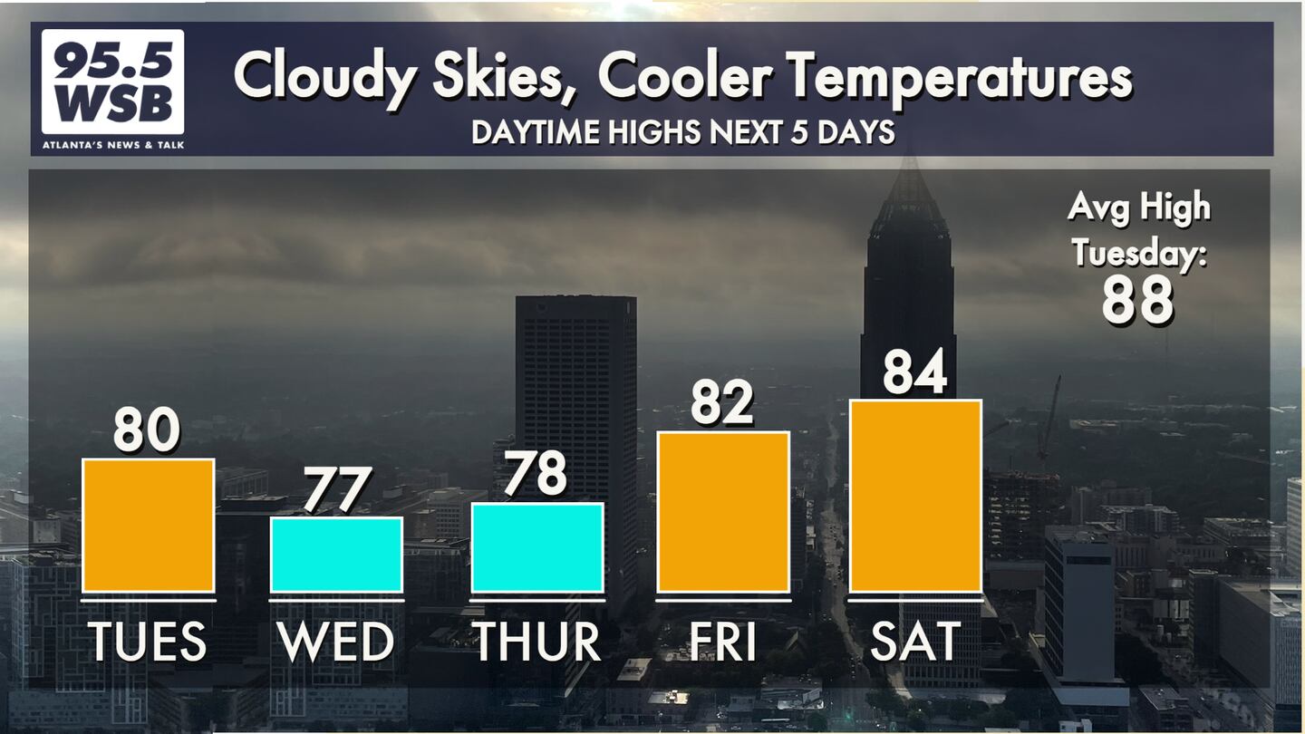
The upper level low will eventually dissipate on Friday, bringing warmer temperatures and drier conditions through the weekend.
Share Your Weather Reports with Me!
Facebook: Christina Edwards WSB
Twitter: @ChristinaWSBwx
©2022 Cox Media Group


