

The peak of the Atlantic Hurricane Season is September 10, and while it is nearly one month post-peak, the season is not over until November 30.
And right on cue, a cluster of thunderstorms off the coast of Mexico, near the Bay of Campeche, may continue to organize into a tropical depression in the next 24 to 48 hours.
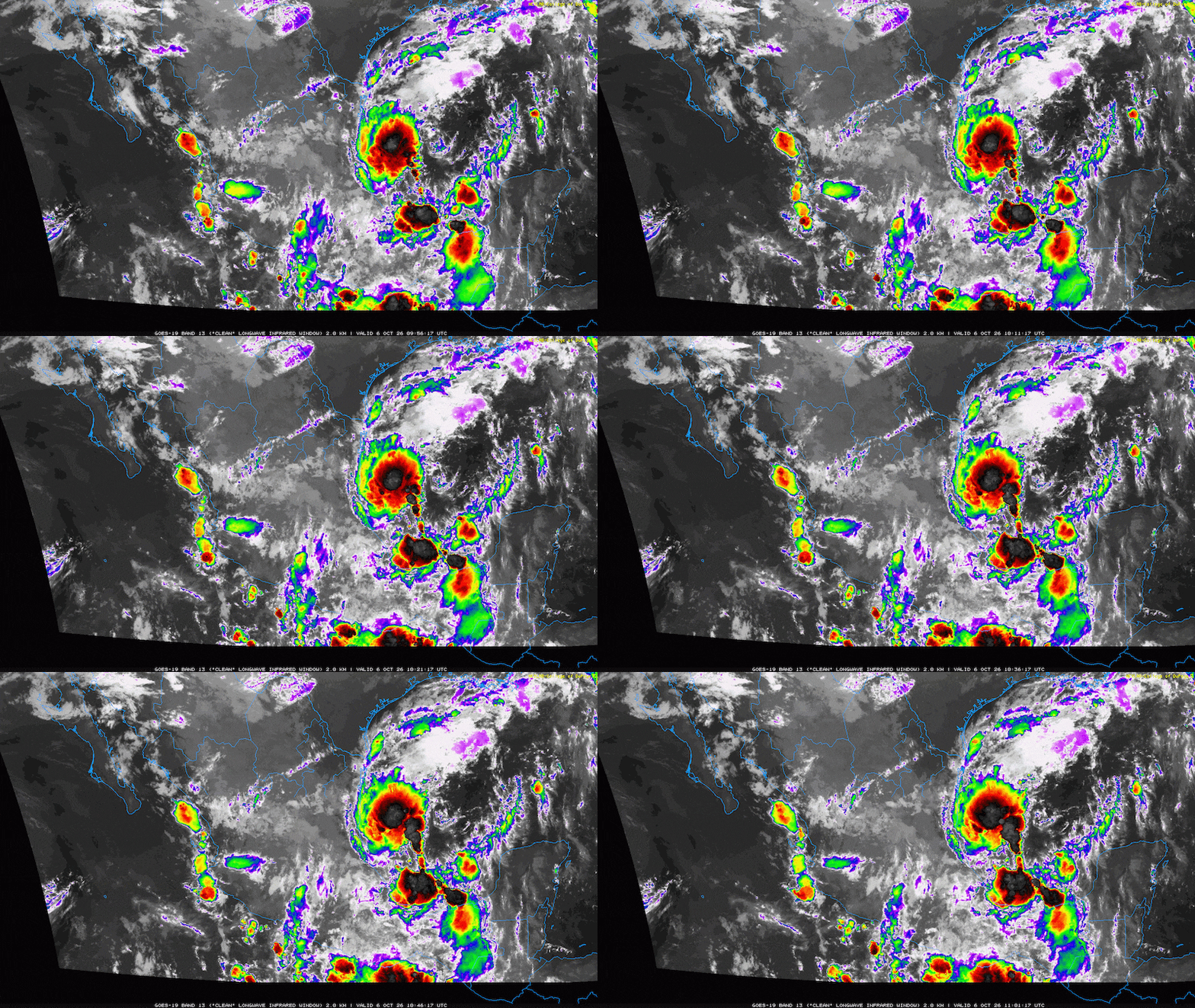
The animation below illustrates the Tuesday morning satellite imagery of the tropical feature.
Below is the Tropical Weather Outlook from the National Hurricane Center. The NHC states that it will send NOAA Gulfstream crew to sample the system today, and it will send Air Force reconnaissance crew tomorrow.

What We Know
The tropical disturbance is forecast to eventually drift east into the open waters of the Gulf, potentially reaching an area with low enough wind shear to allow a tropical depression to form.
Eventually, the disturbance will organize as it moves north-northeast, approaching the Gulf Coast by the end of the week.
What’s Too Early to Know
The system has yet to form a closed center of circulation, which means the exact location and rainfall totals will change with each model update.
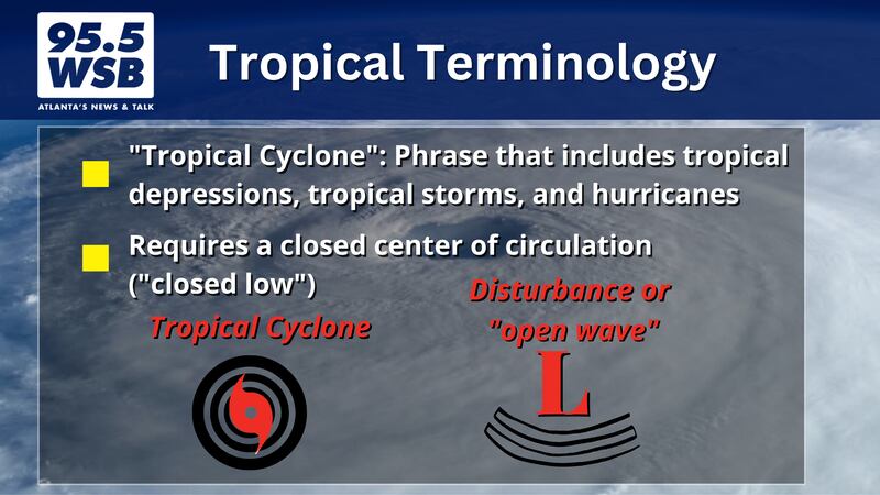
Once a closed center of circulation forms, models will have a better handle on where exactly the system will go -- this will lead to a better idea as to where the strongest winds and heaviest rain will occur this weekend.
Below is the “spaghetti model plot” of all the different model runs, as of Tuesday morning. The consensus is that the tropical low will eventually move east then turn north late this week, however it is too soon to know how strong or how big the system will be between now and then.

What Could Impact the Forecast Through Late Week?
While the tropical disturbance is drifting through the Gulf, high pressure is set up over the Appalachian Mountains of the eastern U.S.

Air flows clockwise around the high, which means the mountain air could push the tropical system further west, away from the state of Georgia.
However, if the high moves further east, or shows a weakening trend, then the tropical system could move further east into the state of Georgia.
Nevertheless, continue to monitor the weekend forecast for timing and location, as the path of the tropical disturbance could bring windy conditions and heavy rain to the Metro Atlanta area.
Below is the Futurecast Radar for this weekend. Stay tuned to 95.5 WSB for updates as the forecast becomes more fine tuned.

Connect with Me!
Facebook: Christina Edwards WSB
Instagram: ChristinaWSBwx
©2026 Cox Media Group