

Coaches and football fans, keep an eye on the sky and perhaps keep the radar handy for this evening!
A frontal boundary will slowly move through North Georgia today, sparking up scattered rain showers and thunderstorms this afternoon and evening.

Some of these storms may be strong to severe with damaging winds and heavy downpours.
The Storm Prediction Center has outlined an area of Marginal Risk for severe storms today, particularly along the northeast quadrant near I-85.
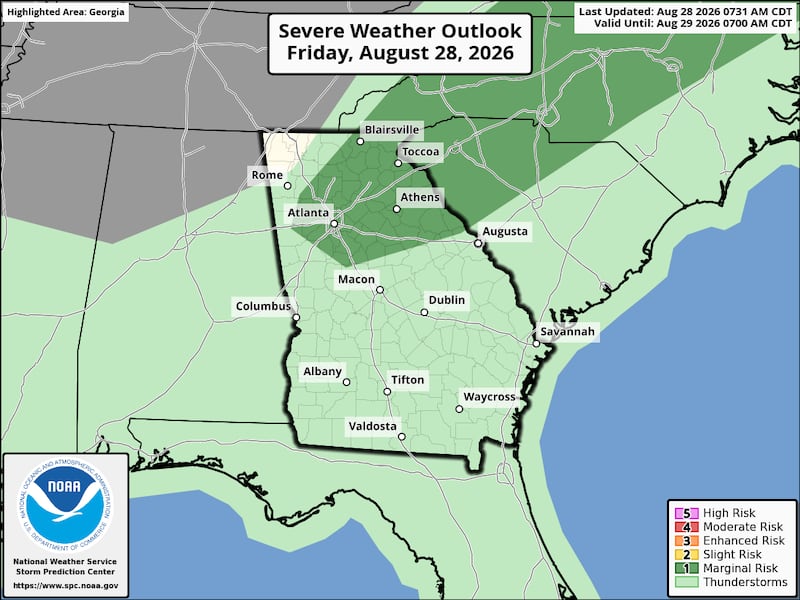


Unfortunately, the timing of the storms is during the late afternoon and evening hours -- potentially impacting kickoff through the first half of Football Friday for local high schools.
The animation below illustrates the Futurecast Radar imagery for this evening into Saturday morning.

Share Your Storm and Score Reports with Me!
Facebook: Christina Edwards WSB
Instagram: ChristinaWSBwx
Twitter: @ChristinaWSBwx
©2026 Cox Media Group