

For the first time in nearly three weeks, heavy rain and thunderstorms return to Metro Atlanta today.
The majority of the storms will remain below severe limits, though a few stronger wind gusts are possible as they roll through the region. The Storm Prediction Center has outlined an area of Marginal Risk of severe storms for Metro Atlanta today.
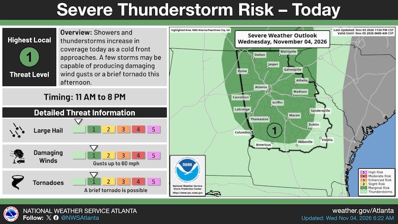
Stay ahead of the rain by using the Interactive Radar tracker below.
Timing the Rain and Storms
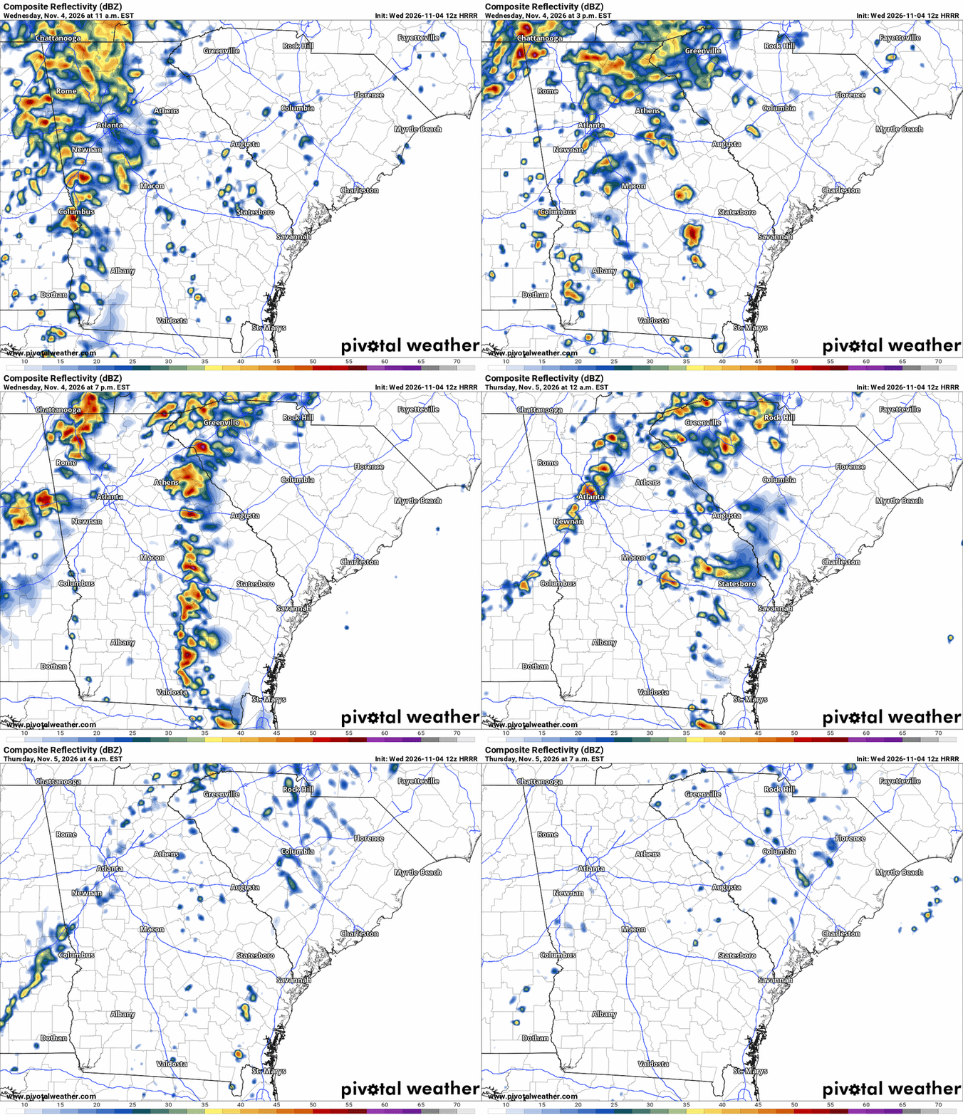
The majority of the rain and storms will arrive mid-morning, and they will continue to move through the region through the late night hours. The majority of the rain showers will taper off by Thursday morning.
The animation below illustrates the Futurecast Radar for today through Thursday morning.
How Much Rainfall?
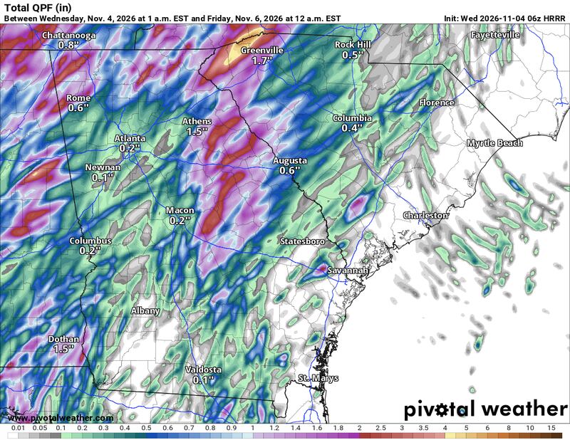
Today’s round of showers and thunderstorms will produce as much as 0.5 inch to 1 inch of rain for much of the Metro Atlanta region. A few isolated spots may receive up to 2 inches of rainfall, depending on where the storms develop and if they “train” or move over the same area repeatedly.
The image below illustrates the Futurecast Rainfall Totals through sunrise Thursday.
Current Rainfall Deficits
On average, Autumn is the driest season of the year here in Metro Atlanta. However, this year’s precipitation is trending well below average, as both September and October rains have been lacking for the Atlanta area.
November has only just begun, but October was very dry for areas that did not receive any rain from Hurricane Isaias.
Metro Atlanta received 2 inches of rainfall from the remnants of the hurricane, but the Athens area did not receive a drop from the storm.

September also remained relatively dry. As a result, year-to-date rainfall for North Georgia is running well below average, with the Athens area experiencing rainfall nearly 10 inches below average.

Share Your Rainfall Totals with Me!
Facebook: Christina Edwards WSB
Instagram: ChristinaWSBwx
©2026 Cox Media Group