

And the heat goes on!
Temperatures will sizzle their way to the upper 90s through the course of this afternoon.
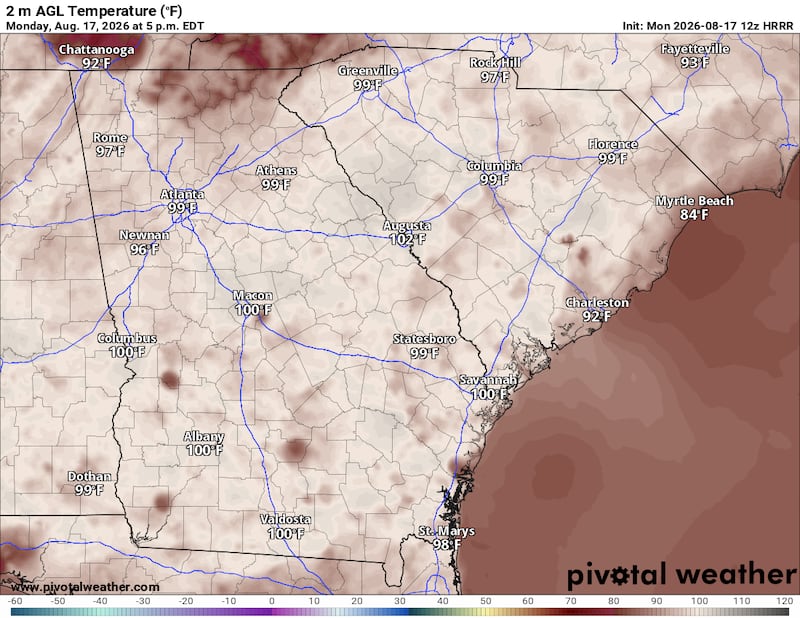
However, the extra moisture in the air -- the humidity levels -- will make the “feels like” Heat Index soar to the 100 to 105 range during the evening commute.

Meanwhile, a cold front is moving south through the eastern United States.

This cold front is forecast to push through North Georgia and Metro Atlanta through the late afternoon and evening hours, potentially sparking up scattered showers and thunderstorms. The animation below illustrates the Futurecast Radar for this afternoon into early tomorrow morning.
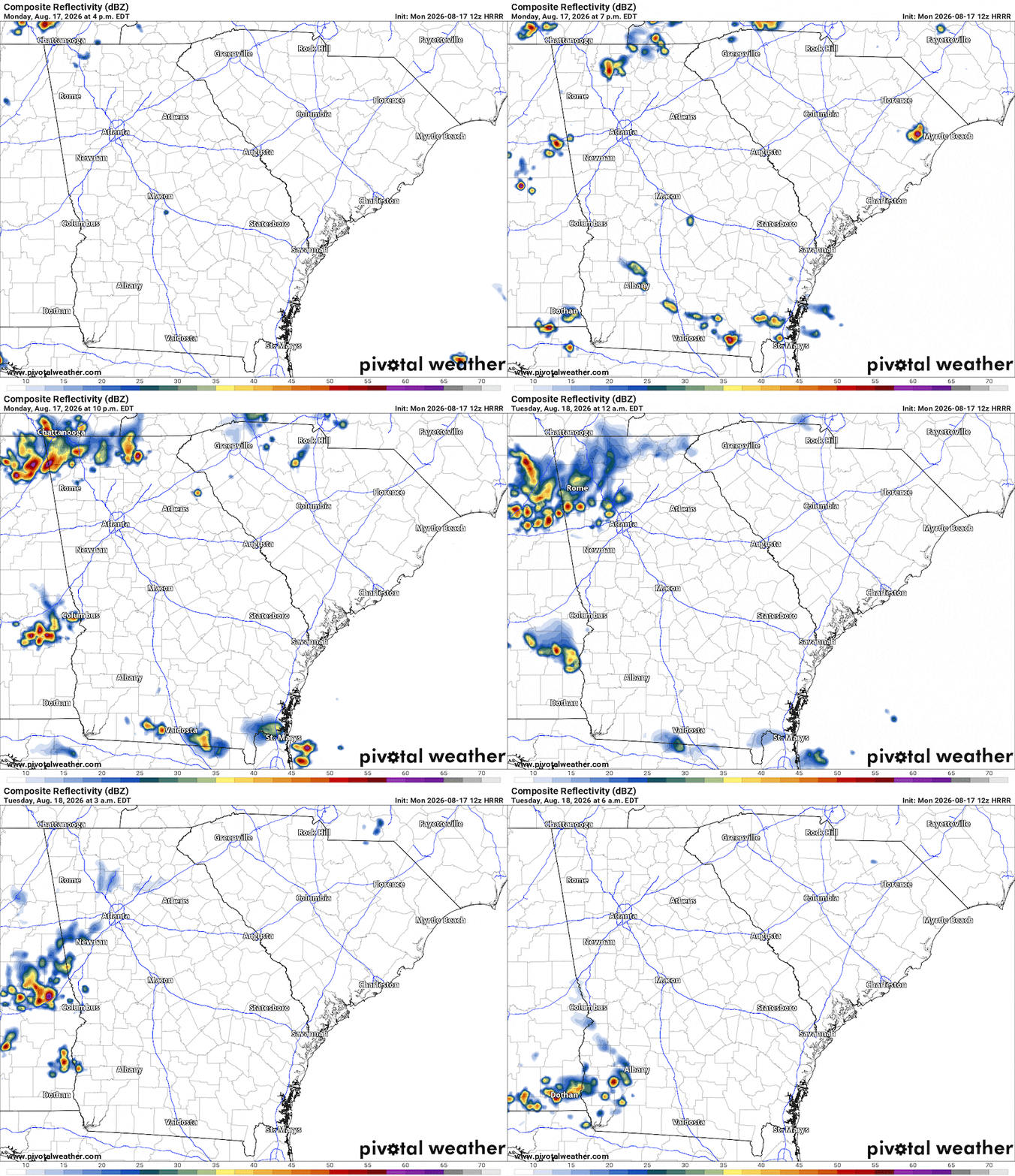
With very hot and humid air in place ahead of the cold front, the storms will have plenty of “fuel” to tap into and use to gain strength.
As a result some storms could be strong with damaging wind gusts and frequent lightning.
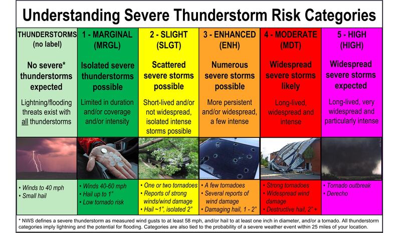
The Storm Prediction Center has outlined an area of Marginal Risk for severe storms this evening. Wind gusts as high as 60 mph are possible with these storms.


Stay tuned to 95.5 WSB Radio for updates.
Share Your Storm Reports with Me!
Facebook: Christina Edwards WSB
Instagram: ChristinaWSBwx
Twitter: @ChristinaWSBwx
©2026 Cox Media Group