

Cloudy skies will prevail today as an upper level low swirls over the Southeast United States.
The satellite imagery below illustrates the unsettled weather rotating over Alabama, Georgia, and Tennessee.

The radar imagery below illustrates the swirling motion of the rain showers and thunderstorms associated with the upper level low.

As a result, cloudy cover will prevent afternoon temperatures from climbing out of the low 80s.
In addition, scattered rain showers will continue to develop through the course of the afternoon, with some storms capable of producing thunder as well.
The animation below illustrates the Futurecast Radar for this afternoon and evening.

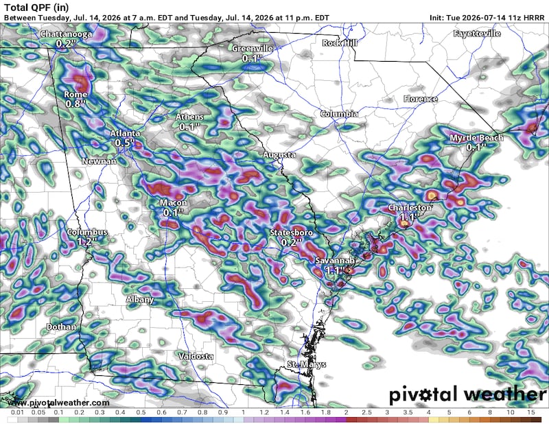
Rainfall totals around 0.5 to 1 inch to be expected through this evening.
Share Your Rainfall Reports with Me!
Facebook: Christina Edwards WSB
Instagram: ChristinaWSBwx
Twitter: @ChristinaWSBwx
©2026 Cox Media Group