

A line of heavy rain and thunderstorms rolled through North Georgia yesterday evening, and the storms continued to move over North Georgia through early this morning.
The animation below illustrates the radar imagery from 6:30pm Wednesday through 3:30am Thursday.

As much as 6 to 8 inches of rain fell within an area between Cherry Log and Blue Ridge to Morganton and McCaysville within a span of 8 hours.
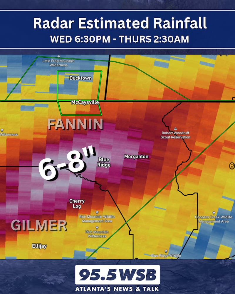
As a result, catastrophic flash flooding is reported in Fannin and Gilmer counties in North Georgia.
Gilmer County Schools states that school will remain closed today, November 5, due to flooding and “dangerous road conditions”.
The National Weather Service reports that the Toccoa/Ocoee River gauge at McCaysville in Fannin County is at 17.73 feet and continues to rise, approaching record high levels at 17.75 feet set in 1990.
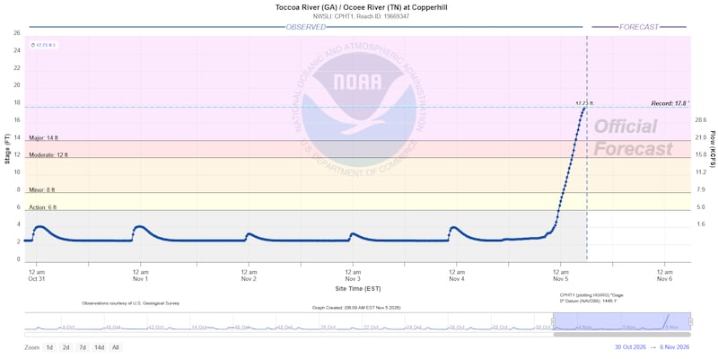
Although rain and thunderstorms have moved away from the area, the impacts from the flash flooding will be experienced through the rest of this morning and into the afternoon.
©2026 Cox Media Group